| Pohatcong Mountain | |
|---|---|
 Pohatcong Mountain Warren County, New Jersey, United States | |
| Highest point | |
| Elevation | 866 ft (264 m) [1] |
| Listing | List of mountains of the United States |
| Coordinates | 40°43′49″N75°01′03″W / 40.73028°N 75.01750°W Coordinates: 40°43′49″N75°01′03″W / 40.73028°N 75.01750°W [1] |
| Geography | |
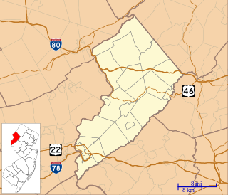
| Location | Warren County, New Jersey, United States |
| Parent range | Appalachian Mountains |
| Topo map | USGS Bloomsbury |
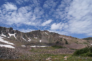
Pohatcong Mountain is a ridge, approximately 6 mi (10 km) long, in the Appalachian Mountains of northwestern New Jersey in the United States. It extends from west Phillipsburg northeast approximately to Allamuchy Township, New Jersey. The ridge continues on north past Washington as Upper Pohatcong Mountain. The term "Pohatcong Mountain" is sometimes taken to include both mountains. The ridge is approximately 800 ft (244 m) high along much of its length.[ citation needed ]

A ridge or a mountain ridge is a geological feature consisting of a chain of mountains or hills that form a continuous elevated crest for some distance. The sides of the ridge slope away from narrow top on either side.The line along the crest formed by the highest points, with the terrain dropping down on either side, is called the ridgeline. Ridges are usually termed hills or mountains as well, depending on size.

The Appalachian Mountains, often called the Appalachians, are a system of mountains in eastern North America. The Appalachians first formed roughly 480 million years ago during the Ordovician Period. They once reached elevations similar to those of the Alps and the Rocky Mountains before experiencing natural erosion. The Appalachian chain is a barrier to east–west travel, as it forms a series of alternating ridgelines and valleys oriented in opposition to most highways and railroads running east–west.

New Jersey is a state in the Mid-Atlantic and Northeastern regions of the United States. It is located on a peninsula, bordered on the north and east by the state of New York, particularly along the extent of the length of New York City on its western edge; on the east, southeast, and south by the Atlantic Ocean; on the west by the Delaware River and Pennsylvania; and on the southwest by the Delaware Bay and Delaware. New Jersey is the fourth-smallest state by area but the 11th-most populous, with 9 million residents as of 2017, and the most densely populated of the 50 U.S. states; its biggest city is Newark. New Jersey lies completely within the combined statistical areas of New York City and Philadelphia. New Jersey was the second-wealthiest U.S. state by median household income as of 2017.
The mountain divides the watersheds of Pohatcong Creek on its northwestern flank and the Musconetcong River on its southeastern flank.
Pohatcong Creek is a 30.7-mile-long (49.4 km) tributary of the Delaware River in northwestern New Jersey in the United States.

The Musconetcong River is a 45.7-mile-long (73.5 km) tributary of the Delaware River in northwestern New Jersey in the United States. It flows through the rural mountainous country of northwestern New Jersey. Part of it is a National Wild and Scenic River.