Silver Hill (New Jersey)

Last updated
Silver Hill
Highest point
Elevation 722 ft (220 m)  NGVD 29 [1]
Coordinates 40°38′37″N75°07′20″W / 40.6437113°N 75.1221183°W / 40.6437113; -75.1221183 Coordinates: 40°38′37″N75°07′20″W / 40.6437113°N 75.1221183°W / 40.6437113; -75.1221183 [2]
Geography
Topo map USGS Bloomsbury
Climbing
Easiest route Hiking

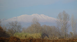
Silver Hill is a mountain in Warren County, New Jersey. It is located in the southeastern portion of Pohatcong Township; the main summit rises to 722 feet (220 m).

Warren County, New Jersey county in New Jersey

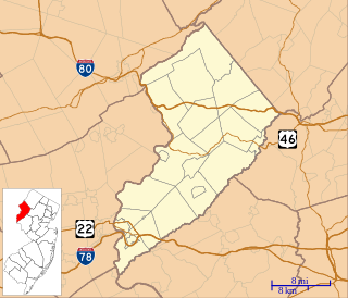
Warren County is a county located in the U.S. state of New Jersey. As of the 2017 Census estimate, the county's population was 106,798, making it the 19th-most populous of the state's 21 counties, representing a decrease of 1.7% from the 108,692 enumerated in the 2010 United States Census, in turn having increased by 6,255 (+6.1%) from 102,437 counted at the 2000 Census, Its county seat is Belvidere. It is part of the Allentown-Bethlehem-Easton, PA-NJ metropolitan area and is generally considered the eastern border of the Lehigh Valley. It is considered part of the New York-Newark, NY-NJ-CT-PA Combined Statistical Area, and shares its eastern border with the New York City Metropolitan Area, with its northwestern section bordering The Poconos. The most populous place was Phillipsburg, with 14,950 residents at the time of the 2010 Census, while Hardwick Township, covered 37.92 square miles (98.2 km2), the largest total area of any municipality.

New Jersey State of the United States of America

New Jersey is a state in the Mid-Atlantic region of the Northeastern United States. It is a peninsula, bordered on the north and east by the state of New York, particularly along the extent of the length of New York City on its western edge; on the east, southeast, and south by the Atlantic Ocean; on the west by the Delaware River and Pennsylvania; and on the southwest by the Delaware Bay and Delaware. New Jersey is the fourth-smallest state by area but the 11th-most populous, with 9 million residents as of 2017, and the most densely populated of the 50 U.S. states; its biggest city is Newark. New Jersey lies completely within the combined statistical areas of New York City and Philadelphia and was the second-wealthiest U.S. state by median household income as of 2017.

Pohatcong Township, New Jersey Township

Pohatcong Township is a township in Warren County, New Jersey, United States, located in the easternmost region of the Lehigh Valley. As of the 2010 United States Census, the township's population was 3,339, reflecting a decline of 77 (-2.3%) from the 3,416 counted in the 2000 Census, which had in turn declined by 175 (-4.9%) from the 3,591 counted in the 1990 Census. The name Pohatcong is said to be from the Lenni Lenape Native American term meaning "stream between split hills".

Silver Hill may be considered an isolated outlier of Pohatcong Mountain; like Pohatcong Mountain it divides the watersheds of Pohatcong Creek on its northwestern flank and the Musconetcong River on its southeastern flank.

Pohatcong Mountain mountain in United States of America

Pohatcong Mountain is a ridge, approximately 6 mi (10 km) long, in the Appalachian Mountains of northwestern New Jersey in the United States. It extends from west Phillipsburg northeast approximately to Allamuchy Township, New Jersey. The ridge continues on north past Washington as Upper Pohatcong Mountain. The term "Pohatcong Mountain" is sometimes taken to include both mountains. The ridge is approximately 800 ft high along much of its length.

Pohatcong Creek is a 30.7-mile-long (49.4 km) tributary of the Delaware River in northwestern New Jersey in the United States.

Musconetcong River river in the United States of America

The Musconetcong River is a 45.7-mile-long (73.5 km) tributary of the Delaware River in northwestern New Jersey in the United States. It flows through the rural mountainous country of northwestern New Jersey. Part of it is a National Wild and Scenic River.

Related Research Articles

Upper Pohatcong Mountain is a ridge in the Appalachian Mountains of northwestern New Jersey in the United States. It is located in eastern Warren County, and extends northeast of Washington approximately 6 mi (10 km) to the vicinity of Hackettstown. The ridge has an average height of approximately 800 ft and reaches a maximum summit of 1235 ft.

Pangaion Hills mountain

The Pangaion Hills are a mountain range in Greece, approximately 40 km from Kavala. The highest elevation is 1,956 m and the mountaintop name is Koutra. The Aegean Sea lies to the south and the plains of Philippi-Kavala to the north The mountain ranges covers the southeastern portion of the Serres regional unit as well as northwestern part of the Kavala regional unit which covers the most part of the hills.

Selkirk Mountains mountain range

The Selkirk Mountains are a mountain range spanning the northern portion of the Idaho Panhandle, eastern Washington, and southeastern British Columbia. They begin at Mica Peak near Spokane and extend approximately 320 km north from the border to Kinbasket Lake, at the now-inundated location of the onetime fur company post Boat Encampment. The range is bounded on its west, northeast and at its northern extremity by the Columbia River, or the reservoir lakes now filling most of that river's course. From the Columbia's confluence with the Beaver River, they are bounded on their east by the Purcell Trench, which contains the Beaver River, Duncan River, Duncan Lake, Kootenay Lake and the Kootenay River. The Selkirks are distinct from, and geologically older than, the Rocky Mountains. Together with the neighboring Monashee and Purcell Mountains, and sometimes including the Cariboo Mountains to the northwest, the Selkirks are part of a larger grouping known as the Columbia Mountains. A scenic highway loop, the International Selkirk Loop, encircles the southern portions of the mountain range.

Columbia Mountains mountain range in Canada

The Columbia Mountains are a group of mountain ranges along the upper Columbia River in southeastern British Columbia, and also in Montana, Idaho and Washington. The mountain range covers 135,952 km². The range is bounded by the Rocky Mountain Trench on the east, and the Kootenay River on the south; their western boundary is the edge of the Interior Plateau. Seventy-five percent of the range is located in Canada and the remaining twenty-five percent in the United States; American geographic classifications place the Columbia Mountains as part of the Rocky Mountains complex, but this designation does not apply in Canada. Mount Sir Sandford is the highest mountain in the range, reaching 3,519 metres (11,545 ft).

Baker Mountain is a mountain ridge in southeastern Hampshire County, West Virginia. The mountain runs southwest northeast between Yellow Spring and the Hardy County line. Baker Mountain is flanked to its east by the Cacapon River with West Virginia Route 259 running parallel between the two. Its forests were once used as a major source of timber for the Baltimore and Ohio Railroad's rail ties. For this reason, the Winchester and Western Railroad was constructed through the Capon Valley in the 1920s to haul the timber harvested in the region to Winchester, Virginia for railroad tie production. The communities of Capon Lake and Intermont lie at the foot of Baker Mountain on the Cacapon.

Anthonys Nose (Westchester County, New York) mountain in United States of America

Anthony's Nose is a peak along the Hudson River at the north end of Westchester County, New York.

Schooleys Mountain mountain in United States of America

Schooley's or, officially, Schooleys Mountain is a mountain ridge in northern New Jersey that stretches from Lake Hopatcong in the north to Hampton in the south. It is centrally located within the southern Highlands, positioned almost equidistantly from the Kittatinny Valley in the west and the Piedmont plateau in the east. Schooley's Mountain is also one of the largest ridges in a group of geologically similar and parallel mountains, which include Allamuchy Mountain, Pohatcong Mountain, Scotts Mountain, and Jenny Jump Mountain.

Mount Elden mountain in United States of America

Mount Elden or Elden Mountain is located in central Coconino County northeast of Flagstaff, Arizona. It takes its name from one of the region's earliest Anglo settlers, John Elden, who, along with his family, established a homestead on the mountain’s lower slopes and grazed sheep on the open grasslands below during the late 19th century.

Fish Lake Valley valley in southwest Nevada

The Fish Lake Valley is a 25 miles (40 km) long endorheic valley in southwest Nevada, one of many contiguous inward-draining basins collectively called the Great Basin. The alluvial valley lies just northwest of Death Valley and borders the southeast, and central-northeast flank of the massif of the White Mountains of California. The valley's southern end lies in eastern Inyo County, California. The valley is sparsely populated with ranchers and indigenous Paiute. Business services are located in the valley's only town Dyer.

Wallface Mountain mountain in United States of America

Wallface Mountain is a mountain located in Essex County, New York. The mountain is named after the cliff on its southeastern side. Wallface is flanked to the west by MacNaughton Mountain, and faces Mount Marshall to the southeast across Indian Pass.

The Reading Prong is a physiographic subprovince of the New England Uplands section of the New England province of the Appalachian Highlands. The prong consists of mountains made up of crystalline metamorphic rock.

Adlisberg mountain

Adlisberg, with an elevation of 701 metres (2,300 ft), is a wooded mountain in Switzerland overlooking Zürichsee to the northwest near the Zürichberg.

Horseshoe Hills

The Horseshoe Hills, el. 6,673 feet (2,034 m), are a roughly crescent-shaped range of hills north of Manhattan, Montana in Gallatin County, Montana. They lie in the area between the southern Big Belt Mountains and the northern Bridger Range. The hills are bounded on the north by Sixteen Mile Creek, the first major tributary of the Missouri River. As they are in the rain shadow of the Boulder, Elkhorn, and Bull Mountains to the west, the Horseshoe Hills are notably dry, receiving 10 - 12 inches of precipitation annually. This is especially true on the southern and southeastern flanks, which are also in the rain shadow of the hills themselves. In the driest areas, Missouri foxtail cacti, plains prickly pear cacti, and yucca abound, as well as prairie rattlesnakes. Much of the hills are private property, but there is also some State, BLM, and National Forest land.

Marlboro Mountains mountain in United States of America

The Marlboro Mountains, sometimes Marlborough Mountains, are a group of hogbacked mountains arranged in a 25-mile-long (40 km) ridge extending from Newburgh, New York to just south of Kingston, New York. Considered to be part of the Ridge and Valley Appalachians, the mountains, which reach elevations over 1,100 feet, form an imposing geologic barrier just west of the Hudson River. They subdivide the relatively flat Hudson River Valley to create the Wallkill Valley further west. Rising abruptly on their eastern flanks, the Marlboro Mountains are known for their sweeping views of the region.

Upper Pohatcong, New Jersey Census-designated place in New Jersey, United States

Upper Pohatcong is an unincorporated community and census-designated place (CDP) located within Pohatcong Township in Warren County, New Jersey, United States, that was defined as part of the 2010 United States Census. As of the 2010 Census, the CDP's population was 1,781.

Mount Forest (New Hampshire)

Mount Forest, locally spelled Mount Forist, is a mountain located in Coös County, New Hampshire, in the United States. The mountain has an elevation of 2,031 feet (619 m), and is a prominent feature of the city of Berlin's landscape. It is sometimes referred to as Elephant Mountain due to its appearance from Berlin.

References

  1. Verified elevation from USGS topographic map Bloomsbury
  2. "Silver Hill". Geographic Names Information System . United States Geological Survey . Retrieved 2014-04-07.