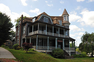
Atlantic Highlands is a borough in Monmouth County, New Jersey, in the Bayshore Region. As of the 2010 United States Census, the borough's population was 4,385,, a decline of 320 (-6.8%) from the 4,705 in the 2000 Census, which had in turn increased by 76 (+1.6%) from the 4,629 in the 1990 Census.

The Delaware Water Gap is a water gap on the border of the U.S. states of New Jersey and Pennsylvania where the Delaware River cuts through a large ridge of the Appalachian Mountains. The gap constitutes the southern portion of the Delaware Water Gap National Recreation Area, which is used primarily for recreational purposes, such as rafting, canoeing, swimming, fishing, hiking, and rock climbing.

Hudson Highlands State Park is a non-contiguous state park in the U.S. state of New York, located on the east side of the Hudson River. The park runs from Peekskill in Westchester County, through Putnam County, to Beacon in Dutchess County, in the eastern section of the Hudson Highlands.

Northern Highlands Regional High School (NHRHS) is a regional public high school and school district in Allendale, Bergen County, New Jersey, United States. The school serves students in ninth through twelfth grades from Allendale, Ho-Ho-Kus, Saddle River, and Upper Saddle River. Students from Saddle River have the option of attending either Northern Highlands or Ramsey High School, as part of sending/receiving relationships with the two districts.

The Hudson Highlands are mountains on both sides of the Hudson River in New York state lying primarily in Putnam County on its east bank and Orange County on its west. They continue somewhat to the south in Westchester County and Rockland County, respectively.
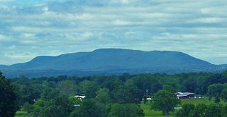
Schunemunk Mountain is the highest mountain in Orange County, New York. The 1,664-foot (507 m) summit is located in the town of Blooming Grove, with other portions in Cornwall and Woodbury. The community of Mountain Lodge Park is built up its western slope.

Anthony's Nose is a peak along the Hudson River at the north end of Westchester County, New York.
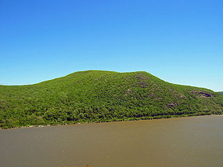
Bull Hill, also known as Mount Taurus, is a mountain north of the village of Cold Spring on the Hudson River in Putnam County in the State of New York. It is part of the river-straddling range known as the Hudson Highlands. The original name came after a bull that used to terrorize the mountain was chased by indignant inhabitants. A hunting party drove the bull over the hill. In an attempt to flee the mountaineers, the bull plunged out into space and fell down. Its broken and shapeless mass on the rocks was memorialized in the name of the mountain the bull used to haunt.
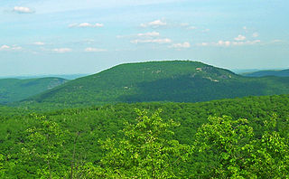
Bear Mountain is one of the best-known peaks of New York's Hudson Highlands. Located partially in Orange County in the town of Highlands and partially in Rockland County in the town of Stony Point, it lends its name to the nearby Bear Mountain Bridge and Bear Mountain State Park that contains it.

The Skylands Region is a region and marketing area of the State of New Jersey located in the Northern and Central part of the state. It is one of six tourism regions established by the New Jersey State Department of Tourism, the others being the Gateway Region, Greater Atlantic City Region, the Southern Shore Region, the Delaware River Region and the Shore Region. The area officially encompasses Hunterdon, Morris, Somerset, Sussex and Warren counties; the northwestern part of the Passaic County fits in with the Skylands Region, but it is part of the Gateway Region and not the Skylands Region. One could also say that the western most part of Bergen is also part of the skylands. The area features uplifted land, rolling hills and mountains characteristic of North Jersey. The region contains 60,000 acres of state parkland, and a diverse geography filled with lakes, rivers and picturesque hills.

New Jersey is a state within the United States of America that lies on the north eastern edge of the North American continent. It shares a land border with the state of State of New York along the north, ratified by both states after the New York – New Jersey Line War. New Jersey is slightly larger than the country of Kuwait.

Stokes State Forest is a state park located in Sandyston, Montague and Frankford in Sussex County, New Jersey, United States. Stokes comprises 16,447 acres (66.56 km2) of mountainous woods in the Kittatinny Mountains, extending from the southern boundary of High Point State Park southwestward to the eastern boundary of the Delaware Water Gap National Recreation Area. The park is operated and maintained by the New Jersey Division of Parks and Forestry.
New Jersey is a very geologically and geographically diverse region in the United States' Middle Atlantic region, offering variety from the Appalachian Mountains and the Highlands in the state's northwest, to the Atlantic Coastal Plain region that encompasses both the Pine Barrens and the Jersey Shore. The state's geological features have impacted the course of settlement, development, commerce and industry over the past four centuries.

Sugarloaf Hill is a peak along the Hudson River in Putnam County, New York, part of the Hudson Highlands. It was named by the Dutch for its resemblance in outline to a sugarloaf when sailing up the river towards it.
The Reading Prong is a physiographic subprovince of the New England Uplands section of the New England province of the Appalachian Highlands. The prong consists of mountains made up of crystalline metamorphic rock.

The New York – New Jersey Highlands is a geological formation composed primarily of Precambrian igneous and metamorphic rock running from the Delaware River near Musconetcong Mountain, northeast through the Skylands Region of New Jersey along the Bearfort Ridge and the Ramapo Mountains, Sterling Forest, Harriman and Bear Mountain State Parks in New York, to the Hudson River at Storm King Mountain. The northern region is also known as the Hudson Highlands and the southern as the New Jersey Highlands. A broader definition would extend the region west to Reading, Pennsylvania, and east to the Housatonic River in Connecticut, encompassing the Reading Prong.
Marble Mountain is a mountain in Warren County, New Jersey. The summit rises to 771 feet (235 m), and is located in Harmony and Lopatcong Townships, overlooking the Delaware River; along with Chestnut Hill on the Pennsylvania side, Marble Mountain forms Weygadt Gap or the Little Water Gap.
Scotts Mountain is a mountain in Warren County, New Jersey. The mountain covers portions of Harmony, Lopatcong, Franklin and Washington Townships; the main summit rises to 1,086 feet (331 m), and is located in Harmony. It is part of the New York–New Jersey Highlands of the Appalachian Mountains, although somewhat isolated to the west of the main body of the Highlands.
The topography of the New England Uplands section is that of a maturely-dissected plateau with narrow valleys, and the entire area is greatly modified by glaciation. It is the most widespread of the geomorphic sections in the New England Province, extending from Canada through New England down to the Seaboard section and extending southwestward through New York and New Jersey as two narrow upland projections, the Reading Prong and the Manhattan Prong. Numerous hills and mountains rise above the general level of the upland; except in the presence of mountains, the horizon of the regional landscape is fairly level. Glaciation has resulted in the erosion and rounding off of the bedrock topography and numerous rock basin lakes. Glacial drift is thin, patchy, and stony, and ice-contact features such as kames, kame terraces, and eskers are abundant. The surface of the New England Uplands slopes southeast from maximum inland altitudes around 670 meters, excluding the other mountainous sections of the province, to about 122 to 152 meters along its seaward edge at the narrow coastal Seaboard section, which goes down to sea level.


