Heyburn, Idaho

Last updated

Heyburn, Idaho
Heyburn Idaho Looking South.JPG
Looking south from Heyburn toward the Albion Mountains
Motto: 
"Where people are important"
Minidoka County Idaho Incorporated and Unincorporated areas Heyburn Highlighted 1637360.svg
Location in Minidoka County, Idaho
Coordinates: 42°33′22″N113°45′46″W / 42.55611°N 113.76278°W / 42.55611; -113.76278
Country United States
State Idaho
County Minidoka
Area
[1]
  Total2.66 sq mi (6.88 km2)
  Land2.61 sq mi (6.76 km2)
  Water0.04 sq mi (0.11 km2)
Elevation
4,154 ft (1,266 m)
Population
 (2020) [2]
  Total3,700
  Density1,416.5/sq mi (546.9/km2)
Time zone UTC-7 (Mountain (MST))
  Summer (DST) UTC-6 (MDT)
ZIP code
83336
Area code(s) 208, 986
FIPS code 16-37360
GNIS feature ID0396650
Website heyburn.id.gov

Heyburn is a city in Minidoka County, Idaho, United States. The population was 3,700 at the 2020 census, [2] up from 3,089 in 2010. It is part of the Burley micropolitan area.

Contents

The city was named after Weldon B. Heyburn, a U.S. senator for Idaho from 1903 to 1912.

Geography

Heyburn, 1905 Heyburn, Idaho (1905).jpg
Heyburn, 1905

Heyburn sits on the southern edge of Minidoka County, bounded to the south by the Snake River, which forms the Cassia County line. The city of Burley borders Heyburn to the south and west. Interstate 84 passes through the north side of the city, with access from Exits 208 and 211. I-84 leads west 37 miles (60 km) to the Twin Falls area and southeast 145 miles (233 km) to Ogden, Utah. U.S. Route 30 passes through the southeast part of Heyburn running from Exit 211 of I-84 southwest across the Snake River into Burley. Idaho State Highway 27 passes through the west side of Heyburn, connecting Burley to the south with Paul 3 miles (5 km) to the north.

According to the United States Census Bureau, Heyburn has a total area of 2.7 square miles (7.0 km2), of which 0.04 square miles (0.10 km2), or 1.66%, are water. [1]

Demographics

Historical population
CensusPop.Note
1920 292
1930 201−31.2%
1940 413105.5%
1950 53930.5%
1960 82953.8%
1970 1,63797.5%
1980 2,88976.5%
1990 2,714−6.1%
2000 2,8996.8%
2010 3,0896.6%
2020 3,70019.8%
U.S. Decennial Census [3]

2010 census

As of the census [4] of 2010, there were 3,089 people, 1,109 households, and 830 families residing in the city. The population density was 1,144.1 inhabitants per square mile (441.7/km2). There were 1,165 housing units at an average density of 431.5 per square mile (166.6/km2). The racial makeup of the city was 77.4% White, 0.6% African American, 2.3% Native American, 0.6% Asian, 16.6% from other races, and 2.6% from two or more races. Hispanic or Latino of any race were 32.5% of the population.

There were 1,109 households, of which 38.5% had children under the age of 18 living with them, 58.3% were married couples living together, 10.6% had a female householder with no husband present, 6.0% had a male householder with no wife present, and 25.2% were non-families. 21.9% of all households were made up of individuals, and 7.9% had someone living alone who was 65 years of age or older. The average household size was 2.79 and the average family size was 3.26.

The median age in the city was 32.8 years. 29.8% of residents were under the age of 18; 8.9% were between the ages of 18 and 24; 24.1% were from 25 to 44; 23.6% were from 45 to 64; and 13.6% were 65 years of age or older. The gender makeup of the city was 50.4% male and 49.6% female.

2000 census

As of the census [5] of 2000, there were 2,899 people, 1,002 households, and 787 families residing in the city. The population density was 1,510.7 inhabitants per square mile (583.3/km2). There were 1,056 housing units at an average density of 550.3 per square mile (212.5/km2). The racial makeup of the city was 74.92% White, 0.17% African American, 1.10% Native American, 0.52% Asian, 0.07% Pacific Islander, 20.08% from other races, and 3.14% from two or more races. Hispanic or Latino of any race were 28.39% of the population.

There were 1,002 households, out of which 41.5% had children under the age of 18 living with them, 62.6% were married couples living together, 11.7% had a female householder with no husband present, and 21.4% were non-families. 18.5% of all households were made up of individuals, and 6.7% had someone living alone who was 65 years of age or older. The average household size was 2.89 and the average family size was 3.28.

In the city, the population was spread out, with 32.5% under the age of 18, 10.0% from 18 to 24, 26.0% from 25 to 44, 22.2% from 45 to 64, and 9.2% who were 65 years of age or older. The median age was 31 years. For every 100 females, there were 97.2 males. For every 100 females age 18 and over, there were 95.4 males.

The median income for a household in the city was $31,685, and the median income for a family was $37,663. Males had a median income of $28,226 versus $20,951 for females. The per capita income for the city was $12,591. About 13.0% of families and 17.0% of the population were below the poverty line, including 20.1% of those under age 18 and 8.1% of those age 65 or over.

Economy

Heyburn's economy is largely influenced by its proximity to the cities of Burley and Twin Falls. The region's agricultural and food distribution sector is prominent. Heyburn is home to a Gem State Processing potato plant and the Double L harvest equipment manufacturer. Additionally, companies such the Packaging Corporation of America have seen employment rise as new businesses seek out their services. [6]

Education

Heyburn is served by the Minidoka County Schools system. [7]

Children are zoned to:

See also

Related Research Articles

<span class="mw-page-title-main">Power County, Idaho</span> County in Idaho, United States

Power County is a county located in the U.S. state of Idaho. As of the 2020 Census, the county had a population of 7,878. The county seat and largest city is American Falls. The county was created by the Idaho Legislature on January 30, 1913, by a partition of Cassia County. It is named for an early hydroelectric power plant (1902) at the American Falls.

<span class="mw-page-title-main">Minidoka County, Idaho</span> County in Idaho, United States

Minidoka County is a county located in the U.S. state of Idaho. As of the 2020 census, the population was 21,613. The county seat and largest city is Rupert.

<span class="mw-page-title-main">Lincoln County, Idaho</span> County in Idaho, United States

Lincoln County is a county located in the U.S. state of Idaho. As of the 2020 census, the population was 5,127. The county seat and largest city is Shoshone. The county is named after President Abraham Lincoln. The Idaho Territory was created in 1863, during the Lincoln Administration of 1861–65.

<span class="mw-page-title-main">Jerome County, Idaho</span> County in Idaho, United States

Jerome County is a county in the U.S. state of Idaho. As of the 2020 Census the county had a population of 24,237. The county seat and largest city is Jerome. The county was created by the Idaho Legislature on February 8, 1919, by a partition of Lincoln County. It was named after either Jerome Hill, a developer of the North Side Irrigation Project, his son-in-law Jerome Kuhn, or his grandson Jerome Kuhn, Jr.

<span class="mw-page-title-main">Cassia County, Idaho</span> County in Idaho, United States

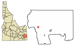
Cassia County is a county in the U.S. state of Idaho. As of the 2020 Census the county had a population of 24,655. The county seat and largest city is Burley. Cassia County is included in the Burley, ID Micropolitan Statistical Area.

<span class="mw-page-title-main">Blaine County, Idaho</span> County in Idaho, United States

Blaine County is a county in the U.S. state of Idaho. As of the 2020 United States Census, the population was 24,272. The county seat and largest city is Hailey. It is also home to the Sun Valley ski resort, adjacent to Ketchum.

<span class="mw-page-title-main">Plummer, Idaho</span> City in Idaho, United States

Plummer is a city in Benewah County, Idaho, United States. The population was 1,044 at the 2010 census, up from 990 in 2000. It is the largest city within the Coeur d'Alene Reservation, and is accessed by U.S. Route 95, the state's primary north–south highway.

<span class="mw-page-title-main">Soda Springs, Idaho</span> City in the United States

Soda Springs is a city in Caribou County, Idaho, United States. Its population was 3,133 at the time of the 2020 census. The city has been the county seat of Caribou County since the county was organized in 1919. In the 1860s, Soda Springs served as the seat of Oneida County.

<span class="mw-page-title-main">Albion, Idaho</span> City in Idaho, United States

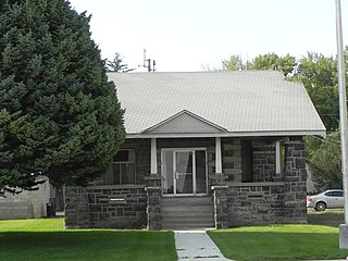
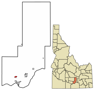
Albion is a city in Cassia County, Idaho, United States. It is part of the Burley, Idaho Micropolitan Statistical Area. The population was 234 at the 2020 census. Albion was the county seat of Cassia County from 1879 to 1918.

<span class="mw-page-title-main">Burley, Idaho</span> City in Idaho, United States

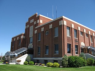
Burley is a city in Cassia and Minidoka counties in southern Idaho, United States. The population was 11,704 at the 2020 census, up from 10,345 in 2010. The city is the county seat of Cassia County.

<span class="mw-page-title-main">Declo, Idaho</span> City in Idaho, United States

Declo is a city in Cassia County, Idaho, United States. It is part of the Burley, Idaho micropolitan area. The population was 338 at the time of the 2020 Census, down from 343 in 2010.
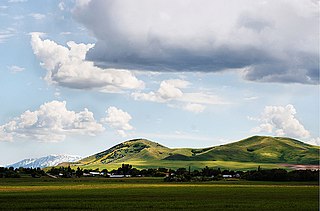
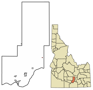
<span class="mw-page-title-main">Malta, Idaho</span> City in Cassia County, Idaho, United States

Malta is a city in Cassia County, Idaho, United States. The population was 193 at the 2010 census. It is part of the Burley, Idaho Micropolitan Statistical Area.

<span class="mw-page-title-main">Acequia, Idaho</span> City in Idaho, United States

Acequia is a city in Minidoka County, Idaho, United States. The population was 131 at the 2020 census. It is part of the Burley, Idaho Micropolitan Statistical Area. The town is named for the Spanish word for canal.

<span class="mw-page-title-main">Minidoka, Idaho</span> City in Idaho, United States

Minidoka is a city in Minidoka County, Idaho, United States. The population was 86 at the 2020 census, down from 112 in 2010. It is part of the Burley, Idaho Micropolitan Statistical Area.

<span class="mw-page-title-main">Paul, Idaho</span> City in Idaho, United States

Paul is a city in Minidoka County, Idaho, United States. founded in 1907. The population was 1,195 at the 2020 census. It is part of the Burley, Idaho Micropolitan Statistical Area. The town received its name from Charles H. Paul, an engineer who worked on the Minidoka Project.

<span class="mw-page-title-main">Rupert, Idaho</span> City in Idaho, United States

Rupert is the county seat and largest city of Minidoka County, Idaho. It is part of the Burley Micropolitan Statistical Area. The population was 6,082 at the 2020 census, up from 5,554 in 2010.

<span class="mw-page-title-main">Grand View, Idaho</span> City in Owyhee County, Idaho, United States

Grand View is a city along the Snake River in Owyhee County, Idaho, United States. The population was 440 at the 2020 census. It is part of the Boise City–Nampa, Idaho Metropolitan Statistical Area.

<span class="mw-page-title-main">Fruitland, Idaho</span> City in Payette County, Idaho, United States

Fruitland is a city along the Snake and Payette rivers in Payette County, Idaho, United States. It lies along U.S. Route 95 in the Treasure Valley of southwest Idaho, about 50 miles (80 km) west of Boise on the border with Oregon. It is part of the Ontario Micropolitan Area. Fruitland is named after apple orchards that surround the community, and its slogan is "The Big Apple of Idaho."

<span class="mw-page-title-main">Kimberly, Idaho</span> City in Idaho, United States

Kimberly is a city in Twin Falls County, Idaho, United States. The population was 3,264 at the 2010 census, up from 2,614 in 2000. It is part of the Twin Falls Metropolitan Statistical Area.

<span class="mw-page-title-main">Burley, Idaho micropolitan area</span> Place

The Burley Micropolitan Statistical Area, as defined by the United States Census Bureau, is an area consisting of two counties in the Magic Valley region of Idaho, anchored by the city of Burley. It is commonly referred to locally as the "Mini-Cassia" area, an amalgam of Minidoka and Cassia Counties.

References

  1. 1 2 "2022 U.S. Gazetteer Files: Idaho". United States Census Bureau. Retrieved February 2, 2023.
  2. 1 2 "P1. Race – Heyburn city, Idaho: 2020 DEC Redistricting Data (PL 94-171)". U.S. Census Bureau. Retrieved February 2, 2023.
  3. "Census of Population and Housing". Census.gov. Retrieved June 4, 2015.
  4. "U.S. Census website". United States Census Bureau . Retrieved December 18, 2012.
  5. "U.S. Census website". United States Census Bureau . Retrieved January 31, 2008.
  6. "Cities on the rise in Idaho". NerdWallet. September 5, 2014. Retrieved August 25, 2014.
  7. "2020 CENSUS - SCHOOL DISTRICT REFERENCE MAP: Minidoka County, ID" (PDF). U.S. Census Bureau . Retrieved March 12, 2024. - Text list