
Cornwall-on-Hudson is a riverfront village in the town of Cornwall, Orange County, New York. It lies on the west bank of the Hudson River about 50 miles (80 km) north of New York City.

North Cornwall is an area of Cornwall, England, United Kingdom. It is also the name of a former local government district, which was administered from Bodmin and Wadebridge 50.516°N 4.835°W. Other towns in the area are Launceston, Bude, Padstow, and Camelford.

The River Lynher flows through east Cornwall, England, and enters the River Tamar at the Hamoaze, which in turn flows into Plymouth Sound.

The A390 is a road in Cornwall and Devon, England. It runs from Tavistock to 5 miles (8.0 km) north west of the city of Truro. Starting in Tavistock, it heads south-westwards towards Liskeard, crossing over the River Tamar and into Cornwall, then through Gunnislake and Callington. Immediately before Liskeard, it merges with the A38 north of the town. It diverges from the A38 at Dobwalls, where it then runs in a south-westerly direction to Truro via Lostwithiel, St. Blazey, and St Austell. It then forms an upside down elongated square loop, and bypasses Truro City Centre. It then heads north west out of the city, where it forms the main corridor into Truro from the west. It passes the Royal Cornwall Hospital and skirts the village of Threemilestone, before linking up with the A30 road at Chiverton Cross, where the A390 terminates. Chiverton Cross is where the A390 trunk road from Truro and the B3277 to St Agnes meet the east-west A30 trunk road. Before the A390 was rerouted away from Chacewater it ended at its junction with the A30 at Scorrier.
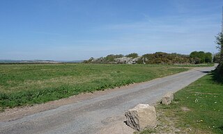
Kelly Rounds, or Castle Killibury is an Iron Age hill fort in Cornwall, England, United Kingdom. It is situated beside the A39 trunk road approximately two miles east of Wadebridge.

Trewoon is a village in south Cornwall, England, United Kingdom. It is on the western outskirts of St Austell, on the A3058 road and is a linear settlement, with housing estates, a village hall, park and playing fields. The village has many amenities and local businesses: a garage, a post office, a Convenience store, hairdressers, "The White Pyramid" pub, and Trinity Methodist church.

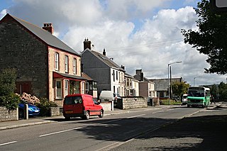
Whitstone is a village and civil parish in east Cornwall, United Kingdom. It is roughly halfway between the towns of Bude and Launceston. The population at the 2011 census was 590.

Mawgan-in-Meneage is a civil parish in Cornwall, England, United Kingdom. It is situated in the Meneage district of The Lizard peninsula south of Helston in the former administrative district of Kerrier. The parish population at the 2011 census was 1437.

The Barrington River is a tidal extension of Runnins River in the U.S. states of Rhode Island and Massachusetts. It flows approximately 6 km (4 mi). There are no dams along the river's length.
There are seventeen disused railway stations on the Cornish Main Line between Plymouth in Devon and Penzance in Cornwall, England. The remains of nine of these can be seen from passing trains. While a number of these were closed following the so-called "Beeching Axe" in the 1960s, many of them had been closed much earlier, the traffic for which they had been built failing to materialise.

Trerulefoot is a village in southeast Cornwall, England, United Kingdom. It is located on the A38 trunk road approximately halfway between the towns of Saltash and Liskeard. Trerulefoot has a farm shop, two cafés and a petrol filling station.
SS Eastfield was a 2,150-ton armed steamship which was torpedoed by the German U-boat SM UB-57 on 27 November 1917. The wreck sits intact at 50°14.255′N4°42.262′W at a depth of 50 metres (160 ft) off Mevagissey, Cornwall. The cargo of coal can be found scattered on the sea bed nearby.

Otterham is a village and a civil parish in north Cornwall, England, United Kingdom. The village is situated approximately ten miles (16 km) south of Bude and six miles (9.7 km) north of Camelford.
Summercourt is a village in mid Cornwall, England, United Kingdom. It is in the civil parish of St Enoder five miles (8 km) southeast of Newquay. The village is centred on the crossroads at OS Grid Ref SW887561 of the old course of the A30 road and the A3058 Newquay to St Austell road.

The A374 is a main road in the United Kingdom, one of six A-roads making the border crossing between Devon and Cornwall. It is the most southerly of the A37x group of roads, starting and ending its journey with the A38 trunk road, from the outskirts of Plymouth in Devon to the Trerulefoot roundabout in Cornwall.

The River Ottery is a small river in northeast Cornwall, United Kingdom. The river is about twenty miles (32 km) long from its source southeast of Otterham to its confluence with the River Tamar at Nether Bridge, two miles (3.2 km) northeast of Launceston.

Quintrell Downs is a village in Cornwall, England, United Kingdom, close to Newquay, at the junction of the A392 and A3058 roads. It is named after the surrounding area of moorland.

The St Austell River properly known as the River Vinnick, but historically called The White River, is a 12 kilometres (7.5 mi) long river located in south Cornwall, England, United Kingdom. 50.337°N 4.793°W. The river has also been known as the "red river" due to tin streaming and mining activity upstream.

Kestle and Kestle Mill are hamlets in Cornwall, England. They are situated south of Quintrell Downs; Kestle Mill is on the A3058 main road. It is in the civil parish of St Ewe

The River Seaton is a river in east Cornwall, England, UK which flows southwards for 11 miles (17 km) into the English Channel.
