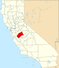
Hilmar-Irwin, California | |
---|---|
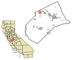
![]() Location in Merced County, California | |
Coordinates: 37°24′30″N120°51′03″W / 37.40833°N 120.85083°W | |
Country | ![]() |
State | ![]() |
County | Merced |
Area | |
• Total | 3.928 sq mi (10.173 km2) |
• Land | 3.928 sq mi (10.173 km2) |
• Water | 0 sq mi (0 km2) 0% |
Population (2020) [2] | |
• Total | 5,164 |
• Density | 1,300/sq mi (510/km2) |
Time zone | UTC-8 (Pacific (PST)) |
• Summer (DST) | UTC-7 (PDT) |
ZIP code | 95324 (Hilmar) |
Area code | 209 |
FIPS code | 06-33861 |
Hilmar-Irwin is a census-designated place (CDP) in Merced County, California, United States. As of the 2020 census, the population was 5,164. [2]
Hilmar-Irwin is located in northern Merced County at 37°24′30″N120°51′3″W / 37.40833°N 120.85083°W . [3] It is 6 miles (10 km) west-southwest of Delhi, 8 miles (13 km) west-northwest of Livingston, and 6 miles (10 km) south of Turlock.
According to the United States Census Bureau, the CDP has a total area of 3.9 square miles (10 km2), all of it land. [1]
It is home to the Hilmar Cheese Company, a cheese manufacturer that offers public tours.
Hilmar-Irwin has hot, mostly dry summers and cool, wet winters. Average January temperatures are a maximum of 54.0 °F (12.2 °C) and a minimum of 40.0 °F (4.4 °C).
Climate data for Hilmar | |||||||||||||
---|---|---|---|---|---|---|---|---|---|---|---|---|---|
Month | Jan | Feb | Mar | Apr | May | Jun | Jul | Aug | Sep | Oct | Nov | Dec | Year |
Record high °F (°C) | 75 (24) | 78 (26) | 87 (31) | 96 (36) | 102 (39) | 111 (44) | 114 (46) | 113 (45) | 105 (41) | 98 (37) | 84 (29) | 72 (22) | 114 (46) |
Mean daily maximum °F (°C) | 54 (12) | 61 (16) | 67 (19) | 73 (23) | 81 (27) | 88 (31) | 94 (34) | 92 (33) | 87 (31) | 77 (25) | 64 (18) | 54 (12) | 74 (23) |
Daily mean °F (°C) | 47.5 (8.6) | 52 (11) | 57 (14) | 61.5 (16.4) | 68 (20) | 74 (23) | 78.5 (25.8) | 77 (25) | 73.5 (23.1) | 65.5 (18.6) | 54.5 (12.5) | 46.5 (8.1) | 63.0 (17.2) |
Mean daily minimum °F (°C) | 40 (4) | 43 (6) | 46 (8) | 49 (9) | 55 (13) | 60 (16) | 63 (17) | 62 (17) | 59 (15) | 53 (12) | 44 (7) | 39 (4) | 51 (11) |
Record low °F (°C) | 18 (−8) | 21 (−6) | 25 (−4) | 28 (−2) | 34 (1) | 40 (4) | 43 (6) | 41 (5) | 37 (3) | 32 (0) | 22 (−6) | 3 (−16) | 3 (−16) |
Average rainfall inches (mm) | 2.47 (63) | 2.36 (60) | 1.93 (49) | 0.87 (22) | 0.52 (13) | 0.06 (1.5) | 0 (0) | 0.01 (0.25) | 0.25 (6.4) | 0.68 (17) | 1.32 (34) | 2.03 (52) | 12.5 (318.15) |
[ citation needed ] |
Census | Pop. | Note | %± |
---|---|---|---|
1990 | 3,278 | — | |
2000 | 4,807 | 46.6% | |
2010 | 5,197 | 8.1% | |
2020 | 5,164 | −0.6% | |
U.S. Decennial Census [4] |
At the 2010 census Hilmar-Irwin had a population of 5,197. The population density was 1,323.1 inhabitants per square mile (510.9/km2). The racial makeup of Hilmar-Irwin was 4,475 (86.1%) White, 15 (0.3%) African American, 23 (0.4%) Native American, 87 (1.7%) Asian, 1 (0.0%) Pacific Islander, 439 (8.4%) from other races, and 157 (3.0%) from two or more races. Hispanic or Latino of any race were 916 people (17.6%). [5]
The whole population lived in households, no one lived in non-institutionalized group quarters and no one was institutionalized.
There were 1,755 households, 694 (39.5%) had children under the age of 18 living in them, 1,082 (61.7%) were opposite-sex married couples living together, 205 (11.7%) had a female householder with no husband present, 106 (6.0%) had a male householder with no wife present. There were 82 (4.7%) unmarried opposite-sex partnerships, and 15 (0.9%) same-sex married couples or partnerships. 301 households (17.2%) were one person and 158 (9.0%) had someone living alone who was 65 or older. The average household size was 2.96. There were 1,393 families (79.4% of households); the average family size was 3.32.
The age distribution was 1,390 people (26.7%) under the age of 18, 483 people (9.3%) aged 18 to 24, 1,289 people (24.8%) aged 25 to 44, 1,323 people (25.5%) aged 45 to 64, and 712 people (13.7%) who were 65 or older. The median age was 36.2 years. For every 100 females, there were 96.9 males. For every 100 females age 18 and over, there were 91.8 males.
There were 1,841 housing units at an average density of 468.7 per square mile, of the occupied units 1,288 (73.4%) were owner-occupied and 467 (26.6%) were rented. The homeowner vacancy rate was 0.9%; the rental vacancy rate was 6.8%. 3,672 people (70.7% of the population) lived in owner-occupied housing units and 1,525 people (29.3%) lived in rental housing units.
As of the census [6] of 2000, there were 4,807 people, 1,602 households, and 1,315 families in the CDP. The population density was 1,226.8 inhabitants per square mile (473.7/km2). There were 1,646 housing units at an average density of 420.1 per square mile (162.2/km2). The racial makeup of the CDP was 77.93% White, 0.35% Black or African American, 0.33% Native American, 2.39% Asian, 6.59% from other races, and 12.40% from two or more races. Hispanic or Latino of any race were 12.38% of the population.
Of the 1,602 households 42.0% had children under the age of 18 living with them, 67.9% were married couples living together, 9.5% had a female householder with no husband present, and 17.9% were non-families. 14.6% of households were one person and 8.9% were one person aged 65 or older. The average household size was 3.00 and the average family size was 3.32.
The age distribution was 29.0% under the age of 18, 9.0% from 18 to 24, 29.5% from 25 to 44, 19.3% from 45 to 64, and 13.2% 65 or older. The median age was 34 years. For every 100 females, there were 98.1 males. For every 100 women age 18 and over, there were 93.7 men.
The median household income was $40,951 and the median family income was $46,250. Males had a median income of $35,244 versus $23,551 for females. The per capita income for the CDP was $16,113. About 4.3% of families and 6.4% of the population were below the poverty line, including 7.3% of those under age 18 and 4.1% of those age 65 or over.
As of the census of 1990, there were 3,278 people. The population density was 1,226.8 inhabitants per square mile (473.7/km2). The racial makeup of the CDP was 92.2% White, .5% Black or African American, 1.7% Native American, 1.3% Asian, 5.3% from other races. Hispanic or Latino of any race were 11.1% of the population.
In the state legislature, Hilmar-Irwin is located in the 12th Senate District, represented by Republican Anthony Cannella, and in the 21st Assembly District, represented by Democrat Adam Gray.
In the United States House of Representatives, Hilmar-Irwin is in California's 16th congressional district , represented by Democrat Sam Liccardo. [7]
2012 Citizen Redstricting:
Hilmar will now belong to CA State Assembly District 21. CA State Assembly District 17 is now a Bay Area assembly district.
The Current Mayor of Hilmar,California is Antonio Azevedo,who is also known as Cowboy KLBS.
Mountain View is a census designated place (CDP) in Contra Costa County, California, United States. The population was 2,622 at the 2020 census.
West Bishop is a census-designated place (CDP) in Inyo County, California, United States. The population was 2,607 at the 2010 census, down from 2,807 at the 2000 census.
North El Monte is a census-designated place (CDP) in the San Gabriel Valley, in Los Angeles County, California, United States. The population was 3,723 at the 2010 census, up from 3,703 at the 2000 census.
West Rancho Dominguez, formerly known as West Compton and also known as East Gardena, is an unincorporated census-designated place (CDP) located in southern Los Angeles County, California. Per the 2020 census, the population was 24,347. The community lies to the west of the city of Compton. The ZIP Codes encompassing the CDP area are 90220 & 90248.
Delhi is a census-designated place (CDP) in Merced County in the U.S. state of California. Delhi is 18 miles (29 km) west-northwest of Merced, at an elevation of 118 feet (36 m). According to the 2020 census, the population was 10,656.
Meadow Vista is a census-designated place (CDP) in Placer County, California, United States. It is part of the Sacramento–Arden-Arcade–Roseville Metropolitan Statistical Area. The population was 3,217 at the 2010 census, up from 3,096 at the 2000 census.
North Auburn is a census-designated place (CDP) in Placer County, California, United States. It is part of the Sacramento–Arden-Arcade–Roseville Metropolitan Statistical Area. The population was 13,452 at the 2020 census.
Cromberg is a census-designated place (CDP) in Plumas County, California, United States. Cromberg is located on the Western Pacific Railroad, 6.5 miles (10.5 km) northwest of Blairsden. The population was 261 at the 2010 census, down from 290 at the 2000 census.
Keddie is a census-designated place in Plumas County, California, United States. The population was 66 at the 2010 census.
El Cerrito is a census-designated place (CDP) in Riverside County, California, United States. It is an unincorporated area mostly surrounded by the city of Corona. The population was 5,100 at the 2010 census, up from 4,590 at the 2000 census.
Big River is a census-designated place (CDP) in San Bernardino County, California, United States. The population was 1,084 at the 2020 census, down from 1,327 at the 2010 census.
Hidden Meadows is a census-designated place (CDP) near Escondido in San Diego County, California. The population was 4,484 at the 2020 census, up from 3,485 at the 2010 census.
La Presa is a census-designated place (CDP) in the East County region of San Diego County, California, United States. The population was 35,033 at the 2020 census, up from 34,169 at the 2010 census.
Winter Gardens is a census-designated place (CDP) in San Diego County, California. The population was 22,380 at the 2020 census, up from 20,631 at the 2010 census.
Bystrom is a census-designated place (CDP) in Stanislaus County, California, United States. The population was 4,008 at the 2010 census, down from 4,518 at the 2000 census. It is part of the Modesto Metropolitan Statistical Area.
Poplar-Cotton Center is a census-designated place (CDP) in Tulare County, California, United States. The population was 2,470 at the 2010 census, up from 1,496 at the 2000 census.
Richgrove is a census-designated place (CDP) in Tulare County, California, United States. The population was 2,358 at the 2020 United States census, down from 2,882 at the 2010 census.
Strathmore is a census-designated place (CDP) in Tulare County, California, United States. The population was 2,819 at the 2010 census, up from 2,584 at the 2000 census.
Tipton is a census-designated place (CDP) in Tulare County, California, United States. The population was 2,543 at the 2010 census, up from 1,790 at the 2000 census.
Traver is a census-designated place (CDP) in Tulare County, California, United States. The population was 713 at the 2010 census, down from 732 at the 2000 census.