Hollabrunn District

Last updated
Hollabrunn District
Bezirk Hollabrunn
Hollabrunn District
Country Austria
State Lower Austria
Number of municipalities24
Administrative seat Hollabrunn
Government
[1]
  District GovernorKarl-Josef Weiss
Area
  Total
1,010.7 km2 (390.2 sq mi)
Population
 (2024) [2]
  Total
52,058
  Density52/km2 (130/sq mi)
Time zone UTC+01:00 (CET)
  Summer (DST) UTC+02:00 (CEST)
NUTS code AT125 [3]
District code310 [4]

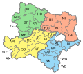
Bezirk Hollabrunn is a district of the state of Lower Austria in Austria.
Municipalities

Towns (Städte) are indicated in boldface; market towns (Marktgemeinden) in italics; suburbs, hamlets and other subdivisions of a municipality are indicated in small characters.

Related Research Articles

<span class="mw-page-title-main">Lower Austria</span> State of Austria

Lower Austria is one of the nine states of Austria, located in the northeastern corner of the country. Major cities are Amstetten, Krems an der Donau, Wiener Neustadt and Sankt Pölten, which has been the capital of Lower Austria since 1986, replacing Vienna, which became a separate state in 1921. With a land area of 19,186 km2 (7,408 sq mi) and a population of 1.7 million people, Lower Austria is the largest and second-most-populous state in Austria.

<span class="mw-page-title-main">Melk District</span> District in Lower Austria, Austria

Bezirk Melk is a district of the state of Lower Austria in Austria.

<span title="German-language text"><i lang="de">Weinviertel</i></span> Subdivision of the region of Lower Austria

The Weinviertel or Viertel unter dem Manhartsberg is located in the northeast of Lower Austria.

<span class="mw-page-title-main">Horn District</span> District in Lower Austria, Austria

Bezirk Horn is a district of the state of Lower Austria in Austria.

Bezirk Perg is a district of the state of Upper Austria in Austria.

Bezirk Vöcklabruck is a district of the state of Upper Austria in Austria.

Bezirk Villach-Land is a district of the state of Carinthia in Austria.

Bezirk Leibnitz is a district of the state of Styria in Austria. Since the 2015 Styria municipal structural reform, it consists of the following municipalities:

Bezirk Krems is a district of the state of Lower Austria in Austria. It comprises the areas to the south, west and north of the city of Krems an der Donau, which itself is a statutory city.

Bezirk Mistelbach is a district of the state of Lower Austria in Austria.

Bezirk Mödling is a district of the state of Lower Austria in Austria.

Bezirk Scheibbs is a district of the state of Lower Austria in Austria.

Bezirk Tulln is a district of the state of Lower Austria in Austria.

Bezirk Waidhofen an der Thaya is a district of the state of Lower Austria in Austria. It is located at the north and north-west of the state.

<span class="mw-page-title-main">Wiener Neustadt District</span> District in Lower Austria, Austria

Bezirk Wiener Neustadt is a district of the state of Lower Austria in Austria.

Bezirk Zwettl is a district of the state of Lower Austria in Austria.

Bezirk Neunkirchen is a district of the state of Lower Austria in Austria. It is located at the south of the state.

<span class="mw-page-title-main">Retz</span> Municipality in Lower Austria, Austria

Retz is a town with a population of 4,168 in the Hollabrunn District in Lower Austria, Austria.

<span class="mw-page-title-main">Battle of Hollabrunn (1809)</span> 1809 combat during the War of the Fifth Coalition

The Battle of Hollabrunn was a rearguard action fought on 9 July 1809 by Austrian VI Korps of the Kaiserlich-königliche Hauptarmee under Johann von Klenau against elements of the French IV Corps of the Armée d'Allemagne, under the command of André Masséna.

<span class="mw-page-title-main">Northwest railway line</span> Railway line in Austria and the Czech Republic

The Northwest railway line is an electrified railway line that runs 95.9 kilometres (59.6 mi) from Wien Floridsdorf, in the vicinity of Vienna, to Znojmo in the Czech Republic.

References

  1. "Neuer Bezirkshauptmann in Hollabrunn - Land Niederösterreich". noe.gv.at (in German). Retrieved 5 May 2024.
  2. "Population on 1 January 2023". www.statistik.at. Retrieved 5 May 2024.
  3. "Nuts Level 3". ec.europa.eu. Retrieved 5 May 2024.
  4. "Regional Units Overview". www.statistik.at. Retrieved 5 May 2024.

48°38′56″N16°01′01″E / 48.649°N 16.017°E / 48.649; 16.017