Scheibbs District

Last updated
Scheibbs District
Bezirk Scheibbs
Scheibbs District
Country Austria
State Lower Austria
Number of municipalities18
Government
[1]
  District GovernorJohann Seper (since 2010)
Area
  Total1,023.5 km2 (395.2 sq mi)
Population
 (2024) [2]
  Total42,006
  Density41/km2 (110/sq mi)
Time zone UTC+01:00 (CET)
  Summer (DST) UTC+02:00 (CEST)
NUTS code AT121 [3]
District code320 [4]

Bezirk Scheibbs is a district of the state of Lower Austria in Austria.
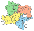
Municipalities

Suburbs, hamlets and other subdivisions of a municipality are indicated in small characters.

Related Research Articles

<span class="mw-page-title-main">Lower Austria</span> State of Austria

Lower Austria is one of the nine states of Austria, located in the northeastern corner of the country. Since 1986, the capital of Lower Austria has been Sankt Pölten, replacing Vienna, which became a separate state in 1921. With a land area of 19,186 km2 (7,408 sq mi) and a population of 1.685 million people, Lower Austria is the second-most-populous state in Austria. Other large cities are Amstetten, Klosterneuburg, Krems an der Donau, Stockerau and Wiener Neustadt.

<span class="mw-page-title-main">Melk District</span> District in Lower Austria, Austria

Bezirk Melk is a district of the state of Lower Austria in Austria.

<span class="mw-page-title-main">Weiz District</span> District in Styria, Austria

Bezirk Weiz is a district of the state of Styria in Austria. Since the 2015 Styria municipal structural reform, it consists of the following municipalities:

Oberndorf may refer to the following places:

The District of Sankt Veit an der Glan is an administrative district in Carinthia, Austria.

Völkermarkt District is an administrative district in the Austrian state of Carinthia.

Bezirk Amstetten is a district of the state of Lower Austria in Austria.

Bezirk Vöcklabruck is a district of the state of Upper Austria in Austria.

Bezirk St. Pölten-Land is a district of the state of Lower Austria in Austria. It completely surrounds the city of Sankt Pölten, which exists as a separate entity and borders Vienna to the west.

<span class="mw-page-title-main">Wiener Neustadt-Land District</span> District in Lower Austria, Austria

Bezirk Wiener Neustadt-Land is a district of the state of Lower Austria in Austria.

<span class="mw-page-title-main">Ybbs Valley Railway</span>

The Ybbs Valley Railway was a narrow-gauge railway of the Austrian Federal Railways with a track gauge of 760 mm, located in the Lower Austrian Mostviertel.

The 1996 UEFA European Under-16 Championship was the 14th edition of UEFA's European Under-16 Football Championship. Players born on or after 1 August 1979 were eligible to participate in this competition. Austria hosted the championship, during 29 April – 11 May 1996. 16 teams entered the competition, and Portugal defeated France in the final to win the competition for the third time. Portugal was the first team to win the title two years in a row.

<span class="mw-page-title-main">Austrian walled towns</span> History of walled towns in Austria

The earliest Austrian walled towns started to appear in the late 11th century to the early 13th century. Their establishment was closely connected with the development of Austria as a march of the Holy Roman Empire and in particular by the Hohenstaufen emperors and their Marcher Lords, the Babenbergs. In present-day Austria, there are 106 towns or cities that were walled. The walls of Radstadt, Freiburg, Hainburg and Drosendorf survive almost intact, and Austria has some of the most impressive walled towns in Europe.

References

  1. "Offizielle Amtsübergabe an der Bezirkshauptmannschaft Scheibbs" [Official handover of office at the district administration of Scheibbs] (Press release) (in German). Provincial Government of Lower Austria. OTS. 2010. Retrieved 2024-05-05.
  2. "Population on 1 January 2023". www.statistik.at. Retrieved 5 May 2024.
  3. "ÖSTERREICH - NUTS level 3". ec.europa.eu. Retrieved 5 May 2024.
  4. "Regional Units Overview". www.statistik.at. Retrieved 5 May 2024.

48°00′40″N15°05′20″E / 48.011°N 15.089°E / 48.011; 15.089