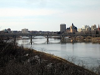
The South Saskatchewan River is a major river in Canada that flows through the provinces of Alberta and Saskatchewan.

The District of Saskatchewan was a regional administrative district of Canada's Northwest Territories. It was formed in 1882 was later enlarged then abolished with the creation of the provinces of Saskatchewan and Alberta in 1905.
The Mackenzie Highway is a Canadian highway in northern Alberta and the Northwest Territories. It begins as Alberta Highway 2 at Mile Zero in Grimshaw, Alberta. After the first 4.0 km (2.5 mi), it becomes Alberta Highway 35 for the balance of its length through Alberta and then becomes Northwest Territories Highway 1.

Alberta Provincial Highway No. 11, commonly referred to as Highway 11 and officially named the David Thompson Highway, is a provincial highway in central Alberta, Canada. It runs for 318 km (198 mi) from Highway 93 at Saskatchewan River Crossing near Mount Sarbach in Banff National Park east to Highway 12 near Nevis. It passes by Nordegg and through Rocky Mountain House, Sylvan Lake and Red Deer along its course. The highway is named after David Thompson, a British-Canadian fur trader, surveyor, and map-maker who explored the area between Rocky Mountain House and Kootenae House through Howse Pass.

Howse Pass is a pass through the Rocky Mountains in Canada. The pass is located in Banff National Park, between Mount Conway and Howse Peak. From here waters flow east via Conway Creek, Howse River, North Saskatchewan River to Lake Winnipeg and Hudson Bay. To the west it drains by the Blaeberry River to the Columbia River and on to the Pacific Ocean.

Athabasca Pass is a high mountain pass in the Canadian Rockies on the border between Alberta and British Columbia. In fur trade days it connected Jasper House on the Athabasca River with Boat Encampment on the Columbia River.

Divide Creek is a short creek near Kicking Horse Pass on the British Columbia/Alberta border. After following the Continental Divide of the Americas for a short distance, the creek forks, with one side draining through the Bow River east to Hudson Bay and the Arctic Ocean, and the other side draining west to the Pacific Ocean by way of the Kicking Horse River.

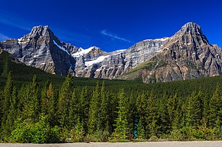
Howse Peak is the highest mountain in the Waputik Mountains, a subrange of the Canadian Rockies. It is located 5 km (3 mi) west of the Icefields Parkway, above Chephren Lake, on the continental divide between Alberta and British Columbia. At 3,295 m (10,810 ft), it is the 46th highest peak in Alberta, and the 59th highest in British Columbia.

Fort Carlton was a Hudson's Bay Company fur trade post from 1795 until 1885. It was rebuilt by the Saskatchewan government as a provincial historic park and can be visited today. It is about 65 kilometers north of Saskatoon.

The Great Divide Trail (GDT) is a wilderness hiking trail in the Canadian Rockies. The trail closely follows the Great Divide between Alberta and British Columbia, crossing the divide more than 30 times. Its southern terminus is in Waterton Lakes National Park at the Canada–US border and its northern terminus is at Kakwa Lake in Kakwa Provincial Park, north of Jasper National Park. The trail is 1,130 km (700 mi) long and ranges in elevation from 1,055 m (3,461 ft) at Old Fort Point trailhead near Jasper to 2,590 m (8,500 ft) at an unnamed pass above Michele Lakes just south of the White Goat Wilderness Area.

The Mistaya River is a short river in western Alberta, Canada. It flows through the Canadian Rockies, and a section of the Icefields Parkway was built along its course.

Mistaya Canyon is a canyon in the western part of the Alberta province of Canada. It is formed by the Mistaya River. Tourists who are visiting Banff National Park often visit it because of its distinctive curvy canyon walls and because it is easy to access, being just off the Icefields Parkway. The 0.5 km trail to the canyon is located at a large parking area on the west side of the Parkway, part way up the long hill south of the North Saskatchewan River. There are actually two such parking areas on the hill; the Mistaya one is clearly marked by signs on the highway and at the beginning of the trail. The trail is an easy walk in summer but too steep for wheelchairs. The canyon is deep and there are no railings. The trail is icy in early spring.

Saskatchewan River Crossing is a locality in western Alberta, Canada. It is located within Banff National Park at the junction of Highway 93 and Highway 11. It is administered by Improvement District No. 9.

Beaver River is a large river in east-central Alberta and central Saskatchewan, Canada. It flows east through Alberta and Saskatchewan and then turns sharply north to flow into Lac Île-à-la-Crosse on the Churchill River which flows into Hudson Bay. The Alberta part is in the Cold Lake oil sands.

Alberta's Rockies comprises the Canadian Rocky Mountains in Alberta, Canada. It is a region on the southwestern part of the province, along the British Columbia border. It covers all but the south of Census Division 15.
Simpson Pass, el. 2,107 m (6,913 ft), is a mountain pass on the border between the Canadian provinces of Alberta and British Columbia, in the area of the Ball Range. It is the prominence col for Mount Ball on the Continental Divide in the vicinity of Sunshine Village ski resort. Simpson River and Simpson Pass are named after Sir George Simpson who first explored the area in 1841.

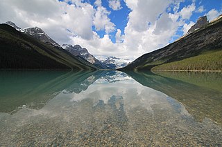
Glacier Lake is the fourth largest lake in Banff National Park, in Alberta, Canada.

Epaulette Mountain is a 3,094-metre (10,151-foot) mountain summit located between the Howse River valley and Mistaya River valley of Banff National Park, in the Canadian Rockies of Alberta, Canada. Its nearest higher peak is Mount Sarbach, 3.64 km (2.26 mi) to the northwest. Epaulette Mountain is situated south of Saskatchewan Crossing, where the Icefields Parkway intersects with the David Thompson Highway. Descriptively named for the shoulder ornament on some military uniforms, a glacier seems to hang on a narrow shelf above the steep cliffs and was thought to resemble an epaulette. Epaulette is a French word which means "little shoulders".

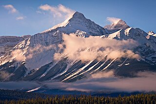
Mount Outram is a 3,245-metre (10,646-foot) mountain summit located in the Howse River Valley of Banff National Park, in the Canadian Rockies of Alberta, Canada. Its nearest higher peak is Mount Forbes, 4.37 km (2.72 mi) to the southwest. Glacier Lake is situated 4.0 km (2.5 mi) to the north, and the Sir James Glacier lies below the south aspect of the peak. Mount Outram can be seen from the Icefields Parkway southwest of Saskatchewan Crossing, with optimum photography conditions in morning light.


