
Campos Altos is a Brazilian municipality located in the west of the state of Minas Gerais. Its population as of 2020 was estimated to be 15,563 people living in a total area of 719 km2 (278 sq mi). The city belongs to the mesoregion of Triângulo Mineiro and Alto Paranaíba and to the micro-region of Araxá. It became a municipality in 1944.

Theinni or Hsenwi is a town in northern Shan State of Burma, situated near the north bank of the Nam Tu River and now the centre of Hsenwi Township in Lashio District. It is 28 miles (45 km) north of Lashio and 2,100 feet (640 m) above sea level.

Felixlândia is a Brazilian municipality located in the northeast of the state of Minas Gerais. Its population as of 2020 was 15,433 living in a total area of 1,553 square kilometres (600 sq mi). The city belongs to the statistical mesoregion of Central Mineira and to the statistical microregion of Curvelo. It became a municipality in 1948.

Joaquim Felício is a Brazilian municipality located in the northeast of the state of Minas Gerais. Its population as of 2020 was 4,727 living in a total area of 791 km². The city belongs to the statistical mesoregion of Central Mineira and to the statistical microregion of Curvelo. It became a municipality in 1962.

Kutkai Township is a township of Muse District in the Shan State of eastern Burma. The principal town is Kutkai.
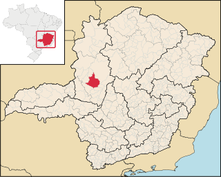
Presidente Olegário is a municipality in the north of the Brazilian state of Minas Gerais. Its population in 2020 was 19,627 inhabitants in a total area of 3,531 km2 (1,363 sq mi).
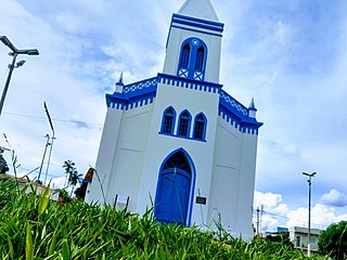
Monte Carmelo is a Brazilian municipality located in the northwest of the state of Minas Gerais. Its population as of 2020 was 47,931 people living in a total area of 1,354 km2 (523 sq mi). The city belongs to the mesoregion of Triângulo Mineiro e Alto Paranaiba and to the microregion of Patrocínio. It became a municipality in 1840.
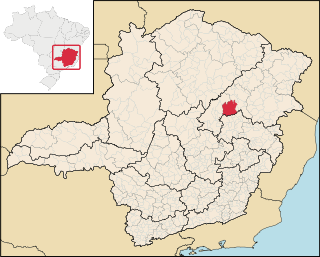
Itamarandiba is a Brazilian municipality located in the north-center of the state of Minas Gerais. Its population as of 2020 was 34,936 living in a total area of 2,736 km2.

Machacalis is a Brazilian municipality located in the northeast of the state of Minas Gerais. Its population as of 2020 was 7,111 living in a total area of 329 km². The city belongs to the statistical mesoregion of Vale do Mucuri and to the statistical microregion of Nanuque. It became a municipality in 1954.
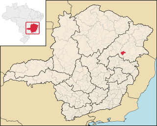
Malacacheta is a Brazilian municipality located in the northeast of the state of Minas Gerais. Its population as of 2020 was estimated to be 18,602 people living in a total area of 719 km2. The city belongs to the mesoregion of Vale do Mucuri and to the micro-region of Teófilo Otoni. It became a municipality in 1924.

Pavão is a Brazilian municipality located in the northeast of the state of Minas Gerais. Its population as of 2020 was estimated to be 8,419 people living in a total area of 599 km2. The city belongs to the mesoregion of Vale do Mucuri and to the micro-region of Teófilo Otoni. It became a municipality in 1962.

Conceição das Alagoas is a Brazilian municipality located in the west of the state of Minas Gerais. Its population as of 2020 was estimated to be 28,346 people living in a total area of 1,348 km². The city belongs to the mesoregion of Triângulo Mineiro and Alto Paranaíba and to the micro-region of Uberaba. It became a municipality in 1938.

Conquista is a municipality located in the west of Minas Gerais, Brazil. As of 2020, 6,969 inhabitants are estimated to live within the 616 square kilometres (238 sq mi) of Conquista. The city belongs to the mesoregion of Triângulo Mineiro and Alto Paranaíba and to the microregion of Uberaba. Conquista became a municipality in 1912.

Ibiá is a Brazilian municipality located in the west of the state of Minas Gerais. Its population as of 2020 was estimated to be 25,358 people living in a total area of 2,707 km². The city belongs to the mesoregion of Triângulo Mineiro and Alto Paranaíba and to the micro-region of Araxá. It became a municipality in 1923.

Guaranésia is a Brazilian municipality located in the southwest of the state of Minas Gerais. Its population as of 2020 was 19,017 people living in a total area of 294 km². The city belongs to the meso-region of Sul e Sudoeste de Minas and to the micro-region of São Sebastião do Paraíso. It became a municipality in 1901. The municipality is an important producer of coffee.

Coroaci is a Brazilian municipality located in the east of the state of Minas Gerais. Its population as of 2010 was 10,270 people living in a total area of 576 km². The city belongs to the meso-region of Vale do Rio Doce and to the micro-region of Governador Valadares. It became a municipality in 1949.

Nawnghkio, variously spelt Naunghkio, Naungcho or Nawngcho, is a town in Kyaukme District, in northern Shan State, Burma. It is the principal town and administrative seat of Nawnghkio Township. It is connected to Mandalay, Pyin U Lwin, Kyaukme, Hsipaw and Lashio by road and rail and by road to Taunggyi via National Road 43. Asia World Company won the contract to rebuild part of the road in 2002. Originally on the Mandalay-Lashio Road, after Pyin U Lwin and before Kyaukme, Nawnghkio is on what is now the Mandalay-Muse Road, part of the Asian Highway Route 14 (AH14).
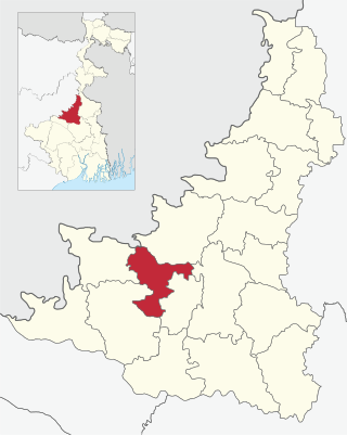
Suri I is a community development block that forms an administrative division in Suri Sadar subdivision of Birbhum district in the Indian state of West Bengal.

Dubrajpur is a community development block that forms an administrative division in Suri Sadar subdivision of Birbhum district in the Indian state of West Bengal.

Murarai II is a community development block that forms an administrative division in Rampurhat subdivision of Birbhum district in the Indian state of West Bengal.


