
Ventura County is a county located in the southern part of the U.S. state of California. As of the 2020 census, the population was 843,843. The largest city is Oxnard, and the county seat is the city of Ventura.

El Rio is a small, rural unincorporated town in Ventura County, California, United States, on the northeast side of the 101 Freeway and Oxnard, and south of the Santa Clara River. The town was founded in 1875 and named New Jerusalem by the owner of general store who became the first postmaster in 1882. In 1885, a school and Santa Clara Catholic Church were built. Located near where the coastal railroad line crosses the Santa Clara River, the town's name was changed to El Rio around 1900. The former wagon river crossing route became the Ventura Freeway which separates the community from the commercial developments that grew up on the southwest side of the freeway. That portion of the historic community and sections closer to the river have been annexed to the city of Oxnard. Vineyard Avenue is the central business district for the largely residential community.

Ventura, officially named San Buenaventura, is a city in and the county seat of Ventura County, California, United States. It is a coastal city located northwest of Los Angeles. The population was 110,763 at the 2020 census. Ventura is a popular tourist destination, owing to its historic landmarks, beaches, and resorts.

The Conejo Valley is a region spanning both southeastern Ventura County and northwestern Los Angeles County in Southern California, United States. It is located in the northwestern part of the Greater Los Angeles Area.

Point Mugu is a cape or promontory within Point Mugu State Park on the Pacific Coast in Ventura County, near the city of Port Hueneme and the city of Oxnard. The name is believed to be derived from the Chumash Indian term "Muwu", meaning "beach", which was first mentioned by Cabrillo in his journals in 1542. Mugu Lagoon is a salt marsh just upcoast from the promontory within the Naval Base Ventura County formerly called the Naval Air Station Point Mugu.
Newbury Park is a populated place and town in Ventura County, California, United States. Most of it lies within the western Thousand Oaks city limits, while unincorporated areas include Casa Conejo and Ventu Park. The town is located in Southern California around 8 miles (13 km) from the Pacific Ocean and has a mild year-round climate, scenic mountains, and environmental preservation. About 28,000 residents of Thousand Oaks reside in Newbury Park.

The Simi Hills are a low rocky mountain range of the Transverse Ranges in eastern Ventura County and western Los Angeles County, of southern California, United States.

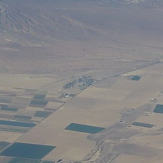
Somis is an unincorporated community in Ventura County, California. It was established in 1892 by Thomas Bard and D.T. Perkins on a portion of the Rancho Las Posas Mexican land grant. Somis is in the Las Posas Valley on the south bank of Fox Barranca, just west of Arroyo Las Posas. For statistical purposes, the United States Census Bureau has defined Somis as a census-designated place (CDP).

The Oxnard Plain is a large coastal plain in southwest Ventura County, California, United States surrounded by the mountains of the Transverse ranges. The cities of Oxnard, Camarillo, Port Hueneme and much of Ventura as well as the unincorporated communities of Hollywood Beach, El Rio, Saticoy, Silver Strand Beach, and Somis lie within the over 200-square-mile alluvial plain (520 km2). The population within the plain comprises a majority of the western half of the Oxnard-Thousand Oaks-Ventura Metro Area and includes the largest city along the Central Coast of California. The 16.5-mile-long coastline (26.6 km) is among the longest stretches of continuous, linear beaches in the state.

Bell Canyon is an unincorporated community in eastern Ventura County, California, United States. Bell Canyon is a gated community in the Simi Hills with the main access through the Los Angeles community of West Hills and the western San Fernando Valley. Bell Canyon sits at an elevation of 1,368 feet (417 m). The 2020 census reported Bell Canyon's population was 1,946. For statistical purposes, the Census Bureau has defined Bell Canyon as a census-designated place (CDP). According to a 2016 study, Bell Canyon is the seventh wealthiest community in the state of California with an annual median income of $230,000.

Saticoy is an unincorporated community in Ventura County, California, United States. The site of one of the largest settlements of the Chumash region, a settlement was laid out in 1887 along the railroad line that was being built from Los Angeles through the Santa Clara River Valley to the town of San Buenaventura. Although the town was 10 miles (16 km) distant at that time, the City of Ventura grew to a point where only a small residential and commercial community is left outside the city limits. For statistical purposes, the United States Census Bureau has defined that community as a census-designated place (CDP).
The Colonia is a neighborhood located in the central portion of the city of Oxnard, California, USA. The neighborhood was laid out by the Colonia Land Improvement Company in close proximity of the sugar factory and beet fields to house workers just east of the city's downtown business district. Long a Latino barrio, it is home to lower-income families, former resident César Chávez once lived there, also known worldwide as Boxnard because of La Colonia Youth Boxing Club, which has produced notable fighters such as Fernando Vargas, Robert Garcia, Miguel Angel Garcia, Victor Ortíz, Brandon Rios and Mia St. John.

Del Valle is a placename in the Castaic area of Los Angeles County, California, United States. The Del Valle Oil Field and L.A. County Fire Department's Del Valle Regional Training Center are located nearby.
New Cuyama is a census-designated place in the Cuyama Valley, Santa Barbara County, California. It was named after the Chumash word for "clams", most likely due to the millions of petrified prehistoric clamshell fossils that are found in the surrounding areas. The town is home to the majority of the utility infrastructure for its residents, including nearby neighbor Cuyama, California. New Cuyama is located very close to the intersection points for Santa Barbara, San Luis Obispo, Ventura and Kern counties. The town is served by Highway 166 and the public-use New Cuyama Airport. The population was 542 at the 2020 census.

Simi Valley is a city in the valley of the same name in the southeast region of Ventura County, California, United States. Simi Valley is 40 miles (65 km) from Downtown Los Angeles, making it part of the Greater Los Angeles Area. The city borders Thousand Oaks, Moorpark, and the Chatsworth neighborhood of Los Angeles. As of the 2020 U.S. Census the population was 126,356, up from 124,243 in 2010. The city of Simi Valley is surrounded by the Santa Susana Mountains and the Simi Hills, west of the San Fernando Valley, and northeast of the Conejo Valley. It grew as a bedroom community for the cities in the Los Angeles area and the San Fernando Valley when a freeway was built over the Santa Susana Pass.

Rancho Guadalasca was a 30,594-acre (123.81 km2) Mexican land grant in present-day Ventura County, California, given in 1836 by Governor Mariano Chico to Ysabel Yorba. The grant was in the southern part of the county, bordering on Los Angeles County. The grant extended along the Pacific coast near Point Mugu for about eight miles and extended into the interior along Guadalasca Creek in the Santa Monica Mountains for about ten miles.
Rancho Huasna was a 22,153-acre (89.65 km2) Mexican land grant in present-day San Luis Obispo County, California given in 1843 by Governor Manuel Micheltorena to Isaac J. Sparks. The grant extended along the Huasna River and the western slope of the Santa Lucia Range, east of present-day Arroyo Grande and encompassing Huasna.
Rancho Pismo was a 8,839-acre (35.77 km2) Mexican land grant in present day San Luis Obispo County, California, given in 1840 by acting governor Manuel Jimeno Casarin to José Ortega. The grant extended along the Pacific coast and encompassed present day Pismo Beach, Grover Beach, Shell Beach and parts of Arroyo Grande.
Rancho El Escorpión was a 1,110-acre (4.5 km2) Mexican land grant in present day Los Angeles County, California given in 1845 by Governor Pío Pico to three Chumash Native Americans - Odón Chijulla, Urbano, and Mañuel. The half league square shaped Rancho El Escorpión was located at the west end of the San Fernando Valley on Bell Creek against the Simi Hills, and encompassed parts of present day West Hills and Woodland Hills.
'olol'koy Beach Park is a recreational area operated by the city of Oxnard, California at the edge of the Oxnard Plain. Formerly called Oxnard Beach Park, the park was renamed after the Chumash word for dolphin in 2023.


