Pozo was named by George Washington Lingo, Esq., "a well known citizen"[4] who proposed the name for the post office because the village is in a holelike valley—pozo means "well" or "hole" in Spanish.[5]
Pozo is home to the still thriving Pozo Saloon, established in 1858. During its early years, the Pozo Saloon was the primary watering hole for weary travelers making their way over Pozo Summit. Today it is a well-known live music venue, hosting internationally-known acts including Willie Nelson, Merle Haggard, and G Love and Special Sauce.[6][7]
The ZIP Code is 93453. The community is inside area code 805.
Southern California is a geographic and cultural region that generally comprises the southern portion of the U.S. state of California. It includes the Los Angeles metropolitan area as well as the Inland Empire. The region generally contains ten of California's 58 counties: Los Angeles, San Diego, Orange, Riverside, San Bernardino, Kern, Ventura, Santa Barbara, San Luis Obispo, and Imperial counties.
San Luis Obispo County, officially the County of San Luis Obispo, is a county on the Central Coast of California. As of the 2020 census, the population was 282,424. The county seat is San Luis Obispo.
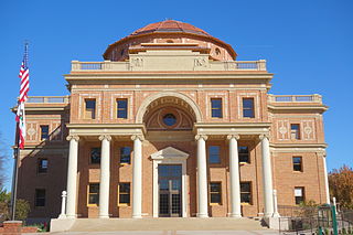
Atascadero is a city in San Luis Obispo County, California, United States, located on U.S. Route 101. Atascadero is part of the San Luis Obispo-Paso Robles metropolitan statistical area, which encompasses the extents of the county. Atascadero is farther inland than most other cities in the county, and as a result, usually experiences warmer, drier summers, and cooler winters than other nearby cities such as San Luis Obispo and Pismo Beach. The main freeway through town is U.S. 101. The nearby State Routes 41 and 46 provide access to the Pacific Coast and the Central Valley of California.
San Luis Obispo is a city and county seat of San Luis Obispo County, in the U.S. state of California. Located on the Central Coast of California, San Luis Obispo is roughly halfway between the San Francisco Bay Area in the north and Greater Los Angeles in the south. The population was 47,063 at the 2020 census.
The Central Coast is an area of California, roughly spanning the coastal region between Point Mugu and Monterey Bay. It lies northwest of Los Angeles and south of the San Francisco Bay Area, and includes the rugged, rural, and sparsely populated stretch of coastline known as Big Sur.
The Sierra Madre is a mountain range in southwestern California. It forms the southernmost part of the California Coast Ranges and lies mostly in Santa Barbara County, with a small portion extending into Ventura County. The Sierra Madre has a northwest-to-southeast orientation, bordered on the north and northeast by the Cuyama River and Cuyama Valley, and on the south and east by the drainage of the Sisquoc River.
Area codes 805 and 820 are telephone area codes in the North American Numbering Plan (NANP) for the U.S. state of California. The numbering plan area (NPA) includes most or all of the counties of San Luis Obispo, Santa Barbara, Ventura, and the southernmost portions of Monterey County. 805 was split from area code 213 in 1957, and area code 820 was added to the NPA in 2018, creating an area code overlay.
The Santa Lucia Mountains or Santa Lucia Range is a rugged mountain range in coastal central California, running from Carmel southeast for 140 miles (230 km) to the Cuyama River in San Luis Obispo County. The range is never more than 11 miles (18 km) from the coast. The range forms the steepest coastal slope in the contiguous United States. Cone Peak at 5,158 feet (1,572 m) tall and three miles (5 km) from the coast, is the highest peak in proximity to the ocean in the lower 48 United States. The range was a barrier to exploring the coast of central California for early Spanish explorers.
Santa Margarita is a unincorporated community located in San Luis Obispo County, California. It was founded in 1889 near Cuesta Peak and San Luis Obispo along State Route 58. The town's name comes from the Mexican Alta California land grant of Rancho Santa Margarita. It is home to the Santa Margarita de Cortona Asistencia site. For statistical purposes, the United States Census Bureau has defined Santa Margarita as a census-designated place (CDP). The population was 1,259 at the 2010 census.
The Nacimiento River is a 64.8-mile-long (104.3 km) river in southern Monterey County and northern San Luis Obispo County, California. A large portion of the river's run is on military reservations. The river's upper reaches are inside Fort Hunter Liggett, Lake Nacimiento is in the middle and the lower reaches are inside Camp Roberts. It is the largest tributary of the Salinas River in terms of streamflow.
The La Panza Range is a mountain range in the Central Coast of California region in San Luis Obispo County, east of the small town of Santa Margarita. It is one of the California Coast Ranges and in the Los Padres National Forest.
Famoso is an unincorporated community in Kern County, California. It is located on Poso Creek 5.5 miles (8.9 km) south-southeast of McFarland, at an elevation of 427 feet (130 m). Famoso is located at the junction of State Route 99 and the eastern terminus of State Route 46. The town is famous for its nut groves and especially the race track - Auto Club Famoso Raceway.
Ventucopa is an unincorporated community in the southeastern Cuyama Valley, within eastern Santa Barbara County, California. Ventucopa has a population of 92 people and is located an elevation of 2,896 feet (883 m). It is an agricultural area situated near the Cuyama River. It is located near the intersection of four counties: Santa Barbara, Ventura, San Luis Obispo and Kern. Ventucopa borders Los Padres National Forest to the east, south and west. When the town was registering a postal office in 1926, local resident Dean Parady came up with Ventucopa, as the community lies between Maricopa and Ventura County.
Buckhorn is a populated place name along State Route 126 in a rural unincorporated area of Ventura County, California, United States. Buckhorn is about 2 miles (3.2 km) outside the town of Piru but is within the eponymous census-designated place. Located in the Santa Clara River Valley, this was an early stagecoach stop and a regular eating place known for being midway between Los Angeles and Santa Barbara. It was run by the Warring family who came to the county in 1869 and owned the nearby Buckhorn Ranch. Buckhorn was also a station on the initial route of the coast rail line that arrived in the valley in 1887. With the completion of the Santa Susana Tunnel in 1904, the route through Oxnard and Simi Valley became the most direct route between Los Angeles and San Francisco. The shipping of agricultural products such as citrus continued to keep this route busy for many years. The Santa Paula Branch Line no longer connects through to Santa Clarita after the rails were washed out. The junction with the main line is near the East Ventura station.
The Cuyama Valley is a valley along the Cuyama River in Central California, in northern Santa Barbara, southern San Luis Obispo, southwestern Kern, and northwestern Ventura counties. It is about two hours driving time from both Los Angeles and the Santa Barbara area.
The following outline is provided as an overview of and topical guide to the U.S. state of California:
Bitterwater Creek, originally named Arroyo de Matarano, is a stream in eastern San Luis Obispo County and northwestern Kern County, central California.
The Salinas Dam is a dam built on the Salinas River in San Luis Obispo County, California. Designed by Raymond A. Hill, the gravity dam features an arched design with an open spillway. The War Department began construction on the dam in mid-1941, as World War II began to reach the Pacific. The original intent of the dam was to supply water to Camp San Luis Obispo, which the Army was considering expanding to meet military needs. However, the camp’s wells ultimately provided sufficient water to the camp, and the reservoir water was never required or used by the military. Today, the dam operations are leased by the city of San Luis Obispo, to supply water to the city and surrounding agricultural areas. The reservoir created by the dam is known as the Santa Margarita Lake, or Santa Margarita Reservoir.
Cuesta Pass or La Cuesta Pass, colloquially referred to as simply the grade, is a low mountain pass in San Luis Obispo County on California's Central Coast. It crosses the southern Santa Lucia Range at an altitude of 1,522 feet (464 m), and connects San Luis Obispo, roughly 5 miles (8.0 km) to the south, with Atascadero, Paso Robles, and the Salinas Valley to the north. It is traversed by U.S. Route 101 and the Coast Line of the Union Pacific Railroad, and is better known for the long slope up to the pass from San Luis Obispo, in the canyon of San Luis Obispo Creek, which is redundantly named the "Cuesta Grade".
Ontario Hot Springs is a hot-water well in southern San Luis Obispo County, California, United States. The geothermally heated water from the well is the central feature of a resort called Avila Hot Springs near Avila Beach.
This page is based on this Wikipedia article Text is available under the CC BY-SA 4.0 license; additional terms may apply. Images, videos and audio are available under their respective licenses.