{{nobold|{{lang|vi|Thành phố Hà Tĩnh}} }}"},"other_name":{"wt":""},"native_name":{"wt":""},"nickname":{"wt":""},"settlement_type":{"wt":"[[Provincial city (Vietnam)|Provincial city (Class-2)]]"},"image_skyline":{"wt":"Hà_Tĩnh_view_from_Sailing_Tower.jpg"},"imagesize":{"wt":"300"},"image_caption":{"wt":"View from the Sailing Tower building"},"flag_size":{"wt":""},"image_seal":{"wt":"Biểu trưng thành phố Hà Tĩnh, tỉnh Hà Tĩnh, Việt Nam.svg"},"seal_size":{"wt":""},"image_shield":{"wt":""},"shield_size":{"wt":""},"image_blank_emblem":{"wt":""},"blank_emblem_type":{"wt":""},"blank_emblem_size":{"wt":""},"image_map":{"wt":""},"mapsize":{"wt":""},"map_caption":{"wt":"{{maplink|frame=yes|plain=yes|type=shape|frame-width=280|frame-align=center|stroke-width=3}}"},"image_map1":{"wt":""},"mapsize1":{"wt":""},"map_caption1":{"wt":""},"image_dot_map":{"wt":""},"dot_mapsize":{"wt":""},"dot_map_caption":{"wt":""},"dot_x":{"wt":""},"dot_y":{"wt":""},"pushpin_map":{"wt":"Vietnam#Southeast Asia#Asia "},"pushpin_label_position":{"wt":""},"pushpin_map_caption":{"wt":"Location of Hà Tĩnh in Vietnam"},"pushpin_mapsize":{"wt":"300\n"},"subdivision_type":{"wt":"Country"},"subdivision_name":{"wt":"{{flag|Vietnam}}"},"subdivision_type1":{"wt":"[[Provinces of Vietnam|Province]]"},"subdivision_name1":{"wt":"[[Hà Tĩnh Province|Hà Tĩnh]]"},"seat_type":{"wt":""},"seat":{"wt":""},"government_footnotes":{"wt":""},"government_type":{"wt":""},"leader_title":{"wt":"People's Committee President"},"leader_name":{"wt":"Nguyễn Văn Quý"},"leader_title1":{"wt":"People's Association President"},"leader_name1":{"wt":"Hà Văn Trọng"},"leader_title2":{"wt":"Secretary"},"leader_name2":{"wt":"Dương Tất Thắng"},"established_title":{"wt":"Upgraded to city"},"established_date":{"wt":"28 May 2007\n"},"area_magnitude":{"wt":""},"unit_pref":{"wt":""},"area_footnotes":{"wt":""},"area_total_km2":{"wt":"230"},"area_land_km2":{"wt":""},"area_water_km2":{"wt":""},"area_total_sq_mi":{"wt":""},"area_land_sq_mi":{"wt":""},"area_water_sq_mi":{"wt":""},"area_water_percent":{"wt":""},"population":{"wt":"380,000\n"},"elevation_footnotes":{"wt":""},"elevation_m":{"wt":""},"elevation_ft":{"wt":""},"elevation_max_m":{"wt":""},"elevation_max_ft":{"wt":""},"elevation_min_m":{"wt":""},"elevation_min_ft":{"wt":""},"population_as_of":{"wt":""},"population_footnotes":{"wt":""},"population_note":{"wt":""},"population_total":{"wt":""},"population_density_km2":{"wt":"auto"},"population_density_sq_mi":{"wt":""},"population_blank1_title":{"wt":"Ethnicities"},"population_blank1":{"wt":"95% [[Vietnamese people|Kinh]], 5% other ethnicities"},"timezone":{"wt":""},"utc_offset":{"wt":""},"timezone_DST":{"wt":""},"utc_offset_DST":{"wt":""},"coor_type":{"wt":""},"coordinates":{"wt":"{{coord|18|20|N|105|54|E|region:VN|display=inline}}"},"blank_name":{"wt":"[[Köppen climate classification|Climate]]"},"blank_info":{"wt":"[[Humid subtropical climate|Cfa]]/[[Tropical monsoon climate|Am]]\n"},"postal_code_type":{"wt":""},"postal_code":{"wt":""},"area_code":{"wt":""},"website":{"wt":"{{url|hatinhcity.gov.vn}}"},"footnotes":{"wt":""}},"i":0}}]}" id="mwBA">Provincial city in Vietnam
Hà Tĩnh | |
---|---|
Hà Tĩnh City Thành phố Hà Tĩnh | |
![]() View from the Sailing Tower building | |
Coordinates: 18°20′N105°54′E / 18.333°N 105.900°E | |
Country | ![]() |
Province | Hà Tĩnh |
Upgraded to city | 28 May 2007 |
Government | |
• People's Committee President | Nguyễn Văn Quý |
• People's Association President | Hà Văn Trọng |
• Secretary | Dương Tất Thắng |
Area | |
• Total | 230 km2 (90 sq mi) |
Population | 380,000 |
• Ethnicities | 95% Kinh 5% other ethnicities |
Climate | Cfa/Am |
Website | hatinhcity |
Hà Tĩnh (Vietnamese: [hâːtǐŋ̟ˀ] ⓘ ) is a city in Vietnam. [1] It is the capital of Hà Tĩnh Province, and lies in the North Central Coast region. It is located on National Highway 1A. The Vietnamese capital Hanoi is located 340 km north of Hà Tĩnh, Vinh is located 50 km to the north, and Huế is located 314 km to the south. Hà Tĩnh is 12.5 km from the South China Sea.
Hà Tĩnh city consists of 16 administration units: 10 wards and 6 communes:
There are many tertiary education institutions such as Hà Tĩnh University, Hà Tĩnh College of Medicine, Nguyễn Du Cultural, Sports and Tourism College, Hà Tĩnh Vocational College of Technology and Vietnam-Germany College of Vocation. Some high schools include Hà Tĩnh Senior High School, Phan Đình Phùng High School and Thành Sen (Lotus City) High School.
Hà Tĩnh has a marginal and unusually wet tropical monsoon climate (Köppen Am) bordering on both an unusually wet humid subtropical climate (Cfa) and a trade-wind tropical rainforest climate (Af) – the last of these being a rare climate type in Vietnam. The heaviest rain is in the northeast monsoon season from September to November, when 1,616 millimetres or 63.6 inches can be expected, but rainfall exceeds 50 millimetres or 2 inches even in the driest months of the “spring” season. The weather during the “winter” season from December to February is warm, humid and somewhat rainy, whilst the “summer” from May to August is hot to sweltering although drier than most of Indochina due to the influence of the mountains to the southwest.
Climate data for Hà Tĩnh | |||||||||||||
---|---|---|---|---|---|---|---|---|---|---|---|---|---|
Month | Jan | Feb | Mar | Apr | May | Jun | Jul | Aug | Sep | Oct | Nov | Dec | Year |
Record high °C (°F) | 34.5 (94.1) | 36.2 (97.2) | 39.4 (102.9) | 43.2 (109.8) | 41.5 (106.7) | 40.1 (104.2) | 40.7 (105.3) | 39.7 (103.5) | 38.5 (101.3) | 35.2 (95.4) | 35.3 (95.5) | 30.4 (86.7) | 43.2 (109.8) |
Mean daily maximum °C (°F) | 20.5 (68.9) | 21.2 (70.2) | 23.9 (75.0) | 28.5 (83.3) | 32.4 (90.3) | 34.1 (93.4) | 34.3 (93.7) | 33.1 (91.6) | 30.8 (87.4) | 27.9 (82.2) | 24.8 (76.6) | 21.7 (71.1) | 27.7 (81.9) |
Daily mean °C (°F) | 17.6 (63.7) | 18.5 (65.3) | 20.8 (69.4) | 24.6 (76.3) | 28.0 (82.4) | 29.7 (85.5) | 29.8 (85.6) | 28.8 (83.8) | 27.0 (80.6) | 24.6 (76.3) | 21.7 (71.1) | 18.7 (65.7) | 24.2 (75.6) |
Mean daily minimum °C (°F) | 15.7 (60.3) | 16.8 (62.2) | 18.9 (66.0) | 22.9 (73.2) | 24.9 (76.8) | 26.5 (79.7) | 26.4 (79.5) | 25.8 (78.4) | 24.5 (76.1) | 22.3 (72.1) | 19.7 (67.5) | 16.7 (62.1) | 21.7 (71.1) |
Record low °C (°F) | 5.6 (42.1) | 8.0 (46.4) | 8.2 (46.8) | 13.3 (55.9) | 17.3 (63.1) | 19.5 (67.1) | 22.0 (71.6) | 22.3 (72.1) | 17.0 (62.6) | 15.1 (59.2) | 11.3 (52.3) | 6.8 (44.2) | 5.6 (42.1) |
Average rainfall mm (inches) | 95.9 (3.78) | 59.8 (2.35) | 61.3 (2.41) | 78.0 (3.07) | 152.5 (6.00) | 138.7 (5.46) | 114.1 (4.49) | 231.9 (9.13) | 525.6 (20.69) | 728.0 (28.66) | 312.2 (12.29) | 159.8 (6.29) | 2,651.4 (104.39) |
Average rainy days | 15.0 | 14.9 | 15.0 | 11.2 | 11.0 | 8.5 | 7.8 | 11.6 | 14.8 | 18.0 | 15.6 | 13.9 | 157.5 |
Average relative humidity (%) | 89.9 | 91.3 | 90.4 | 87.0 | 80.5 | 74.8 | 73.4 | 79.3 | 85.1 | 87.3 | 87.4 | 87.3 | 84.4 |
Mean monthly sunshine hours | 70.7 | 53.0 | 73.1 | 135.8 | 219.3 | 210.8 | 226.5 | 191.8 | 156.5 | 129.5 | 94.4 | 73.5 | 1,629.6 |
Source: Vietnam Institute for Building Science and Technology [2] |
Bến Tre is a province of Vietnam. It is one of the country's southern provinces, and is situated in the Mekong Delta. It is also famous for its coconuts and the Coconut Religion nationwide. Disconnected from the mainland, the province lies mainly on 2 river islands. It has land borders only with Vĩnh Long Province, which occupies the western tip of the southern river island.
Hà Tây was a former province of Vietnam, in the Red River Delta, now part of Hanoi.
Hà Tĩnh is a northern coastal province in the North Central Coast region, the Central of Vietnam. It borders Nghệ An to the north, Quảng Bình to the south, Bolikhamsai and Khammouane of Laos to the west and the South China Sea to the east.
Khánh Hòa is a southern coastal province in the South Central Coast region, the Central of Vietnam. It borders Phú Yên to the north, Ninh Thuận to the south, Đắk Lắk to the west, Lâm Đồng to the southwest and the South China Sea to the east.
Nam Định is a province in the southern part of the Red River Delta region of northern Vietnam.
Hưng Yên is a province in the Red River Delta of northern Vietnam.
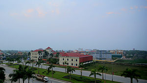
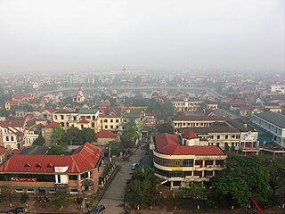
Hải Dương is a city in Vietnam. It is the capital of Hải Dương, an industrialized province in the Hanoi Capital Region and the Red River Delta in Northern Vietnam. The city is at the midpoint between the capital Hanoi and the major port Haiphong, and is part of the Northern Key Economic Zone. In 2019, Hai Duong city had a population of 241,373.
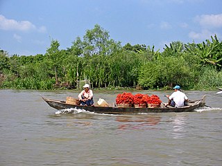
Rạch Giá is a provincial city and the capital city of Kiên Giang province, Vietnam. It is located on the Eastern coast of the Gulf of Thailand, 250 kilometres (160 mi) southwest of Ho Chi Minh City. East of city, it borders Tân Hiệp and Châu Thành town, the Gulf of Thailand is to the West and surrounds some parts of the city, south of the city is Châu Thành and An Biên town, and to the North it borders Hòn Đất and Tân Hiệp.
Cẩm Phả is a city of Quảng Ninh Province in the Northeast region of Vietnam.
Lệ Thủy is a district of Quảng Bình province in the North Central Coast of Vietnam. The district borders Quảng Ninh district on the north, Vĩnh Linh district on the south, Laos on the west. Lệ Thủy central is 40 km south of the provincial capital Đồng Hới. The district government seat is Kiến Giang Township. The district area is 1420.52 km2, population: 140,804 (1998). Lệ Thủy district is home to Võ Nguyên Giáp and the family of Ngô Đình Diệm. Economy bases on agriculture, mainly rice culture. Mỹ Trạch massacre by French army happened here on 29 November 1947.
An Phú is a district of An Giang province in the Mekong Delta region of Vietnam and shares the international border with Cambodia. An Phú juts out at the western edge of Vietnam into Cambodia. As of 2019, the district had a population of 148,615. The district covers an area of 226 km2. The district capital lies at An Phú town.
Triệu Phong is one of 10 districts, towns and cities of Quảng Trị Province, Vietnam. The district is located in the southeastern part of the province and stretches like a silk strip from the border between two districts of Cam Lộ and Đakrông to the South China Sea; The length on the mainland from West to East is more than 30 km, the width in the delta ranges from 10 to 13 km.
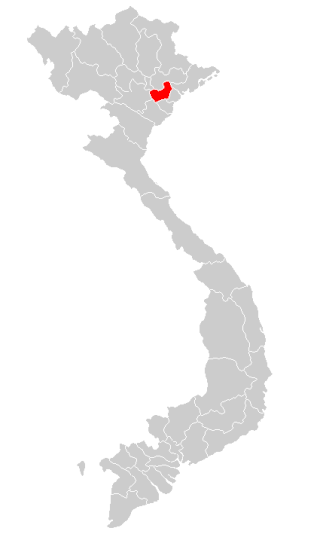
Đồng Hỷ is a rural district of Thái Nguyên province in the Northeast region of Vietnam. As of April 1, 2019, the district had a population of 92.421. The district covers an area of 427,73 km2. The district capital lies at Hóa Thượng.
Vĩnh Tường is a rural district of Vĩnh Phúc province in the Red River Delta region of northern Vietnam. As of 2003, the district had a population of 189,970.
Hải Hưng is a former province in the Red River Delta of Vietnam. It was established in 1968. On November 6, 1996, Hai Hung was split into two provinces: Hải Dương and Hưng Yên. The capital of Hải Hưng is Hải Dương. Hải Hưng had 1 town, and 10 districts: Chí Linh, Kim Môn, Nam Thanh, Cẩm Bình, Tứ Lộc, Ninh Thanh, Mỹ Văn, Châu Giang, Kim Thi and Phù Tiên.
Bình Trị Thiên (1975–1990) was a former administrative grouping of three provinces in Vietnam: Quảng Bình, Quảng Trị and Thừa Thiên. The grouping did not work well and was reversed in 1992. The geographical term had been used previously, for example in relation to culture, folk songs (1967) and is still used after, for example in relation to dialect (1997) and folk songs again (1997).
Nghệ Tĩnh was a province of Vietnam from 1976 to 1991, then from 1991 divided into Nghệ An and Hà Tĩnh.
Nguyễn Nhữ Soạn, courtesy name Thủ Trung (首中), pseudonym Hiền Đức (賢德), posthumous name Hiền-đức Mister (橫敏先生), was an Annamese official.
18°20′N105°54′E / 18.333°N 105.900°E