Ila, Georgia

Last updated

Ila, Georgia
Ila-Main-St-ga.jpg
Main Street (SR 106)
Madison County Georgia Incorporated and Unincorporated areas Ila Highlighted.svg
Location in Madison County and the state of Georgia
Coordinates: 34°10′25″N83°17′34″W / 34.17361°N 83.29278°W / 34.17361; -83.29278
Country United States
State Georgia
County Madison
Area
[1]
  Total0.77 sq mi (2.00 km2)
  Land0.77 sq mi (1.99 km2)
  Water0.00 sq mi (0.00 km2)
Elevation
801 ft (244 m)
Population
 (2020) [2]
  Total350
  Density454.55/sq mi (175.49/km2)
Time zone UTC-5 (Eastern (EST))
  Summer (DST) UTC-4 (EDT)
ZIP code
30647
Area code 706
FIPS code 13-40840 [3]
GNIS feature ID0315877 [4]

Ila is a city in Madison County, Georgia, United States. The population was 350 at the 2020 census. [2]

Contents

History

Ila was first settled in the mid-1800s by farmers from North Carolina and Virginia. The community became an agricultural one and growing corn, cotton, soybeans, wheat, and other crops. [5]

The Georgia General Assembly incorporated the Town of Ila in 1910. [6] Ila is a name derived from the Choctaw language meaning "dead". [7]

Geography

Ila is located in northwestern Madison County at 34°10′25″N83°17′34″W / 34.17361°N 83.29278°W / 34.17361; -83.29278 (34.173692, -83.292706). [8] The city is concentrated around the intersection of Georgia State Route 98 and Georgia State Route 106. SR 106 leads south-southwest 16 miles (26 km) to Athens and north-northeast 15 miles (24 km) to Carnesville, while SR 98 leads west-northwest 10 miles (16 km) to Commerce and southeast 5 miles (8 km) to Danielsville, the Madison county seat.

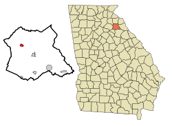
According to the United States Census Bureau, Ila has a total area of 0.8 square miles (2.1 km2), of which 0.001 square miles (0.6 acres), or 0.13%, are water. [1] Ila sits on a ridge between the South Fork of the Broad River to the south and its tributary, Furnace Creek, to the northeast. The city is part of the Savannah River watershed.

Demographics

Historical population
CensusPop.Note
1920 232
1930 2330.4%
1940 224−3.9%
1950 2250.4%
1960 216−4.0%
1970 202−6.5%
1980 28742.1%
1990 2973.5%
2000 32810.4%
2010 3372.7%
2020 3503.9%
U.S. Decennial Census [9]

As of the census [3] of 2000, there were 328 people, 137 households, and 86 families residing in the city. The population density was 403.2 inhabitants per square mile (155.7/km2). There were 143 housing units at an average density of 175.8 per square mile (67.9/km2). The racial makeup of the city was 97.26% White, 2.13% African American, and 0.61% from two or more races. Hispanic or Latino of any race were 0.30% of the population.

There were 137 households, out of which 27.0% had children under the age of 18 living with them, 49.6% were married couples living together, 6.6% had a female householder with no husband present, and 37.2% were non-families. 29.9% of all households were made up of individuals, and 13.9% had someone living alone who was 65 years of age or older. The average household size was 2.39 and the average family size was 3.03.

In the city, the population was spread out, with 22.9% under the age of 18, 7.6% from 18 to 24, 29.0% from 25 to 44, 28.4% from 45 to 64, and 12.2% who were 65 years of age or older. The median age was 39 years. For every 100 females, there were 97.6 males. For every 100 females age 18 and over, there were 94.6 males.

The median income for a household in the city was $41,250, and the median income for a family was $44,583. Males had a median income of $31,875 versus $24,167 for females. The per capita income for the city was $16,890. About 11.6% of families and 14.6% of the population were below the poverty line, including 22.2% of those under age 18 and 15.2% of those age 65 or over.

Related Research Articles

<span class="mw-page-title-main">Oglethorpe County, Georgia</span> County in Georgia, United States

Oglethorpe County is a county located in the northeastern part of the U.S. state of Georgia. As of the 2020 census, the population was 14,825. The county seat is Lexington.

<span class="mw-page-title-main">Morgan County, Georgia</span> County in Georgia, United States

Morgan County is a county located in the north central Piedmont region and the lake country region of the U.S. state of Georgia. As of the 2020 census, the population was 20,097. The county seat is Madison.

<span class="mw-page-title-main">Madison County, Georgia</span> County in Georgia, United States

Madison County is a county located in the northeastern part of the U.S. state of Georgia. As of the 2020 census, the population was 30,120. The county seat is Danielsville. The county was created on December 5, 1811. The county's largest city is Comer with a population of 1,200.

<span class="mw-page-title-main">Colquitt County, Georgia</span> County in Georgia, United States

Colquitt County is a county in the U.S. state of Georgia. As of the 2020 census, the population was 45,898. The county seat is Moultrie. The county was created on February 25, 1856, and is named for Walter Terry Colquitt, a U.S. senator. Colquitt County comprises the Moultrie, GA Micropolitan Statistical Area.

<span class="mw-page-title-main">Clarke County, Georgia</span> County in Georgia, United States

Clarke County is located in the northeastern part of the U.S. state of Georgia. As of the 2020 census, the population was 128,671. Its county seat is Athens, with which it is a consolidated city-county.

<span class="mw-page-title-main">Lindale, Georgia</span> Census-designated place in Georgia, United States

Lindale is an unincorporated community and census-designated place (CDP) in Floyd County, Georgia, United States. It is part of the Rome, Georgia Metropolitan Statistical Area. The population was 4,191 at the 2010 census.

<span class="mw-page-title-main">Royston, Georgia</span> City in Georgia, United States

Royston is a city in Franklin, Hart, and Madison counties in the U.S. state of Georgia. The population was 2,649 at the 2020 census.

<span class="mw-page-title-main">Greensboro, Georgia</span> City in Georgia, United States

Greensboro is a city in and the county seat of Greene County, Georgia, United States. Its population was 3,648 as of the 2020 census. The city is located approximately halfway between Atlanta and Augusta on Interstate 20.

<span class="mw-page-title-main">Union Point, Georgia</span> City in Georgia, United States

Union Point is a city in Greene County, Georgia, United States. As of the 2020 census, the city population was 1,597.

<span class="mw-page-title-main">Arcade, Georgia</span> City in Georgia, United States

Arcade is a city in Jackson County, Georgia, United States. As of the 2020 census it had a population of 1,884.

<span class="mw-page-title-main">Hoschton, Georgia</span> City in Georgia, United States

Hoschton is a city in Jackson County, Georgia, United States. The population was 1,377 at the 2010 census. As of 2018 the estimated population was 1,916.

<span class="mw-page-title-main">Talmo, Georgia</span> Town in Georgia, United States

Talmo is a town in Jackson County, Georgia, United States. The population was 257 at the 2020 census.

<span class="mw-page-title-main">Carlton, Georgia</span> City in Georgia, United States

Carlton is a city in Madison County, Georgia, United States. The population was 263 at the 2020 census.

<span class="mw-page-title-main">Colbert, Georgia</span> City in Georgia, United States

Colbert is a city in Madison County and Oglethorpe County, Georgia, United States. The population was 630 at the 2020 census.

<span class="mw-page-title-main">Comer, Georgia</span> City in Georgia, United States

Comer is a city in Madison County, Georgia, United States. It had a population of 1,512 as of the 2020 census, up from 1,126 in 2010. Comer is the largest city in Madison County based on population and total land area. The city is included in the Athens-Clarke County Metropolitan Statistical Area, part of the Atlanta-Athens-Clarke County-Sandy Springs Combined Statistical Area.

<span class="mw-page-title-main">Danielsville, Georgia</span> City in Georgia, United States

Danielsville is a city in Madison County, Georgia, United States. The population was 654 at the 2020 census, up from 560 in 2010. The city is the county seat of Madison County.

<span class="mw-page-title-main">Hull, Georgia</span> City in Georgia, United States

Hull is a city in Madison County, Georgia, United States. The population was 230 at the 2020 census, up from 198 in 2010.

<span class="mw-page-title-main">Rutledge, Georgia</span> City in Georgia, United States

Rutledge is a city in Morgan County, Georgia, United States. Founded in 1871, the city had a population of 871 at the 2020 census, up from 781 in 2010.

<span class="mw-page-title-main">Madison, Illinois</span> City in Illinois, United States

Madison is a city in Madison and St. Clair counties in the U.S. state of Illinois. The population was 3,171 at the 2020 census, down from 3,891 in 2010. It is home to World Wide Technology Raceway at Gateway and the first Bulgarian Orthodox church in the United States.

<span class="mw-page-title-main">Woodbourne-Hyde Park, Ohio</span> Unincorporated community & former census-designated place in Ohio, United States

Woodbourne-Hyde Park is an unincorporated area in Washington Township in Montgomery County, Ohio, United States. A Suburb of Dayton. It was delineated as a census-designated place (CDP) at the 2000 census, at which time its population was 7,910. It was not delineated as a CDP for the 2010 census.

References

  1. 1 2 "2022 U.S. Gazetteer Files: Georgia". United States Census Bureau. Retrieved January 23, 2023.
  2. 1 2 "P1. Race – Ila city, Georgia: 2020 DEC Redistricting Data (PL 94-171)". U.S. Census Bureau. Retrieved January 23, 2023.
  3. 1 2 "U.S. Census website". United States Census Bureau . Retrieved January 31, 2008.
  4. "US Board on Geographic Names". United States Geological Survey. October 25, 2007. Retrieved January 31, 2008.
  5. topschoolsintheusa. "Ila, Georgia – Top Schools in the USA" . Retrieved November 9, 2023.
  6. Acts and Resolutions of the General Assembly of the State of Georgia. Clark & Hines, State Printers. 1910. p. 771.
  7. Krakow, Kenneth K. (1975). Georgia Place-Names: Their History and Origins (PDF). Macon, GA: Winship Press. p. 115. ISBN   0-915430-00-2.
  8. "US Gazetteer files: 2010, 2000, and 1990". United States Census Bureau. February 12, 2011. Retrieved April 23, 2011.
  9. "Census of Population and Housing". Census.gov. Retrieved June 4, 2015.