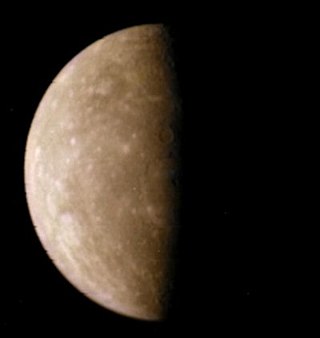
Inter-crater plains on Mercury

Last updated

Inter-crater plains on Mercury are a land-form consisting of plains between craters on Mercury.

Contents

Inter-crater plains and heavily cratered terrain typical of much of Mercury outside the area affected by the formation of the Caloris Basin. Abundant shallow elongate craters and crater chains are present on the plains. This image, taken during the first mission of Mariner 10, shows a large tract of inter-crater plains centered at 3deg N, 20deg W. The scarp running down the middle of the image, Santa Maria Rupes cuts through both the plains and large craters. The scene is 200 km across; north is the top. PIA02444.tif
Inter-crater plains and heavily cratered terrain typical of much of Mercury outside the area affected by the formation of the Caloris Basin. Abundant shallow elongate craters and crater chains are present on the plains. This image, taken during the first mission of Mariner 10 , shows a large tract of inter-crater plains centered at 3° N, 20° W. The scarp running down the middle of the image, Santa Maria Rupes cuts through both the plains and large craters. The scene is 200 km across; north is the top.

Of the eight planets in the Solar System, Mercury is the smallest and closest to the Sun. The surface of this planet is similar to the Moon in that it shows characteristics of heavy cratering and plains formed through volcanic eruptions on the surface. These features indicate that Mercury has been geologically inactive for billions of years. Knowledge of Mercury's geology was initially quite limited because observations have only been through the Mariner 10 flyby in 1975 and observations from Earth. The MESSENGER (an acronym of MErcury Surface, Space ENvironment, GEochemistry, and Ranging) mission of 2004 was a robotic NASA spacecraft orbiting the planet, the first spacecraft ever to do so. [1] The data provided by MESSENGER has revealed a geologically complex planet. [2]

Types of plains

Close up view of the Mercury crater named Rudaki. Image taken from the MESSENGER mission. On the floor of Rudaki and the region surrounding the crater to the west, or left, are areas flooded with lava, leaving only the rims of these craters. This terrain is known as smooth plains, formed by volcanic flows on the surface of Mercury. To the east, or right, of this crater are the inter-crater plains which can be present at many different elevations due to previous uplift after formation. Rudaki CW0131770591G web.png
Close up view of the Mercury crater named Rudaki. Image taken from the MESSENGER mission. On the floor of Rudaki and the region surrounding the crater to the west, or left, are areas flooded with lava, leaving only the rims of these craters. This terrain is known as smooth plains, formed by volcanic flows on the surface of Mercury. To the east, or right, of this crater are the inter-crater plains which can be present at many different elevations due to previous uplift after formation.

There are two geologically distinct types of plains on Mercury - smooth plains of volcanic origin, and, inter-crater plains, of uncertain origin. [3]

Smooth plains

Smooth plains are widespread flat areas resembling the lunar maria of the Moon, which fill depressions of various sizes. A prime example of a smooth plain is the one in which fills a wide ring surrounding the Caloris Basin, the largest impact basin on Mercury. However, a noticeable difference between the lunar maria of the Moon and the smooth plains of Mercury is that these smooth plains have the same albedo, or properties, as the bordering inter-crater plains. Even with a lack of volcanic features, it is still believed that smooth plains are of volcanic origin. [3]

Inter-crater plains

Inter-crater plains are the oldest visible surface on Mercury, [3] predating the heavily cratered terrain. They are gently rolling or hilly plains and occur in the regions between larger craters. The inter-crater plains appear to have covered up or destroyed many earlier craters, and show a general scarcity of smaller craters below about 30 km in diameter. [4] It is not clear whether they are of volcanic or impact origin. [4] The inter-crater plains are distributed roughly uniformly over the entire surface of the planet.

Caloris Basin--Mercury's largest impact crater (left side of image), is surrounded by a ring of mountains with chaotic terrain following this and eventually leading to smooth and inter-crater plains. PIA02439 Caloris Basin.jpg
Caloris Basin—Mercury's largest impact crater (left side of image), is surrounded by a ring of mountains with chaotic terrain following this and eventually leading to smooth and inter-crater plains.

The most heavily cratered regions on Mercury contain large areas essentially free of impact craters with diameters greater than 50 kilometers. The surface areas of these regions can basically be divided into two categories: clusters of large craters and plains bordering these clusters of craters. This combination of surface features has been called "inter-crater plains" by the Mariner 10 Imaging Science Team. [5] [6] These plains have sparked debate. [7]

Origin hypotheses

An example of inter-crater plains on Mercury. Yellow shows the inter-crater plains, whereas green shows younger impact craters. White is the surrounding areas of these features. Black is other craters of the area. InterCrater Example.jpg
An example of inter-crater plains on Mercury. Yellow shows the inter-crater plains, whereas green shows younger impact craters. White is the surrounding areas of these features. Black is other craters of the area.

Unlike smooth plains, the origin of inter-crater plains has yet to be well determined. Research and studies have narrowed the origin of inter-crater plains on Mercury down to two hypotheses. The first hypotheses attributes formation from fluidized impact, ejecta, [8] [9] which is the result of a meteorite impacting the surface so hard that it turns to liquid, then liquid debris is ejected into the air and lands, filling in any lower elevation areas or craters. The other hypothesis is that the plains formed from volcanic deposits originating from below the surface of Mercury itself. [10] [11]

On the basis of the distribution of inter-crater plains and stratigraphic relationships between secondary craters and smooth plains it is argued that the majority of the inter-crater plains were emplaced volcanically. [12]

MESSENGER data

Information and data were gathered from Mariner 10 stereoscopic images and higher resolution MESSENGER datasets. The higher resolution of the MESSENGER datasets compared with those of Mariner 10 enables the most ancient plains units on Mercury to be better characterized. The inter-crater plains units are densely cratered at diameters under ten km, producing a highly textured surface that yields ancient pre-Tolstojan and Tolstojan ages over 3.9 Ga (billion years). [13] There is no clear correlation with topography; inter-crater plains cover high-standing plateaus and continue into topographic depressions. These results show that either the formation process must have been able to take place over a range of several kilometers supporting an impact-related origin, or that plains are generally flat lying areas which become uplifted, lowered, or tilted after formation. [14] [15]

Related Research Articles

<span class="mw-page-title-main">Mercury (planet)</span> First planet from the Sun

Mercury is the first planet from the Sun and the smallest in the Solar System. In English, it is named after the Roman god Mercurius (Mercury), god of commerce and communication, and the messenger of the gods. Mercury is classified as a terrestrial planet, with roughly the same surface gravity as Mars. The surface of Mercury is heavily cratered, as a result of countless impact events that have accumulated over billions of years. Its largest crater, Caloris Planitia, has a diameter of 1,550 km (960 mi) and one-third the diameter of the planet. Similarly to the Earth's Moon, Mercury's surface displays an expansive rupes system generated from thrust faults and bright ray systems formed by impact event remnants.

<span class="mw-page-title-main">Caloris Planitia</span> Crater on Mercury

Caloris Planitia is a plain within a large impact basin on Mercury, informally named Caloris, about 1,550 km (960 mi) in diameter. It is one of the largest impact basins in the Solar System. "Calor" is Latin for "heat" and the basin is so-named because the Sun is almost directly overhead every second time Mercury passes perihelion. The crater, discovered in 1974, is surrounded by the Caloris Montes, a ring of mountains approximately 2 km (1.2 mi) tall.

<span class="mw-page-title-main">Geology of Mercury</span> Geologic structure and composition of planet Mercury

The geology of Mercury is the scientific study of the surface, crust, and interior of the planet Mercury. It emphasizes the composition, structure, history, and physical processes that shape the planet. It is analogous to the field of terrestrial geology. In planetary science, the term geology is used in its broadest sense to mean the study of the solid parts of planets and moons. The term incorporates aspects of geophysics, geochemistry, mineralogy, geodesy, and cartography.

<span class="mw-page-title-main">Geology of solar terrestrial planets</span> Geology of Mercury, Venus, Earth, Mars and Ceres

The geology of solar terrestrial planets mainly deals with the geological aspects of the four terrestrial planets of the Solar System – Mercury, Venus, Earth, and Mars – and one terrestrial dwarf planet: Ceres. Earth is the only terrestrial planet known to have an active hydrosphere.
<span class="mw-page-title-main">Borealis quadrangle</span> Quadrangle on Mercury

The Borealis quadrangle is a quadrangle on Mercury surrounding the north pole down to 65° latitude. It was mapped in its entirety by the MESSENGER spacecraft, which orbited the planet from 2008 to 2015, excluding areas of permanent shadow near the north pole. Only approximately 25% of the quadrangle was imaged by the Mariner 10 spacecraft during its flybys in 1974 and 1975. The quadrangle is now called H-1.
<span class="mw-page-title-main">Goethe Basin</span> Crater on Mercury

Goethe Basin is an impact basin at 81.4° N, 54.3° W on Mercury approximately 317 kilometers in diameter. It is named after German poet Johann Wolfgang von Goethe.

<span class="mw-page-title-main">Victoria quadrangle</span> Quadrangle on Mercury

The Victoria quadrangle is a region on Mercury from 0 to 90° longitude and 20 to 70 ° latitude. It is designated the "H-2" quadrangle, and is also known as Aurora after a large albedo feature.

<span class="mw-page-title-main">Tolstoj quadrangle</span> Quadrangle on Mercury

The Tolstoj quadrangle in the equatorial region of Mercury runs from 144 to 216° longitude and -25 to 25° latitude. It was provisionally called "Tir", but renamed after Leo Tolstoy by the International Astronomical Union in 1976. Also called Phaethontias.
<span class="mw-page-title-main">Shakespeare quadrangle</span> Quadrangle on Mercury

The Shakespeare quadrangle is a region of Mercury running from 90 to 180° longitude and 20 to 70° latitude. It is also called Caduceata.

The Caloris group is a set of geologic units on Mercury. McCauley and others have proposed the name “Caloris Group” to include the mappable units created by the impact that formed the Caloris Basin and have formally named four formations within the group, which were first recognized and named informally by Trask and Guest.

<span class="mw-page-title-main">Kuiper quadrangle</span> Quadrangle on Mercury

The Kuiper quadrangle, located in a heavily cratered region of Mercury, includes the young, 55-km-diameter crater Kuiper, which has the highest albedo recorded on the planet, and the small crater Hun Kal, which is the principal reference point for Mercurian longitude. Impact craters and basins, their numerous secondary craters, and heavily to lightly cratered plains are the characteristic landforms of the region. At least six multiringed basins ranging from 150 km to 440 km in diameter are present. Inasmuch as multiringed basins occur widely on that part of Mercury photographed by Mariner 10, as well as on the Moon and Mars, they offer a potentially valuable basis for comparison between these planetary bodies.
<span class="mw-page-title-main">Bach quadrangle</span> Quadrangle on Mercury

The Bach quadrangle encompasses the south polar part of Mercury poleward of latitude 65° S. It is named after the prominent crater Bach within the quadrangle, which is in turn named after Baroque composer Johann Sebastian Bach. The quadrangle is now called H-15.

<span class="mw-page-title-main">Beethoven quadrangle</span> Quadrangle on Mercury

The Beethoven quadrangle is located in the equatorial region of Mercury, in the center of the area imaged by Mariner 10. Most pictures of the quadrangle were obtained at high sun angles as the Mariner 10 spacecraft receded from the planet. Geologic map units are described and classified on the basis of morphology, texture, and albedo, and they are assigned relative ages based on stratigraphic relations and on visual comparisons of the density of superposed craters. Crater ages are established by relative freshness of appearance, as indicated by topographic sharpness of their rim crests and degree of preservation of interior and exterior features such as crater floors, walls, and ejecta aprons. Generally, topography appears highly subdued because of the sun angle, and boundaries between map units are not clearly defined.

<span class="mw-page-title-main">Discovery quadrangle</span> Quadrangle on Mercury

The Discovery quadrangle lies within the heavily cratered part of Mercury in a region roughly antipodal to the 1550-km-wide Caloris Basin. Like the rest of the heavily cratered part of the planet, the quadrangle contains a spectrum of craters and basins ranging in size from those at the limit of resolution of the best photographs to those as much as 350 km across, and ranging in degree of freshness from pristine to severely degraded. Interspersed with the craters and basins both in space and time are plains deposits that are probably of several different origins. Because of its small size and very early segregation into core and crust, Mercury has seemingly been a dead planet for a long time—possibly longer than the Moon. Its geologic history, therefore, records with considerable clarity some of the earliest and most violent events that took place in the inner Solar System.

<span class="mw-page-title-main">Michelangelo quadrangle</span> Quadrangle on Mercury

The Michelangelo quadrangle is in the southern hemisphere of the planet Mercury, where the imaged part is heavily cratered terrain that has been strongly influenced by the presence of multiring basins. At least four such basins, now nearly obliterated, have largely controlled the distribution of plains materials and structural trends in the map area. Many craters, interpreted to be of impact origin, display a spectrum of modification styles and degradation states. The interaction between basins, craters, and plains in this quadrangle provides important clues to geologic processes that have formed the morphology of the mercurian surface.
<span class="mw-page-title-main">Rembrandt (crater)</span> Crater on Mercury

Rembrandt is a large impact crater on Mercury. With a diameter of 716 km it is the second-largest impact basin on the planet, after Caloris, and is one of the larger craters in the Solar System. It was discovered by MESSENGER during its second flyby of Mercury on October 6, 2008. The crater is 3.9 billion years old, and was created during the period of Late Heavy Bombardment. The density and size distribution of impact craters along Rembrandt's rim indicate that it is one of the youngest impact basins on Mercury.

<span class="mw-page-title-main">Raditladi (crater)</span> Crater on Mercury

Raditladi is a large impact crater on Mercury with a diameter of 263 km. Inside its peak ring there is a system of concentric extensional troughs (graben), which are rare surface features on Mercury. The floor of Raditladi is partially covered by relatively light smooth plains, which are thought to be a product of the effusive volcanism. The troughs may also have resulted from volcanic processes under the floor of Raditladi. The basin is relatively young, probably younger than one billion years, with only a few small impact craters on its floor and with well-preserved basin walls and peak-ring structure. It is one of 110 peak ring basins on Mercury.

<span class="mw-page-title-main">Rachmaninoff (crater)</span> Crater on Mercury

Rachmaninoff is an impact crater on Mercury. This basin, first imaged in its entirety during MESSENGER's third Mercury flyby, was quickly identified as a feature of high scientific interest, because of its fresh appearance, its distinctively colored interior plains, and the extensional troughs on its floor. The morphology of Rachmaninoff is similar to that of Raditladi, which is one of the youngest impact basins on Mercury. The age of Raditladi is estimated at one billion years. Rachmaninoff appears to be only slightly older.

<span class="mw-page-title-main">Pre-Tolstojan</span>

Pre-Tolstojan, also Pretolstojan Period, refers to the oldest period of the history of Mercury, 4500–3900 MYA. It is the "first period of the Eomercurian Era and of the Mercurian Eon, as well as being the first period in Mercury's geologic history", and refers to its formation and the 600 million or so years in its aftermath. Mercury was formed with a tiny crust, mantle, and a giant core and as it evolved it faced heavy bombardments that created most of the craters and intercrater plains seen on the planet's surface today. Many of the smaller basins and multi-ring basins were created during this period. Considered a "dead" planet, its geology is highly diverse with craters forming the dominant terrain.

Hollows are a landform on the planet Mercury, discovered during the MESSENGER mission that orbited the planet from 2011 to 2015.

References

  1. Wall, Mike (March 17, 2011). "NASA spacecraft now circling Mercury - a first". NBC News . Retrieved 18 May 2014.
  2. Lakdawalla, Emily (July 3, 2008). "MESSENGER Scientists 'Astonished' to Find Water in Mercury's Thin Atmosphere". The Planetary Society . Archived from the original on 2016-09-02. Retrieved 2014-05-18.
  3. 1 2 3 P. D. Spudis (2001). The Geological History of Mercury. Chicago. p. 100. Bibcode:2001mses.conf..100S.{{cite book}}: |work= ignored (help)CS1 maint: location missing publisher (link)
  4. 1 2 R.J. Wagner; et al. (2001). "Application of an Updated Impact Cratering Chronology Model to Mercury's Time-Stratigraphic System". Workshop on Mercury: Space Environment, Surface, and Interior (1097): 106. Bibcode:2001mses.conf..106W.
  5. Trask, N. J.; Guest, J. E. (1975). "Preliminary geologic terrain map of Mercury". Journal of Geophysical Research. 80 (17): 2461–2477. doi:10.1029/jb080i017p02461.
  6. B.C. Murray; R.G. Strom; H.J. Trask; D.E. Gault (1975). "Surface History of Mercury: Implications for Terrestrial Planets" (PDF). Journal of Geophysical Research. 80 (17): 2508–2515. Bibcode:1975JGR....80.2508M. doi:10.1029/JB080i017p02508.
  7. Malin, Michael C. (1976). "Observations of intercrater plains on Mercury". Geophysical Research Letters. 3 (10): 581–584. Bibcode:1976GeoRL...3..581M. doi:10.1029/GL003i010p00581. ISSN   0094-8276.
  8. V.R. Oberbeck; R.H. Morrison; F. Horz; W.L. Quaide; D.E. Gault (March 1974). Smooth plains and continuous deposits of craters and basins. Proceedings of the Fifth Lunar Science Conference. Vol. 1. pp. 111–136. Bibcode:1974LPSC....5..111O.
  9. Don E. Wilhelms (August 1976). "Mercurian volcanism questioned". Icarus. 28 (4): 551–558. Bibcode:1976Icar...28..551W. doi:10.1016/0019-1035(76)90128-7.
  10. Robert G. Strom (1977). "Origin and relative age of lunar and mercurian intercrater plains". Physics of the Earth and Planetary Interiors. 15 (2–3): 156–172. Bibcode:1977PEPI...15..156S. doi:10.1016/0031-9201(77)90028-0.
  11. Caleb I. Fassett, Kadish; S.J., Head; J.W., Solomon; S.C.; Strom R.G. (2011). "The Global Population of Large Craters on Mercury and Comparison with the Moon". Geophysical Research Letters. 38 (10): L10202. Bibcode:2011GeoRL..3810202F. doi: 10.1029/2011GL047294 . S2CID   16075828.
  12. Jennifer L. Whitten; James W. Head; B. W. Denevi; Sean C. Solomon (17–21 March 2014). Formation of Intercrater Plains on Mercury. 45th Lunar and Planetary Science Conference. The Woodlands, Texas. p. 1219. Bibcode:2014LPI....45.1219W.
  13. P. D. Spudis & J. E. Guest (1988). F.Vilas; C. Chapman & M. Matthews (eds.). Stratigraphy and Geologic History of Mercury (PDF). Tucson: University of Arizona Press. pp. 118–164. Archived from the original (PDF) on 2016-03-05. Retrieved 2014-05-16.{{cite book}}: |work= ignored (help)
  14. Jürgen Oberst; Frank Preusker; Roger J. Phillips; Thomas R. Watters; James W. Head; Maria T. Zuber; Sean C. Solomon (September 2010). "The morphology of Mercury's Caloris basin as seen in MESSENGER stereo topographic models". Icarus. 209 (1): 230–238. Bibcode:2010Icar..209..230O. doi:10.1016/j.icarus.2010.03.009.
  15. Maria T. Zuber; David E. Smith; Roger J. Phillips; Sean C. Solomon; et al. (13 April 2012). "Topography of the Northern Hemisphere of Mercury from MESSENGER Laser Altimetry". Science. 336 (6078): 217–220. Bibcode:2012Sci...336..217Z. CiteSeerX   10.1.1.657.1909 . doi:10.1126/science.1218805. PMID   22438510. S2CID   22343038.