
The geology of Mercury is the scientific study of the surface, crust, and interior of the planet Mercury. It emphasizes the composition, structure, history, and physical processes that shape the planet. It is analogous to the field of terrestrial geology. In planetary science, the term geology is used in its broadest sense to mean the study of the solid parts of planets and moons. The term incorporates aspects of geophysics, geochemistry, mineralogy, geodesy, and cartography.
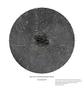
The Borealis quadrangle is a quadrangle on Mercury surrounding the north pole down to 65° latitude. It was mapped in its entirety by the MESSENGER spacecraft, which orbited the planet from 2008 to 2015, excluding areas of permanent shadow near the north pole. Only approximately 25% of the quadrangle was imaged by the Mariner 10 spacecraft during its flybys in 1974 and 1975. The quadrangle is now called H-1.

The Tolstoj quadrangle in the equatorial region of Mercury runs from 144 to 216° longitude and -25 to 25° latitude. It was provisionally called "Tir", but renamed after Leo Tolstoy by the International Astronomical Union in 1976. Also called Phaethontias.

The Shakespeare quadrangle is a region of Mercury running from 90 to 180° longitude and 20 to 70° latitude. It is also called Caduceata.

The Kuiper quadrangle, located in a heavily cratered region of Mercury, includes the young, 55-km-diameter crater Kuiper, which has the highest albedo recorded on the planet, and the small crater Hun Kal, which is the principal reference point for Mercurian longitude. Impact craters and basins, their numerous secondary craters, and heavily to lightly cratered plains are the characteristic landforms of the region. At least six multiringed basins ranging from 150 km to 440 km in diameter are present. Inasmuch as multiringed basins occur widely on that part of Mercury photographed by Mariner 10, as well as on the Moon and Mars, they offer a potentially valuable basis for comparison between these planetary bodies.
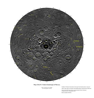
The Bach quadrangle encompasses the south polar part of Mercury poleward of latitude 65° S. It is named after the prominent crater Bach within the quadrangle, which is in turn named after Baroque composer Johann Sebastian Bach. The quadrangle is now called H-15.

The Beethoven quadrangle is located in the equatorial region of Mercury, in the center of the area imaged by Mariner 10. Most pictures of the quadrangle were obtained at high sun angles as the Mariner 10 spacecraft receded from the planet. Geologic map units are described and classified on the basis of morphology, texture, and albedo, and they are assigned relative ages based on stratigraphic relations and on visual comparisons of the density of superposed craters. Crater ages are established by relative freshness of appearance, as indicated by topographic sharpness of their rim crests and degree of preservation of interior and exterior features such as crater floors, walls, and ejecta aprons. Generally, topography appears highly subdued because of the sun angle, and boundaries between map units are not clearly defined.

The Discovery quadrangle lies within the heavily cratered part of Mercury in a region roughly antipodal to the 1550-km-wide Caloris Basin. Like the rest of the heavily cratered part of the planet, the quadrangle contains a spectrum of craters and basins ranging in size from those at the limit of resolution of the best photographs to those as much as 350 km across, and ranging in degree of freshness from pristine to severely degraded. Interspersed with the craters and basins both in space and time are plains deposits that are probably of several different origins. Because of its small size and very early segregation into core and crust, Mercury has seemingly been a dead planet for a long time—possibly longer than the Moon. Its geologic history, therefore, records with considerable clarity some of the earliest and most violent events that took place in the inner Solar System.

The Michelangelo quadrangle is in the southern hemisphere of the planet Mercury, where the imaged part is heavily cratered terrain that has been strongly influenced by the presence of multiring basins. At least four such basins, now nearly obliterated, have largely controlled the distribution of plains materials and structural trends in the map area. Many craters, interpreted to be of impact origin, display a spectrum of modification styles and degradation states. The interaction between basins, craters, and plains in this quadrangle provides important clues to geologic processes that have formed the morphology of the mercurian surface.

Sveinsdóttir is a large, elongated impact crater on Mercury. Its dimensions are 220 × 120 km.

The Ceraunius Fossae are a set of fractures in the northern Tharsis region of Mars. They lie directly south of the large volcano Alba Mons and consist of numerous parallel faults and tension cracks that deform the ancient highland crust. In places, younger lava flows cover the fractured terrain, dividing it into several large patches or islands. They are found in the Tharsis quadrangle.
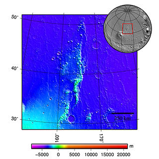
The Phlegra Montes are a system of eroded Hesperian–Noachian-aged massifs and knobby terrain in the mid-latitudes of the northern lowlands of Mars, extending northwards from the Elysium Rise towards Vastitas Borealis for nearly 1,400 km (870 mi). The mountain ranges separate the large plains provinces of Utopia Planitia (west) and Amazonis Planitia (east), and were named in the 1970s after a classical albedo feature. The massif terrains are flanked by numerous parallel wrinkle ridges known as the Phlegra Dorsa.
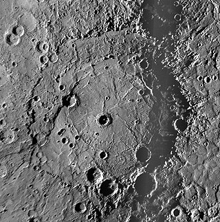
Rembrandt is a large impact crater on Mercury. With a diameter of 716 km it is the second-largest impact basin on the planet, after Caloris, and is one of the larger craters in the Solar System. It was discovered by MESSENGER during its second flyby of Mercury on October 6, 2008. The crater is 3.9 billion years old, and was created during the period of Late Heavy Bombardment. The density and size distribution of impact craters along Rembrandt's rim indicate that it is one of the youngest impact basins on Mercury.

Raditladi is a large impact crater on Mercury with a diameter of 263 km. Inside its peak ring there is a system of concentric extensional troughs (graben), which are rare surface features on Mercury. The floor of Raditladi is partially covered by relatively light smooth plains, which are thought to be a product of the effusive volcanism. The troughs may also have resulted from volcanic processes under the floor of Raditladi. The basin is relatively young, probably younger than one billion years, with only a few small impact craters on its floor and with well-preserved basin walls and peak-ring structure. It is one of 110 peak ring basins on Mercury.

Rachmaninoff is an impact crater on Mercury. This basin, first imaged in its entirety during MESSENGER's third Mercury flyby, was quickly identified as a feature of high scientific interest, because of its fresh appearance, its distinctively colored interior plains, and the extensional troughs on its floor. The morphology of Rachmaninoff is similar to that of Raditladi, which is one of the youngest impact basins on Mercury. The age of Raditladi is estimated at one billion years. Rachmaninoff appears to be only slightly older.

Guinevere Planitia is an expansive lowland region of Venus that lies east of Beta Regio and west of Eistla Regio. These low-lying plains, particularly in the western portion, are characterized by apparent volcanic source vents and broad regions of bright, dark, and mottled deposits. They are the only break in an equatorially connected zone of highlands and tectonic zones. The types, numbers, and patterns of mapped tectonic features and small volcanic landforms in the region provide important detail in the interpretation and evolution of venusian landscape.

Irnini Mons is a volcanic structure on the planet Venus, and is named after the Assyro-Babylonian goddess of cedar-tree mountains. It has a diameter of 475 km (295 mi), a height of 1.75 km (1.09 mi), and is located in Venus' northern hemisphere. More specifically, it is located in the central Eistla Regio region at in the V-20 quadrangle. Sappho Patera, a 225 km (140 mi) diameter wide, caldera-like, depression tops the summit of Irnini Mons. The primary structural features surrounding Irnini Mons are graben, seen as linear depressed sections of rock, radiating from the central magma chamber. Also, concentric, circular ridges and graben outline the Sappho Patera depression at the summit. The volcano is crossed by various rift zones, including the north-south trending Badb Linea rift, the Guor Linea rift extending to the northwest, and the Virtus Linea rift continuing to the southeast.

The surface of Venus is dominated by geologic features that include volcanoes, large impact craters, and aeolian erosion and sedimentation landforms. Venus has a topography reflecting its single, strong crustal plate, with a unimodal elevation distribution that preserves geologic structures for long periods of time. Studies of the Venusian surface are based on imaging, radar, and altimetry data collected from several exploratory space probes, particularly Magellan, since 1961. Despite its similarities to Earth in size, mass, density, and possibly composition, Venus has a unique geology that is unlike Earth's. Although much older than Earth's, the surface of Venus is relatively young compared to other terrestrial planets, possibly due to a global-scale resurfacing event that buried much of the previous rock record. Venus is believed to have approximately the same bulk elemental composition as Earth, due to the physical similarities, but the exact composition is unknown. The surface conditions on Venus are more extreme than on Earth, with temperatures ranging from 453 to 473 °C and pressures of 95 bar. Venus lacks water, which makes crustal rock stronger and helps preserve surface features. The features observed provide evidence for the geological processes at work. Twenty feature types have been categorized thus far. These classes include local features, such as craters, coronae, and undae, as well as regional-scale features, such as planitiae, plana, and tesserae.
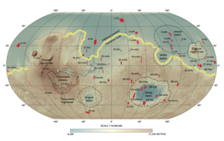
Like the Earth, the crustal properties and structure of the surface of Mars are thought to have evolved through time; in other words, as on Earth, tectonic processes have shaped the planet. However, both the ways this change has happened and the properties of the planet's lithosphere are very different when compared to the Earth. Today, Mars is believed to be largely tectonically inactive. However, observational evidence and its interpretation suggests that this was not the case further back in Mars' geological history.
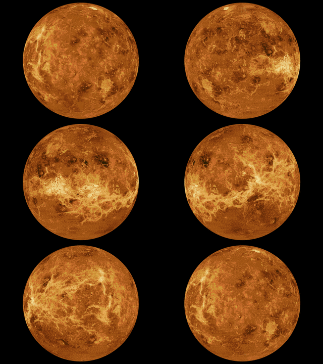
The mapping of Venus refers to the process and results of human description of the geological features of the planet Venus. It involves surface radar images of Venus, construction of geological maps, and the identification of stratigraphic units, volumes of rock with a similar age.


