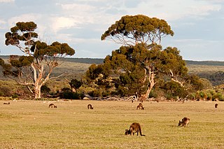
Iron-grass Natural Temperate Grassland of South Australia

Last updated

Iron-grass Natural Temperate Grassland of South Australia
CSIRO ScienceImage 3948 Kangaroo in ranges near Burra SA 1992.jpg
A sloped grassy field near Burra
Ecology
Realm Australasia
Biome Temperate grasslands, savannas, and shrublands
Borders Mount Lofty woodlands, Eyre Yorke Block and Murray Darling Depression
Geography
Area50 km2 (19 sq mi)
CountryAustralia
Elevation50–500 metres (160–1,640 ft)
Coordinates 33°50′0″S138°36′0″E / 33.83333°S 138.60000°E / -33.83333; 138.60000 Coordinates: 33°50′0″S138°36′0″E / 33.83333°S 138.60000°E / -33.83333; 138.60000
Climate type Mediterranean climate (Csa)
Semi-arid climate (BSk)
Soil types Loam, clay

The Iron-grass Natural Temperate Grassland of South Australia is a temperate grassland in the southeast of South Australia that stretches from Orroroo in the north, to Strathalbyn in the south, just straddling the eastern fringes of Adelaide's Mount Lofty Ranges. Listed as Critically Endangered under the EPBC Act, the grasslands predominantly feature Iron-grasses (Lomandra species). [1] [2]

Contents

The community is found in smooth slopes of low-level hills, and in wide valleys with elevations from 50 m (160 ft) to more than 500 m (1,600 ft) above sea level, covering most of the Mid North area and Clare Valley. They are distinguished from other grasslands of southeastern Australia because they are frequently dominated by Lomandra species (Iron-grasses) which are tussocks in the Asparagaceae [note 1] family, rather than actual grasses. [4]

Geography

The region lies eastwards of, and in parallel with, Gulf St Vincent. Satellite image of Spencer Gulf and Gulf St Vincent, South Australia (NASA image).png
The region lies eastwards of, and in parallel with, Gulf St Vincent.

The vegetation community is mostly found within the Flinders-Lofty Block Bioregion, with minor presence in the Kanmantoo, Eyre Yorke Block and Murray Darling Depression Bioregions. The community once spread over an area estimated at 750,000 to 1,000,000 hectares (1,900,000 to 2,500,000 acres) between Clare and Burra to Jamestown, Peterborough and to west of Carrieton, but has since been reduced to around 5,000 hectares due to agriculture and land clearing. 780 hectares have been used in conservation parks and private heritage agreements, with minor parts remaining in several reserves, including road and rail reserves, gullies, ridges and on slopes of hills. The residue patches alter in size from less than 1 hectare to large blocks of 100 ha or more. [1]

They area distributed in the transition zone between the higher rainfall woodlands and the drier Mallee areas at the base of the eastern Mount Lofty Ranges to the Mallee, and from Callington northwards to Terowie. [5] The mean annual rainfall ranges from 280–600 mm (11–24 in) across the community with a rainfall peak in winter. The distribution of the Iron-grass Natural Temperate Grassland is located within various Aboriginal Nations, including lands of the Ngarrindjeri, Peramangk, Kaurna, Narrunga, Nukunu and Ngadjuri people. [1]

Ecology

Wheat fields in Nuriootpa Twilight Upon Wheat Fields (139677885).jpeg
Wheat fields in Nuriootpa

In the community, Lomandra multiflora and Lomandra effusa predominantly occur alongside perennial, tussock-forming native grasses, which cover 70 per cent of the area. Grasses include Austrodanthonia and Austrostipa species, and as well as Austrodanthonia tenuior and Dianella longifolia . Wildflowers and forbs include Acanthocladium dockeri , Caladenia colorata , Dodonaea procumbens , Eryngium ovinum , Swainsona behriana , Arthropodium strictum , Triptilodiscus pygmaeus , Chrysocephalum apiculatum , Convolvulus erubescens , Goodenia pinnatifida , Bulbine bulbosa , Einadia nutans , Wurmbea dioica , Velleia paradoxa , Swainsona behriana , Vittadinia gracilis and Wahlenbergia luteola . [1]

Trees and gangling shrubs are devoid to sparse and would cover less than 10 per cent of the community, in addition to being mostly associated with contiguous woodlands. The sparse tree species are Allocasuarina verticillata , Acacia pycnantha , Eucalyptus leucoxylon , Eucalyptus odorata and Eucalyptus porosa , and the few shrubs include Bursaria spinosa , Enchylaena tomentosa , Eutaxia microphylla and Maireana brevifolia . These grasslands are possibly traced from dissipated grassy woodlands, which also occur in the dispersion range of Iron-grass Natural Temperate Grassland. The region features loam to clay loam soils usually found on soft to precipitous slopes of hills and stony ridgelines. [1]

Animals

Mammals, birds, reptiles, insects, spiders and other invertebrates influence the necessary ecological procedure of the grassland, with Macropus fuliginosus , Chalinolobus gouldii , Chalinolobus morio , Tadarida australis , Dromaius novaehollandiae , Aprasia pseudopulchella , Aprasia pseudopulchella , Tiliqua adelaidensis , Pedionomus torquatus and Eolophus roseicapillus being the most recorded species. The state vulnerable Ardeotis australis , Pedionomus torquatus and Trapezites luteus have also been observed in the Grassland. Birds include Cincloramphus cruralis , Corvus mellori , Pedionomus torquatus , Aquila audax , Cracticus tibicen , Ocyphaps lophotes , Phaps chalcoptera , Coturnix pectoralis and Turnix velox . [1]

See also

Notes

  1. Previously, Lomandra species were considered part of the Liliaceae family, but are now in Asparagaceae. [3]

Related Research Articles

<span class="mw-page-title-main">Geography of Western Australia</span>

Western Australia occupies nearly one third of the Australian continent. Due to the size and the isolation of the state, considerable emphasis has been made of these features; it is the second largest administrative territory in the world, after Yakutia in Russia, despite the fact that Australia is only the sixth largest country in the world by area, and no other regional administrative jurisdiction in the world occupies such a high percentage of a continental land mass. It is also the only first level administrative subdivision to occupy the entire continental coastline in one cardinal direction.

<span class="mw-page-title-main">Mulga Lands</span>

The Mulga Lands are an interim Australian bioregion of eastern Australia consisting of dry sandy plains with low mulga woodlands and shrublands that are dominated by Acacia aneura (mulga). The Eastern Australia mulga shrublands ecoregion is coterminous with the Mulga Lands bioregion.

<span class="mw-page-title-main">Southeast Australia temperate savanna</span>

The Southeast Australia temperate savanna ecoregion is a large area of grassland dotted with eucalyptus trees running north–south across central New South Wales, Australia.

<span class="mw-page-title-main">Coolgardie woodlands</span> Terrestrial ecoregion in Western Australia

The Coolgardie woodlands is an ecoregion in southern Western Australia. The predominant vegetation is woodlands and mallee scrub. The ecoregion is a transitional zone between the Mediterranean-climate forests, woodlands, and shrublands of Southwest Australia and the deserts and dry scrublands of the Australian interior.

<span class="mw-page-title-main">Mount Lofty woodlands</span> Ecoregion in South Australia

The Mount Lofty woodlands, or the Peppermint Box Grassy Woodland of South Australia is an ecoregion in South Australia, which includes woodlands, shrublands, and grasslands in the Mount Lofty Ranges, Fleurieu Peninsula, and Kangaroo Island.

The Queanbeyan Nature Reserve is a protected nature reserve that is located in the Southern Tablelands region of New South Wales, in eastern Australia. The 67-hectare (170-acre) reserve is situated approximately 4 kilometres (2.5 mi) west-south-west of the City of Queanbeyan.
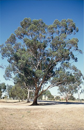
<i>Eucalyptus occidentalis</i> Species of eucalyptus

Eucalyptus occidentalis, commonly known as the flat topped yate or the swamp yate, is a tree that is native to Western Australia. The Noongar names for the tree are Mo or Yundill.

<i>Lomandra effusa</i> Species of plant

Lomandra effusa is a perennial, dioecious, rhizomatous herb native to Australia. It is a perennial tussock with bluish green, large, arching leaves which are distinctive by the two toothed leaf tip. It has white, cream or pink fragrant flowers during the months of June to October.

<span class="mw-page-title-main">Cumberland Plain Woodland</span> Indigenous woodland community in Sydney, Australia

The Cumberland Plain Woodland, or Western Sydney woodland, is a grassy woodland community found predominantly in Western Sydney, New South Wales, Australia, that comprises an open tree canopy, a groundcover with grasses and herbs, usually with layers of shrubs and/or small trees.

<span class="mw-page-title-main">Southeast Australia temperate forests</span> Terrestrial ecoregion in Australia

The Southeast Australia temperate forests is a temperate broadleaf and mixed forests ecoregion of south-eastern Australia. It includes the temperate lowland forests of southeastern Australia, at the southern end of the Great Dividing Range. Vegetation ranges from wet forests along the coast to dry forests and woodlands inland.

<span class="mw-page-title-main">Gawler bioregion</span> Region in South Australia

Gawler is an interim Australian bioregion located in South Australia. It has an area of 12,002,883 hectares. Gawler bioregion is part of the Tirari–Sturt stony desert ecoregion.

<span class="mw-page-title-main">Victorian Volcanic Plain grasslands</span> Ecological community in southern Victoria

The Victorian Volcanic Plain Grasslands are a critically endangered temperate grasslands that occur in the Australian state of Victoria, stretching from Hamilton in the northwest to the city of Melbourne. Part of the Southern Volcanic Plain and bordering the Gippsland Plains Grassy Woodland to the east, the grasslands sit on Cainozoic volcanic deposits. In 2011, the Victorian Government had reserved 15,000 hectares of land to protect the critically endangered community. Only less than 5% of the pre-European concentration of the grasslands remain.

<span class="mw-page-title-main">Gippsland Plains Grassy Woodland</span> Ecological community in southern Victoria

The Gippsland Plains Grassy Woodland is an ecological temperate grassland community located in the Gippsland region in southern Victoria, Australia. Stretching from Bairnsdale in the east to the eastern portion of Melbourne in the west, they typify one of Victoria's most threatened and disconnected indigenous ecosystems. The Gippsland Red Gum Grassy Woodland is the most prominent community in the system situated in the centre.

<span class="mw-page-title-main">Northern Plains Grassland</span> Ecological community in northern Victoria

The Northern Plains Grassland (NPGL) is an open, shrubby temperate grassland community located in northern Victoria straddling the Murray Darling Depression and Wimmera, extending to the Riverina and South Western Slopes regions in southern New South Wales. Floristically rich, the area features 30 native plant species per 100 m2.

<span class="mw-page-title-main">Southern Tablelands Temperate Grassland</span> Ecological community in New South Wales

The Southern Tablelands Temperate Grassland, formally Natural Temperate Grassland of the Southern Tablelands, is a temperate grassland community situated in the Southern Tablelands and Monaro region of New South Wales, extending into the Australian Capital Territory and the Victorian border. Listed as Endangered under the Environment Protection and Biodiversity Conservation Act 1999, the grassland is dominated by reasonably tall, dense to open tussock grasses.

<span class="mw-page-title-main">Southern Highlands Shale Forest and Woodland</span> Ecological community in New South Wales

The Southern Highlands Shale Forest and Woodland is a mixed grassy woodland and sclerophyll-temperate forest community situated within the Southern Highlands region of New South Wales, Australia. An ecotone featuring clay soils derived from Wianamatta Group, it is listed as an endangered ecological community by the Environment Protection and Biodiversity Conservation Act 1999 as less than 5% of the original extent remains today. Three varieties of the Shale Woodland exist: ‘typical’, ‘tall wet’ and ‘short dry’.

<span class="mw-page-title-main">Lowland Native Grasslands of Tasmania</span> Ecological community in southern Victoria

The Lowland Native Grasslands of Tasmania are a temperate grassland situated in the eastern portion of Tasmania, Australia. Listed as a critically endangered ecological community listed under the national environment law, they are dominated by kangaroo grass, velvet tussock grass and/or silver tussock grass.

References

  1. 1 2 3 4 5 6 "National Recovery Plan for the Iron-grass Natural Temperate Grassland of South Australia ecological community" (PDF). Department of Environment and Natural Resources, South Australian Government. 2012. Retrieved 14 September 2022.
  2. "Iron-grass Natural Temperate Grassland of South Australia in Community and Species Profile and Threats Database". Canberra: Department of Climate Change, Energy, the Environment and Water. 2022. Retrieved 14 September 2022.
  3. Chase, M.W.; Reveal, J.L. & Fay, M.F. (2009), "A subfamilial classification for the expanded asparagalean families Amaryllidaceae, Asparagaceae and Xanthorrhoeaceae", Botanical Journal of the Linnean Society, 161 (2): 132–136, doi: 10.1111/j.1095-8339.2009.00999.x
  4. "Iron-grass Natural Temperate Grasslands of South Australia". Grasslands | Biodiversity of South-Eastern Australia. Department of Education and Training . Retrieved 14 September 2022.
  5. "Iron-grass native grassland project". South Australian Government . Retrieved 14 September 2022.