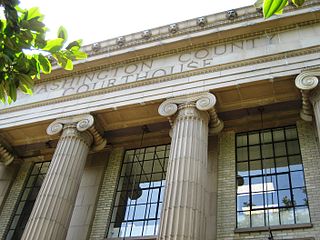
Washington County is one of 36 counties in the U.S. state of Oregon and part of the Portland metropolitan area. The 2020 census recorded the population as 600,372, making it the second most populous county in the state and the most populous "Washington County" in the United States. Hillsboro is the county seat and largest city, while other major cities include Beaverton, Tigard, Cornelius, Banks, Gaston, Sherwood, North Plains, and Forest Grove, the county's oldest city. Originally named Twality when created in 1843, the Oregon Territorial Legislature renamed it for the nation's first president in 1849 and included the entire northwest corner of Oregon before new counties were created in 1854. The Tualatin River and its drainage basin lie almost entirely within the county, which shares its boundaries with the Tualatin Valley. It is bordered on the west and north by the Northern Oregon Coast Range, on the south by the Chehalem Mountains, and on the north and east by the Tualatin Mountains, or West Hills.
The Territory of Washington was an organized incorporated territory of the United States that existed from March 2, 1853, until November 11, 1889, when the territory was admitted to the Union as the State of Washington. It was created from the portion of the Oregon Territory north of the lower Columbia River and north of the 46th parallel east of the Columbia. At its largest extent, it also included the entirety of modern Idaho and parts of Montana and Wyoming, before attaining its final boundaries in 1863.
Baker House may refer to:
Davis House may refer to:

Imbrie Farm is an Italian Villa style home in Hillsboro, Oregon. It was built by Robert Imbrie and was a working farm for over a century. It was added to the National Register of Historic Places in 1977.
Bowers House may refer to:

Jesse Applegate was an American pioneer who led a large group of settlers along the Oregon Trail to the Oregon Country. He was an influential member of the early government of Oregon, and helped establish the Applegate Trail as an alternative route to the Oregon Trail.

WE Communications and commonly known as WE is a global public relations and integrated marketing communications firm often associated with its largest client, Microsoft. The firm was founded in 1983 by Melissa Waggener Zorkin.
Hamilton House may refer to:
Thompson House may refer to:
Edwards House or Edwards Farm or The Edwards House may refer to:
Peterson House may refer to:

The Sackville House was an historic, American building that was located at 309 East Wheeling Street in East Washington, Pennsylvania before it was demolished in 1980.
The Martin Farmstead is a historic building in Washington, Pennsylvania.
Caples is an unincorporated community in Cowlitz County, Washington. The Caples community is located 2.5 miles (4.0 km) west of Woodland along Caples Road, on the east shore of Columbia River and across the river from Columbia City, Oregon. The Caples community is part of the Woodland School District, a K-12 school district of about 2,200 students.
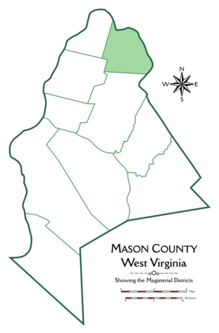
Graham Magisterial District is one of ten magisterial districts in Mason County, West Virginia, United States. The district was originally established as a civil township in 1863, and converted into a magisterial district in 1872. In 2020, Graham District was home to 2,618 people.

Waggener Magisterial District is one of ten magisterial districts in Mason County, West Virginia, United States. The district was originally established as a civil township in 1863, and converted into a magisterial district in 1872. In 2020, Waggener District was home to 2,483 people.

Shute–Meierjurgen Farmstead is a farm located in the north of Hillsboro Airport, in the vicinity of Hillsboro, Washington County, Oregon. It is listed on the National Register of Historic Places in 2018.
Gates House may refer to:


