National Register of Historic Places listings in Tillamook County, Oregon
Last updated
Location of Tillamook County in Oregon
This list presents the full set of buildings, structures, objects, sites, or districts designated on the National Register of Historic Places in Tillamook County, Oregon, and offers brief descriptive information about each of them. The National Register recognizes places of national, state, or local historic significance across the United States.[1] Out of over 90,000 National Register sites nationwide,[2]Oregon is home to over 2,000,[3] and 30 of those are found in Tillamook County.
This archeological site, occupied probably between 1600 and 1800 CE, is characterized by a quantity of burned rock, indicating a possible village site. Shards of Asian ceramicware link the site to the Nehalem Beeswax shipwreck and early contact with Europeans. Studies suggest that occupation ended abruptly, likely due to earthquake-related subsidence.[8]
This archaeological site likely represents a precontact/postcontact Nehalem Tillamook campsite used for subsistence activities, including fishing, hunting, food processing, tool manufacture, and related tasks. Radiocarbon dating based on a single sample suggests it may have been occupied as early as 1490 CE.[9]
The contents of this shell midden, including mussels, barnacles, and chiton, have been dated to around 1660 CE. The supposed wreck of a European ship nearby in the same period suggests the site may preserve information from both before and after contact between local people and Europeans.[10]
Artist Harry F. Wentz and architect A.E. Doyle designed this 1916 bungalow, which came to be regarded as a prototype of the Northwest Regional style. Some characteristic features include: colors and materials associated with the Northwest; low massing with simple wall surfaces; porches with slender wooden supports; and siting to harmonize with the surrounding landscape.[11]
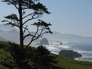
Ecola State Park is a state park located approximately 3 miles north of Cannon Beach in Clatsop County in the U.S. state of Oregon on the Oregon Coast. It is administered by the Oregon Parks and Recreation Department.
The Cronin Point Site is an archeological site located in Nehalem Bay State Park near Manzanita, Oregon, United States, that was occupied probably between 1600 and 1800 CE. The site is characterized by a significant quantity of burned, fire-cracked rock, indicating the presence of hearths and other cultural activities associated with occupation and a possible village site. Artifacts in the site include stone flaking debris, and a smaller number of projectile points, glass pieces, bone pieces, and shell fragments. Notably, the site also includes shards of Chinese and Japanese ceramicware, datable by their design to ca. 1550–1680 CE, which link the Cronin Point Site to the Nehalem Beeswax Shipwreck. The site spans both submerged and exposed areas; auger-based studies suggest that occupation of the site ended abruptly, likely when the land it rests on subsided due to a large earthquake.
The Smuggler Cove Shell Midden is an archeological site located in Oswald West State Park near Neahkahnie Beach, Oregon, United States. First documented by archeologists in 1976, the midden has been found to contain remains of mussels, barnacles, and chiton to a depth of approximately 30 centimeters (12 in). Radiocarbon dating of a single sample of shell debris indicates that the Smuggler Cove campsite was occupied around 1660 CE, approximately the same date as the supposed wreck of a European ship at nearby Nehalem Spit, suggesting the site may preserve information from both before and after first contact between local people and Europeans. The site has been heavily damaged by construction of recreational facilities and coastal erosion, but a significant portion remains with potential to contribute to future research. Data generated from the site may help answer questions related to environmental change in the Oregon Coast region, settlement and subsistence patterns, emergence of ethnographic patterns among coastal people, the change in cultural patterns from before to after contact with European Americans, and other topics.
The Spruce Tree Site is an archeological site located in Nehalem Bay State Park near Manzanita, Oregon, United States. The site likely represents a precontact/postcontact Nehalem Tillamook campsite used for subsistence activities, including fishing, hunting, food processing, tool manufacture, and related tasks. Radiocarbon dating based on a single sample suggests it may have been occupied as early as 1490 CE. The site has yielded rock flake debris, burned rock, and charcoal, while the presence of glass beads and small fragments of ceramic provide information potential related to early contacts between Europeans and the peoples of the Oregon coast. The porcelain fragments may also link it to the Nehalem Beeswax Shipwreck. The site has been partially eroded, but significant cultural deposits remain above the water line. Submerged stumps amid the site indicate significant subsidence of over 1 meter, possibly related to a large earthquake, which can help answer research questions about the effect of seismic activity on the peoples and landscapes of the Oregon coast as well as on the preservation of cultural remains.
The Osprey Site is an archeological site located near Bandon, Oregon, United States. Associated with the Coquille people, it is the largest known complex of fishing weirs on the Oregon coast, encompassing over 3000 identified wooden weir stakes organized into 25 discrete weir features. Radiocarbon dating suggests the site was in use possibly as early as 560 to 670 CE, and historic accounts indicate it continued in use into the 1850s. The site has also yielded more split wood lattice panels than any other weir location along the Northwest coast. It is a site of outstanding cultural importance to the Coquille people, and great research importance for understanding variation in weir technology during the precontact and postcontact periods.
The High Point Shell Midden is a prehistoric archeological site located in Samuel H. Boardman State Scenic Corridor near Carpenterville, Oregon, United States. The midden is located on a strategic high point overlooking the Pacific coast, and is visible in the eroding cliff face. Radiocarbon dating indicates that the site was occupied c. 1070 CE and again c. 1385 CE, but additional dating may extend this chronology. Although shell deposits are evident without excavation, it is likely that evidence of other activities related to site occupation may be found on the periphery of the midden. The site has potential to produce scientific data related to several topics, including "site formation processes, landscape evolution, and changes in settlement, subsistence, technology, and society among the Native American cultures of the Oregon Coast."
The Tahkenitch Landing Site is a prehistoric archeological site located in Oregon Dunes National Recreation Area near Gardiner, Oregon, United States. Stratified remains up to 2 meters deep show the site has served various functions including shell midden and probably village over a history spanning 7000 to 8000 years, up to as late as 1858 CE. It also bears evidence of dramatic environmental changes including estuarine development, dune formation, and a transition from estuarine to lacustrine habitats. It was the first site on the Oregon coast to yield cultural remains older than about 3000 BP, and as such is one of the most significant sites on the Pacific coast of Oregon and North America.
↑ Oregon Parks and Recreation Department, Oregon Historic Sites Database, retrieved August 6, 2015. Note that a simple count of National Register records in this database returns a slightly higher total than actual listings, due to duplicate records. A close reading of detailed query results is necessary to arrive at the precise count.
↑ Numbers represent an alphabetical ordering by significant words. Various colorings, defined here, differentiate National Historic Landmarks and historic districts from other NRHP buildings, structures, sites or objects.
↑ The eight-digit number below each date is the number assigned to each location in the National Register Information System database, which can be viewed by clicking the number.
This page is based on this Wikipedia article Text is available under the CC BY-SA 4.0 license; additional terms may apply. Images, videos and audio are available under their respective licenses.