
Kodiak Island, is a large island on the south coast of the U.S. state of Alaska, separated from the Alaska mainland by the Shelikof Strait. The largest island in the Kodiak Archipelago, Kodiak Island is the second largest island in the United States and the 80th largest island in the world, with an area of 3,595.09 sq mi (9,311.2 km2), slightly larger than Cyprus. It is 160 km long and in width ranges from 16 to 97 kilometers. Kodiak Island is the namesake for Kodiak Seamount, which lies off the coast at the Aleutian Trench. The largest community on the island is the city of Kodiak, Alaska.

Glacier Bay National Park and Preserve is an American national park located in Southeast Alaska west of Juneau. President Calvin Coolidge proclaimed the area around Glacier Bay a national monument under the Antiquities Act on February 26, 1925. Subsequent to an expansion of the monument by President Jimmy Carter in 1978, the Alaska National Interest Lands Conservation Act (ANILCA) enlarged the national monument by 523,000 acres on December 2, 1980, and created Glacier Bay National Park and Preserve. The national preserve encompasses 58,406 acres of public land to the immediate northwest of the park, protecting a portion of the Alsek River with its fish and wildlife habitats, while allowing sport hunting.

Kenai Fjords National Park is an American national park that comprises the Harding Icefield, its outflowing glaciers, and coastal fjords and islands. The park covers an area of 669,984 acres on the Kenai Peninsula in south-central Alaska, west of the town of Seward.
Turnagain Arm is a waterway into the northwestern part of the Gulf of Alaska. It is one of two narrow branches at the north end of Cook Inlet, the other being Knik Arm. Turnagain is subject to climate extremes and large tide ranges.
The Chugach National Forest is a 6,908,540-acre (27,958 km2) United States National Forest in south central Alaska. Covering portions of Prince William Sound, the Kenai Peninsula and the Copper River Delta, it was formed in 1907 from part of a larger forest reserve. The Chugach includes extensive shorelines, glaciers, forests and rivers, much of which is untouched by roads or trails. It hosts numerous bird, mammal and marine species, including extensive shorebird habitat and a bald eagle population larger than the contiguous 48 states combined. Human industry in the forest includes extensive tourism and some mining and oil and gas operations.
Mohawk State Forest, also known as Mohawk State Forest/Mohawk Mountain State Park, encompasses over 4,000 acres (1,600 ha) in the towns of Cornwall, Goshen, and Litchfield in the southern Berkshires of Litchfield County, Connecticut. As overseen by the Connecticut Department of Energy and Environmental Protection, the area is used for hiking, picnicking, and winter sports by the public, while being actively managed to produce timber and other forest products.

Misty Fjords National Monument is a national monument and wilderness area administered by the U.S. Forest Service as part of the Tongass National Forest. Misty Fiords is about 40 miles (64 km) east of Ketchikan, Alaska, along the Inside Passage coast in extreme southeastern Alaska, comprising 2,294,343 acres (928,488 ha) of Tongass National Forest in Alaska's Panhandle. All but 151,832 acres (61,444 ha) are designated as wilderness.
Beartown State Forest is a publicly owned forest with recreational features located in the towns of Great Barrington, Monterey, Lee, and Tyringham, Massachusetts. The state forest's more than 10,000 acres (4,000 ha) include 198 acres (80 ha) of recreational parkland. It is managed by the Massachusetts Department of Conservation and Recreation.

Savoy, Mountain State Forest is a Massachusetts state forest located primarily in the towns of Savoy and Florida, with portions extending into neighboring Adams and North Adams. Situated along the Hoosac Mountain Range, it features four ponds, and seven hill and mountain summits, including Lewis Hill (2177 ft), Flat Rock Hill (2195 ft), Spruce Hill (2566 ft), and Borden Mountain (2505 ft). Also within the forest are at least two notable waterfalls, Parker Brook Falls and Tannery Falls, the latter of which is a 100-foot (30 m) drop. The forest is managed by the Department of Conservation and Recreation.

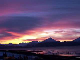
Mount Marathon, or officially Marathon Mountain, is a 4,826-foot (1,471 m) mountain summit directly west of Seward in the Kenai Mountains in the U.S. state of Alaska. The peak is situated in Chugach National Forest, rising above Resurrection Bay, 2.35 mi (4 km) south of Mount Benson, and 2 mi (3 km) north of Bear Mountain. The namesake of the mountain is the Mount Marathon Race held every Fourth of July.

Tolmie State Park is a public recreation area covering 154 acres (62 ha) on Nisqually Beach on Puget Sound, eight miles (13 km) northeast of Olympia, Washington. The state park includes 1,800 ft (550 m) of saltwater shoreline at the mouth of a creek known as Big Slough as well as forest lands, a saltwater marsh, and an underwater park with artificial reef for scuba diving.

The Coast Range ecoregion is a Level III ecoregion designated by the Environmental Protection Agency (EPA) in the U.S. states of Washington, Oregon, and California. It stretches along the Pacific Coast from the tip of the Olympic Peninsula in the north to the San Francisco Bay in the south, including Grays Harbor, Willapa Bay, and the Long Beach Peninsula in Washington, the entire length of the Oregon Coast, and the Northern California Coast. Named for the Coast Range mountains, it encompasses the lower elevations of the Olympic Mountains, the Oregon Coast Range, the Californian North Coast Ranges, and surrounding lowlands.
Kachemak Bay State Park and Kachemak Bay State Wilderness Park is a 400,000-acre (1,600 km2) park in and around Kachemak Bay, Alaska, United States. Kachemak Bay State Park was the first legislatively designated state park in the Alaska State Parks system. Kachemak Bay State Wilderness Park is the state's only legislatively designated wilderness park. No road accesses most areas of the park; visitors normally fly in or travel by boat from Homer.
Afognak Island State Park is a 75,047-acre (30,370 ha) Alaska state park on Afognak Island in Kodiak Island Borough, Alaska in the United States. Afognak Island is northeast of Kodiak Island on the Alaska Peninsula. Most of Afognak Island State Park is undeveloped. The park is known for its rugged topography and wide variety of wildlife. Afognak Island State Park is open to year-round recreation, including fishing, hunting, and hiking. Transportation is provided by float plane from Kodiak to various areas around the park. It is on the northern and eastern ends of the island and surrounds Perenosa, Seal and Tonki Bays. It borders part of Kodiak National Wildlife Refuge to the west.
The Kuiu Wilderness and Tebenkof Bay Wilderness are federally designated wilderness areas within the Tongass National Forest, located on Kuiu Island, Petersburg Census Area, Alaska. The 60,581-acre (24,516 ha) Kuiu and 66,812-acre (27,038 ha) Tebenkof Bay wildernesses are managed by the United States Forest Service as a single area—creating a 200-square-mile (520 km2) wilderness preserve covering the heart of the island. Together, the two areas protect old-growth temperate rainforests rising from coastal estuaries to subalpine meadows more than 2,000 feet (610 m) in elevation, with a high point atop the 3,355-foot (1,023 m) Kuiu Mountain.
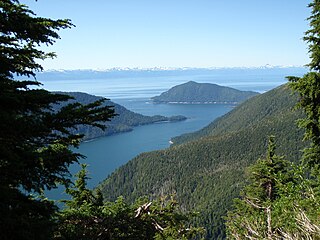
Caines Head State Recreation Area is a 6,571-acre (26.59 km2) recreational area encompassing the Caines Head cape in Resurrection Bay, Alaska. The area is located in the Kenai Peninsula Borough, 7 miles (11 km) south of the city of Seward. A popular tourist destination, Caines Head features spruce and hemlock forests as well as a variety of terrestrial and marine wildlife. It also features the remains of Fort McGilvray, a World War II-era fortification erected in 1941–1942 to defend against the potential invasion of the Imperial Japanese Army.

Pacific Coastal Mountain icefields and tundra is a tundra ecoregion in Alaska, British Columbia, and Yukon, as defined by the World Wildlife Fund (WWF) categorization system.
Shoup Bay is an inlet of Port Valdez inside the Valdez Arm of Prince William Sound in Alaska. steep-walled, flat-bottomed basin with a depth of approximately 200 ft. described as a hanging valley that formed during more extensive Pleistocene glaciation. Located eight miles west of Valdez, Alaska, United States, it is fed by Shoup Glacier, as well as McCallister Creek, Palmer Creek, and Uno Creek. The bay itself opens into the Valdez Narrows and is included as part of the Shoup Bay State Marine Park.
The Swan Lake Wildlife Area is a 2,466 acres (998 ha) tract of protected land located in Columbia County, Wisconsin, managed by the Wisconsin Department of Natural Resources (WDNR). Land to be used for the wildlife area was first acquired in 1963 to provide for hunting and other outdoor recreational activities in the county. In addition to outdoor recreation activities, the wildlife area was established to protect the Fox River watershed.
The Amberg Wildlife Area (AWA) is a 1,190-acre (480 ha) tract of protected land located in Marinette County, Wisconsin, managed by the Wisconsin Department of Natural Resources (WDNR). The wildlife area is surrounded by other protected areas, operated by either the county or other WDNR lands. The property was established in 1948, primarily to protect rare swamp conifer land, made up of 90-100 year old white cedar. The wildlife area is split up into two land management areas, the 909-acre (368 ha) native community management area of the Amberg Swamp Conifers and the eponymous 299-acre (121 ha) habitat management area.
