
Salt Lake City, often shortened to Salt Lake or SLC, is the capital and most populous city of the U.S. state of Utah. It is the county seat of Salt Lake County, the most populous county in the state. The city is the core of the Salt Lake City Metropolitan Statistical Area (MSA), which had a population of 1,257,936 at the 2020 census. Salt Lake City is further situated within a larger metropolis known as the Salt Lake City–Ogden–Provo Combined Statistical Area, a corridor of contiguous urban and suburban development stretched along a 120-mile (190 km) segment of the Wasatch Front, comprising a population of 2,746,164, making it the 22nd largest in the nation. With a population of 200,133 in 2020, it is the 117th most populous city in the United States. It is also the central core of the larger of only two major urban areas located within the Great Basin.

Salt Lake County is located in the U.S. state of Utah. As of the 2020 United States census, the population was 1,185,238, making it the most populous county in Utah. Its county seat and largest city is Salt Lake City, the state capital. The county was created in 1850. Salt Lake County is the 37th most populated county in the United States and is one of four counties in the Rocky Mountains to make it into the top 100. Salt Lake County has been the only county of the first class in Utah – under the Utah Code is a county with a population of 700,000 or greater. Although, Utah County directly to the south has recently reached this threshold.

Kanab is a city in and the county seat of Kane County, Utah, United States. It is located on Kanab Creek just north of the Arizona state line.

Sandy is a city in the Salt Lake City metropolitan area, located in Salt Lake County, Utah, United States. The population was 96,904 according to the 2020 United States Census.

South Jordan is a city in south central Salt Lake County, Utah, United States, 18 miles (29 km) south of Salt Lake City. Part of the Salt Lake City metropolitan area, the city lies in the Salt Lake Valley along the banks of the Jordan River between the 10,000-foot (3,000 m) Oquirrh Mountains and the 11,000-foot (3,400 m) Wasatch Mountains. The city has 3.5 miles (5.6 km) of the Jordan River Parkway that contains fishing ponds, trails, parks, and natural habitats. The Salt Lake County fair grounds and equestrian park, 67-acre (27 ha) Oquirrh Lake, and 37 public parks are located inside the city. As of 2020, there were 77,487 people in South Jordan.

Coalville is a city in and the county seat of Summit County, Utah, United States. It is part of the Salt Lake City, Utah Metropolitan Statistical Area. The population was 1,486 as of the 2020 census. Interstate 80 passes through the town, as well as the Weber River, which flows into Echo Reservoir, just north of Coalville.

Tooele is a city in Tooele County in the U.S. state of Utah. The population was 35,742 at the 2020 census. It is the county seat of Tooele County. Located approximately 40 minutes southwest of Salt Lake City, Tooele is known for Tooele Army Depot, for its views of the nearby Oquirrh Mountains and the Great Salt Lake.
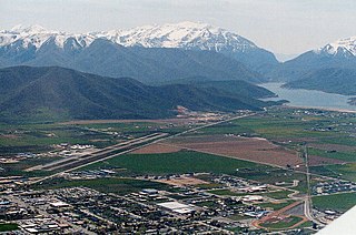
Heber City is a city and county seat of Wasatch County, Utah. The population was 16,856 as of the 2020 United States census. The city is located 43 miles southeast of Salt Lake City.

The Territory of Utah was an organized incorporated territory of the United States that existed from September 9, 1850, until January 4, 1896, when the final extent of the territory was admitted to the Union as the State of Utah, the 45th state. At its creation, the Territory of Utah included all of the present-day State of Utah, most of the current state of Nevada save for that portion of Southern Nevada, much of modern western Colorado, and the extreme southwest corner of present-day Wyoming.

Hiawatha is an unincorporated community and near-ghost town, formerly a coal mining town in southwestern Carbon County, Utah, United States. While the town's former corporate limits were almost entirely within Carbon County, the western part was within the Manti-La Sal National Forest and a very small part extended west into Emery County.

The Lucin Cutoff is a 102-mile (164 km) railroad line in Utah, United States that runs from Ogden to its namesake in Lucin. The most prominent feature of the cutoff was a twelve-mile-long (19 km) railroad trestle crossing the Great Salt Lake, which was in use from 1904 until the late 1950s, when it was replaced by an earthen causeway.

Thistle is a ghost town in Spanish Fork Canyon in southeastern Utah County, Utah, United States. During the era of steam locomotives, the town's primary industry was servicing trains for the Denver and Rio Grande Western Railroad. The fortunes of the town were closely linked with those of the railroad until the changeover to diesel locomotives, when the town started to decline.

The Los Angeles and Salt Lake Railroad was a rail company in California, Nevada, and Utah in the United States, that completed and operated a railway line between its namesake cities, via Las Vegas, Nevada. Incorporated in Utah in 1901 as the San Pedro, Los Angeles and Salt Lake Railroad, the line was largely the brainchild of William Andrews Clark, a Montana mining baron and United States Senator. Clark enlisted the help of Utah's U.S. Senator Thomas Kearns, mining magnate and newspaper man, to ensure the success of the line through Utah. Construction of the railroad's main line was completed in 1905. Company shareholders adopted the LA&SL name in 1916. The railway was also known by its official nickname, "The Salt Lake Route", and was sometimes informally referred to as "The Clark Road". The tracks are still in use by the modern Union Pacific Railroad, as the Cima, Caliente, Sharp, and Lynndyl Subdivisions.

Interstate 80 (I-80) is a part of the Interstate Highway System that runs from San Francisco, California, to Teaneck, New Jersey. The portion of the highway in the US state of Utah is 197.51 miles (317.86 km) long through the northern part of the state. From west to east, I-80 crosses the state line from Nevada in Tooele County and traverses the Bonneville Salt Flats—which are a part of the larger Great Salt Lake Desert. It continues alongside the Wendover Cut-off—the corridor of the former Victory Highway—US Route 40 (US-40) and the Western Pacific Railroad Feather River Route. After passing the Oquirrh Mountains, I-80 enters the Salt Lake Valley and Salt Lake County. A short portion of the freeway is concurrent with I-15 through Downtown Salt Lake City. At the Spaghetti Bowl, I-80 turns east again into the mouth of Parleys Canyon and Summit County, travels through the mountain range, and intersects the eastern end of I-84 near Echo Reservoir before turning northeast toward the Wyoming border near Evanston. I-80 was built along the corridor of the Lincoln Highway and the Mormon Trail through the Wasatch Range. The easternmost section also follows the historical routes of the first transcontinental railroad and US-30S.

Kelton is a ghost town, just north of the Great Salt Lake, in the Park Valley area of Box Elder County, Utah, United States. The town was inhabited during the period of 1869–1942. Once an important section station on the First transcontinental railroad, Kelton was dependent on the railroad throughout its history. The town suffered serious setbacks in the 1880s when its busy stagecoach route to Boise, Idaho was discontinued, and in the 1900s when the Lucin Cutoff left it off the main rail line. The strongest earthquake in Utah history caused severe damage in 1934, but Kelton ceased to exist only when the rails were completely removed during World War II.

Terrace is a ghost town in the Great Salt Lake Desert in west-central Box Elder County, Utah, United States.
Grass Creek is a ghost town in Summit County, Utah, United States. Lying some 8 miles (13 km) northeast of Coalville, it was once an important coal mining town. Grass Creek was inhabited circa 1860–1940.

Silver City is a ghost town located at the mouth of Dragon Canyon on the west flank of the East Tintic Mountains in northeast Juab County in central Utah, United States. It was a silver mining town approximately 90 miles (140 km) south-southwest of Salt Lake City. This area was considered part of the Tintic Mining District and also produced bismuth, copper, gold, and lead. Settlement began with the first mining strikes here in 1869. Silver City was inhabited until 1930, after the mines played out. Jesse Knight, known as the "Mormon Wizard" for his ability to find ore easily, decided to build a smelter in Silver City because it had the flattest ground in all of the Tintic Mining District. Silver City had several mines in 1890, but the mines hit water and were abandoned. Now there is little left other than a few holes where mines were, and a number of tailings piles. The Silver City Cemetery, however, survives and is listed on the National Register of Historic Places.


