Morgan County is a county in northern Utah, United States. As of the 2020 census, the population was 12,295. Its county seat and largest city is Morgan. Morgan County is part of the Ogden-Clearfield, UT Metropolitan Statistical Area as well as the Salt Lake City-Provo-Orem, UT Combined Statistical Area.

Howell is a town located in the Blue Creek Valley in northeast Box Elder County, Utah, United States. The population was 245 at the 2010 census.

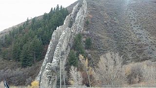
The Wasatch Range or Wasatch Mountains is a mountain range in the western United States that runs about 160 miles (260 km) from the Utah-Idaho border south to central Utah. It is the western edge of the greater Rocky Mountains, and the eastern edge of the Great Basin region. The northern extension of the Wasatch Range, the Bear River Mountains, extends just into Idaho, constituting all of the Wasatch Range in that state.
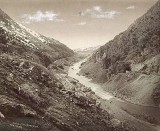
The Bear River is the largest tributary of the Great Salt Lake, draining a mountainous area and farming valleys northeast of the lake and southeast of the Snake River Plain. It flows through northeastern Utah, southwestern Wyoming, southeastern Idaho, and back into northern Utah, in the United States. Approximately 350 miles (560 km) long it is the longest river in North America that does not ultimately reach the sea.

The Price River is a 137-mile-long (220 km) southeastward flowing river in Carbon, Utah and Emery counties in eastern Utah. It is a tributary to the Green River, itself a tributary to the Colorado River.

Lund is an unincorporated village located in the Escalante Valley of northwestern Iron County, Utah, United States, approximately 35 miles (56 km) northwest of Cedar City. The town, established in the early twentieth century, was a station stop on the Los Angeles and Salt Lake Railroad, and was a community center for early twentieth century homesteaders. The area's population was never large, however, and most early settlers were unsuccessful due to the region's harsh and arid climate.
Chester is an unincorporated community in central Sanpete County, Utah, United States.

Gold Hill is an unincorporated community in far western Tooele County, Utah, located near the Nevada state line.

Park Valley is an unincorporated community in north-central Box Elder County, Utah, United States.

Tucker is a ghost town located near the east end of the Spanish Fork River in Utah County, Utah, United States 7 miles (11 km) below Soldier Summit on U.S. Route 6. It was once an important loading point and construction camp on the Denver and Rio Grande Western Railroad (D&RGW). After the town was abandoned, the state of Utah used the town site for a rest area. In 2009, the site was buried as part of a project to re-align a portion of US-6's western approach to Soldier Summit. To honor the town, the state of Utah built a replacement rest area about 2 miles (3.2 km) downstream from Tucker, called the Tie Fork Rest Area.
Hebron is a ghost town on Shoal Creek in Washington County in southwestern Utah, United States. Hebron was inhabited from 1862 until 1902, when the already-declining town was mostly destroyed by an earthquake. The present-day city of Enterprise, 6 miles (9.7 km) to the east, was settled largely by people leaving Hebron.

Alexander Toponce was an American pioneer in the Intermountain West region of the United States. His family immigrated to the United States from Belfort, France when he was seven and Alexander left home about three years later. He worked as a laborer for several years, mostly in the logging and lumber business, before becoming a teamster, stagecoach driver and freight handler. Toponce headed west when he was about fifteen years old, first to Missouri and then to the northern Intermountain West. There, he ran freight and stagecoach outfits, owned livestock herds, sometimes tried his hand at mining, and invested in all manner of development projects. He is credited with opening or improving many early freight and stage routes throughout the region. Later in life, he mostly invested in mining properties while holding interests in land development companies. Over his lifetime, Toponce made and lost several fortunes, the result of bad weather, Indian raids, unpredictable prices and dishonest partners.

Wahsatch is a ghost town in Summit County, Utah, United States. It lies along I-80 at the northeastern end of Echo Canyon some 23 miles (37 km) east of Echo, and 11 miles (18 km) west of Evanston, Wyoming. Wahsatch was established as a railroad camp, later achieving local prominence in sheep ranching. It was inhabited from 1868 until the 1930s.
Grass Creek is a ghost town in Summit County, Utah, United States. Lying some 8 miles (13 km) northeast of Coalville, it was once an important coal mining town. Grass Creek was inhabited circa 1860–1940.
Jackson is a ghost town in the western desert of Box Elder County, Utah, United States. It lies on the western end of the Lucin Cutoff, just west of the Great Salt Lake. Jackson was never much more than a railroad siding, named by the railroad for a prospector who operated a mine in the area. On February 19, 1904, during a collision between two Southern Pacific trains, a carload of dynamite exploded, wrecking everything within an 0.5 miles (0.80 km) radius, including the majority of lives within the town of 45. The effects are credited to concussion, although officials at the time were surprised by the disaster's magnitude.

Lake Point is a city on the eastern edge of northern Tooele County, Utah, United States. It is located 17 miles southwest of Salt Lake City International Airport and 11 miles north of Tooele, Utah. At its location on the south shore of the Great Salt Lake, the city is served by Interstate 80 and Utah State Route 36.
Winter Quarters is a ghost town in Carbon County, Utah, United States. Coal was discovered in the area in 1875, and later that year, the Pleasant Valley Coal Company began coal mining operations. A group of coal miners were delayed during an early winter storm in 1877, which led to the town's name of Winter Quarters. On May 1, 1900, an explosion in the Winter Quarters Number Four mine killed 200 miners. Despite the mine explosion, the coal mining operations remained active until 1922, when the opening of a new mine in Castle Gate caused many people to relocate there. By 1930, Winter Quarters was abandoned.
The Curlew Valley is a 23-mile (37 km) long valley located on the northern edge of the Great Salt Lake in Box Elder County in northern Utah and extending north into Oneida County in southern Idaho.

The Juab Valley is a 40-mile (64 km) long valley located on the eastern edge of Juab County, Utah, United States.

Salduro is a ghost town located in Tooele County, Utah, United States.


