South Willard, Utah

Last updated

South Willard, Utah
CDP
Box Elder County Utah incorporated and unincorporated areas South Willard highlighted.svg
Location within Box Elder County and the State of Utah.
Map of USA UT.svg
Location of Utah in the United States
Coordinates: 41°21′16″N112°2′26″W / 41.35444°N 112.04056°W / 41.35444; -112.04056
Country United States
State Utah
County Box Elder
Named for Willard Richards
Area
  Total5.8 sq mi (15.1 km2)
  Land5.8 sq mi (15.1 km2)
  Water0.0 sq mi (0.0 km2)
Elevation
[1]
4,331 ft (1,320 m)
Population
 (2010)
  Total1,571
  Density100.6/sq mi (38.9/km2)
Time zone UTC-7 (Mountain (MST))
  Summer (DST) UTC-6 (MDT)
FIPS code 49-71255 [2]
GNIS feature ID1852446 [1]

South Willard is a census-designated place (CDP) in Box Elder County, Utah, United States. The population was 1,571 at the 2010 census.

Contents

Geography

According to the United States Census Bureau, the CDP has a total area of 5.8 square miles (15.1 km2), all land.

Demographics

Historical population
CensusPop.Note
2000 586
2010 1,571168.1%

As of the census [2] of 2000, there were 586 people, 209 households, and 156 families residing in the CDP. The population density was 100.6 people per square mile (38.9/km2). There were 228 housing units at an average density of 39.2/sq mi (15.1/km2). The racial makeup of the CDP was 95.22% White, 1.19% Native American, 0.17% Asian, 1.87% from other races, and 1.54% from two or more races. Hispanic or Latino of any race were 5.12% of the population.

There were 209 households, out of which 39.2% had children under the age of 18 living with them, 66.5% were married couples living together, 6.7% had a female householder with no husband present, and 24.9% were non-families. 23.0% of all households were made up of individuals, and 7.7% had someone living alone who was 65 years of age or older. The average household size was 2.80 and the average family size was 3.34.

In the CDP, the population was spread out, with 29.0% under the age of 18, 12.3% from 18 to 24, 29.4% from 25 to 44, 17.4% from 45 to 64, and 11.9% who were 65 years of age or older. The median age was 31 years. For every 100 females, there were 104.2 males. For every 100 females age 18 and over, there were 104.9 males.

The median income for a household in the CDP was $43,214, and the median income for a family was $45,000. Males had a median income of $36,607 versus $20,938 for females. The per capita income for the CDP was $16,560. About 9.5% of families and 7.4% of the population were below the poverty line, including 8.2% of those under age 18 and 3.1% of those age 65 or over.

See also

Related Research Articles

<span class="mw-page-title-main">East Fork, Arizona</span> CDP in Navajo County, Arizona

East Fork is a census-designated place (CDP) in Navajo County, Arizona, United States, on the Fort Apache Indian Reservation. The population was 699 at the 2010 census.

<span class="mw-page-title-main">Squirrel Mountain Valley, California</span> Census-designated place in California, United States

Squirrel Mountain Valley is a census-designated place (CDP) in the southern Sierra Nevadas, in Kern County, California, United States. Squirrel Mountain Valley is located in the Lake Isabella area 5 miles (8 km) northeast of Bodfish, at an elevation of 2,900 feet (883.9 m). The population was 547 at the 2010 census, up from 498 at the 2000 census.

<span class="mw-page-title-main">Dry Run, Ohio</span> Census-designated place in Ohio, United States

Dry Run is a census-designated place (CDP) in Hamilton County, Ohio, United States. The population was 7,672 at the 2020 census.

<span class="mw-page-title-main">Riverside, Utah</span> CDP in Utah, United States

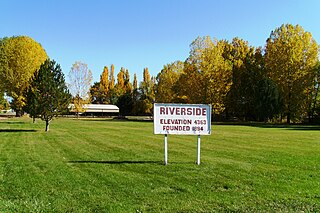
Riverside is a census-designated place (CDP) in Box Elder County, Utah, United States. The population was 760 at the 2010 census.

<span class="mw-page-title-main">Cove, Utah</span> Census-designated place in Utah, United States

Cove is a census-designated place (CDP) in Cache County, Utah, United States. The population was 460 at the 2010 census. It is included in the Logan, Utah-Idaho Metropolitan Statistical Area.

<span class="mw-page-title-main">Neola, Utah</span> Census-designated place in Utah, United States

Neola is a census-designated place (CDP) in Duchesne County, Utah, United States. The population was 461 at the 2010 census. Neola was established in 1912.

<span class="mw-page-title-main">Silver Summit, Utah</span> CDP in Utah, United States

Silver Summit is a census-designated place (CDP) in Summit County, Utah, United States. Prior to the 2010 Census, the area was designated as North Snyderville Basin CDP. The population was 1,821 at the 2000 census.

<span class="mw-page-title-main">Snyderville, Utah</span> CDP in Utah, United States

Snyderville is a census-designated place (CDP) near the southwestern edge of Summit County, Utah, United States. Prior to the 2010 Census, the area was designated as South Snyderville Basin CDP. The population was 3,636 at the 2000 census.

<span class="mw-page-title-main">Woodland, Utah</span> CDP in Utah, United States

Woodland is a census-designated place (CDP) in Summit County, Utah, United States. The population was 335 at the 2000 census.

<span class="mw-page-title-main">Fort Duchesne, Utah</span> CDP in Utah, United States

Fort Duchesne is a census-designated place (CDP) in Uintah County, Utah, United States. The population was 714 at the 2010 census, an increase from the 2000 figure of 621.

<span class="mw-page-title-main">Randlett, Utah</span> CDP in Utah, United States

Randlett is a census-designated place (CDP) in west-central Uintah County, Utah, United States. In the 2000 census its population was 224, a 21% decrease from the 1990 figure of 283.

<span class="mw-page-title-main">Benjamin, Utah</span> CDP in Utah, United States

Benjamin is a census-designated place (CDP) in Utah County, Utah, United States. It is part of the Provo–Orem Metropolitan Statistical Area. The population was 1,145 at the 2010 census.

<span class="mw-page-title-main">Elberta, Utah</span> CDP in Utah, United States

Elberta is a census-designated place (CDP) in Utah County, Utah, United States. It is part of the Provo–Orem Metropolitan Statistical Area. The population was 256 at the 2010 census. It was founded as Mt. Nebo. After the water failed in 1901, most of the early settlers moved away. It was purchased by Matthew B. Whitney, a native of New York, on November 7, 1907, and he renamed it "Elberta" after the peach cultivar.

<span class="mw-page-title-main">Lake Shore, Utah</span> CDP in Utah, United States

Lake Shore is a census-designated place (CDP) in Utah County, Utah, United States. It is part of the Provo–Orem Metropolitan Statistical Area. The population was 817 at the 2010 census.

<span class="mw-page-title-main">West Mountain, Utah</span> CDP in Utah, United States

West Mountain is a census-designated place (CDP) in Utah County, Utah, United States. It is part of the Provo–Orem Metropolitan Statistical Area. As of the 2010 census, the CDP population was 1,186. The town is at the base of West Mountain and bears its name.

<span class="mw-page-title-main">Daniel, Utah</span> Town in Utah, United States

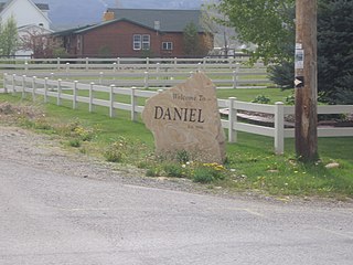
Daniel is a town in Wasatch County, Utah, United States. The population was 938 at the 2010 census, at which time it was a township and census-designated place (CDP). Daniel incorporated as a town in February 2006. Daniel was first settled in 1874.

<span class="mw-page-title-main">Hooper, Utah</span> City in Utah, United States

Hooper is a city in Weber County, Utah, United States, first called Muskrat Springs and later Hooperville for Captain William Henry Hooper, an early Utah delegate to Congress. The population was 9,087 at the 2020 census, up from the 2010 figure of 6,932. Prior to the city's incorporation on November 30, 2000, Hooper was an unincorporated census-designated place (CDP).

<span class="mw-page-title-main">Maple Heights-Lake Desire, Washington</span> Census-designated place in Washington, United States

Maple Heights-Lake Desire is a census-designated place (CDP) in King County, Washington, United States. At the 2010 census, the population was 3,152.

<span class="mw-page-title-main">Maltby, Washington</span> Census-designated place in Washington, United States

Maltby is a census-designated place (CDP) in Snohomish County, Washington. The population was 10,830 at the 2010 census.

<span class="mw-page-title-main">Oljato–Monument Valley, Utah</span> CDP in Utah, United States

Oljato-Monument Valley is a census-designated place (CDP) in San Juan County, Utah, United States. The population was 864 at the 2000 census.

References

  1. 1 2 U.S. Geological Survey Geographic Names Information System: South Willard
  2. 1 2 "U.S. Census website". United States Census Bureau . Retrieved January 31, 2008.

Commons-logo.svg Media related to South Willard, Utah at Wikimedia Commons