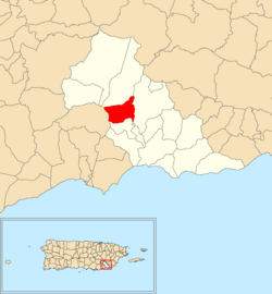
Río Cañas is a barrio in the municipality of Añasco, Puerto Rico. Its population in 2010 was 300.

Jagual is a barrio in the municipality of San Lorenzo, Puerto Rico. Its population in 2010 was 4,042.

Mamey is a barrio in the municipality of Patillas, Puerto Rico. Its population in 2010 was 1,380.

Apeadero is a barrio in the municipality of Patillas, Puerto Rico. Its population in 2010 was 699.

Cacao Alto is a barrio in the municipality of Patillas, Puerto Rico. Its population in 2010 was 2,449.

Cacao Bajo is a barrio in the municipality of Patillas, Puerto Rico. Its population in 2010 was 1,437.

Egozcue is a barrio in the municipality of Patillas, Puerto Rico. Its population in 2010 was 52.

Guardarraya is a barrio in the municipality of Patillas, Puerto Rico. Its population in 2010 was 1,603.

Jacaboa is a barrio in the municipality of Patillas, Puerto Rico. Its population in 2010 was 1,278.

Quebrada Arriba is a barrio in the municipality of Patillas, Puerto Rico. Its population in 2010 was 711.

Marín is a barrio in the municipality of Patillas, Puerto Rico. Its population in 2010 was 890.

Mulas is a barrio in the municipality of Patillas, Puerto Rico. Its population in 2010 was 439.

Muñoz Rivera is a barrio in the municipality of Patillas, Puerto Rico. Its population in 2010 was 673.

Pollos is a barrio in the municipality of Patillas, Puerto Rico. Its population in 2010 was 3,146.

Ríos is a barrio in the municipality of Patillas, Puerto Rico. Its population in 2010 was 348.

Bajo also spelled Bajos is a barrio in the municipality of Patillas, Puerto Rico. Its population in 2010 was 1,530.

Puerto Diablo is a barrio in the municipality of Vieques, Puerto Rico. Its population in 2010 was 1,896.

Caracol is a barrio in the municipality of Añasco, Puerto Rico. Its population in 2010 was 1,869.

Carreras is a barrio in the municipality of Arecibo, Puerto Rico. Its population in 2010 was 1,226.

Maizales is a barrio in the municipality of Naguabo, Puerto Rico. Its population in 2010 was 1,913.


