Jenner Township, Somerset County, Pennsylvania

Last updated
Jenner Township,
Somerset County, Pennsylvania
Matthew Hair Farm House.jpg
The Matthew Hair Farmhouse, a historic site in the township
Map of Somerset County, Pennsylvania highlighting Jenner Township.PNG
Map of Somerset County, Pennsylvania Highlighting Jenner Township
Map of Pennsylvania highlighting Somerset County.svg
Map of Somerset County, Pennsylvania
Country United States
State Pennsylvania
County Somerset
Area
[1]
  Total65.12 sq mi (168.65 km2)
  Land64.62 sq mi (167.37 km2)
  Water0.50 sq mi (1.29 km2)
Population
 (2020) [2]
  Total3,703 Decrease2.svg
  Estimate 
(2021) [2]
3,666
  Density60.57/sq mi (23.39/km2)
Time zone UTC-5 (Eastern (EST))
  Summer (DST) UTC-4 (EDT)
FIPS code 42-111-38032

Jenner Township is a township in Somerset County, Pennsylvania, United States. The population was 3,703 at the 2020 census. [2] It is part of the Johnstown, Pennsylvania, Metropolitan Statistical Area.

Contents

Jenner Township includes the unincorporated communities of Jenners, Jenner Crossroads, Ralphton, Pilltown, Ferrellton, Acosta, and Gray. Jenner Township completely surrounds the nearby boroughs of Boswell and Jennerstown, each of which has its own government and is not part of the Township.

Geography

It is located approximately at 40.175°N by 79.06°W. According to the U.S. Census Bureau, the township has a total area of 65.1 square miles (169 km2), of which 64.6 square miles (167 km2) is land and 0.5 square miles (1.3 km2) (0.77%) is water. Jenner Township is bordered by Conemaugh Township to the northeast, Quemahoning Township to the southeast, Lincoln Township to the southwest, and Westmoreland County to the northwest.

Demographics

Historical population
CensusPop.Note
2010 4,122
2020 3,703−10.2%
2021 (est.)3,666 [2] −1.0%
U.S. Decennial Census [3]

As of the census [4] of 2000, there were 4,054 people, 1,598 households, and 1,192 families residing in the township. The population density was 62.8 inhabitants per square mile (24.2/km2). There were 1,773 housing units at an average density of 27.4 per square mile (10.6/km2). The racial makeup of the township was 99.33% White, 0.05% Native American, 0.10% Asian, 0.12% from other races, and 0.39% from two or more races. Hispanic or Latino of any race were 0.25% of the population.

There were 1,598 households, out of which 28.8% had children under the age of 18 living with them, 59.6% were married couples living together, 9.9% had a female householder with no husband present, and 25.4% were non-families. 22.3% of all households were made up of individuals, and 11.4% had someone living alone who was 65 years of age or older. The average household size was 2.54 and the average family size was 2.96.

In the township the population was spread out, with 22.1% under the age of 18, 8.0% from 18 to 24, 27.0% from 25 to 44, 26.7% from 45 to 64, and 16.2% who were 65 years of age or older. The median age was 41 years. For every 100 females there were 98.0 males. For every 100 females age 18 and over, there were 97.6 males.

The median income for a household in the township was $32,141, and the median income for a family was $39,341. Males had a median income of $26,163 versus $22,688 for females. The per capita income for the township was $15,066. About 8.8% of families and 10.2% of the population were below the poverty line, including 14.6% of those under age 18 and 11.7% of those age 65 or over.

History

Initial hunters and settlers in the territory that includes present-day Jenner Township were Mingo, also known as the Seneca, one of the Six Nations of the Iroquois. [5] The land was ceded by the Iroquois Six Nations officially by the Treaty of Fort Stanwix of 1768 to Penn family as proprietors of Pennsylvania province. [6] Early European traders crossed Jenner Township as early as 1750, when Christopher Gist documented his brief time there in his travel diary. [7] Gist is said to have named Quemahoning Creek, [7] which drains much of Jenner Township. The Northern Trail, an established Indian trail, crossed the territory from east to west, intersecting Quemahoning Creek at Kickenapaulin's Town, a rather substantial Indian settlement, the site of which now lies under the waters of the Quemahoning Reservoir, just outside the township. [8] In August 1758, the Northern Trail was improved, initially for the British military use, and renamed the Forbes Trail, [9] later known as the Pennsylvania Road, the Lincoln Highway, and now U.S. Route 30. [10]

With the building of the Forbes Road to Fort Ligonier and, later, onward to Fort Pitt, present-day Pittsburgh, European settlement began in earnest. Jenner Township was formed out of the western part of Quemahoning Township in 1811. [11] The township was named in honor of Dr. Edward Jenner, discoverer of the smallpox vaccine. Early Jenner Township settlers were primarily German and English speakers engaged in agriculture. Pennsylvania Dutch was still spoken in rural parts of the township until the 1960s.

Some of the first settlers were Robert & Rhoda Smiley in the 1780s. [12] Jenner Crossroads, the township's first substantial European settlement, grew near a grist mill and tavern stop established about 1800 along the Pennsylvania Road. [13] Samuel Steel built a sawmill at Jenner Crossroads in 1817; John Shopwood opened a hotel in 1825, and Samuel Elder opened the first store in 1836. [14] Other early industry in the township included a sawmill on Quemahoning Creek built about 1813 by Moses Fream and a small woolen mill, built in 1817 by William Dalley, enlarged by Owen and William Morgan later into a small settlement known as Morgantown. [15] A Lutheran church was built in the township in 1814, a Methodist Episcopal church in 1827, a Reformed church in 1841, and a United Brethren church in 1849. [12]

Jenners, Ralphton, Acosta and Gray were each built shortly after 1900 as company towns by Consolidation Coal, a Rockefeller interest, for its newly opened deep coal mines. Immigrants from Poland, Italy, Russia, Ruthenia, Wales, and Ireland filled the coal towns. The Somerset Coal Strike of 1922–1923 centered in these towns, and nearby Boswell, Jerome and Windber. The strike, which ultimately failed in its goal to unionize miners, drew significant nationwide attention for the hardships suffered by local miners. [16] By the 1960s, the deep mines had closed. The town of Randolph was also a very small coal mining community in Jenner Township, any trace of which is now virtually gone, having been destroyed by highway construction in 1970.

Surface mining and some deep mining of coal continues in the immediate area. Farming, timber harvest and tourism are also mainstays of the local economy. Jenner Township also serves as a bedroom community for the nearby Somerset and Johnstown areas.

The Bridge in Jenner Township and Matthew Hair Farm are listed on the National Register of Historic Places. [17]

Notable person

Related Research Articles

<span class="mw-page-title-main">Straban Township, Adams County, Pennsylvania</span> Township in Pennsylvania, United States

Straban Township is a township in Adams County, Pennsylvania, United States. The population was 4,928 at the 2010 census.

<span class="mw-page-title-main">Worth Township, Centre County, Pennsylvania</span> Township in Pennsylvania, United States

Worth Township is a township in Centre County, Pennsylvania, United States. It is part of the State College, Pennsylvania Metropolitan Statistical Area. The population was 734 at the 2020 census.

<span class="mw-page-title-main">Conyngham Township, Luzerne County, Pennsylvania</span> Township in Pennsylvania

Conyngham Township is a township in Luzerne County, Pennsylvania, United States. The population was 1,309 at the 2020 census.

<span class="mw-page-title-main">Jackson Township, Mercer County, Pennsylvania</span> Township in Pennsylvania, United States

Jackson Township is a township in Mercer County, Pennsylvania, United States. The population was 1,181 at the 2020 census, a decrease from the figure of 1,273 in 2010.

<span class="mw-page-title-main">Blythe Township, Schuylkill County, Pennsylvania</span> Township in Pennsylvania, United States

Blythe Township is a township in Schuylkill County, Pennsylvania. Formed in 1846 from part of Schuylkill Township, it is named for State Legislator Calvin Blythe.

<span class="mw-page-title-main">East Union Township, Schuylkill County, Pennsylvania</span> Township in Pennsylvania, United States

East Union Township is a township in Schuylkill County, Pennsylvania, United States. The population was 1,648 at the 2020 census.

<span class="mw-page-title-main">Ryan Township, Schuylkill County, Pennsylvania</span> Township in Pennsylvania, United States

Ryan Township is a township in Schuylkill County, Pennsylvania, United States. The population was 2,526 at the 2020 census.

<span class="mw-page-title-main">Boswell, Pennsylvania</span> Borough in Pennsylvania, United States

Boswell is a borough in Somerset County, Pennsylvania, United States. It is part of the Johnstown, Pennsylvania Metropolitan Statistical Area. The population was 1,221 at the 2020 census.

<span class="mw-page-title-main">Conemaugh Township, Somerset County, Pennsylvania</span> Township in Pennsylvania, United States

Conemaugh Township is a township in Somerset County, Pennsylvania, United States. The population was 6,753 at the 2020 census. It is part of the Johnstown, Pennsylvania, Metropolitan Statistical Area. Conemaugh Township includes the towns of Jerome, Davidsville, Tire Hill, Thomas Mills, part of Holsopple, and surrounding countryside.

<span class="mw-page-title-main">Hooversville, Pennsylvania</span> Borough in Pennsylvania, United States

Hooversville is a borough in Somerset County, Pennsylvania, United States. It is part of the Johnstown, Pennsylvania, Metropolitan Statistical Area. The population was 626 at the 2020 census.

<span class="mw-page-title-main">Lincoln Township, Somerset County, Pennsylvania</span> Township in Pennsylvania, United States

Lincoln Township is a township in Somerset County, Pennsylvania, United States. The population was 1,456 at the 2020 census. It is part of the Johnstown, Pennsylvania, Metropolitan Statistical Area.

<span class="mw-page-title-main">Paint Township, Somerset County, Pennsylvania</span> Township in Pennsylvania, United States

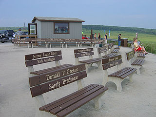
Paint Township is a township in Somerset County, Pennsylvania, United States. The population was 3,038 at the 2020 census. It is part of the Johnstown, Pennsylvania, Metropolitan Statistical Area.

<span class="mw-page-title-main">Quemahoning Township, Somerset County, Pennsylvania</span> Township in Pennsylvania, United States

Quemahoning Township is a township in Somerset County, Pennsylvania, United States. The population was 1,838 at the 2020 census. It is part of the Johnstown, Pennsylvania, Metropolitan Statistical Area.

<span class="mw-page-title-main">Shade Township, Somerset County, Pennsylvania</span> Township in Pennsylvania, United States

Shade Township is a township in Somerset County, Pennsylvania, United States. The population was 2,452 at the 2020 census. It is part of the Johnstown, Pennsylvania, Metropolitan Statistical Area.

<span class="mw-page-title-main">Somerset Township, Somerset County, Pennsylvania</span> Township in Pennsylvania, United States

Somerset Township is a township in Somerset County, Pennsylvania, United States. The population was 12,165 at the 2020 census. It is part of the Johnstown, Pennsylvania, Metropolitan Statistical Area and encompasses the census-designated place (CDP) of Friedens.

<span class="mw-page-title-main">Stonycreek Township, Somerset County, Pennsylvania</span> Township in Pennsylvania, United States

Stonycreek Township is a township in Somerset County, Pennsylvania, United States. The township takes its name from the stony creek, which flows through it and represents its western boundary. The stream takes its name from the rocky bed over which it flows for a great part of its course. Its Indian name was Sinne-Hanne or Achsin-Hanne. Hanne means a stream and especially a swift mountain stream. The population was 2,089 at the 2020 census. It is part of the Johnstown, Pennsylvania, metropolitan statistical area.

<span class="mw-page-title-main">Summit Township, Somerset County, Pennsylvania</span> Township in Pennsylvania, United States

Summit Township is a township in Somerset County, Pennsylvania, United States. The population was 2,141 at the 2020 census. It is part of the Johnstown, Pennsylvania, Metropolitan Statistical Area.

<span class="mw-page-title-main">Upper Turkeyfoot Township, Somerset County, Pennsylvania</span> Township in Pennsylvania, United States

Upper Turkeyfoot Township is a township in Somerset County, Pennsylvania, United States. The population was 1,063 at the 2020 census. It is part of the Johnstown, Pennsylvania, Metropolitan Statistical Area.

<span class="mw-page-title-main">Lewis Township, Union County, Pennsylvania</span> Township in Pennsylvania, United States

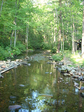
Lewis Township is a township in Union County, Pennsylvania, United States. The population was 1,456 at the 2020 census. Sand Bridge State Park, a Pennsylvania state park, is in Lewis Township along Pennsylvania Route 192.

<span class="mw-page-title-main">Donegal Township, Westmoreland County, Pennsylvania</span> Township in Pennsylvania, United States

Donegal Township is a township in Westmoreland County, Pennsylvania, United States. The population was 2,192 at the 2020 census, a decrease of 9% compared to 2010.

References

  1. "2016 U.S. Gazetteer Files". United States Census Bureau. Retrieved Aug 14, 2017.
  2. 1 2 3 4 Bureau, US Census. "City and Town Population Totals: 2020—2021". Census.gov. US Census Bureau. Retrieved July 24, 2022.
  3. "Census of Population and Housing". Census.gov. Retrieved June 4, 2016.
  4. "U.S. Census website". United States Census Bureau . Retrieved 2008-01-31.
  5. Cassady, John C. 1932. The Somerset County Outline. Scottdale, Pa.: Mennonite Publishing House. pp. 75–76.
  6. Cassady, pp. 80–81.
  7. 1 2 Cassady, p. 82
  8. Cassady, p. 113.
  9. Cassady, pp. 106–109
  10. Cassady, pp. 189–191.
  11. Cassady, p. 211
  12. 1 2 History of Bedford, Somerset and Fulton Counties, Pennsylvania. Chicago: Waterman, Watkins & Co. 1884. pp. 505–510.
  13. Cassady, 1932. pp. 58, 213.
  14. Cassady, pp. 50, 216.
  15. Cassady, pp. 50, 59.
  16. For additional detail, see Blankenhorn, Heber. 1924. The Strike for Union: A Study of the Non-Union Question in Coal and the Problems of a Democratic Movement. New York: H.W. Wilson; Brophy, John. 1964. A Miner's Life. Madison: University of Wisconsin Press. Bussel, Robert. 1999. From Harvard to the Ranks of Labor: Powers Hapgood and the American Working Class. University Park: Pennsylvania State University Press.
  17. "National Register Information System". National Register of Historic Places . National Park Service. July 9, 2010.
40°09′00″N79°07′59″W / 40.15000°N 79.13306°W / 40.15000; -79.13306