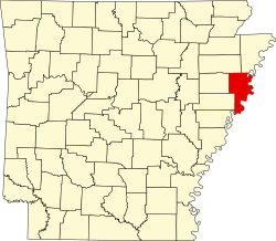
Jericho, Arkansas

Last updated

Jericho, Arkansas
Jericho AR 01 sign.jpg
Jericho, AR
Crittenden County Arkansas Incorporated and Unincorporated areas Jericho Highlighted 0535140.svg
Location of Jericho in Crittenden County, Arkansas.
Coordinates: 35°17′16″N90°13′50″W / 35.28778°N 90.23056°W / 35.28778; -90.23056
Country United States
State Arkansas
County Crittenden
Area
[1]
  Total0.31 sq mi (0.79 km2)
  Land0.31 sq mi (0.79 km2)
  Water0.00 sq mi (0.00 km2)
Elevation
[2]
226 ft (69 m)
Population
 (2020)
  Total98
  Density319.22/sq mi (123.36/km2)
Time zone UTC-6 (Central (CST))
  Summer (DST) UTC-5 (CDT)
ZIP code
72327
Area code 870
FIPS code 05-35140
GNIS feature ID2405915 [2]

Jericho is a town in Crittenden County, Arkansas, United States. The population was 119 at the 2010 census, [3] down from 184 in 2000.

Contents

Geography

Jericho is located in northern Crittenden County at 35°17′12″N90°13′39″W / 35.286550°N 90.227498°W / 35.286550; -90.227498 . [4] It lies along Arkansas Highway 77, 10 miles (16 km) north of West Memphis.

According to the United States Census Bureau, the town has a total area of 0.46 square miles (1.2 km2), all land. [3]

Demographics

Historical population
CensusPop.Note
1990 210
2000 184−12.4%
2010 119−35.3%
2020 98−17.6%
U.S. Decennial Census [5]

As of the census [6] of 2000, there were 184 people, 66 households, and 46 families residing in the town. The population density was 151.2/km2 (394.6/mi2). There were 73 housing units at an average density of 60.0/km2 (156.5/mi2). The racial makeup of the town was 4.35% White, 92.93% Black or African American, 0.54% from other races, and 2.17% from two or more races. 2.72% of the population were Hispanic or Latino of any race.

There were 66 households, out of which 19.7% had children under the age of 18 living with them, 40.9% were married couples living together, 27.3% had a female householder with no husband present, and 30.3% were non-families. 27.3% of all households were made up of individuals, and 13.6% had someone living alone who was 65 years of age or older. The average household size was 2.79 and the average family size was 3.50.

In the town, the population was spread out, with 25.5% under the age of 18, 6.5% from 18 to 24, 25.5% from 25 to 44, 23.4% from 45 to 64, and 19.0% who were 65 years of age or older. The median age was 40 years. For every 100 females, there were 75.2 males. For every 100 females age 18 and over, there were 77.9 males.

The median income for a household in the town was $20,625, and the median income for a family was $28,214. Males had a median income of $22,250 versus $13,125 for females. The per capita income for the town was $8,577. About 25.0% of families and 25.4% of the population were below the poverty line, including 20.0% of those under the age of eighteen and 56.8% of those 65 or over.

Education

Jericho is in the Marion School District. [7] Its comprehensive high school is Marion High School.

Related Research Articles

<span class="mw-page-title-main">Crittenden County, Arkansas</span> County in Arkansas, United States

Crittenden County is a county located in the U.S. state of Arkansas. As of the 2020 census, the population was 48,163. The county seat is Marion, and the largest city is West Memphis.

<span class="mw-page-title-main">Chester, Arkansas</span> Town in Arkansas, United States

Chester is a town in Crawford County, Arkansas, United States. It is part of the Fort Smith, Arkansas-Oklahoma Metropolitan Statistical Area. As of the 2020 Census the population was 144.

<span class="mw-page-title-main">Anthonyville, Arkansas</span> Town in Arkansas, United States

Anthonyville is a town in Crittenden County, Arkansas, United States. The population was 161 at the 2010 census, down from 250 in 2000.

<span class="mw-page-title-main">Edmondson, Arkansas</span> Town in Arkansas, United States

Edmondson is a town in Crittenden County, Arkansas, United States. The population was 427 at the 2010 census.

<span class="mw-page-title-main">Gilmore, Arkansas</span> City in Arkansas, United States

Gilmore is a city in Crittenden County, Arkansas, United States. Per the 2020 census, the population was 176.

<span class="mw-page-title-main">Horseshoe Lake, Arkansas</span> Town in Arkansas, United States

Horseshoe Lake is a town in Crittenden County, Arkansas, United States. The population was 264 at the 2020 census.

<span class="mw-page-title-main">Jennette, Arkansas</span> Town in Arkansas, United States

Jennette is a town in Crittenden and St. Francis counties, Arkansas, United States. The population was 118 at the 2020 census.

<span class="mw-page-title-main">Wooster, Arkansas</span> City in Arkansas, United States

Wooster is a city in Faulkner County, Arkansas, United States. The population was 860 at the 2010 census, up from 516 at the 2000 census. It is part of the Central Arkansas region.

<span class="mw-page-title-main">Jacksonport, Arkansas</span> Town in Arkansas, United States

Jacksonport is a town in Jackson County, Arkansas, United States, along the White River at its confluence with the Black River. The population was 212 at the 2010 census.

<span class="mw-page-title-main">Minturn, Arkansas</span> Town in Arkansas, United States

Minturn is a town in Lawrence County, Arkansas, United States. The population was 109 at the 2010 census.

<span class="mw-page-title-main">Bassett, Arkansas</span> Town in Arkansas, United States

Bassett is a town in Mississippi County, Arkansas, United States. The population was 124 at the 2020 census, down from 173 in 2010.

<span class="mw-page-title-main">Traskwood, Arkansas</span> City in Arkansas, United States

Traskwood is a city in Saline County, Arkansas, United States. The population was 518 at the 2010 census. It is part of the Little Rock–North Little Rock–Conway Metropolitan Statistical Area.

<span class="mw-page-title-main">Midland, Arkansas</span> Town in Sebastian County, Arkansas, United States

Midland is a town in Sebastian County, Arkansas, United States. It is part of the Fort Smith, Arkansas-Oklahoma Metropolitan Statistical Area. The population was 325 at the 2010 census.

<span class="mw-page-title-main">Gillham, Arkansas</span> Town in Arkansas, United States

Gillham is a town in Sevier County, Arkansas, United States. The population was 188 at the 2000 census. It is located six miles from Gillham Lake.

<span class="mw-page-title-main">Caldwell, Arkansas</span> Town in Arkansas, United States

Caldwell is a town in St. Francis County, Arkansas, United States. The population was 555 at the 2010 census, an increase from 465 in 2000.

<span class="mw-page-title-main">Widener, Arkansas</span> Town in Arkansas, United States

Widener is a town in St. Francis County, Arkansas, United States. The population was 212 at the 2020 census, a decline from 273 in 2010.

<span class="mw-page-title-main">Griffithville, Arkansas</span> Town in Arkansas, United States

Griffithville is a town in White County, Arkansas, United States. Windle Porter is the current mayor. The population was 262 at the 2000 census.

<span class="mw-page-title-main">Letona, Arkansas</span> Town in Arkansas, United States

Letona is a town in White County, Arkansas, United States. Sherrel Bennett is the current mayor. The population was 201 at the 2000 census.

<span class="mw-page-title-main">West Point, Arkansas</span> Town in Arkansas, United States

West Point is a town in White County, Arkansas, United States.

<span class="mw-page-title-main">Patterson, Arkansas</span> City in Arkansas, United States

Patterson is a city in Woodruff County, Arkansas, United States. The population was 452 at the 2010 census.

References

  1. "2020 U.S. Gazetteer Files". United States Census Bureau. Retrieved October 29, 2021.
  2. 1 2 U.S. Geological Survey Geographic Names Information System: Jericho, Arkansas
  3. 1 2 "Geographic Identifiers: 2010 Demographic Profile Data (G001): Edmondson town, Arkansas". U.S. Census Bureau, American Factfinder. Archived from the original on February 12, 2020. Retrieved June 20, 2014.
  4. "US Gazetteer files: 2010, 2000, and 1990". United States Census Bureau. February 12, 2011. Retrieved April 23, 2011.
  5. "Census of Population and Housing". Census.gov. Retrieved June 4, 2015.
  6. "U.S. Census website". United States Census Bureau . Retrieved January 31, 2008.
  7. "2020 CENSUS - SCHOOL DISTRICT REFERENCE MAP: Crittenden County, AR" (PDF). U.S. Census Bureau . Retrieved September 22, 2022.