Jobs Gate, Queensland

Last updated

Jobs Gate
Queensland
Australia Queensland location map.svg
Red pog.svg
Jobs Gate
Coordinates 28°48′26″S146°43′59″E / 28.8073°S 146.7331°E / -28.8073; 146.7331 (Jobs Gate (centre of locality))
Population0 (2021 census) [1]
 • Density0.0000/km2 (0.0000/sq mi)
Postcode(s) 4490
Area1,468.5 km2 (567.0 sq mi)
Time zone AEST (UTC+10:00)
Location
LGA(s) Shire of Paroo
State electorate(s) Warrego
Federal division(s) Maranoa
Suburbs around Jobs Gate:
Widgeegoara Nebine Bollon
Noorama Jobs Gate Hebel
Enngonia (NSW) Weilmoringle (NSW) Weilmoringle (NSW)

Jobs Gate is a rural locality in the Shire of Paroo, Queensland, Australia. [2] It is on the border of Queensland and New South Wales. [3] In the 2021 census, Jobs Gate had "no people or a very low population". [1]

Contents

The abandoned town of Tego is in the south-east of the locality ( 28°50′49″S146°47′07″E / 28.8469°S 146.7852°E / -28.8469; 146.7852 (Tego (town centre)) ). [4]

Geography

The southern boundary of Jobs Gate is the border of Queensland and New South Wales. [3]

Jobs Gate Road enters the locality from the west (Noorama) and exits to the south (Weilmoringle). [3]

The south-east of the locality is within the Culgoa Floodplain National Park ( 28°54′59″S147°00′40″E / 28.9164°S 147.0111°E / -28.9164; 147.0111 (Culgoa Floodplain National Park (centre point)) ), [5] which extends into neighbouring Hebel. [3] The town of Tego is within the national park (but excised from the protected area). The Tego springs are approximately 600 metres (2,000 ft) ESE of the town ( 28°50′58″S146°47′30″E / 28.8494°S 146.7916°E / -28.8494; 146.7916 (Tego Springs) ) and are natural springs from the Great Artesian Basin. [3] [6] The springs were close to a stock route that commences in the area and extends to Cunnamulla. [3]

Apart from the national park, the predominant land use is grazing on native vegetation. [7]

History

In March 1901 1,150 acres (470 ha) were reserved for the town of Tego. The gazettal of the town was published in the Queensland Government Gazette on 30 March 1901. It was originally called Tego Springs. [4]

The motivation for establishing Tego was its location, approximately midway between Cunnamulla and Brewarrina (in New South Wales). Town lots were surveyed and sold, and in its early days the town had a hotel and other buildings. The hotel appears to have pre-dated the town being shown on a 1896 map. [8] By 1924 only one cottage remained with two inhabitants. [9] As at May 2020, there is no evidence of any structures remaining at the town. [3]

Demographics

In the 2016 census, Jobs Gate had a population of 6 people. [10]

In the 2021 census, Jobs Gate had "no people or a very low population". [1]

Education

There are no schools in Jobs Gate. The nearest primary and secondary schools are in Cunnamulla, 166 kilometres (103 mi) away. Distance education and boarding schools are the alternatives. [3]

Related Research Articles

<span class="mw-page-title-main">Culgoa Floodplain National Park</span> Protected area in Queensland, Australia

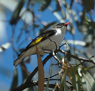
The Culgoa Floodplain National Park is a protected national park that is located in the South West region of Queensland in eastern Australia. The 42,859-hectare (105,910-acre) national park is situated at the western extent of Hebel in the Shire of Balonne and in the east of Jobs Gate in the Paroo Shire, approximately 630 kilometres (390 mi) west of Brisbane. The park occupies the former pastoral and grazing property of Byra Station. The park's southern boundary is defined by part of the state border between Queensland and New South Wales.

The Culgoa River is a river that is part of the Darling catchment within the Murray–Darling basin and is located in South West Queensland.

<span class="mw-page-title-main">Cunnamulla</span> Town in Queensland, Australia

Cunnamulla is a town and a locality in the Shire of Paroo, Queensland, Australia. It is 206 kilometres (128 mi) south of Charleville, and approximately 750 kilometres (470 mi) west of the state capital, Brisbane. In the 2021 census, Cunnamulla had a population of 1,233 people.

<span class="mw-page-title-main">Hebel, Queensland</span> Town in Queensland, Australia

Hebel is a rural town and locality in the Shire of Balonne, Queensland, Australia. It is on the border of Queensland and New South Wales. In the 2016 census, Hebel had a population of 67 people.

Dirranbandi is a rural town and locality in the Shire of Balonne, Queensland, Australia. The locality is on the border of Queensland with New South Wales. In the 2021 census, the locality of Dirranbandi had a population of 610 people.

<span class="mw-page-title-main">Thargomindah</span> Town in Queensland, Australia

Thargomindah is a rural town and locality in the Shire of Bulloo, Queensland, Australia. The town of Thargomindah is the administrative centre for the Shire of Bulloo. In the 2016 census, Thargomindah had a population of 270 people. It was founded on Wongkumara and Kalali territory.

<span class="mw-page-title-main">Shire of Paroo</span> Local government area in Queensland, Australia

The Shire of Paroo is a local government area in South West Queensland, Australia. The administrative centre is the town of Cunnamulla. The Paroo Shire covers an area of 47,623 square kilometres (18,387 sq mi). In the 2021 census, the Shire had a population of 1,679.

<span class="mw-page-title-main">Wyandra, Queensland</span> Town in Queensland, Australia

Wyandra is a rural town and locality in the Shire of Paroo, Queensland, Australia. In the 2021 census, the locality of Wyandra had a population of 78 people.

<span class="mw-page-title-main">Eulo, Queensland</span> Town in Queensland, Australia

Eulo is an outback town and locality in the Shire of Paroo, Queensland, Australia. In the 2016 census, Eulo had a population of 95 people. It is known for its opal mining.

<span class="mw-page-title-main">Hungerford, Queensland</span> Town in Queensland, Australia

Hungerford is an outback town in the Shire of Bulloo and a locality in the Shire of Bulloo and Shire of Paroo, South West Queensland, Australia. The locality is on the Queensland border with New South Wales.

<span class="mw-page-title-main">Bollon, Queensland</span> Town in Queensland, Australia

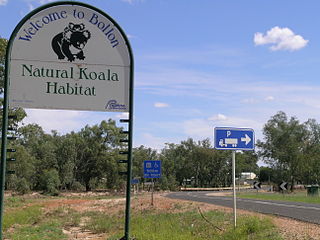
Bollon is a rural town and locality in the Shire of Balonne, Queensland, Australia. In the 2016 census, Bollon had a population of 221 people.

<span class="mw-page-title-main">South West Queensland</span> Region in Queensland, Australia

South West Queensland is a remote region in the Australian state of Queensland which covers 319,808 km2 (123,479 sq mi). The region lies to the south of Central West Queensland and west of the Darling Downs and includes the Maranoa district and parts of the Channel Country. The area is noted for its cattle grazing, cotton farming, opal mining and oil and gas deposits.

<span class="mw-page-title-main">Yowah</span> Town in Queensland, Australia

Yowah is an outback town and locality in the Shire of Paroo, Queensland, Australia. In the 2021 census, the locality of Yowah had a population of 126 people.

<span class="mw-page-title-main">Sommariva, Queensland</span> Suburb of Shire of Murweh, Queensland, Australia

Sommariva is a locality in the Shire of Murweh, Queensland, Australia. It is situated 37.9 kilometres (23.5 mi) east of Charleville and 57.4 kilometres (35.7 mi) west of Morven on the Warrego Highway. In the 2021 census, Sommariva had a population of 25 people.

Bakers Bend is a rural locality in the Shire of Murweh, Queensland, Australia. In the 2021 census, Bakers Bend had a population of 7 people.

Dynevor is a former locality in the Shire of Bulloo, Queensland, Australia. In the 2016 census, Dynevor had a population of 21 people.

Linden is a rural locality in the Shire of Paroo, Queensland, Australia. In the 2021 census, Linden had "no people or a very low population".

Boatman is a locality in the Shire of Murweh, Queensland, Australia. In the 2021 census, Boatman had a population of 18 people.

Humeburn is a locality in the Shire of Paroo, Queensland, Australia. In the 2021 census, Humeburn had a population of 9 people.

<span class="mw-page-title-main">Noorama, Queensland</span> Suburb of Shire of Paroo, Queensland, Australia

Noorama is a rural locality in the Shire of Paroo, Queensland, Australia. It in on the border of Queensland and New South Wales. In the 2016 census, Noorama had a population of 21 people.

References

  1. 1 2 3 Australian Bureau of Statistics (28 June 2022). "Jobs Gate (SAL)". 2021 Census QuickStats. Retrieved 28 February 2023. OOjs UI icon edit-ltr-progressive.svg
  2. "Jobs Gate – locality in Shire of Paroo (entry 42657)". Queensland Place Names. Queensland Government . Retrieved 10 May 2020.
  3. 1 2 3 4 5 6 7 8 "Queensland Globe". State of Queensland . Retrieved 8 April 2019.
  4. 1 2 "Tego – town in Shire of Paroo (entry 43900)". Queensland Place Names. Queensland Government . Retrieved 30 November 2019.
  5. "Culgoa Floodplain National Park – national park in Shire of Balonne (entry 39439)". Queensland Place Names. Queensland Government . Retrieved 11 May 2020.
  6. "Culgoa Floodplain National Park - Nature, culture and history". Department of Environment and Science. Queensland Government . Retrieved 10 May 2020.
  7. "Warrego". Murray-Darling Basin Authority. Australian Government. Archived from the original on 18 March 2019. Retrieved 19 April 2019.
  8. "Map of Queensland Sheet 1". Queensland Government. April 1896. Archived from the original on 12 May 2020. Retrieved 12 May 2020.
  9. "THE WINDING ROAD". Balonne Beacon . Queensland, Australia. 27 November 1924. p. 1. Retrieved 11 May 2020 via Trove.
  10. Australian Bureau of Statistics (27 June 2017). "Jobs Gate (SSC)". 2016 Census QuickStats. Retrieved 20 October 2018. OOjs UI icon edit-ltr-progressive.svg