Education
| | This section needs expansion. You can help by adding to it. (January 2023) |
Jugial | |
|---|---|
| Country | India |
| State | Punjab |
| District | Pathankot |
| Population | |
| • Total | 16,664 |
| Languages | |
| • Official | Punjabi |
| Time zone | UTC+5:30 (IST) |
| PIN | 145029 |
| Telephone code | 01870 |
| Vehicle registration | PB-35 |
Jugial is a census town in Pathankot district in the Indian state of Punjab India
As of 2001 [update] India census, [1] Jugial had a population of 16,664. Males constitute 54% of the population and females 46%. Jugial has an average literacy rate of 79%, higher than the national average of 74.04%: male literacy is 81%, and female literacy is 76%. In Jugial, 11% of the population is under 6 years of age.
Jugial lies 13 km north of Pathankot and 6 km east of Madhopur, it lies near Shapurkandi village, which is the last town of Punjab, before entering the state of Jammu and Kashmir while traveling on Amritsar-Jammu National Highway. Jugial is situated on the road to the Ranjit Sagar Dam Project from Pathankot, Punjab. While, Ranjit Sagar Dam Project is further 15 km from Jugial, various fabrication unit & other workshops and the staff colony of the project is located in the land adjoining Jugial.
| | This section needs expansion. You can help by adding to it. (January 2023) |

Bathinda is a city and municipal corporation in Punjab, India. The city is the administrative headquarters of Bathinda District. It is located in northwestern India in the Malwa Region, 227 km (141 mi) west of the capital city of Chandigarh and is the fifth largest city of Punjab.

Nakodar is a town and a municipal council in Jalandhar district in the Indian state of Punjab.

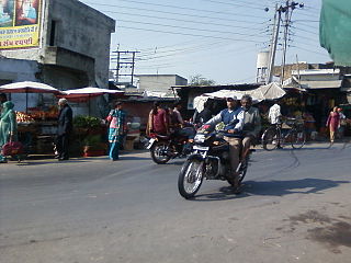
Pathankot is a city and the district headquarters of the Pathankot district in Punjab, India. Pathankot is the 6th most populous city of Punjab, after Ludhiana, Amritsar, Jalandhar, Patiala and Bathinda. Its local government is a municipal corporation.
Bharoli Kalan is a village and locality on the outskirts of Pathankot City in the state of Punjab, India. Prior to creation of Pathankot district after 2011 census, Bharoli Kalan was part of Gurdaspur district. Postal code (PIN) number of Bharoli Kalan is 145025. Bharoli is a gram panchayat in Pathankot Community development block(CD).
Daulatpur is a census town in Pathankot district in the state of Punjab, India.
Dinanagar is a town and a municipal council in Gurdaspur district in the Majha region of the state of Punjab, India. It takes its name after Adina Beg, who served as the subahdar of Punjab for the Mughals and Marathas. He built up his residence and exercised his government mainly from this town, whlist he was serving as the governor of the nearby town of Behrampur. During the rule of the Sikh Empire, it was the favourite summer resort of Maharaja Ranjit Singh, who held durbar in the town in the summer, effectively making the town his summer capital.
Garhdiwala is a town and a municipal council in Hoshiarpur district in the state of Punjab, India.
Lakhanpur is a town and a notified area committee in Kathua district in the Indian union territory of Jammu and Kashmir. Lakhanpur is the entrance to Jammu and Kashmir from Punjab and rest of India. It is a sparsely populated area about 20 km (12 mi) from the center of Kathua city,and also known for its lakhanpur fort and famous dish called [palle]

Mukerian is a city and municipal council of Hoshiarpur district in Punjab, India. Mukerian is located on National Highway 44 and state highway 15 about 450 kilometres (280 mi) north of New Delhi.It is a Sub-district headquarters situated on Jalandhar-jammu railway line and is connected by road with Jalandhar, Hoshiarpur, Talwara, Gurdaspur and Pathankot. National Highway-44 also passes through here.
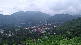
Nurpur is a city and a municipal council in Kangra district in the Indian state of Himachal Pradesh. It was formerly part of the Nurpur State since the 11th century AD. The capital of the state was at Pathankot formerly known as Paithan, now in Punjab.It got its name from wife of Mughal emperor Jahangir, Nur Jahan, when they visited Kangra (Nagarkot) after Jahangir's successful conquest of the Kangra Fort.
Nagri Parole is a tehsil and notified area committee in Kathua District in the Indian union territory of Jammu and Kashmir.
Patran is a city in Patiala district in the Indian state of Punjab. It lies at a distance of around 60 Km from the city Patiala.

Reasi is a town and a notified area committee and tehsil in Reasi district of the Indian union territory of Jammu and Kashmir. Situated at the bank of River Chenab, It is the headquarters of the Reasi district. In the eighth century, Reasi was a part of the Bhimgarh state established by Rajput king Bhim Dev Rasyal. The name Reasi is derived from the town's old name "Rasyal".
Sujanpur is a city and municipal council in the Pathankot district of the Indian state of Punjab. It is 06 km from Pathankot towards Jammu on Jalandhar-Jammu-Amritsar National Highway (NH-1A). It is situated near the banks of Ravi River and surrounded by two canals: UBDC and Bias Link. Sujanpur Municipal Council area is divided into 15 wards.
Sundar Nagar is a town and a municipal council in Mandi district in the Indian state of Himachal Pradesh. Formerly it was a princely state, known as Suket.
Udaipurwati is a small town and a municipality in Jhunjhunun district in the Indian state of Rajasthan. Jhunjhunu city, Sikar, Sri Madhopur and Neem ka thana are some more developed towns near Udaipurwati. Udaipurwati (उदयपुरवाटी) is a town and tahsil in the Jhunjhunu district in Rajasthan. Its ancient name, mentioned in Harsha Inscription 961 AD (L-39), was Udarbhatika (उदर्भटिका).
Urmar Tanda is a town and municipal council in Hoshiarpur district, Punjab, India.

The Ranjit Sagar Dam, also known as the Thein Dam, is part of a hydroelectric project constructed by the Punjab Irrigation Department on the Ravi River on the border of Union Territory, Jammu and Kashmir and state Punjab. It is located upstream of the Madhopur Barrage at Madhopur. A large portion, up to 60%, of the reservoir falls within Jammu and Kashmir. The dam is around and equidistant 30 km from both Pathankot in the state of Punjab and Kathua in Jammu and Kashmir. The project is used for both irrigation and power generation. The project is the largest hydroelectric dam in Punjab with a capacity of 600 megawatts. Also, the dam is amongst the highest earth-fill dams in India and has the largest diameter penstock pipes in the country. The township where the site is located is called Shah pur Kandi Township. Feasibility studies for the project began in 1953 and geotechnical studies continued until 1980. Construction began in 1981, the generators were commissioned in 2000 and the project complete in March 2001.

Pathankot district, is the northernmost district of the Indian state of Punjab. Pathankot city is the district headquarters. The district was created on 27 July 2011.

Jammu is the winter capital of the Indian union territory of Jammu and Kashmir. It is the headquarters and the largest city in Jammu district of the union territory. Lying on the banks of the river Tawi, the city of Jammu, with an area of 240 km2 (93 sq mi), is surrounded by the Himalayas in the north and the northern-plains in the south. Jammu is the second most populous city of the union territory. Three battles have been fought in the city: first by the founder Raja Mal Dev against Timur in Battle of Jammu (1399), second by Sardar Bhag Singh against Mughal army in Battle of Jammu (1712) and the third by Mian Dido & Maharaja Gulab Singh against Ranjit Singh's army in Battle of Jammu (1808).