Juliette, Georgia

Last updated
Juliette, Georgia
Window at the Whistlestop.760.jpg
Window at the Whistle Stop Café in Juliette
USA Georgia location map.svg
Red pog.svg
Juliette
Usa edcp location map.svg
Red pog.svg
Juliette
Coordinates: 33°6′25″N83°48′0″W / 33.10694°N 83.80000°W / 33.10694; -83.80000
Country United States
State Georgia
County Monroe
Named for Juliette McCracken
Area
[1]
  Total1.92 sq mi (5.0 km2)
  Land1.83 sq mi (4.7 km2)
  Water0.09 sq mi (0.2 km2)
Elevation
380 ft (120 m)
Population
 (2020) [2]
  Total290
  Density158.2/sq mi (61.1/km2)
ZIP code
31046 [3]
Area code 478

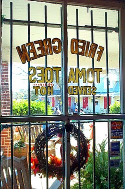
Juliette is an unincorporated community and census-designated place (CDP) in Monroe County, Georgia, United States. The community is part of the Macon metropolitan statistical area. Named for Juliette McCracken, daughter of a railroad engineer, the town formed with the merging of Brownsville and Iceberg. [4] The film Fried Green Tomatoes was filmed there, and the town has been the focal point of three popular Southern humor books.[ clarification needed ] After the filming of Fried Green Tomatoes, the sets used for the town's main street were renovated into a tourist district, complete with a fully operational "Whistle Stop Cafe".

Contents

Other movie productions set in Juliette were Cockfighter (1974) starring Warren Oates, A Killing Affair (1986) starring Peter Weller, The Tuskegee Airmen (1995) and the documentary Fried Green Tomorrows: Juliette, Ga. Lives (2006) directed by Neill Calabro and starring Danny Vinson. A small cafe scene set in Juliette in The War (1994) with Kevin Costner also displayed the Juliette Volunteer Fire Department.

The 2020 census listed a population of 290. [5]

Geography

Juliette is in northeastern Monroe County, on the west bank of the Ocmulgee River, which forms the Monroe–Jones County line. U.S. Route 23 passes through the west side of the community, leading southeast 23 miles (37 km) to Macon and northwest 17 miles (27 km) to Jackson. Round Oak Juliette Road crosses the Ocmulgee at Juliette and leads east 12 miles (19 km) to Round Oak.

According to the U.S. Census Bureau, the Juliette CDP has a total area of 1.9 square miles (4.9 km2), of which 0.1 square miles (0.3 km2), or 4.48%, are water. [1]

Demographics

Historical population
CensusPop.Note
2020 290
U.S. Decennial Census [6]
2020 [7]

Juliette was first listed as a census designated place in the 2020 U.S. Census. [7]

Juliette CDP, Georgia – Racial and ethnic composition
(NH = Non-Hispanic)
Note: the US Census treats Hispanic/Latino as an ethnic category. This table excludes Latinos from the racial categories and assigns them to a separate category. Hispanics/Latinos may be of any race.
Race / EthnicityPop 2020 [7] % 2020
White alone (NH)23280.00%
Black or African American alone (NH)3110.69%
Native American or Alaska Native alone (NH)00.00%
Asian alone (NH)00.00%
Pacific Islander alone (NH)00.00%
Some Other Race alone (NH)00.00%
Mixed Race/Multi-Racial (NH)155.17%
Hispanic or Latino (any race)124.14%
Total290100.00%

Places and events of interest

Less than 10 miles outside of Juliette is the Jarrell Plantation, historical site on the U.S. National Register of Historic Places with a museum and a park.

Juliette is also home to Plant Scherer, one of the nation's largest power generation facilities.

On February 14 of each year, the town of Juliette offers a special dual postmark with the village of Romeo, Michigan. This tradition began in 1994, as a nod to the William Shakespeare play, Romeo and Juliet . [8]

Related Research Articles

<span class="mw-page-title-main">Peach County, Georgia</span> County in Georgia, United States

Peach County is a county located in the central portion of the U.S. state of Georgia. As of the 2020 census, the population was 27,981. Its county seat is Fort Valley. Founded in 1924, it is the state's newest county, taken from Houston and Macon counties on July 18 of that year. Its namesake is the peach on account of it being located in a peach-growing district.

<span class="mw-page-title-main">Monroe County, Georgia</span> County in Georgia, United States

Monroe County is a county located in the central portion of the U.S. state of Georgia. As of the 2020 census, the population was 27,957. The county seat is Forsyth. The county was created on May 15, 1821. The county was named for James Monroe. Monroe County is included in the Macon, GA metropolitan statistical area.

<span class="mw-page-title-main">Bibb County, Georgia</span> County in Georgia, United States

Bibb County is located in the U.S. state of Georgia. As of the 2020 census, its population was 157,346. Bibb County is geographically located in the Central Georgia region, and is the largest county in the Macon metropolitan area.

<span class="mw-page-title-main">Country Club Estates, Georgia</span> Place in Georgia, United States

Country Club Estates is an unincorporated community and census-designated place (CDP) in Glynn County, Georgia, United States. It is part of the Brunswick metropolitan statistical area. The population was 8,373 at the 2020 census, down from 8,545 in 2010.

<span class="mw-page-title-main">Oglethorpe, Georgia</span> City in Georgia, United States

Oglethorpe is a city in Macon County, Georgia, United States. The population was 995 at the 2020 census, down from 1,328 in 2010. The city is the county seat of Macon County. It was named for Georgia's founder, James Oglethorpe.

<span class="mw-page-title-main">Culloden, Georgia</span> City in Georgia, United States

Culloden is a city in Monroe County, Georgia, United States. The population was 200 in the 2020 census. It is part of the Macon metropolitan statistical area.

<span class="mw-page-title-main">Georgetown, Quitman County, Georgia</span> City in Georgia, United States

Georgetown is a city in Quitman County, Georgia, United States. It is on the Alabama-Georgia state line next to Walter F. George Lake and across the Chattahoochee River from Eufaula, Alabama. Per the 2020 census, the population was 2,235. In 2006, Georgetown and Quitman County voted to consolidate their governments, becoming the smallest such consolidated entity in the Lower 48 states.

<span class="mw-page-title-main">Harrison, Georgia</span> Town in Georgia, United States

Harrison is a town in Washington County, Georgia, United States. The population was 339 in 2020.

<span class="mw-page-title-main">Boykin, Georgia</span> Place in Georgia, United States

Boykin is an unincorporated community and census-designated place (CDP) in Miller County, Georgia, United States. The 2020 census listed a population of 151.

Bolingbroke, founded in 1867, is an unincorporated community and census-designated place (CDP) in Monroe County, Georgia, United States. It lies just north of Macon, between Interstates 475 and 75. The community is part of the Macon metropolitan statistical area.

<span class="mw-page-title-main">Naylor, Georgia</span> Place in Georgia, United States

Naylor is an unincorporated community and census-designated place in Lowndes County, Georgia, United States.

Smarr is an unincorporated community and census-designated place (CDP) in Monroe County, in the U.S. state of Georgia. It was first listed as a CDP in the 2020 census with a population of 218.

Crescent is an unincorporated community and census-designated place (CDP) in McIntosh County, Georgia, United States. It lies along State Route 99, 12 miles (19 km) north of the city of Darien, the county seat of McIntosh County. Its elevation is 30 feet (9.1 m) above sea level. It has a post office with the ZIP code 31304.

Seville is an unincorporated community and census-designated place (CDP) in Wilcox County, Georgia, United States. Per the 2020 census, the population was 197. It lies approximately 0.5 miles (0.80 km) away from the Crisp County line, and about 4 miles (6.4 km) away from Pitts.

Empire is an unincorporated community and census-designated place in Dodge and Bleckley counties in the U.S. state of Georgia. As of the 2020 census, the CDP had a population of 319.

<span class="mw-page-title-main">Mineral Bluff, Georgia</span> Place in Georgia, United States

Mineral Bluff is a census-designated place and unincorporated community located in Fannin County in the U.S. state of Georgia. Its population was 223 as of the 2020 census. The community is situated 6 miles (10 km) northeast of the city of Blue Ridge, the county seat, 80 miles (130 km) east of Chattanooga, Tennessee, and 100 miles (160 km) north of Atlanta.

Norristown is an unincorporated community and census-designated place (CDP) in Emanuel County, Georgia, United States. Its population was 54 as of the 2020 census.

Gough is an unincorporated community and census-designated place (CDP) in Burke County, Georgia, United States. The community is located along Georgia State Route 305, 12.2 miles (19.6 km) west of Waynesboro.

Godfrey is an unincorporated community and census-designated place in Morgan County, in the U.S. state of Georgia. It first appeared as a CDP in the 2020 Census with a population of 108.

<span class="mw-page-title-main">Tazewell, Georgia</span> Place in Georgia, United States

Tazewell is an unincorporated community and census-designated place (CDP) in Marion County, in the U.S. state of Georgia.

References

  1. 1 2 "2022 U.S. Gazetteer Files: Georgia". United States Census Bureau. Retrieved January 27, 2023.
  2. "P1. Race – Culloden city, Georgia: 2020 DEC Redistricting Data (PL 94-171)". U.S. Census Bureau. Retrieved January 27, 2023.
  3. "Juliette ZIP Code". zipdatamaps.com. 2023. Retrieved January 12, 2023.
  4. Krakow, Kenneth K. (1975). Georgia Place-Names: Their History and Origins (PDF). Macon, GA: Winship Press. p. 123. ISBN   0-915430-00-2.
  5. "Juliette CDP, Georgia". United States Census Bureau . Retrieved April 7, 2022.
  6. "Decennial Census of Population and Housing by Decades". US Census Bureau.
  7. 1 2 3 "P2 Hispanic or Latino, and Not Hispanic or Latino by Race – 2020: DEC Redistricting Data (PL 94-171) – Juliette CDP, Georgia". United States Census Bureau .
  8. Advisor and Source Newspapers: "Valentine tradition continues in Romeo, Juliette", January 22, 2010.