
Hastings is an inland city of New Zealand and is one of the two major urban areas in Hawke's Bay, on the east coast of the North Island. The population of Hastings is 51,500, with a further 15,200 people in Havelock North and 2,090 in Clive. Hastings is about 18 kilometres inland of the coastal city of Napier. These two neighbouring cities are often called "The Bay Cities" or "The Twin Cities".

Havelock North is a town in the Hawke's Bay region of the North Island of New Zealand, situated less than 2 km south-east of the city of Hastings. It was a borough for many years until the 1989 reorganisation of local government saw it merged into the new Hastings District, and it is now administered by the Hastings District Council.
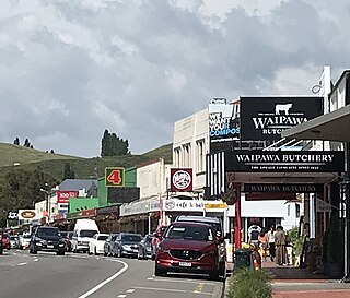
Central Hawke's Bay District is in the Hawke's Bay Region in the North Island of New Zealand. Formed in 1989, it covers an area of 3,333 square kilometres, from Pukehou in the north to Takapau in the south, and from the western Ruahine Range to the Pacific coast in the east. It has a population of 16,000, up from 14,142 in the 2018 census and 12,717 in the 2013 census.

Waipawa is the second-largest town in Central Hawke's Bay in the east of the North Island of New Zealand. It has a population of 2,400.
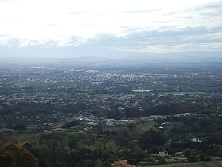
Hastings District is a Territorial authority district within the Hawke's Bay Region, on the east coast of the North Island of New Zealand. It covers the southern half of the Hawke's Bay coast, excluding Napier City, which is a separate territorial authority. Hastings District Council is headquartered in the city of Hastings, the district's largest town.

Pōrangahau is a small township close to the Pacific Ocean coast in the south-east of the North Island of New Zealand. It lies in the southernmost part of Hawke's Bay, 45 kilometres south of Waipukurau, and close to the mouth of the Porangahau River. The settlement includes a marae and a school.
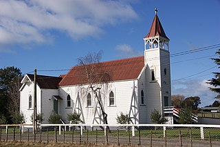
Clive is a small town, ten kilometres from the city centres of both Napier and Hastings in the Hawke's Bay region of New Zealand's North Island. It is close to the mouth of the Ngaruroro River.
Flaxmere is a township in the Hastings District and outlying suburb of Hastings City, in the Hawke's Bay Region of New Zealand's North Island. It consists of a series of cul-de-sacs, radiating from a main street.
Raureka is a suburb of Hastings City, in the Hawke's Bay Region of New Zealand's North Island.
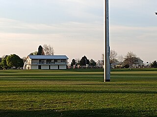
St Leonards is an inner suburb of Hastings, New Zealand, in the Hawke's Bay region of New Zealand. It is named for St Leonards-on-Sea, a neighbouring town to Hastings' own English namesake.
Whakatu is a rural community in the Hastings District and Hawke's Bay Region of New Zealand's North Island. It is located 8 kilometres (5.0 mi) north-east of the centre of Hastings. A large industrial area is enclosed by a bend in the Clive River, and the closure of the freezing works in Whakatu in 1986 cost the region 2000 full-time and seasonal jobs. State Highway 2 and the Palmerston North–Gisborne Line pass through Whakatu.
Waipatu is a semi-rural suburb of Hastings, in the Hastings District and Hawke's Bay Region of New Zealand's North Island.
Omakere is a farming settlement in the Central Hawke's Bay District and Hawke's Bay Region of New Zealand's North Island. It is located east of Waipawa.
Pakowhai is a small settlement in the Hastings District and Hawke's Bay Region of New Zealand's North Island. It is a located between Napier and Hastings, north of the Ngaruroro River.

Parkvale is a suburb of Hastings City, in the Hawke's Bay Region of New Zealand's North Island.
Frimley is a suburb of Hastings City, in the Hawke's Bay Region of New Zealand's North Island.
Sherenden is a settlement in the Hastings District and Hawke's Bay Region of New Zealand's North Island.
Whakaki is a settlement east of Wairoa within the Wairoa District and Hawke's Bay Region of New Zealand's North Island. State Highway 2 runs through it.
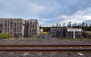
Longlands is a rural community in the Hastings District and Hawke's Bay Region of New Zealand's North Island. The area is on the southern and western outskirts of Hastings city.
Mangateretere is a rural community in the Hastings District and Hawke's Bay Region of New Zealand's North Island. The area is northeast of Hastings city and southwest of Clive.


