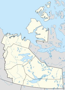
Kasba Lake is a lake in the northern Canadian wilderness. The majority of the lake lies within the Northwest Territories, but a small section is in Nunavut. The lake is close to Canada's four corners. A seasonal fishing lodge is open to tourists each summer.
Angling Lake/Wapekeka Airport is located 1.5 nautical miles west of the First Nations settlement of Wapekeka, Ontario, Canada, to the east of Big Trout Lake and on the south shores of Weir Lake.
Lake Simcoe Regional Airport, formerly the Oro Barrie Orillia Regional Airport, is a registered aerodrome that operates as a regional airport located near Highway 11 in the township of Oro-Medonte, Ontario, Canada. The airport is operated by Lake Simcoe Regional Airport Inc., a municipal service corporation jointly owned by the County of Simcoe (90%) and the City of Barrie (10%).
Kasba Lake Water Aerodrome is located on Kasba Lake, Northwest Territories, Canada and is open from June until October.
Deer Lake Airport is located 3 nautical miles north of Deer Lake, Ontario, Canada.

Bearskin Lake Airport is located 3 nautical miles northwest of Bearskin Lake, Ontario, Canada.

Big Trout Lake Airport is located 0.6 nautical miles southwest of Kitchenuhmaykoosib Inninuwug, Ontario, Canada.
Cat Lake Airport is located adjacent to the Cat Lake First Nation, Kenora District, Ontario, Canada, on the central north shore of Cat Lake.
Kingfisher Lake Airport is located 1.5 nautical miles southwest of the First Nations community of Kingfisher Lake, Ontario, Canada.
R. Elmer Ruddick Nakina Airport, or simply Nakina Airport, is located adjacent to Nakina, Ontario, Canada.
North Spirit Lake Airport is located 5 nautical miles southeast of the First Nations community of North Spirit Lake, Ontario, Canada.
Round LakeAirport is located 1.0 nautical mile east of Round Lake, Ontario, Canada.
Sandy Lake Airport is a domestic airport located adjacent to Sandy Lake, Ontario, Canada.

Canada is divided into six time zones. Most areas of the country's provinces and territories operate on standard time from the first Sunday in November to the second Sunday in March and daylight saving time the rest of the year.
Highway 995, also known as Welcome Street, is a provincial highway in the far north region of the Canadian province of Saskatchewan. It is one of the few highways in Saskatchewan that is completely isolated from the other highways. Seasonal access is provided to Highway 905 by way of the Wollaston Lake Barge.
Highway 954 is a provincial highway in the Canadian province of Saskatchewan. It runs from Highway 26 on the north side of Goodsoil to a dead end at Northern Cross Resort on Lac des Îles within Meadow Lake Provincial Park. At the eastern end of the highway is the Goodsoil Airport. It is about 12.9 kilometres (8.0 mi) long.


