Kazusa Province

Last updated • 5 min readFrom Wikipedia, The Free Encyclopedia
Kazusa Province
上総国
Province of Japan
7th century–1868
Provinces of Japan-Kazusa.svg
Map of Japanese provinces (1868) with Kazusa Province highlighted
CapitalIchihara District
History
History 
 Established
7th century
 Disestablished
1868
Preceded by
Succeeded by
Blank.png Fusa Province
Chiba Prefecture Blank.png
Today part of Chiba Prefecture

Kazusa Province (上総国, Kazusa-no kuni) was a province of Japan in the area of modern Chiba Prefecture. [1] The province was located in the middle of the Bōsō Peninsula, whose name takes its first kanji from the name of Awa Province and its second from Kazusa and Shimōsa provinces. Its abbreviated form name was Sōshū (総州) or Nansō (南総). [2] The borders of Kazusa Province were defined by Shimōsa Province to the north, the Pacific Ocean to the east, Awa Province to the south, and Tokyo Bay to the west.

Contents

Hiroshige ukiyo-e "Kazusa" in "The Famous Scenes of the Sixty States" (Liu Shi Yu Zhou Ming Suo Tu Hui ), depicting Kujukuri Beach 19 Kazusa.jpg
Hiroshige ukiyo-e "Kazusa" in "The Famous Scenes of the Sixty States" (六十余州名所図会), depicting Kujūkuri Beach

Kazusa was classified as one of the provinces of the Tōkaidō. Under the Engishiki classification system, Kazusa was ranked as a "great country" (大国) and a "far country" in relation to its distance from the capital (遠国). Along with Kōzuke and Hitachi, it was originally one of the provinces where an imperial prince was nominally assigned as governor.

History

Early history

Kazusa was originally part of a larger territory known as Fusa Province (総国, occasionally 捄国, Fusa-no-kuni), which was divided into "upper" and “lower” portions (i.e. Kazusa and Shimōsa) during the reign of Emperor Kōtoku (645–654). It was well known to the Imperial Court in Nara -period Japan for its fertile lands, and is mentioned in Nara period records as having supplied hemp to the Court. Kazusa was divided into 15 counties, of which the four counties comprising the district of Awa were separated in 718 into a separate province. [2] The exact location of the capital of Kazusa is not precisely known, but is believed to have been somewhere within the borders of the modern city of Ichihara, Chiba. The ruins of the kokubun-ji, or provincial temple, of Kazusa has been located in the Sōza district of Ichihara. The kokubun-ji was first excavated in 1949, and is on a plateau 30 metres (98 ft) above the Yōrō River in close proximity to Tokyo Bay. The site is protected as a Designated Historic Site of Japan. [3] [4] However, the Ichinomiya of Kazusa Province is the Tamasaki Shrine in what is now the town of Ichinomiya, Chiba, on the opposite coast of the province.

During the Heian period, the province was divided into numerous shōen controlled by local samurai clans, primarily the Chiba clan, which sided with Minamoto no Yoritomo in the Genpei War. During the Kamakura period, much of the province was under the control of the Ashikaga clan. By the early Muromachi period, the area was a highly contested region highly fragmented by various samurai clans. However, by the Sengoku period, the Satomi clan had gained control over much of Awa, Kazusa and Shimōsa provinces.

The Satomi provided only lukewarm support to Toyotomi Hideyoshi during the Battle of Odawara against the Later Hōjō clan and were subsequently deprived of their holdings in Kazusa and Shimōsa. After the installation of Tokugawa Ieyasu in Edo, Kazusa became part of the Tokugawa clan holdings, and Tokugawa hereditary retainer Honda Tadakatsu was promoted to daimyō of Ōtaki Domain (50,000 koku ).

Edo period

During the Edo period, several small domains were created within the borders of Kazusa, most of which continued to be retained as tenryō territory owned directly by the shōgun and administered by various hatamoto . The entire province had an assessed revenue of 425,080 koku.

Edo period Domains in Kazusa Province

DomainDaimyōDatesRevenue (koku)Type
Kururi Domain (久留里藩)Kuroda1659–187130,000fudai
Ōtaki Domain (大多喜藩)Matsudaira (Nagasawa/Ōkōchi)1590–187120,000fudai
Iino Domain (飯野藩)Hoshina1648–187120,000fudai
Sanuki Domain (佐貫藩)Abe1590–187116,000fudai
Tsurumaki Domain (鶴牧藩)Mizuno1827–187115,000fudai
Ichinomiya Domain (一宮藩)Kanō1826–187113,000fudai
Jōzai Domain (請西藩)Hayashi1825–186510,000fudai
Goi Domain (五井藩)Arima1781–184210,000fudai
Kikuma Domain (菊間藩)Mizuno1868–187123,700NA
Kokubo Domain (小久保藩)Tanuma1868–187110,000NA
Ōami Domain (大網藩)Yonekitsu1868–187110,000NA
Tsurumai Domain (鶴舞藩)Inoue1868–187110,000NA
Matsuo Domain (松尾藩)Ōta1868–187153,350NA
Sakurai Domain (桜井藩)Matsudaira (Tatewaki)1868–187110,000NA

Abolishment

Following the Boshin War, Jōzai Domain was abolished for its opposition to the Meiji Restoration, and six minor domains were created for daimyō dispossessed with the creation of Sunpu Domain for the ex-shōgun Tokugawa Yoshinobu. These various domains and tenryō territories were transformed into short-lived prefectures in July 1871 by the abolition of the han system, and the entire territory of Kazusa Province became part of the new Chiba Prefecture on June 15, 1873.

Historical districts

The area of former Kazusa Province was organized into nine districts by the Meiji period cadastral reforms, later reduced to five:

Notes

  1. Nussbaum, Louis-Frédéric. (2005). "Kazusa" in Japan Encyclopedia, p. 502 , p. 502, at Google Books.
  2. 1 2 "上総国" [Kazusa Province]. Nihon Daihyakka Zensho (Nipponika) (in Japanese). Tokyo: Shogakukan. 2012. OCLC   153301537. Archived from the original on 2007-08-25. Retrieved 2012-09-04.
  3. "上総国分寺跡" [Remains of Kazusa Kokubun-ji]. Nihon Rekishi Chimei Taikei (in Japanese). Tokyo: Shogakukan. 2012. OCLC   173191044. dlc 2009238904. Archived from the original on 2007-08-25. Retrieved 2012-11-21.
  4. よみがえる天平の甍:国指定史跡上総国分尼寺跡 [Restoring the Tempyō Tiles: The Kazusa Kokubunniji National Historical Site](PDF) (in Japanese). Ichihara, Chiba Prefecture, Japan: Kazusa Kokubunniji National Historical Site Exhibition Hall. c. 1998. Retrieved Nov 21, 2012.

Related Research Articles

<span class="mw-page-title-main">Ichihara, Chiba</span> City in Kantō, Japan

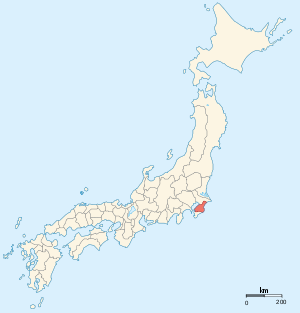
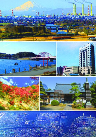
Ichihara is a city, located in Chiba Prefecture, Japan. As of 1 December 2020, the city had an estimated population of 274,117 in 128,316 households and a population density of 240 persons per km². The total area of the city is 368.20 square kilometres (142.16 sq mi). The city is home, together with the city of Chiba, to the JEF United football club. The whole city is also parts of Greater Tokyo Area.

<span class="mw-page-title-main">Kimitsu</span> City in Kantō, Japan

Kimitsu is a city located in Chiba Prefecture, Japan. As of 30 November 2020, the city had an estimated population of 83,058 in 39,138 households and a population density of 260 persons per km2. The total area of the city is 318.83 km2 (123.10 sq mi).

<span class="mw-page-title-main">Futtsu</span> City in Kantō, Japan

Futtsu is a city located in Chiba Prefecture, Japan. As of 1 November 2020, the city had an estimated population of 42,476 in 18,115 households and a population density of 210 persons per km². The total area of the city is 205.53 square kilometres (79.36 sq mi).

<span class="mw-page-title-main">Kōzuke Province</span> Former province of Japan

Kōzuke Province was a province of Japan in the area of Japan that is today Gunma Prefecture. Kōzuke bordered by Echigo, Shinano, Musashi and Shimotsuke Provinces. Its abbreviated form name was Jōshū (上州). Under the Engishiki classification system, Kōzuke was ranked as one of the 13 "great countries" (大国) in terms of importance, and one of the 30 "far countries" (遠国) in terms of distance from the capital. The provincial capital is located in what is now the city of Maebashi; however, its exact location remains uncertain. The ichinomiya of the province is located in what is now the city of Tomioka.

<span class="mw-page-title-main">Shimotsuke Province</span> Former province of Japan

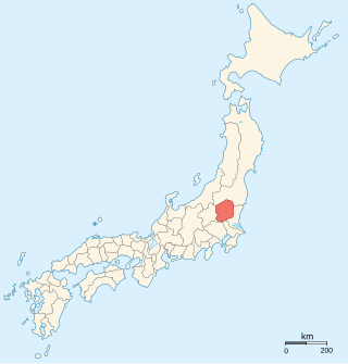
Shimotsuke Province was a province of Japan in the area of Japan that is today Tochigi Prefecture. Shimotsuke was bordered by Kōzuke, Hitachi, Mutsu and Shimōsa Provinces. Its abbreviated form name was Yashū (野州). Under the Engishiki classification system, Shimotsuke was ranked as one of the 13 "great countries" (大国) in terms of importance, and one of the 30 "far countries" (遠国) in terms of distance from the capital. The provincial capital is located in what is now the city of Tochigi. The Ichinomiya of the province is the Futarasan jinja located in what is now the city of Utsunomiya.

<span class="mw-page-title-main">Sagami Province</span> Former province of Japan

Sagami Province was a province of Japan located in what is today the central and western Kanagawa Prefecture. Sagami Province bordered the provinces of Izu, Musashi, and Suruga. It had access to the Pacific Ocean through Sagami Bay. However, most of the present-day cities of Yokohama and Kawasaki, now part of Kanagawa Prefecture, were not in Sagami, but rather, in Musashi Province. Its abbreviated form name was Sōshū (相州).

<span class="mw-page-title-main">Tōtōmi Province</span> Former province of Japan

Tōtōmi Province was a province of Japan in the area of Japan that is today western Shizuoka Prefecture. Tōtōmi bordered on Mikawa, Suruga and Shinano Provinces. Its abbreviated form name was Enshū (遠州). The origin of its name is the old name of Lake Hamana.

<span class="mw-page-title-main">Awa Province (Chiba)</span> Former province of Japan

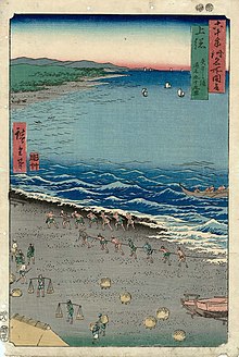
Awa Province was a province of Japan in the area of modern Chiba Prefecture. It lies on the tip of the Bōsō Peninsula (房総半島), whose name takes its first kanji from the name of Awa Province and its second from Kazusa and Shimōsa Provinces. Its abbreviated form name was Bōshū (房州) or Anshū (安州). Awa Province in Shikoku phonetically has the same name, but is written with different kanji (阿波国). Awa is classified as one of the provinces of the Tōkaidō. Under the Engishiki classification system, Awa was ranked as a "middle country" (中国) and a "far country" (遠国).

<span class="mw-page-title-main">Hitachi Province</span> Former province of Japan

Hitachi Province was an old province of Japan in the area of Ibaraki Prefecture. It was sometimes called Jōshū (常州). Hitachi Province bordered on Shimōsa, Shimotsuke, and Mutsu Provinces. Generally, its northern border was with Mutsu.

<span class="mw-page-title-main">Suruga Province</span> Former province of Japan

Suruga Province was an old province in the area that is today the central part of Shizuoka Prefecture. Suruga bordered on Izu, Kai, Sagami, Shinano, and Tōtōmi provinces; and was bordered by the Pacific Ocean through Suruga Bay to the south. Its abbreviated form name was Sunshū (駿州).

<span class="mw-page-title-main">Shimōsa Province</span> Former province of Japan

Shimōsa Province was a province of Japan in the area modern Chiba Prefecture, and Ibaraki Prefecture. It lies to the north of the Bōsō Peninsula (房総半島), whose name takes its first kanji from the name of Awa Province and its second from Kazusa and Shimōsa Provinces. Its abbreviated form name was Sōshū (総州) or Hokusō (北総).

<span class="mw-page-title-main">Ōtaki, Chiba</span> Town in Kantō, Japan

Ōtaki is a town located in Chiba Prefecture, Japan. The town is known for its association with Edo period general Honda Tadakatsu, and its prominent castle. As of 1 January 2019, the town had an estimated population of 8,982 in 3820 households and a population density of 69 persons per km². The total area of the town is 129.87 square kilometres (50.14 sq mi), making it the largest of Chiba Prefecture's towns and villages.

<span class="mw-page-title-main">Isumi District</span> District of Chiba Prefecture in Kantō, Japan

Isumi District is a district located in Chiba, Japan. As of 2010, the district has an estimated population of 18,593 and a density of 120 persons per km2. The total area was 154.76 square kilometres (59.75 sq mi). The district formerly included all of the city of Katsuura, most of the city of Isumi and a portion of the town of Mutsuzawa. It has been reduced in size through mergers and consolidation to two towns. The district is located in the outer zone of Metropolitan Tokyo, roughly 70 kilometres (43 mi) from the center of the capital.

Kimitsu District was an administrative district in Chiba Prefecture Japan. The district was dissolved April 1, 1991 when the town of Sodegaura gained city status.

<span class="mw-page-title-main">Kisarazu</span> City in Kantō, Japan

Kisarazu is a city located in Chiba Prefecture, Japan. As of 1 December 2020, the city had an estimated population of 136,023 in 63,431 households and a population density of 980 persons per km2. The total area of the city is 138.95 square kilometres (53.65 sq mi).

<span class="mw-page-title-main">Tateyama Domain</span>

Tateyama Domain was a feudal domain under the Tokugawa shogunate of Edo period Japan, located in Awa Province, Japan. It was centered on Tateyama Castle in what is now the city of Tateyama, Chiba.

<span class="mw-page-title-main">Kururi Domain</span>

Kururi Domain was a feudal domain under the Tokugawa shogunate of Edo period Japan, located in Kazusa Province, Japan. It was centered on Kururi Castle in what is now the city of Kimitsu, Chiba.

Ichinomiya Domain was a feudal domain under the Tokugawa shogunate of Edo period Japan, located in Kazusa Province, Japan. It was centered on Ichinomiya jin'ya in what is now the town of Ichinomiya, Chiba.

Tsurumaki Domain was a feudal domain under the Tokugawa shogunate of the Edo period, located in Kazusa Province, Japan. It was centered on Tsurumaki jin'ya in what is now the city of Ichihara, Chiba. It was ruled for the entirety of its history by a branch of the Mizuno clan. The name of “Tsurumaki” came from the Mizuno kamiyashiki in Edo, which was located in Wadeda-Tsurumaki-cho.

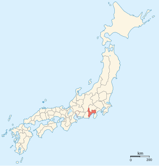
Fusa Province was an ancient province of Japan, in the area of Shimōsa and Kazusa provinces. At the time of the establishment of Kazusa Province, it also included the southern tip of the Bōsō Peninsula that would later be split off as Awa Province. The ambit of this ancient entity is within Chiba Prefecture and Ibaraki Prefecture. It was sometimes called Sōshū (総州).

References

Commons-logo.svg Media related to Kazusa Province at Wikimedia Commons