High Bradfield is a rural village 6.5 miles (10 km) north-west of the centre of Sheffield in South Yorkshire, England and within the city's boundaries. The village lies just within the Peak District National Park, 1.3 miles (2 km) inside the park's north-eastern border, is at an altitude of 260 metres (850 feet) AOD, and has extensive views across Bradfield Dale towards Derwent Edge and the Dark Peak.

A motte-and-bailey castle is a European fortification with a wooden or stone keep situated on a raised area of ground called a motte, accompanied by a walled courtyard, or bailey, surrounded by a protective ditch and palisade. Relatively easy to build with unskilled labour, but still militarily formidable, these castles were built across northern Europe from the 10th century onwards, spreading from Normandy and Anjou in France, into the Holy Roman Empire, as well as the Low Countries it controlled, in the 11th century, when these castles were popularized in the area that became the Netherlands. The Normans introduced the design into England and Wales. Motte-and-bailey castles were adopted in Scotland, Ireland, and Denmark in the 12th and 13th centuries. By the end of the 13th century, the design was largely superseded by alternative forms of fortification, but the earthworks remain a prominent feature in many countries.

Loughor Castle is a ruined, medieval fortification located in the town of Loughor, Wales. The castle was built around 1106 by the Anglo-Norman lord Henry de Beaumont, during the Norman invasion of Wales. The site overlooked the River Loughor and controlled a strategic road and ford running across the Gower Peninsula. The castle was designed as an oval ringwork, probably topped by wicker fence defences, and reused the remains of the former Roman fort of Leucarum.
Biggleswade Castle was a castle in the market town of Biggleswade in Bedfordshire.
Bletchingley Castle is a ruined castle and set of earthworks partly occupied by three buildings. The Scheduled Ancient Monument is directly beside the Greensand Way below it to the south in the village of Bletchingley in Surrey. The site's tower standing from c.1170 to 1264 had a panorama from one of the narrower parts of the Greensand Ridge, which runs from mid-Kent to south-west Surrey.
Eaton Socon Castle was a Norman fortification. It was constructed next to the River Great Ouse in what is now Eaton Socon, Cambridgeshire, England.

In archaeology, earthworks are artificial changes in land level, typically made from piles of artificially placed or sculpted rocks and soil. Earthworks can themselves be archaeological features, or they can show features beneath the surface.

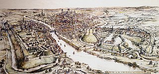
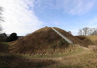
Thetford Castle is a medieval motte and bailey castle in the market town of Thetford in the Breckland area of Norfolk, England. The first castle in Thetford, a probable 11th-century Norman ringwork called Red Castle, was replaced in the 12th century by a much larger motte and bailey castle on the other side of the town. This new castle was largely destroyed in 1173 by Henry II, although the huge motte, the second largest man-made mound in England, remained intact. The motte, recognised as a scheduled monument, now forms part of a local park, and the remains are known variously as Castle Hill, Castle Mound and Military Parade.
Watch Hill Castle is a medieval motte-and-bailey on the boundary of Bowdon and Dunham Massey, Greater Manchester, England. It is a scheduled monument. The castle is located north of the River Bollin and south of a deep ravine.

Pilsbury Castle was a Norman castle in Derbyshire near the present-day village of Pilsbury, overlooking the River Dove.
Voley Castle is an Iron Age hill fort situated close to Parracombe in north Devon, England. The fort is situated on a promontory on the eastern side of Heale Down, approximately 230 metres (750 ft) above sea level. It is close to another Iron Age hill fort at Beacon Castle. Voley Castle is a slight univallate hillfort, a rare type of hill fort found mainly in Devon, and is unusual for its type because it has an outer earthwork.
Stockport Castle was a promontory castle in Stockport, Greater Manchester, England. The castle was in the medieval town, overlooking a ford over the River Mersey. It was first documented in 1173, but the next mention of it is in 1535 when it was in ruins. What remained of the castle was demolished in 1775.

While there are many castles in South Yorkshire, the majority are manor houses and motte-and-bailey which were commonly found in England after the Norman Conquest.

A ringwork is a form of fortified defensive structure, usually circular or oval in shape. Ringworks are essentially motte-and-bailey castles without the motte. Defences were usually earthworks in the form of a ditch and bank surrounding the site.
Pen y Clawdd Castle is a ditched mound with a double moat, roughly circular in shape, with a diameter of approximately 28m to 30m and about 2.4m high. The castle is in Llanvihangel Crucorney, about five miles to the north of Abergavenny, Monmouthshire, in south east Wales and lies between the Usk and Monnow rivers. The mound was designated a scheduled monument in 1950 and described as a defensive medieval motte.

Bincknoll Castle, or Bincknoll Camp, is the site of a possible Iron Age univallate hillfort in Wiltshire, England.

Granard Motte is the remains of a motte-and-bailey castle and National Monument in Granard, County Longford, Ireland.
Weston Turville Castle is a motte-and-bailey in Buckinghamshire, England. It consists of a mound with two enclosures (baileys). The castle was built in the 11th or 12th century and first mentioned in 1145. It was held by Geoffrey de Turville in 1173–74 when it was demolished (slighted) on the instructions of Henry II.

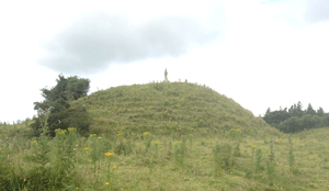
Castle Knob is the motte of Castle Gresley, a ruined motte and bailey castle in Derbyshire, England. The date of construction is not known but may have been in the mid-12th century Anarchy era. The site was long under the ownership of the de Gresley family. The castle survives as earthworks including a 4-metre (13 ft) high motte and three baileys, the largest measuring 70 metres (230 ft) across. The site had been abandoned by the 16th century and, in the mid-20th century, the Royal Observer Corps (ROC) installed a nuclear warfare monitoring post in the central bailey. The site became a scheduled monument in 1966.

Kemeys Inferior is a rural parish and hamlet of Newport, Wales, formerly part of the old county of Monmouthshire. It was the home of the Kemeys family from the Middle Ages until the 19th century. The parish contains a number of scheduled ancient monuments dating back to the Iron Age and listed buildings.


