Kemuning–Shah Alam Highway

Last updated • 2 min readFrom Wikipedia, The Free Encyclopedia
Mes-e13.svg
Expressway 13
Kemuning–Shah Alam Highway
Route information
Maintained by Prolintas with its subsidiary Projek Lintasan Shah Alam Sdn Bhd (LKSA)
Length7.3 km (4.5 mi)
Existed2007–present
HistoryCompleted in 2010
Major junctions
North end Shah Alam, Federal Highway Route 2 Interchange
Major intersections Jkr-ft---.svg BSA1 Persiaran Sultan
MYS Jkr-ft2.svg FT 2 Federal Highway
MYS Jkr-ft3216.svg FT 3216 Persiaran Selangor
Jkr-ft---.svg BSA-- Persiaran Jubli Perak
Persiaran Tun Teja
MYS Jkr-ft190.svg FT 190 Jalan Bukit Kemuning
Mes-e5.svg Shah Alam Expressway Shah Alam Expressway
Persiaran Kota Kemuning
South endKemuning Interchange
Mes-e5.svg Shah Alam Expressway Shah Alam Expressway
Location
Country Malaysia
Primary
destinations
Shah Alam, Alam Impian, Kota Kemuning, Bukit Rimau, Klang, Pelabuhan Klang
Highway system

The Kemuning–Shah Alam HighwayMes-e13.svg Kemuning–Shah Alam Highway (Malay: Lebuhraya Kemuning–Shah Alam), (LKSA), is an expressway in Klang Valley, Selangor, Malaysia. The 7.3 km (4.5 mi) expressway connects Kemuning Interchange of the Shah Alam Expressway E5 near Kota Kemuning until Federal Highway Route 2 Interchange (also known as Bulatan Darul Ehsan Interchange) of the Federal Highway Route 2 near Klang. It originally was given route code Mes-e4.svg South Kedah Expressway but later changed to Mes-e13.svg Kemuning–Shah Alam Highway and Mes-e4.svg South Kedah Expressway was used by South Kedah Expressway.

Contents

Route background

The expressway starts at Kemuning Interchange and its interchange with the Persiaran Kota Kemuning and Shah Alam Expressway E5. After that, it passes the Jalan Bukit Kemuning Interchange, a toll plaza near Taman Sri Muda and Alam Impian Interchange. The expressway crosses the Klang River bridge to Section 24. The expressway overlaps with the Persiaran Sultan from Bulatan Jubli Perak Interchange towards Bulatan Selangor Interchange, Federal Highway Route 2 Interchange of the Federal Highway Route 2 and finally towards the Shah Alam city centre.

History

Construction of the expressway began in 2007. The expressway used to be known as Persiaran Sultan, and covers areas from Shah Alam city to Section 24. It was built at the Majlis Bandaraya Shah Alam (MBSA) (Shah Alam City Council) area and took 24 months to construct. It was completed during 2010. The expressway was opened to traffic on 18 May 2010.

Features

Tolls

The Kemuning–Shah Alam Highway uses opened toll systems where all toll transactions at both toll plazas on the Kemuning–Shah Alam Highway are conducted electronically via Touch 'n Go cards or SmartTAGs starting 13 January 2016. Cash payments are no longer available. In October 2022, it was one of the four expressways maintained by PROLINTAS to have its toll rates deducted between 8% and 15%. [2] [3]

Toll rates

(Since 20 October 2022) [4] [5]

ClassTypes of vehiclesRate
(in Malaysian Ringgit (RM))
Seri MudaAlam Impian
0Motorcycles
(Vehicles with two axles and two wheels)
Free
1Private Cars
(Vehicles with two axles and three or four wheels (excluding taxis and buses))
1.560.83
2Vans and other small goods vehicles
(Vehicles with two axles and five or six wheels (excluding buses))
3.401.80
3Large Trucks
(Vehicles with three or more axles (excluding buses))
5.102.70
4Taxis0.83
5Buses1.100.55

List of interchanges

KmExitInterchangeToRemarks
South
Persiaran Anggerik Mokara
Kemuning Utama (Section 33)
Kota Kemuning (Section 31)
Kota Kemuning Golf and Country Club
Bukit Rimau (Section 32)
Bandar Rimbayu
Bandar Saujana Putra
Persiaran Anggerik Mokara
MBSA border limit
Malaysia expressway logo.svgMes-e13.svg Kemuning–Shah Alam Highway Kemuning–Shah Alam Highway
(Touch 'n Go
, MyRFID and SmartTAG only)
Start/end of expressway
Prolintas border limit
Mes-e13.svg Kemuning–Shah Alam Highway
0
0.1
0.2
0.3
1301A
1301B

Kemuning Interchange
Mes-e5.svg Shah Alam Expressway Shah Alam Expressway

1301A West
Mes-e5.svg Shah Alam Expressway Klang
MYS Jkr-ft181.svg FT 181 Pulau Indah
MYS Jkr-ft181.svg FT 181 West Port
MYS Jkr-ft180.svg FT 180 South Port
MYS Jkr-ft180.svg FT 180 North Port

1301B East
Mes-e6.svg North–South Expressway Central Link Tabliczka AH2.svg AH2 Kuala Lumpur International Airport (KLIA) Airport (malaysia).jpg
Mes-e2.svg North–South Expressway Southern Route Tabliczka AH2.svg AH2 Johor Bahru
Mes-e5.svg Shah Alam Expressway Subang Jaya
Mes-e5.svg Shah Alam Expressway Petaling Jaya
Mes-e5.svg Shah Alam Expressway Sri Petaling
Mes-e5.svg Shah Alam Expressway Kuala Lumpur
MYS Jkr-ft28.svg FT 28 Cheras
MYS Jkr-ft28.svg FT 28 Ampang
Mes-e8.svg East Coast Expressway MYS Jkr-ft2.svg FT 2 Tabliczka AH141.svg AH141 Kuantan
Cloverleaf expressway interchange
Start/end of flyover
Mes-e13.svg Kemuning–Shah Alam Highway
1
Kemuning flyover
Kemuning flyover
1.11302
Jalan Bukit Kemuning Interchange
MYS Jkr-ft190.svg FT 190 Jalan Bukit Kemuning

East
Taman Sri Muda (Section 25)
Section 25 until 31
Hicom
Puchong
From/to Shah Alam only
Kemuning flyover
Kemuning flyoverStart/end of flyover
1.8 Malaysia road sign GI4b.svg Seri Muda Layby Malaysia road sign GI4a.svg Malaysia Symbols-Toilet.svg Malaysia Symbols-Surau.svg Malaysia Symbols-Pavilion.svg Telephone (malaysia).jpg
Sri Muda toll plaza
LKSA operation office
TnG TAG Information centre (malaysia).jpg
Customer Service Centre
Shah Alam bound
1.9
Seri Muda toll plaza
SRM
MyRFID TnG POS Touch 'n Go SmartTAG SmartTAG Touch 'n Go TnG POS
Opened toll systems
Pay toll
(Accepts electronic toll payment (Touch 'n Go and SmartTAG) only)
Mes-e13.svg Kemuning–Shah Alam Highway
2
Malaysia road sign GI4b.svg Seri Muda toll plaza
2.1
2.21303Alam Impian Interchange
LKSA operation office
TnG TAG Information centre (malaysia).jpg
Customer Service Centre
West
T Alam Impian toll plaza
Malaysia road sign GI4b.svg Alam Impian layby (eastbound only)

Persiaran Tun Teja
Alam Impian (Section 35)
Trumpet interchange with layby and toll plaza
(Accepts Touch 'n Go and SmartTAG only.)
2.5LKSA BridgeStart/end of bridge
2.6LKSA Bridge
Sungai Rasau Bridge
2.7LKSA Bridge
Sungai Rasau Bridge
2.8LKSA Bridge
2.9LKSA Bridge
Mes-e13.svg Kemuning–Shah Alam Highway
3
LKSA Bridge
3.1LKSA Bridge
LKSA Arch
LKSA Bridge
Sungai Klang bridge
Petaling–Klang district border
Mes-e13.svg Kemuning–Shah Alam Highway
3
LKSA Bridge
LKSA BridgeU-Turn
Section 24
Shah Alam
Malaysia road sign GI4a.svg Uptown Shah Alam
Start/end of bridge
Section 24West
Jalan Rebung 24/13
Section 24
Shah Alam bound
Mes-e13.svg Kemuning–Shah Alam Highway
4
1304Bulatan Jubli Perak Interchange Jkr-ft---.svg BSA-- Persiaran Jubli Perak

West
Section 16 until 18

East
Section 19 until 35
MYS Jkr-ft3214.svg FT 3214 Batu Tiga
MYS Jkr-ft3214.svg FT 3214 Subang
MYS Jkr-ft3214.svg FT 3214 Hicom
MYS Jkr-ft3214.svg FT 3214 Puchong
Roundabout interchange
Mes-e13.svg Kemuning–Shah Alam Highway
5
Section 18-Section 19West
Jalan Kelapa 18/42
Section 18
Malaysia road sign GI4a.svg P&R Shah Alam Komuter station

East
Jalan Petani 19/1
Section 19
Centre for Instructor & Advanced Skill Training (CIAST) Malaysia Symbols-University.svg
Malaysia road sign GI4a.svg P&R Shah Alam Komuter station
LILO exit
Railway crossing bridge
Mes-e13.svg Kemuning–Shah Alam Highway
6
Jalan Utas 15/1Jalan UTAS 15/1

West
Yeo Hiap Seng factory
Selangor State Veterinary Services Department
Slaughterhouse (Abattoir) Centre

East
UMW Toyota asslembly plant
N-IOI
Other factories
LILO exit
Section 15 Police StationShah Alam bound
Shah Alam Fire StationShah Alam bound
6.61305Bulatan Selangor InterchangeMYS Jkr-ft3216.svg FT 3216 Persiaran Selangor

West
Padang Jawa
Other factories
Section 15 and 16

East
Other factories
Section 15
Roundabout interchange
Mes-e13.svg Kemuning–Shah Alam Highway
7
1306A
1306B
Federal Highway Route 2 Interchange
Slip Roads
Shah Alam City Centre
Universiti Teknologi MARA (UiTM) Malaysia Symbols-University.svg


Cloverleaf Interchange

Malaysia expressway logo.svgMYS Jkr-ft2.svg FT 2 Federal Highway

1306B West
Klang (Royal Town)
I-City
1306A East
Kuala Lumpur
Subang Airport (malaysia).jpg
Subang Jaya
Petaling Jaya
Cloverleaf interchange with separated slip roads
7.3
Malaysia expressway logo.svgMes-e13.svg Kemuning–Shah Alam Highway Kemuning–Shah Alam Highway
(Touch 'n Go,
MyRFID and SmartTAG ETC only)
Start/end of expressway
Prolintas border limit
Persiaran Sultan
MBSA border limit
North
Jkr-ft---.svg BSA1 Persiaran Sultan
Shah Alam City Centre
Section 1 until 14
Sultan Salahuddin Abdul Aziz Shah Building
Sultan Salahuddin Abdul Aziz Shah Mosque
Universiti Teknologi MARA (UiTM) Malaysia Symbols-University.svg
Hospital Shah Alam Hospital (malaysia).jpg

Related Research Articles

<span class="mw-page-title-main">Shah Alam</span> City and state capital in Selangor, Malaysia

Shah Alam is a city and the state capital of Selangor, Malaysia and situated within the Petaling District and a small portion of the neighbouring Klang District. Shah Alam replaced Kuala Lumpur as the capital city of the state of Selangor in 1978 due to Kuala Lumpur's incorporation into a Federal Territory in 1974. Shah Alam was the first planned city in Malaysia after independence from Britain in 1957.

The North–South Expressway is a network of tolled controlled-access highways running through the west coast of Peninsular Malaysia. The expressway network consists of the northern and southern route, having a total length of 772 kilometres. Running through seven states and connecting the Thailand and Singapore borders, the North–South Expressway is an important thoroughfare for local, interstate and international traffic. The expressway is part of route AH2, a designation of the Asian Highway Network.

<span class="mw-page-title-main">Federal Highway (Malaysia)</span> Major highway in Klang Valley, Malaysia

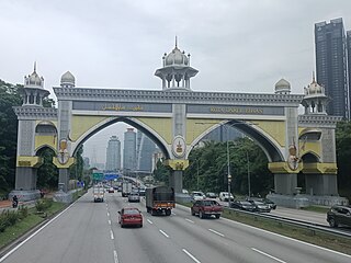
Federal Highway is a Malaysian controlled-access highway connecting the capital city of Kuala Lumpur, and Klang, Selangor. The highway starts from Seputeh in Kuala Lumpur to Klang, Selangor. It is the busiest highway in Klang Valley during rush hour from/to Kuala Lumpur. The Federal Highway is coded as Federal Route 2.

<span class="mw-page-title-main">New Klang Valley Expressway</span> Road in Malaysia

The New Klang Valley Expressway (NKVE), designated E1, is an expressway entirely within the Klang Valley region of Selangor and Kuala Lumpur in Peninsular Malaysia. The expressway begins at the settlement of Bukit Raja near Klang, and ends at Jalan Duta in Kuala Lumpur. The 35-kilometre (22-mile) expressway is one of the most heavily utilised expressways in the Klang Valley region. The expressway shares its designation with the North–South Expressway Northern Route.

The North–South Expressway Central LinkNorth–South Expressway Central Link also known as ELITE, is a 63-kilometre (39-mile) controlled-access highway in Malaysia, running between Shah Alam in Selangor and Nilai in Negeri Sembilan. The expressway joins the separated northern and southern sections of the North–South Expressway, allowing interstate traffic to bypass Kuala Lumpur. The expressway also serves as a primary access route to Putrajaya and Kuala Lumpur International Airport.

<span class="mw-page-title-main">Shah Alam Expressway</span> Road in Malaysia

The Shah Alam ExpresswayShah Alam Expressway is a 57.5-kilometre (35.7-mile) controlled-access highway in Peninsular Malaysia running between Pandamaran in Klang, Selangor to Sri Petaling in Kuala Lumpur. Shah Alam Expressway is the third east–west-oriented expressway in the Klang Valley after the Federal Highway and New Klang Valley Expressway. This expressway is part of the Kuala Lumpur Middle Ring Road 2 Scheme.

<span class="mw-page-title-main">North–South Expressway Northern Route</span> Major interstate expressway in Malaysia

The North–South Expressway Northern Route is an interstate controlled-access highway running parallel to the northwestern coast of Peninsular Malaysia. The 460-kilometre (290-mile) expressway forms the north section of the North–South Expressway, passing through the northwestern states of Kedah, Penang, Perak and Selangor. The expressway begins at the Bukit Kayu Hitam checkpoint in Kedah, where the Malaysia–Thailand border lies, and ends at Bukit Lanjan in Selangor state where the expressway interchanges with the New Klang Valley Expressway. The expressway is operated by PLUS Expressways.

<span class="mw-page-title-main">Guthrie Corridor Expressway</span> Expressway in Malaysia

Guthrie Corridor Expressway, GCE, Guthrie Corridor Expressway is an expressway in Klang Valley, Selangor, Malaysia. It connects Shah Alam to Rawang. GCE is approximately 25 km (16 mi).

The Federal Route 2 is a major east–west oriented federal highway in Malaysia. The 276.9 kilometres (172 mi) road connects Port Klang in Selangor to Kuantan Port in Pahang. The Federal Route 2 became the backbone of the road system linking the east and west coasts of Peninsula Malaysia before being surpassed by the East Coast Expressway E8.

Federal Route 5 is one of the three north–south oriented backbone federal roads running along the west coast of Peninsular Malaysia, Malaysia. The 655.85 kilometres (408 mi) federal highway runs from Jelapang, Perak in the north to Skudai, Johor in the south.

Kota Kemuning is a township located in the constituency of Kota Raja, in Klang District, Selangor, Malaysia, just south of Shah Alam. Kota Kemuning borders Putra Heights on its east, across the Klang River.

<span class="mw-page-title-main">Ara Damansara</span> Township in Selangor, Malaysia

Ara Damansara is a residential township in Petaling Jaya, Petaling District, Selangor, Malaysia. It is located along Federal Route 15.

<span class="mw-page-title-main">Ampang–Kuala Lumpur Elevated Highway</span> Expressway in Malaysia

Ampang–Kuala Lumpur Elevated Highway (AKLEH), Ampang–Kuala Lumpur Elevated Highway, is the first elevated highway in Malaysia. The 7.9 km (4.9 mi) elevated highway connects Ampang and Kuala Lumpur. This highway was built to reduce traffic congestion at Jalan Ampang and make access to the city more convenient. Motorcycles and other vehicles with two wheels were banned from using this highway for safety reasons; the ban on motorcycles was lifted on 19 June 2008 because of escalating fuel prices.

<span class="mw-page-title-main">Malaysia Federal Route 15</span> Road in Malaysia

Federal Route 15 is main federal road in the Klang Valley region, Selangor, Malaysia. The main link begins from Kampung Melayu Subang at Subang to Sultan Abdul Aziz Shah Airport (Skypark) and ends at Subang Jaya.

<span class="mw-page-title-main">Alam Impian</span> Township in Selangor, Malaysia

Alam Impian is a township in Shah Alam. The township was launched in 2006. It has graffiti walls, an art gallery, linear parks, an amphitheatre, street art and a 31-acre central town park.

<span class="mw-page-title-main">Bukit Jalil Highway</span> Road in Malaysia

The Bukit Jalil Highway, or Puchong–Sungai Besi Highway, Federal Route 217, is a major highway in Klang Valley, Malaysia. It is a toll-free and also a second highway after Shah Alam Expressway E5. It connects the Sungai Besi Expressway E9 near Selangor Turf Club in the east to Damansara–Puchong Expressway E11 near Puchong Jaya in the west. The highway passes Bandar Kinrara and Bukit Jalil.

<span class="mw-page-title-main">Greater Kuala Lumpur</span> Metropolitan area in Malaysia

Greater Kuala Lumpur is the geographical term that determines the boundaries of metropolitan Kuala Lumpur in Malaysia. Though similar to the term "Klang Valley", there remains a variation between the two. Ranked as the 30th-largest in Asia, it covers a total land size of 13,565.61km2.

<span class="mw-page-title-main">Malaysian Expressway System</span>

The Malaysian Expressway System is a network of national controlled-access expressways in Malaysia that forms the primary backbone network of Malaysian national highways. The network begins with the Tanjung Malim–Slim River tolled road which was opened to traffic on 16 March 1966, later North–South Expressway (NSE), and is being substantially developed. Malaysian toll road-expressways are built by private companies under the supervision of the government highway authority, Malaysian Highway Authority. While toll-free expressways are built by Malaysian Public Works Department or Jabatan Kerja Raya Malaysia (JKR) in Malay.

<span class="mw-page-title-main">Damansara–Shah Alam Elevated Expressway</span> Road in Malaysia

The Damansara–Shah Alam Elevated Expressway (DASH) E31 is an expressway in Klang Valley, Selangor, Malaysia. Estimated cost of the expressway is MYR 11.5 billion.

The following is an alphabetical list of articles related to Selangor.

References

  1. https://m.facebook.com/story.php?story_fbid=pfbid0B1imqcdyajygmtXjPEofk6jtBNF8opr5 sqamkm3aFTw5k2ZDPiydTgkiRvCKtZzMl&id=181456668606085&m_entstream_source=timeline&__tn__=%2As%2As-R&wtsid=rdr_0o0k92YFPSk6aYPDw
  2. "Kadar Tol Baharu AKLEH, GCE, LKSA & SILK". Facebook . Retrieved 30 October 2022.
  3. "PENGURANGAN KADAR TOL" . Retrieved 30 October 2022.
  4. https://lom.agc.gov.my/act-view.php?language=BI&type=pua&no=P.U.%20(A)%20341/2022 [ bare URL ]
  5. "LKSA - PROLINTAS".