
Khandwa is a city and a nagar nigam in the Nimar region of Madhya Pradesh, India. It is the administrative headquarters of the Khandwa district, formerly known as East Nimar District.
Nimar / Nimad is the southwestern region of Madhya Pradesh state in west-central India. This region has sub-regions which include Nimar, Khargone Khandwa Barwani Burhanpur and Dhar.

Barwani or Badwani is a municipal town in Barwani district of Madhya Pradesh, India, that is situated near the left bank of the Narmada River. It is the administrative headquarters of Barwani district and has also served as the capital of the former princely state of Barwani. Barwani is only accessible by road.

Khargone district, formerly known as West Nimar district, is a district of Madhya Pradesh state in central India. The district lies in the Nimar region and is part of the Indore Division. The district headquarters is the city of Khargone, which lies south of the Indore metropolis, the headquarters of Indore district.

Burhanpur District is a district of Madhya Pradesh state in central India. The city of Burhanpur is the district headquarters.

Khandwa district, formerly known as the East Nimar district, is a district of the Madhya Pradesh state in central India. The city of Khandwa is the administrative headquarters of the district. Other notable towns in the district include Mundi, Harsud, Punasa, Pandhana and Omkareshwar.
Multai is a town and a Nagar Palika in Betul district in the Indian state of Madhya Pradesh. Multai is one of the southern cities of Madhya Pradesh, occupying almost half of the Satpura plateau. Considering the small villages around, it occupies a large area in width of the Satpura range between the valley of the Narmada on the north and the barer plains on the south. Forests lie to the west of the city between the districts of East Nimar and Amaraoti. It lies on the Northern bank of the Tapti and the place is also known for being the origin of the Tapti river.

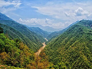
Mundi is a city and Tehsil in the Khandwa district of Nimar region the Indian state of Madhya Pradesh. It is situated in North Side of East Nimar District.
Sarangpur is a city and tehsil in Rajgarh district in the Indian state of Madhya Pradesh. It is situated at the bank of the river Kali Sindh.

Vijayraghavgarh is a town, tehsil headquarters, and a nagar panchayat located in Katni district in the Indian state of Madhya Pradesh. It belongs to Jabalpur division and is 34 km (21 mi) east of district headquarters Katni.
Sangrampur is a Nagar Panchayat, a tehsil of Buldhana district, Maharashtra State, India.
Bahoriband is a tehsil and gram panchayat in Katni district in the Indian state of Madhya Pradesh. The headquarters is located in Bahoriband. It belongs to Jabalpur Division. It is located 44 km west of Katni and 320 km west of the state capital Bhopal. Bahoriband Tehsil is bounded by Sihora and Majhouli Tehsils to the south, Rithi Tehsil to the north and Murwara Tehsil to the east. Nearby cities include Jabalpur, Umaria and Katni.
Chhanera is a town and municipality in Khandwa district in the Indian state of Madhya Pradesh. The town was established for residents of Harsud displaced when it was submerged under the waters of the Indira Sagar dam in July 2004.

Punasa is a Town and a Nagar Panchayat in Khandwa district of Madhya Pradesh, India.it's also a Tehsil Headquarter.
Khirala — A village in the Pandhana tahsll about 16 miles south of Khandwa and a mile from Borgaon on the Sukta river. Population 1243. The village contains an old mosque and a Muhammadan tomb. There are a number of Muhammadan dyers here who dye and print red cloths and are called Sindhis because they are supposed to have come from Sind. The village is owned by a Maratha Brahman widow, who is hopelessly involved in debt.

Nankhari is a Tehsil (town) and a block in Shimla district in the Indian state of Himachal Pradesh. It is about 92.5 km from Shimla and 33 km from Narkanda and NH 5. It consists of 17 Gram panchayat and 102 villages.
Tamia is a small town located in Chhindwara District of Madhya Pradesh which is also a tehsil headquarter and a Development Block.
Icchapur is a town in Burhanpur District of Madhya Pradesh in India. It's Famous for its Icchadevi Temple.
Chhapiheda is a Nagar Panchayat city located in district of Rajgarh, Madhya Pradesh. It belongs to Khilchipur Tehsil.
Gulana or Golana is a town and Tehsil Headquarter in Shajapur District of Madhya Pradesh. Gulana was an assembly constituency until 2008. It was abolished in 2008.
