
Roslavl is a town and the administrative center of Roslavlsky District in Smolensk Oblast, Russia. It is a road and rail junction and a market town. Population: 54,900 (2010 Census); 57,701 (2002 Census); 60,470 (1989 Soviet census).
Dukhovshchina is a town and the administrative center of Dukhovshchinsky District in Smolensk Oblast, Russia, located on the Vostitsa River 57 kilometers (35 mi) northeast of Smolensk, the administrative center of the oblast. Population: 4,371 (2010 Census); 4,683 (2002 Census); 5,747 (1989 Soviet census).
Pochinok is a town and the administrative center of Pochinkovsky District in Smolensk Oblast, Russia, located on the Khmara River 62 kilometers (39 mi) southeast of Smolensk, the administrative center of the oblast. Population: 8,776 (2010 Census); 9,578 (2002 Census); 10,753 (1989 Soviet census).

Rudnya is a town and the administrative center of Rudnyansky District in Smolensk Oblast, Russia, located on the Malaya Berezina River 68 kilometers (42 mi) northwest of Smolensk, the administrative center of the oblast. Population: 10,030 (2010 Census); 9,853 (2002 Census); 11,032 (1989 Soviet census).

Sychyovka is a town and the administrative center of Sychyovsky District in Smolensk Oblast, Russia, located between the Vazuza and Losmina Rivers, 234 kilometers (145 mi) northeast of Smolensk, the administrative center of the oblast. Population: 8,111 (2010 Census); 8,683 (2002 Census); 9,643 (1989 Soviet census).
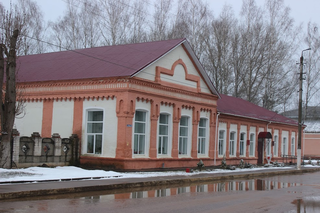
Krasny is an urban locality and the administrative center of Krasninsky District of Smolensk Oblast, Russia, located at the confluence of the Svinaya and the Mereyka Rivers 67 kilometers (42 mi) southwest of Smolensk. Population: 4,349 (2010 Census); 4,714 (2002 Census); 5,087 (1989 Soviet census).

Przhevalskoye is an urban locality in Demidovsky District of Smolensk Oblast, Russia, located in the northwestern part of the oblast, on Lake Sapsho, northeast of the town of Demidov, the administrative center of the district. It is a terminus of the Demidov-Przhevalskoye Highway. As of the 2010 Census, its population was 1,683.

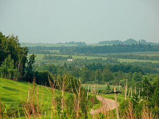
Krasninsky District is an administrative and municipal district (raion), one of the twenty-five in Smolensk Oblast, Russia. It is located in the west of the oblast and borders with Rudnyansky District in the north, Smolensky District in the east, Monastyrshchinsky District in the south, Horki District of Mogilev Region of Belarus in the southwest, and with Dubrowna District of Vitebsk Region, also of Belarus, in the west. The area of the district is 1,507.67 square kilometers (582.11 sq mi). Its administrative center is the urban locality of Krasny. Population: 12,895 ; 15,537 (2002 Census); 18,758 (1989 Soviet census). The population of Krasny accounts for 33.7% of the district's total population.

Kardymovsky District is an administrative and municipal district (raion), one of the twenty-five in Smolensk Oblast, Russia. It is located in the center of the oblast and borders with Dukhovshchinsky District in the north, Yartsevsky District in the northeast, Dorogobuzhsky District in the east, Glinkovsky District in the southeast, Pochinkovsky District in the south, and with Smolensky District in the west. The area of the district is 1,093.15 square kilometers (422.07 sq mi). Its administrative center is the urban locality of Kardymovo. Population: 11,852 ; 12,521 (2002 Census); 13,505 (1989 Soviet census). The population of Kardymovo accounts for 39.3% of the district's total population.
Khislavichsky District is an administrative and municipal district (raion), one of the twenty-five in Smolensk Oblast, Russia. It is located in the southwest of the oblast and borders with Monastyrshchinsky District in the north, Pochinkovsky District in the east, Shumyachsky District in the south, and with Mstsislaw District of Mogilev Region of Belarus in the west. The area of the district is 1,161 square kilometers (448 sq mi). Its administrative center is the urban locality of Khislavichi. Population: 9,070 ; 12,007 (2002 Census); 15,071 (1989 Soviet census). The population of Khislavichi accounts for 45.6% of the district's total population.
Monastyrshchinsky District is an administrative and municipal district (raion), one of the twenty-five in Smolensk Oblast, Russia. It is located in the west of the oblast and borders with Smolensky District in the north, Pochinkovsky District in the east, Khislavichsky District in the south, Mstsislaw District of Mogilev Region of Belarus in the west, and with Krasninsky District in the northwest. The area of the district is 1,513.75 square kilometers (584.46 sq mi). Its administrative center is the urban locality of Monastyrshchina. Population: 10,788 ; 13,876 (2002 Census); 17,559 (1989 Soviet census). The population of Monastyrshchino accounts for 37.7% of the district's total population.

Pochinkovsky District is an administrative and municipal district (raion), one of the twenty-five in Smolensk Oblast, Russia. It is located in the southern central part of the oblast and borders with Kardymovsky District in the north, Glinkovsky District in the northeast, Yelninsky District in the east, Roslavlsky District in the southeast, Shumyachsky District in the south, Khislavichsky District in the southwest, Monastyrshchinsky District in the west, and with Smolensky District in the northwest. The area of the district is 2,380.75 square kilometers (919.21 sq mi). Its administrative center is the town of Pochinok. Population: 30,959 ; 37,537 (2002 Census); 44,162 (1989 Soviet census). The population of Pochinok accounts for 28.3% of the district's total population.
Rudnyansky District is an administrative and municipal district (raion), one of the twenty-five in Smolensk Oblast, Russia. It is located in the west and northwest of the oblast and borders with Velizhsky District in the north, Demidovsky District in the northeast, Smolensky District in the east, Krasnensky District in the south, and with Vitebsk, Liozna, and Dubrowna Districts of Vitebsk Region of Belarus in the west. The area of the district is 2,111.41 square kilometers (815.22 sq mi). Its administrative center is the town of Rudnya. Population: 25,244 ; 28,037 (2002 Census); 34,724 (1989 Soviet census). The population of Rudnya accounts for 39.7% of the district's total population.

Safonovsky District is an administrative and municipal district (raion), one of the twenty-five in Smolensk Oblast, Russia. It is located in the northern central part of the oblast. The area of the district is 2,258.46 square kilometers (872.00 sq mi). Its administrative center is the town of Safonovo. Population: 61,572 ; 65,251 (2002 Census); 17,115 (1989 Soviet census). The population of Safonovo accounts for 74.9% of the district's total population.

Shumyachsky District is an administrative and municipal district (raion), one of the twenty-five in Smolensk Oblast, Russia. It is located in the southwest of the oblast and borders with Khislavichsky District in the north, Pochinkovsky District in the northwest, Roslavlsky District in the east, Yershichsky District in the southeast, Klimavichy District of Mogilev Region of Belarus in the south, and with Krychaw and Mstsislaw Districts, also of Mogilev Region, in the west. The area of the district is 1,367.70 square kilometers (528.07 sq mi). Its administrative center is the urban locality of Shumyachi. Population: 10,713 ; 14,032 (2002 Census); 17,678 (1989 Soviet census). The population of Shumyachi accounts for 39.5% of the district's total population.
Smolensky District is an administrative and municipal district (raion), one of the twenty-five in Smolensk Oblast, Russia. It is located in the west of the oblast and borders with Demidovsky District in the north, Dukhovshchinsky District in the northeast, Kardymovsky District in the east, Pochinkovsky District in the south, Monastyrshchinsky District in the southwest, Krasninsky District in the west, and with Rudnyansky District in the northwest. The area of the district is 2,494.98 square kilometers (963.32 sq mi). Its administrative center is the city of Smolensk. Population: 44,964 ; 47,281 (2002 Census); 50,620 (1989 Soviet census).

Yelninsky District is an administrative and municipal district (raion), one of the twenty-five in Smolensk Oblast, Russia. It is located in the southeast of the oblast and borders with Dorogobuzhsky District in the north, Ugransky District in the east, Spas-Demensky District of Kaluga Oblast in the southeast, Roslavlsky District in the south, Pochinkovsky District in the west, and with Glinkovsky District in the northwest. The area of the district is 1,808.15 square kilometers (698.13 sq mi). Its administrative center is the town of Yelnya. Population: 14,948 ; 17,457 (2002 Census); 19,699 (1989 Soviet census). The population of Yelnya accounts for 67.5% of the district's total population.
Yershichsky District is an administrative and municipal district (raion), one of the twenty-five in Smolensk Oblast, Russia. It is located in the south of the oblast and borders with Roslavlsky District in the north, Dubrovsky District of Bryansk Oblast in the east, Kletnyansky District, also of Bryansk Oblast, in the south, Khotsimsk District of Mogilev Region of Belarus in the southwest, Klimavichy District of Mogilev Region in the west, and with Shumyachsky District in the northwest. The area of the district is 1,039.00 square kilometers (401.16 sq mi). Its administrative center is the rural locality of Yershichi. Population: 7,102 ; 8,859 (2002 Census); 11,544 (1989 Soviet census). The population of Yershichi accounts for 44.6% of the district's total population.
Golynki is an urban-type settlement in Rudnyansky District of Smolensk Oblast, Russia. It is located on the banks of the Yelenka River. Population: 3,573 (2010 Census); 3,884 (2002 Census); 4,607 (1989 Soviet census).

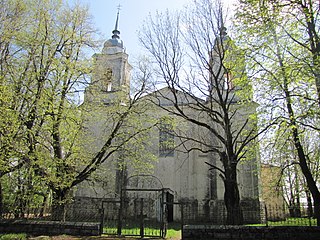
Monastyrshchina is an urban locality and the administrative center of Monastyrshchinsky District of Smolensk Oblast, Russia. It is located on the left bank of the Vikhra River, in the western part of the oblast. Population: 4,065 (2010 Census); 4,622 (2002 Census); 5,166 (1989 Soviet census).


