Shumyachsky District

Last updated
Shumyachsky District
Шумячский район(Russian)
Location Shumyachsky District Smolensk Oblast.svg
Location of Shumyachsky District in Smolensk Oblast
Coordinates: 53°51′N32°25′E / 53.850°N 32.417°E / 53.850; 32.417 Coordinates: 53°51′N32°25′E / 53.850°N 32.417°E / 53.850; 32.417
Peizazh Shumiachskii raion.jpg
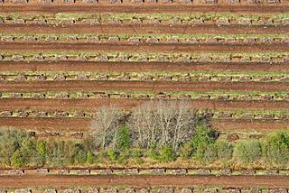
Lime trees near Pervomayskaya, Shumyachsky District
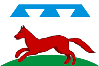
Flag of Shumyachsky rayon.png
Flag
Location
Country Russia
Federal subject Smolensk Oblast [1]
Administrative structure (as of February 2013)
Administrative center settlement of  Shumyachi [1]
Administrative divisions: [1]
Urban settlements 1
Rural settlements 7
Inhabited localities: [1]
Urban-type settlements [2] 1
Rural localities 139
Municipal structure (as of October 2011)
Municipally incorporated asShumyachsky Municipal District [3]
Municipal divisions: [3]
Urban settlements1
Rural settlements7
Statistics
Area (administrative district) (February 2013) 1,367.70 km2 (528.07 sq mi) [1]
Population (2010 Census) 10,713 inhabitants [4]
 Urban39.5%
 Rural60.5%
Density 7.83/km2 (20.3/sq mi) [5]
Time zone MSK (UTC+03:00) [6]
Official website
Shumyachsky District on WikiCommons

Shumyachsky District (Russian : Шумячский райо́н) is an administrative [1] and municipal [3] district (raion), one of the twenty-five in Smolensk Oblast, Russia. It is located in the southwest of the oblast and borders with Khislavichsky District in the north, Pochinkovsky District in the northwest, Roslavlsky District in the east, Yershichsky District in the southeast, Klimavichy District of Mogilev Region of Belarus in the south, and with Krychaw and Mstsislaw Districts, also of Mogilev Region, in the west. The area of the district is 1,367.70 square kilometers (528.07 sq mi). [1] Its administrative center is the urban locality (a settlement) of Shumyachi. [1] Population: 10,713 (2010 Census); [4] 14,032(2002 Census); [7] 17,678(1989 Census). [8] The population of Shumyachi accounts for 39.5% of the district's total population. [4]

Russian language East Slavic language

Russian is an East Slavic language, which is official in the Russian Federation, Belarus, Kazakhstan and Kyrgyzstan, as well as being widely used throughout Eastern Europe, the Baltic states, the Caucasus and Central Asia. It was the de facto language of the Soviet Union until its dissolution on 25 December 1991. Although, nowadays, over two decades after the breakup of the Soviet Union, Russian is used in official capacity or in public life in all the post-Soviet nation-states, as well as in Israel and Mongolia, the rise of state-specific varieties of this language tends to be strongly denied in Russia, in line with the Russian World ideology.

A raion is a type of administrative unit of several post-Soviet states. The term is from the French "rayon", which is both a type of a subnational entity and a division of a city, and is commonly translated in English as "district".

Contents

Geography

The whole district belongs to the drainage basin of the Sozh River, a major left tributary of the Dnieper. The Sozh itself makes the northwestern border of the district, separating it from Mogilev Region of Belarus. The biggest tributary of the Sozh traversing the district is the Ostyor River, which makes the southwestern border of the district, separating it from Mogilev Region as well.

Drainage basin Area of land where precipitation collects and drains off into a common outlet

A drainage basin is any area of land where precipitation collects and drains off into a common outlet, such as into a river, bay, or other body of water. The drainage basin includes all the surface water from rain runoff, snowmelt, and nearby streams that run downslope towards the shared outlet, as well as the groundwater underneath the earth's surface. Drainage basins connect into other drainage basins at lower elevations in a hierarchical pattern, with smaller sub-drainage basins, which in turn drain into another common outlet.

Sozh River river

Sozh, or Sož is an international river flowing in Russia, Belarus, and Ukraine. It is a left bank tributary of the Dnieper River. Sozh passes through Gomel, the second largest city in Belarus.

Dnieper longest river of Ukraine and Belarus

The Dnieper is one of the major rivers of Europe, rising in the Valdai Hills near Smolensk, Russia, and flowing through Russia, Belarus and Ukraine to the Black Sea. It is the longest river of Ukraine and Belarus and the fourth-longest river in Europe. The total length is approximately 2,200 km (1,400 mi) with a drainage basin of 504,000 square kilometres (195,000 sq mi). The river is noted for its dams and hydroelectric stations. The Dnieper is an important navigable waterway for the economy of Ukraine and is connected via the Dnieper–Bug Canal to other waterways in Europe.

History

Historically, the area belonged intermittently to the Principality of Smolensk and the Grand Duchy of Lithuania, subsequently to Poland. Shumyachi is first mentioned in 1587. [9] The western part of the district was in 1772, as a result of the First Partition of Poland, transferred to Russia and included in the newly established Mogilev Governorate. It belonged to Klimovichsky Uyezd. In 1810, one of the first Arakcheev military settlements (Shtab-Zagustino) was established here. [10] In 1919, Mogilev Governorate was abolished, and the area was transferred to Gomel Governorate. The eastern part, in the course of the administrative reform carried out in 1708 by Peter the Great, was included into Smolensk Governorate and remained there until 1929, with the exception of the brief periods between 1713 and 1726, when it belonged to Riga Governorate, and between 1775 and 1796, when Smolensk Governorate was transformed into Smolensk Viceroyalty. It belonged to Roslavlsky Uyezd. In 1922, the western part of the district was included to Roslavlsky Uyezd as well. [11]

The Principality of Smolensk was a Kievan Rus' lordship from the eleventh to the fifteenth century. Until 1127, when it passed to the Rostislavichi, the principality was part of the land of Kiev.

Grand Duchy of Lithuania European state from the 12th century until 1795

The Grand Duchy of Lithuania was a European state that lasted from the 13th century to 1795, when the territory was partitioned among the Russian Empire, the Kingdom of Prussia and Austria.

First Partition of Poland

The First Partition of Poland took place in 1772 as the first of three partitions that ended the existence of the Polish–Lithuanian Commonwealth by 1795. Growth in the Russian Empire's power, threatening the Kingdom of Prussia and the Habsburg Monarchy, was the primary motive behind this first partition. Frederick the Great engineered the partition to prevent Austria, jealous of Russian successes against the Ottoman Empire, from going to war. The weakened Commonwealth's land, including what was already controlled by Russia, was apportioned among its more powerful neighbors—Austria, Russia and Prussia—so as to restore the regional balance of power in Central Europe among those three countries. With Poland unable to effectively defend itself, and with foreign troops already inside the country, the Polish parliament (Sejm) ratified the partition in 1773 during the Partition Sejm convened by the three powers.

On 12 July 1929, governorates and uyezds were abolished, and Shumyachsky District with the administrative center in the settlement of Shumyachi was established. The district belonged to Roslavl Okrug of Western Oblast. [10] On August 1, 1930 the okrugs were abolished, and the districts were subordinated directly to the oblast. On 27 September 1937 Western Oblast was abolished and split between Oryol and Smolensk Oblasts. Shumyachsky District was transferred to Smolensk Oblast. Between August 1941 and 1943, during WWII, the district was occupied by German troops. [10] [12] In 1965, Shumyachi was granted the urban-type settlement status. [11]

Western Oblast was an oblast of the Russian Soviet Federative Socialist Republic from 1929 to 1937. Its seat was in the city of Smolensk. The oblast was located in the west of European Russia, and its territory is currently divided between Bryansk, Kaluga, Pskov, Smolensk, and Tver Oblasts.

Oryol Oblast First-level administrative division of Russia

Oryol Oblast is a federal subject of Russia. Its administrative center is the city of Oryol. Population: 786,935.

In 1972, during the abortive Khrushchyov administrative reform, Yershichsky District was merged into Shumyachsky District. In 1965, it was re-established. [12]

Economy

Industry

The enterprises in the district produce peat, glass, as well as there are several enterprises of food industry. [9]

Peat accumulation of partially decayed vegetation

Peat, also known as turf, is an accumulation of partially decayed vegetation or organic matter. It is unique to natural areas called peatlands, bogs, mires, moors, or muskegs. The peatland ecosystem is the most efficient carbon sink on the planet, because peatland plants capture CO2 naturally released from the peat, maintaining an equilibrium. In natural peatlands, the "annual rate of biomass production is greater than the rate of decomposition", but it takes "thousands of years for peatlands to develop the deposits of 1.5 to 2.3 m [4.9 to 7.5 ft], which is the average depth of the boreal [northern] peatlands". Sphagnum moss, also called peat moss, is one of the most common components in peat, although many other plants can contribute. Soils consisting primarily of peat are known as histosols. Peat forms in wetland conditions, where flooding obstructs the flow of oxygen from the atmosphere, slowing the rate of decomposition.

Agriculture

The main agricultural specializations are cattle breeding with meat and milk production as well as growing of crops and potatoes. [9]

Transportation

The A130 highway (the "Warsaw Highway") which connects Moscow with Babruysk via Obninsk, Roslavl, and Krychaw, crosses the southern part of the district. Shumyachi has a connection to A130. There are also local roads with bus traffic originating from Shumyachi.

The railway connecting Roslavl and Krychaw crosses the southern part of the district. The only station inside the district is Ponyatovka railway station, about 10 kilometres (6.2 mi) south of Shumyachi. In Roslavl, the railway has access to Smolensk and Bryansk; there is not through traffic to Belarus. There is no passenger traffic.

Culture and recreation

In Shumyachi, there is a local museum. [13]

Related Research Articles

Roslavl Town in Smolensk Oblast, Russia

Roslavl is a town and the administrative center of Roslavlsky District in Smolensk Oblast, Russia. It is a road and rail junction and a market town. Population: 54,900 (2010 Census); 57,701 (2002 Census); 60,470 (1989 Census).

Demidov, Smolensk Oblast Town in Smolensk Oblast, Russia

Demidov is a town and the administrative center of Demidovsky District in Smolensk Oblast, Russia, located on the Kasplya River at its confluence with the Gobza River. Population: 7,333 (2010 Census); 8,786 (2002 Census); 10,198 (1989 Census). It was previously known as Porechye.

Yelnya, Yelninsky District, Smolensk Oblast Town in Smolensk Oblast, Russia

Yelnya is a town and the administrative center of Yelninsky District in Smolensk Oblast, Russia, located on the Desna River, 82 kilometers (51 mi) from Smolensk, the administrative center of the oblast. Population: 10,095 (2010 Census); 10,798 (2002 Census); 9,868 (1989 Census).

Pochinok, Pochinkovsky District, Smolensk Oblast Town in Smolensk Oblast, Russia

Pochinok is a town and the administrative center of Pochinkovsky District in Smolensk Oblast, Russia, located on the Khmara River 62 kilometers (39 mi) southeast of Smolensk, the administrative center of the oblast. Population: 8,776 (2010 Census); 9,578 (2002 Census); 10,753 (1989 Census).

Krasninsky District, Smolensk Oblast District in Smolensk Oblast, Russia

Krasninsky District is an administrative and municipal district (raion), one of the twenty-five in Smolensk Oblast, Russia. It is located in the west of the oblast and borders with Rudnyansky District in the north, Smolensky District in the east, Monastyrshchinsky District in the south, Horki District of Mogilev Region of Belarus in the southwest, and with Dubrowna District of Vitebsk Region, also of Belarus, in the west. The area of the district is 1,507.67 square kilometers (582.11 sq mi). Its administrative center is the urban locality of Krasny. Population: 12,895 ; 15,537 (2002 Census); 18,758 (1989 Census). The population of Krasny accounts for 33.7% of the district's total population.

Khislavichi Settlement in Smolensk Oblast, Russia

Khislavichi is an urban locality and the administrative center of Khislavichsky District of Smolensk Oblast, Russia, located by the right bank of the Sozh River. Population: 4,138 (2010 Census); 4,617 (2002 Census); 5,013 (1989 Census).

Dorogobuzhsky District District in Smolensk Oblast, Russia

Dorogobuzhsky District is an administrative and municipal district (raion), one of the twenty-five in Smolensk Oblast, Russia. It is located in the center of the oblast. The area of the district is 1,771.99 square kilometers (684.17 sq mi). Its administrative center is the town of Dorogobuzh. Population: 29,077 ; 32,672 (2002 Census); 36,016 (1989 Census). The population of Dorogobuzh accounts for 36.9% of the district's total population.

Glinkovsky District District in Smolensk Oblast, Russia

Glinkovsky District is an administrative and municipal district (raion), one of the twenty-five in Smolensk Oblast, Russia. It lies in the center of the oblast and borders with Dorogobuzhsky District in the northeast, Yelninsky District in the southeast, Pochinkovsky District in the southwest, and with Kardymovsky District in the west. The area of the district is 1,225.74 square kilometers (473.26 sq mi). Its administrative center is the rural locality of Glinka. Population: 4,948 ; 6,149 (2002 Census); 7,866 (1989 Census).
Khislavichsky District District in Smolensk Oblast, Russia

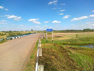
Khislavichsky District is an administrative and municipal district (raion), one of the twenty-five in Smolensk Oblast, Russia. It is located in the southwest of the oblast and borders with Monastyrshchinsky District in the north, Pochinkovsky District in the east, Shumyachsky District in the south, and with Mstsislaw District of Mogilev Region of Belarus in the west. The area of the district is 1,161 square kilometers (448 sq mi). Its administrative center is the urban locality of Khislavichi. Population: 9,070 ; 12,007 (2002 Census); 15,071 (1989 Census). The population of Khislavichi accounts for 45.6% of the district's total population.
Kholm-Zhirkovsky District District in Smolensk Oblast, Russia

Kholm-Zhirkovsky District is an administrative and municipal district (raion), one of the twenty-five in Smolensk Oblast, Russia. It is located in the north of the oblast. The area of the district is 2,033.40 square kilometers (785.10 sq mi). Its administrative center is the urban locality of Kholm-Zhirkovsky. Population: 10,717 ; 12,815 (2002 Census); 15,966 (1989 Census). The population of the administrative center accounts for 32.6% of the district's total population.

Monastyrshchinsky District District in Smolensk Oblast, Russia

Monastyrshchinsky District is an administrative and municipal district (raion), one of the twenty-five in Smolensk Oblast, Russia. It is located in the west of the oblast and borders with Smolensky District in the north, Pochinkovsky District in the east, Khislavichsky District in the south, Mstsislaw District of Mogilev Region of Belarus in the west, and with Krasninsky District in the northwest. The area of the district is 1,513.75 square kilometers (584.46 sq mi). Its administrative center is the urban locality of Monastyrshchina. Population: 10,788 ; 13,876 (2002 Census); 17,559 (1989 Census). The population of Monastyrshchino accounts for 37.7% of the district's total population.

Pochinkovsky District, Smolensk Oblast District in Smolensk Oblast, Russia

Pochinkovsky District is an administrative and municipal district (raion), one of the twenty-five in Smolensk Oblast, Russia. It is located in the southern central part of the oblast and borders with Kardymovsky District in the north, Glinkovsky District in the northeast, Yelninsky District in the east, Roslavlsky District in the southeast, Shumyachsky District in the south, Khislavichsky District in the southwest, Monastyrshchinsky District in the west, and with Smolensky District in the northwest. The area of the district is 2,380.75 square kilometers (919.21 sq mi). Its administrative center is the town of Pochinok. Population: 30,959 ; 37,537 (2002 Census); 44,162 (1989 Census). The population of Pochinok accounts for 28.3% of the district's total population.

Roslavlsky District District in Smolensk Oblast, Russia

Roslavlsky District is an administrative and municipal district (raion), one of the twenty-five in Smolensk Oblast, Russia. It is located in the south of the oblast and borders with Yelninsky District in the north, Spas-Demensky District, of Kaluga Oblast, in the northeast, Kuybyshevsky District, also of Kaluga Oblast, in the east, Rognedinsky District of Bryansk Oblast in the southeast, Dubrovsky District, also of Bryansk Oblast, in the south, Yershichsky District in the southwest, Shumyachsky District in the west, and with Pochinkovsky District in the northwest. The territory of the town of Desnogorsk is enclosed from all sides by Roslavlsky District. The area of the district is 3,000 square kilometers (1,200 sq mi). Its administrative center is the town of Roslavl. Population: 76,100 ; 81,307 (2002 Census); 61,000 (1989 Census). The population of Roslavl accounts for 72.1% of the district's total population.

Sychyovsky District District in Smolensk Oblast, Russia

Sychyovsky District is an administrative and municipal district (raion), one of the twenty-five in Smolensk Oblast, Russia. It is located in the northeast of the oblast. The area of the district is 1,803.90 square kilometers (696.49 sq mi). Its administrative center is the town of Sychyovka. Population: 14,158 ; 15,835 (2002 Census); 18,847 (1989 Census). The population of Sychyovka accounts for 57.3% of the district's total population.

Yelninsky District District in Smolensk Oblast, Russia

Yelninsky District is an administrative and municipal district (raion), one of the twenty-five in Smolensk Oblast, Russia. It is located in the southeast of the oblast and borders with Dorogobuzhsky District in the north, Ugransky District in the east, Spas-Demensky District of Kaluga Oblast in the southeast, Roslavlsky District in the south, Pochinkovsky District in the west, and with Glinkovsky District in the northwest. The area of the district is 1,808.15 square kilometers (698.13 sq mi). Its administrative center is the town of Yelnya. Population: 14,948 ; 17,457 (2002 Census); 19,699 (1989 Census). The population of Yelnya accounts for 67.5% of the district's total population.
Yershichsky District District in Smolensk Oblast, Russia

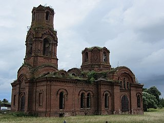
Yershichsky District is an administrative and municipal district (raion), one of the twenty-five in Smolensk Oblast, Russia. It is located in the south of the oblast and borders with Roslavlsky District in the north, Dubrovsky District of Bryansk Oblast in the east, Kletnyansky District, also of Bryansk Oblast, in the south, Khotsimsk District of Mogilev Region of Belarus in the southwest, Klimavichy District of Mogilev Region in the west, and with Shumyachsky District in the northwest. The area of the district is 1,039.00 square kilometers (401.16 sq mi). Its administrative center is the rural locality of Yershichi. Population: 7,102 ; 8,859 (2002 Census); 11,544 (1989 Census). The population of Yershichi accounts for 44.6% of the district's total population.

Golynki Work settlement in Smolensk Oblast, Russia

Golynki is an urban-type settlement in Rudnyansky District of Smolensk Oblast, Russia. It is located on the banks of the Yelenka River. Population: 3,573 (2010 Census); 3,884 (2002 Census); 4,607 (1989 Census).

Monastyrshchina, Monastyrshchinsky District, Smolensk Oblast Settlement in Smolensk Oblast, Russia

Monastyrshchina is an urban locality and the administrative center of Monastyrshchinsky District of Smolensk Oblast, Russia. It is located on the left bank of the Vikhra River, in the western part of the oblast. Population: 4,065 (2010 Census); 4,622 (2002 Census); 5,166 (1989 Census).

Shumyachi Settlement in Smolensk Oblast, Russia

Shumyachi is an urban locality and the administrative center of Shumyachsky District of Smolensk Oblast, Russia. Population: 4,227 (2010 Census); 4,731 (2002 Census); 5,724 (1989 Census).

Yershichi Settlement in Smolensk Oblast, Russia

Yershichi is a rural locality and the administrative center of Yershichsky District of Smolensk Oblast, Russia. It is located on the right bank of the Iput River. Population: 3,169 (2010 Census); 3,326 (2002 Census); 3,808 (1989 Census).

References

Notes

  1. 1 2 3 4 5 6 7 8 Resolution #261
  2. The count of urban-type settlements may include the work settlements, the resort settlements, the suburban (dacha) settlements, as well as urban-type settlements proper.
  3. 1 2 3 Law #138-z
  4. 1 2 3 Russian Federal State Statistics Service (2011). "Всероссийская перепись населения 2010 года. Том 1" [2010 All-Russian Population Census, vol. 1]. Всероссийская перепись населения 2010 года (2010 All-Russia Population Census) (in Russian). Federal State Statistics Service . Retrieved June 29, 2012.
  5. The value of density was calculated automatically by dividing the 2010 Census population by the area specified in the infobox. Please note that this value is only approximate as the area specified in the infobox does not necessarily correspond to the area of the entity proper or is reported for the same year as the population.
  6. Правительство Российской Федерации. Федеральный закон №107-ФЗ от 3 июня 2011 г. «Об исчислении времени», в ред. Федерального закона №271-ФЗ от 03 июля 2016 г. «О внесении изменений в Федеральный закон "Об исчислении времени"». Вступил в силу по истечении шестидесяти дней после дня официального опубликования (6 августа 2011 г.). Опубликован: "Российская газета", №120, 6 июня 2011 г. (Government of the Russian Federation. Federal Law #107-FZ of June 31, 2011 On Calculating Time , as amended by the Federal Law #271-FZ of July 03, 2016 On Amending Federal Law "On Calculating Time". Effective as of after sixty days following the day of the official publication.).
  7. Russian Federal State Statistics Service (May 21, 2004). "Численность населения России, субъектов Российской Федерации в составе федеральных округов, районов, городских поселений, сельских населённых пунктов – районных центров и сельских населённых пунктов с населением 3 тысячи и более человек" [Population of Russia, Its Federal Districts, Federal Subjects, Districts, Urban Localities, Rural Localities—Administrative Centers, and Rural Localities with Population of Over 3,000](XLS). Всероссийская перепись населения 2002 года [All-Russia Population Census of 2002] (in Russian). Retrieved August 9, 2014.
  8. Demoscope Weekly (1989). "Всесоюзная перепись населения 1989 г. Численность наличного населения союзных и автономных республик, автономных областей и округов, краёв, областей, районов, городских поселений и сёл-райцентров" [All Union Population Census of 1989: Present Population of Union and Autonomous Republics, Autonomous Oblasts and Okrugs, Krais, Oblasts, Districts, Urban Settlements, and Villages Serving as District Administrative Centers]. Всесоюзная перепись населения 1989 года [All-Union Population Census of 1989] (in Russian). Институт демографии Национального исследовательского университета: Высшая школа экономики [Institute of Demography at the National Research University: Higher School of Economics]. Retrieved August 9, 2014.
  9. 1 2 3 "Паспорт муниципального образования "Шумячский район" Смоленской области" (in Russian). Shumyachsky District Administration. Retrieved 23 August 2017.
  10. 1 2 3 "Историческая справка" (in Russian). Shumyachsky District Administration. Retrieved 24 August 2017.
  11. 1 2 "История п.Шумячи" (in Russian). Shumyachsky District Administration. Retrieved 24 August 2017.
  12. 1 2 Борис Парфенов; Ольга Хоренженкова. "К истории формирования Смоленской области" (in Russian). Смоленск. Archived from the original on May 31, 2016. Retrieved June 18, 2016.
  13. "Муниципальное бюджетное учреждение «Шумячский художественно-краеведческий музей»" (in Russian). Шумячский художественно-краеведческий музей. Retrieved 23 August 2017.

Sources