Mogilev Governorate

Last updated
Mogilev Governorate
Могилёвская губернія
Coat of arms of Mogilev Governorate 1878.svg
Mogilev in Russian Empire (1914).svg
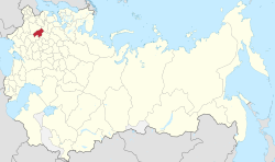
Location in the Russian Empire
Country Russian Empire
Krai Northwestern
Established1772
Abolished1919
Capital Mogilev
Area
  Total48,047.50 km2 (18,551.24 sq mi)
Population
 (1897)
  Total1,686,764
  Density35/km2 (91/sq mi)
   Urban
8.73%
   Rural
91.27%

Mogilev Governorate [lower-alpha 1] was an administrative-territorial unit ( guberniya ) of the Northwestern Krai of the Russian Empire. The governorate bordered the Vitebsk Governorate to the north, the Smolensk Governorate to the east, the Chernigov Governorate to the south, and the Minsk Governorate to the west. Its capital was Mogilev, also referred to as Mogilev-on-the-Dnieper, or Mogilev Gubernskiy. [1] The area of the Mogilev Governorate covered concomitant Belarus' Vitebsk, Mogilev and Gomel Regions.

Contents

The area of the governorate was inhabited in the 10th century by the Slav tribes of the Krivichi and Radimichi. In the 14th century, the land became part of Lithuania, and later Poland. [1] The governorate was formed in 1772, in the aftermath of the First partition of Poland, from parts of the voivodeships of Witebsk, Mścisław, Połock and Inflanty. Parts of these territories were also used to form the Pskov Governorate. In 1796, Mogilev and Polotsk Governorates were united and formed Belorussian Governorate. In 1802, the Belorussian Governorate was divided into Vitebsk Governorate and Mogilev Governorate. In 1917, Vitebsk, Mogilev and parts of Minsk Governorate and Vilna Governorate were united into the Western District (from 1918 known as Western Komuna). In 1918, it was joined by Smolensk Governorate and in October 1919, Mogilev Governorate was reformed into Gomel Governorate. [2]

Subdivisions

Notes

    • Russian: Могилёвская губе́рнія, romanized: Mogilyovskaya gubérniya
    • Belarusian: Магілёўская губе́рня, romanized: Mahilioŭskaja hubiérnja

Related Research Articles

White Ruthenia — one of the historical divisions of Kievan Rus' according to the color scheme, which also includes Black and Red Ruthenia. In the Late Middle Ages and Early Modern period, the name White Ruthenia was characterized by instability, designating a number of different regions on the territory of modern Belarus, Russia, and Ukraine. It is recorded mainly in Western European sources, starting from the middle of the 13th century.

<span class="mw-page-title-main">Byelorussian Soviet Socialist Republic</span> Republic of the Soviet Union

The Byelorussian Soviet Socialist Republic, also known as Byelorussia, Soviet Belarus, or simply Belarus, was a republic of the Soviet Union (USSR). It existed between 1920 and 1991 as one of fifteen constituent republics of the USSR, with its own legislation from 1990 to 1991. The republic was ruled by the Communist Party of Byelorussia and was also referred to as Soviet Byelorussia or Soviet Belarus by a number of historians. Other names for Byelorussia included White Russia or White Russian Soviet Socialist Republic and Belorussian Soviet Socialist Republic.

<span class="mw-page-title-main">Vitebsk Region</span> Region of Belarus

Vitebsk Region or Viciebsk Region, also known as Vitebsk Oblast or Vitsyebsk Voblasts, is one of the regions of Belarus. Its administrative center is Vitebsk. It is located in the north of the country, and borders on Russia.

<span class="mw-page-title-main">Regions of Belarus</span> First-level administrative divisions of Belarus

At the top level of administration, Belarus is divided into six regions and one capital city. The six regions are oblasts, while the city of Minsk has a special status as the capital of Belarus. Minsk also serves as the administrative center of Minsk Region.

<span class="mw-page-title-main">Socialist Soviet Republic of Lithuania and Belorussia</span> 1919–1920 soviet republic in Eastern Europe

The Socialist Soviet Republic of Lithuania and Belorussia, alternatively referred to as the Socialist Soviet Republic of Lithuania and White Russia or simply Litbel (Lit-Bel), was a Soviet republic that existed within the parts of the territories of modern Belarus and Lithuania for approximately five months during the Lithuanian–Soviet War and the Polish–Soviet War in 1919. The Litbel republic was created in February 1919 formally through the merger of the short-lived Lithuanian Soviet Socialist Republic and the Socialist Soviet Republic of Belorussia.

<span class="mw-page-title-main">Smolensk Governorate</span> Division of the Russian Empire, 1796–1929

Smolensk Governorate, or the Government of Smolensk, was an administrative-territorial unit (guberniya) of the Tsardom of Russia, the Russian Empire, and the Russian SFSR. It existed, with interruptions, between 1708 and 1929.

<span class="mw-page-title-main">Minsk Governorate</span> 1793–1921 Russian governorate in modern Belarus

Minsk Governorate or Government of Minsk was an administrative-territorial unit (guberniya) of the Russian Empire, with its capital in Minsk. It was created in 1793 from the land acquired in the partitions of Poland and lasted until 1921. Its territory covered the majority of modern-day Belarus.

<span class="mw-page-title-main">Rudnya, Rudnyansky District, Smolensk Oblast</span> Town in Smolensk Oblast, Russia

Rudnya is a town and the administrative center of Rudnyansky District in Smolensk Oblast, Russia, located on the Malaya Berezina River 68 kilometers (42 mi) northwest of Smolensk, the administrative center of the oblast. Population: 10,030 (2010 Census); 9,853 (2002 Census); 11,032 (1989 Census).

<span class="mw-page-title-main">Grodno Governorate</span> Governorate in the Russian Empire

Grodno Governorate was an administrative-territorial unit (guberniya) of the Northwestern Krai of the Russian Empire, with its capital in Grodno. It encompassed 38,671.5 square kilometres (14,931.1 sq mi) in area and consisted of a population of 1,631,645 inhabitants by 1897. Grodno Governorate bordered by Suwałki Governorate to the north, Vilna Governorate to the northeast, Minsk Governorate to the east, Volhynian Governorate to the south, Kholm Governorate to the west, and Łomża Governorate to the northwest. The governorate covered the areas of modern-day Grodno Region of Belarus, part of the Podlaskie Voivodeship of Poland, and a small part of Druskininkai, Lazdijai and Varėna districts of Lithuania.

<span class="mw-page-title-main">Socialist Soviet Republic of Byelorussia</span> Short-lived socialist state in present-day Belarus (1919)

The Socialist Soviet Republic of Byelorussia was an early republic in the historical territory of Belarus for only one month in 1919 after the collapse of the Russian Empire as a result of the October Revolution.

<span class="mw-page-title-main">Subdivisions of the Polish–Lithuanian territories following the partitions</span>

Following three consecutive partitions of Poland carried out between 1772 and 1795, the sovereign state known as the Polish–Lithuanian Commonwealth disappeared from the map of Europe. In 1918 following the end of World War I, the territories of the former state re-emerged as the states of Poland and Lithuania among others. In the intervening period, the territory of the former Polish–Lithuanian Commonwealth was split between the Austrian Empire, the Kingdom of Prussia and the Russian Empire. These powers subdivided the territories that they gained and created new toponyms for the territories conquered. The subdivisions created were complicated by changes within those empires as well as by the periodic establishment of other forms of the quasi-Polish provinces led by a foreign head of state.

<span class="mw-page-title-main">Russian Partition</span> Former territories of the Polish–Lithuanian Commonwealth invaded by the Russian Empire

The Russian Partition, sometimes called Russian Poland, constituted the former territories of the Polish–Lithuanian Commonwealth that were annexed by the Russian Empire in the course of late-18th-century Partitions of Poland. The Russian acquisition encompassed the largest share of Poland's population, living on 463,200 km2 of land constituting the eastern and central territory of the former commonwealth. The three partitions, which took place in 1772, 1793 and 1795, resulted in the complete loss of Poland's sovereignty, with its territory split between Russia, Prussia and Austria. The Napoleonic Wars saw significant parts of Prussia's and Austria's partitions reconstituted as the Duchy of Warsaw, most of which was then reconstituted as the Kingdom of Poland within the Russian Empire in 1815.

Gomel Governorate was an administrative division of the Russian Soviet Federative Socialist Republic from 1919 to 1926. Its capital was Gomel. It was formed from nine uyezds of the abolished Mogilev Governorate, one uyezd of Minsk Governorate and four uyezds of Chernigov Governorate.

<span class="mw-page-title-main">Rudnyansky District, Smolensk Oblast</span> District in Smolensk Oblast, Russia

Rudnyansky District is an administrative and municipal district (raion), one of the twenty-five in Smolensk Oblast, Russia. It is located in the west and northwest of the oblast and borders with Velizhsky District in the north, Demidovsky District in the northeast, Smolensky District in the east, Krasnensky District in the south, and with Vitebsk, Liozna, and Dubrowna Districts of Vitebsk Region of Belarus in the west. The area of the district is 2,111.41 square kilometers (815.22 sq mi). Its administrative center is the town of Rudnya. Population: 25,244 ; 28,037 (2002 Census); 34,724 (1989 Census). The population of Rudnya accounts for 39.7% of the district's total population.

<span class="mw-page-title-main">Pskov Governorate</span> Governorate of the Russian Empire

Pskov Governorate was an administrative-territorial unit (guberniya) of the Russian Empire and the Russian SFSR, which existed in 1772–1777 and 1796–1927. Its seat was located in Opochka between 1772 and 1776, and in Pskov after 1776. The governorate was located in the west of the Russian Empire and bordered Saint Petersburg Governorate in the north, Novgorod Governorate in the northeast, Tver Governorate in the east, Smolensk Governorate in the southeast, Belarusian Governorate in the south, and Governorate of Livonia in the west. In terms of modern administrative division of Russia, the area of the governorate is currently split between the Pskov, Tver, and Novgorod oblasts. The former border between Pskov Governorate and Governorate of Livonia still largely corresponds to the state border between Russia in the east and Estonia and Latvia in the west.

<span class="mw-page-title-main">Baran, Belarus</span> Town in Vitebsk Region, Belarus

Baran is a town in Vitebsk Region, eastern Belarus. It is located in the southeast of the region. Administratively, Baran is subordinate to the city of Orsha. In 2009, its population was 11,662. As of 2023, it has a population of 10,301.

<span class="mw-page-title-main">Vitebsk Governorate</span> Governorate of the Russian Empire

Vitebsk Governorate was an administrative-territorial unit (guberniya) of the Russian Empire, with the seat of governorship in Vitebsk. It was established in 1802 by splitting the Byelorussia Governorate and existed until 1924. Today most of the area belongs to Belarus, the northwestern part to Latvia and the northeastern part to Pskov and Smolensk Oblasts of Russia.Together with the Vilna, Kovno, Grodno, Minsk, and Mogilev Governorates, it formed the Northwestern Krai. The provincial city was Vitebsk, the largest city was Dvinsk.

Golynki is an urban-type settlement in Rudnyansky District of Smolensk Oblast, Russia. It is located on the banks of the Yelenka River. Population: 3,573 (2010 Census); 3,884 (2002 Census); 4,607 (1989 Census).

<span class="mw-page-title-main">Henry Dymsha</span> Politician (1856–1918)

Heinrich Kleofasovich Dymsha was a Polish landowner and deputy of the State Duma of the II convocation from Vitebsk Governorate.

<span class="mw-page-title-main">North-Western Regional Committee of the Russian Communist Party (Bolsheviks)</span> Former regional party committee in Soviet Russia

The North-Western Regional Committee of the Russian Communist Party (Bolsheviks), earlier the North-Western Regional Committee of the Russian Social Democratic Labour Party (Bolsheviks), was a regional committee (obkom) of the Bolshevik Party in the Western Region 1917–1918. Alexander Miasnikian was the chairman of the regional committee. Vilhelm Knorin was the secretary of the regional committee. Another leader of the regional committee was Ivan Alibegov.

References

  1. 1 2 Chisholm, Hugh, ed. (1911). "Mogilev"  . Encyclopædia Britannica (11th ed.). Cambridge University Press.
  2. "Page Not Found - Belarus SIG - JewishGen.org". www.jewishgen.org. Retrieved 5 December 2022.{{cite web}}: Cite uses generic title (help)

53°55′00″N30°21′00″E / 53.9167°N 30.3500°E / 53.9167; 30.3500