Poltava Governorate

Last updated

Poltava Governorate
Полтавская губерния
Governorate of the Russian Empire (1802–1917) and Ukrainian successor states (1917–25)
1802–1925
Coat of arms of Poltava Governorate 1878.svg
Coat of arms
Poltava Governorate (1913).png
Poltava Governorate in 1913
Poltava in Russian Empire (1914).svg
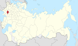
Location in the Russian Empire
Capital Poltava
Area 
 (1897)
49,894 km2 (19,264 sq mi)
Population 
 (1897)
2,778,151
History 
 Established
1802
 Abolished
1925
Political subdivisions15 uezds (1802–1923)
7 okruhas (1923–25)
Preceded by
Succeeded by
Blank.png Little Russia Governorate (1796–1802)
Kremenchutsky Okruha Blank.png
Lubensky Okruha Blank.png
Poltavsky Okruha Blank.png
Prylutsky Okruha Blank.png
Romensky Okruha Blank.png
Today part of Poltava Oblast
Kharkiv Oblast
Kyiv Oblast
Sumy Oblast

Poltava Governorate [a] was an administrative-territorial unit ( guberniya ) of the Russian Empire. It was officially created in 1802 from the disbanded Little Russia Governorate and had its capital in Poltava.

Contents

Its borders encompassed the modern Poltava Oblast of Ukraine, in addition to Berestyn, Pereiaslav, Romny and Zolotonosha.

It was bordering the Chernigov and Kursk Governorates to the north, Kiev Governorate to the west, Kharkov Governorate to the east and the Kherson and Yekaterinoslav Governorates to the south.

History

In 1802, the Little Russia Governorate was disbanded and its territory split between the new Chernigov and Poltava Governorates.

The governorate was part of the Ukrainian People's Republic from 1917 to 1920, interrupted in 1918 by the Ukrainian State.

After the formation of the Ukrainian SSR, the territory was wholly included into the new Soviet Republic. Initially the governorate system was retained – although variations included the Kremenchug Governorate  [ uk ] which was temporarily formed on its territory (August 1920 – December 1922), and the passing of the Pereyaslavsky Uyezd to the Kiev Governorate. However, on June 3, 1925, the governorate was liquidated and succeded by five okruhas (which already were its subdivisions as of March 7, 1923): Kremenchutsky, Lubensky, Poltavsky, Prylutsky and Romensky (the remainding two okrugs existed within the governate, Zolotonoshsky and Krasnohradsky, were also liquidated).

Demographics

The governorate had a population of 2,778,151 according to the 1897 Russian Empire census. [1] Most people (90.13%) lived on the countryside, while a tenth (9.87%) lived in towns and cities. [2] [3] In 1914, the population had increased to 2,794,727.[ citation needed ]

Largest towns and cities

According to the 1897 census, nine settlements had more than 10,000 people.

Russian census of 1897 1897 Gov Poltava ethno.jpg

In bold are cities with a population of over 50,000.

Native Languages

By the 1897 census, [4] Ukrainian was by far the most native spoken language in the governorate, followed by Yiddish and Russian.

Comparison with other governorates (1897) Ukraine ethnic 1897.jpg
Comparison with other governorates (1897)

In bold are native languages spoken by more people than the state language.

Religion

By the 1897 census, [5] the majority religion in the governorate and virtually the state religion was Eastern Orthodox Christianity with some of the population following Judaism. Other religions were much less common.

Administrative divisions

The governorate was divided into 15 uezds ( povits in Ukrainian):

Uezd Administrative seatAreaPopulation
(1897 census)
Transliteration (Cyrillic)Coat of arms Transliteration (Cyrillic)
Gadyachsky (Гадячский)
Gadyach COA (Poltava Governorate) (1782).png
Gadyach (Гадячъ)2,460.9 km2 (950.2 sq mi)142,806
Zenkovsky (Зеньковский)
Zenkov COA (Poltava Governorate) (1782).gif
Zenkov (Зеньковъ)2,250.5 km2 (868.9 sq mi)140,304
Zolotonoshsky (Золотоношский)
Zolotonosha COA (Poltava Governorate) (1782).gif
Zolotonosha (Золотоноша)4,425.5 km2 (1,708.7 sq mi)227,594
Kobelyaksky (Кобелякский)
Kobelyaki COA (Poltava Governorate) (1842).gif
Kobeliaki (Кобеляки)3,672.8 km2 (1,418.1 sq mi)217,875
Konstantinogradsky (Константиноградский)
Konstantinograd COA (Poltava Governorate) (1842).gif
Konstantinograd (Константиноградъ)6,079.2 km2 (2,347.2 sq mi)230,310
Kremenchugsky (Кременчугский)
Kremenchug COA (Poltava Governorate) (1798).gif
Kremenchug (Кременчугъ)3,429.2 km2 (1,324.0 sq mi)244,894
Lokhvitsky (Лохвицкий)
Lohvitsa city coa 1782.gif
Lokhvitsa (Лохвица)2,640.9 km2 (1,019.6 sq mi)150,985
Lubensky (Лубенский)
Lubny COA (Poltava Governorate) (1782).gif
Lubny (Лубны)2,344.0 km2 (905.0 sq mi)136,613
Mirgorodsky (Миргородский)
Mirgorod COA (Poltava Governorate) (1782).gif
Mirgorod (Миргородъ)2,659.3 km2 (1,026.8 sq mi)157,790
Pereyaslavsky (Переяславский)
Pereyaslavl COA (Poltava Governorate) (1782).png
Pereyaslav (Переяславъ)4,091.6 km2 (1,579.8 sq mi)185,306
Piryatinsky (Пирятинский)
Gerb Piriatina (1782).png
Piryatin (Пирятинъ)3,268.1 km2 (1,261.8 sq mi)163,505
Poltavsky (Полтавский)
Poltava COA (Poltava Governorate) (1803).gif
Poltava (Полтава)3,389.0 km2 (1,308.5 sq mi)227,795
Priluksky (Прилукский)
Priluki COA (Poltava Governorate) (1782).gif
Priluki (Прилуки)3,274.7 km2 (1,264.4 sq mi)192,502
Romensky (Роменский)
Romny COA (Poltava Governorate) (1782).gif
Romny (Ромны)2,600.7 km2 (1,004.1 sq mi)186,497
Khorolsky (Хорольский)
Khorol herb.png
Khorol (Хороль)3,311.0 km2 (1,278.4 sq mi)173,375

Notes

  1. Languages, number of speakers which in all gubernia were less than 1000
  2. Religions, number of believers which in all gubernia were less than 10000

References

49°34′28″N34°34′07″E / 49.5744°N 34.5686°E / 49.5744; 34.5686