Baku Governorate

Last updated
Baku Governorate
Бакинская губерния
Coat of arms of Baku 1883.svg
Baku Governorate ATD.png
Administrative map of the Baku Governorate (1905–1917)
Country Russian Empire
Viceroyalty Caucasus
Established1846
Abolished1920
Capital Baku
Area
  Total37,948.97 km2 (14,652.18 sq mi)
Highest elevation4,466 m (14,652 ft)
Population
 (1916)
  Total875,746
  Density23/km2 (60/sq mi)
   Urban
8.28%
   Rural
91.72%

The Baku Governorate, [lower-alpha 1] known before 1859 as the Shemakha Governorate, [lower-alpha 2] was a province ( guberniya ) of the Caucasus Viceroyalty of the Russian Empire, with its center in the booming metropolis and Caspian Sea port of Baku. Area (1897): 34,400 sq. versts, population (1897): 789,659. [2] The Baku Governorate bordered Persia to the south, the Elizavetpol Governorate (the Tiflis and Erivan governorates before 1868) to the west, the Dagestan Oblast to the north, and the Baku gradonachalstvo to the east on the Absheron Peninsula.

Contents

History

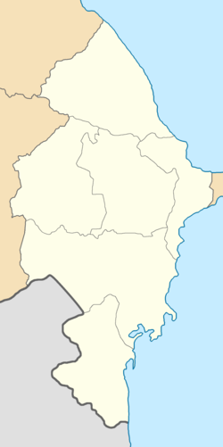
The governorate was originally established in 1846 as the Shemakha Governorate, replacing what had been several military precincts. Following the catastrophic 1859 Shamakhi earthquake, the capital of the governorate was transferred from Shamakha (Shаmakhi) to the fast-growing city of Baku, and on July 12, 1859, the governorate's name was changed accordingly. The coat of arms of the Baku Governorate was instituted on July 5, 1878. [3] Initially, the Baku Governorate included the areas of the former khanates of Karabakh and Shaki until these areas were detached in 1868 to form part of the adjacent Elizavetpol Governorate.

The Armenians were dominant in the commerce of the Baku Governorate as evidenced by them controlling 29% of enterprises in the province as opposed to the Azerbaijanis owning only 18%. Whilst Armenians enjoyed more favourable treatment under the Russian administration and produced oil tycoons such as Alexander Mantashev, Azerbaijanis made up most of the unskilled low-paid labor jobs and were virtually absent from the administration of the province despite their preponderance. In the early 20th century, Russian official Grigory Golitsyn increased the number of Azerbaijanis in the administration and confiscated properties of the Armenian Apostolic Church, however, his anti-Armenian policies (which provoked the Armenian–Tatar clashes) were later repealed in 1905 under the rule of Illarion Vorontsov-Dashkov. [4]

Upon the establishment of the Azerbaijan Democratic Republic, the Baku Governorate was incorporated into the fledgling state and subsequently separated into a smaller Baku General-Governorate and a Lenkoran General-Governorate, the latter being the location of the Provisional Military Dictatorship of Mughan which was suppressed in spring 1919. The governorate was eventually abolished in its entirety following the establishment of Soviet rule in Azerbaijan in 1920, however, its uezds ("counties") continued to exist until their administrative reorganization into raions ("districts") in 1929–1930.

Administrative divisions

The counties ( uezds ) of the Baku Governorate in 1917 were as follows: [5] [6]

NameCapitalPopulationArea
18971916
Baku uezd (Бакинскій уѣздъ)Sarai (Saray)182,89716,2682,610.22 square versts (2,970.59  km2 ; 1,146.95  sq mi )
Geokchay uezd (Геокчайскій уѣздъ)Geokchay (Goychay)117,705134,0984,676.58 square versts (5,322.24  km2 ; 2,054.93  sq mi )
Javad uezd (Джеватскій уѣздъ) Salyan 90,043162,3058,396.97 square versts (9,556.27  km2 ; 3,689.70  sq mi )
Kuba uezd (Кубинскій уѣздъ)Kuba (Quba)183,242198,2046,308.61 square versts (7,179.59  km2 ; 2,772.06  sq mi )
Lenkoran uezd (Ленкоранскій уѣздъ)Lenkoran (Lankaran)130,987203,3194,726.88 square versts (5,379.48  km2 ; 2,077.03  sq mi )
Shemakha uezd (Шемахинскій уѣздъ)Shemakha (Shamakhi)121,842161,5526,625.99 square versts (7,540.79  km2 ; 2,911.51  sq mi )

Demographics

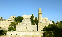
The ethnic group composition of the governorate changed considerably in the latter part of the 19th century. By the beginning of the 20th century, there were 214,700 inhabitants, amongst them, Russians, Ukrainians and Belarusians consisting of 76.3 thousand (35.5%), Tatars 46 thousand (21.4%), Armenians 42 thousand (19.4%), Persians 25 thousand (11.7%), Jews 9.7 thousand (4.5%), Georgians 4 thousand (1.9%), Germans 3.3 thousand (1.5%), and Kazan Tatars 2.3 thousand (1.1%). [7] Muslims generally lived in the historical centre of Baku (Old Baku), surrounded by the khan's castle in the west of the city. Armenians mostly lived in the industrial zone in the north of the city. During the construction of the new city centre, various ethnic groups started to move to different districts. [8]

Russian Empire Census

According to the Russian Empire Census, the Baku Governorate had a population of 826,716 on 28 January [ O.S. 15 January] 1897, including 458,065 men and 368,651 women. The majority of the population indicated Tatar [lower-alpha 3] to be their mother tongue, with significant Tat, Russian, Armenian, Kyurin, and Talysh speaking minorities. [5]

Linguistic composition of the Baku Governorate in 1897 [5]
LanguageNative speakers%
Tatar [lower-alpha 3] 485,14658.68
Tat 89,51910.83
Russian 73,6328.91
Armenian 52,2336.32
Kyurin 48,1925.83
Talysh 34,9944.23
Kazi-Kumukh 11,8111.43
Jewish 8,1720.99
Persian 5,9730.72
German 3,4300.41
Ukrainian 3,3720.41
Avar-Andean 2,8980.35
Georgian 1,6160.20
Polish 1,4390.17
Turkish 1,1550.14
Belarusian 6770.08
Mordovian 5310.06
Swedish 3470.04
Greek 2780.03
Lithuanian 2720.03
Other1,0290.12
TOTAL826,716100.00
Religious composition of the Baku Governorate in 1897 [11]
FaithMaleFemaleBoth
Number%
Muslim 372,770303,473676,24381.80
Eastern Orthodox 32,16423,92656,0906.78
Armenian Apostolic 31,40321,16052,5636.36
Old Believer 11,07510,83721,9122.65
Judaism 6,5996,15412,7531.54
Lutheran 1,9111,8693,7800.46
Roman Catholic 1,5746442,2180.27
Baptist 3133506630.08
Armenian Catholic 961092050.02
Reformed 102881900.02
Karaite 3580.00
Anglican 4370.00
Buddhist 5050.00
Mennonite 1120.00
Other Christian denomination4231730.01
Other non-Christian denomination3140.00
TOTAL458,065368,651826,716100.00

Kavkazskiy kalendar

According to the 1917 publication of Kavkazskiy kalendar , the Baku Governorate had a population of 875,746 on 14 January [ O.S. 1 January] 1916, including 465,711 men and 410,035 women, 838,717 of whom were the permanent population, and 37,029 were temporary residents: [6]

Nationality Urban Rural TOTAL
Number%Number%Number%
Shia Muslims [lower-alpha 4] 34,49947.58395,31949.22429,81849.08
Sunni Muslims [lower-alpha 5] 12,90517.80249,85131.11262,75630.00
Russians 3,7885.2268,8478.5772,6358.29
North Caucasians 6310.8749,1446.1249,7755.68
Armenians 5,6637.8137,2584.6442,9214.90
Jews 14,94820.622,6130.3317,5612.01
Asiatic Christians 220.031390.021610.02
Other Europeans 530.07360.00890.01
Georgians 00.00300.00300.00
TOTAL72,509100.00803,237100.00875,746100.00

Governors

Azerbaijan Democratic Republic period

Notes

  1. 1 2 Before 1918, Azerbaijanis were generally known as "Tatars". This term, employed by the Russians, referred to Turkic-speaking Muslims of the South Caucasus. After 1918, with the establishment of the Azerbaijan Democratic Republic and "especially during the Soviet era", the Tatar group identified itself as "Azerbaijani". [9] [10]
  2. Primarily Tatars. [12]
  3. Primarily Turco-Tatars. [12]

Related Research Articles

<span class="mw-page-title-main">Elizavetpol Governorate</span> Governorate of the Russian Empire

The Elizavetpol Governorate, also known after 1918 as the Ganja Governorate, was a province (guberniya) of the Caucasus Viceroyalty of the Russian Empire, with its capital in Yelisavetpol. The area of the governorate stretched 38,922.43 square versts and was composed of 1,275,131 inhabitants in 1916. The Elizavetpol Governorate bordered the Erivan Governorate to the west, the Tiflis Governorate and Zakatal Okrug to the north, the Dagestan Oblast to the northeast, the Baku Governorate to the east, and Iran to the south.

<span class="mw-page-title-main">Erivan Governorate</span> Governorate of the Russian Empire

The Erivan Governorate was a province (guberniya) of the Caucasus Viceroyalty of the Russian Empire, with its centеr in Erivan. Its area was 27,830 sq. kilometеrs, roughly corresponding to what is now most of central Armenia, the Iğdır Province of Turkey, and the Nakhchivan exclave of Azerbaijan. At the end of the 19th century, it bordered the Tiflis Governorate to the north, the Elizavetpol Governorate to the east, the Kars Oblast to the west, and Persia and the Ottoman Empire to the south. Mount Ararat and the fertile Ararat Valley were included in the center of the province.

<span class="mw-page-title-main">Black Sea Governorate</span> Governorate of the Russian Empire

The Black Sea Governorate was an administrative-territorial unit (guberniya) of the Caucasus Viceroyalty of the Russian Empire, established in 1896 on the territory of the Black Sea Okrug of the Kuban Oblast. The administrative center of the governorate was the Black Sea port of Novorossiysk. In 1905, the population of the governorate was approximately 70,000 and its area was 6,455 square versts, making it the smallest Russian governorate by both measures. The governorate ceased to exist when the Black Sea Soviet Republic was established on its territory in the spring of 1918—later the governorate was incorporated into the Kuban-Black Sea Oblast of the Russian SFSR in March 1920.

<span class="mw-page-title-main">Tiflis Governorate</span> Governorate of the Russian Empire

Tiflis Governorate was a province (guberniya) of the Caucasus Viceroyalty of the Russian Empire with its administrative centre in Tiflis. In 1897, it constituted 44,607 square kilometres (17,223 sq mi) in area and had a population of 1,051,032 inhabitants. Tiflis Governorate bordered Elizavetpol Governorate to the southeast, Erivan Governorate to the south, Kars Oblast to the southwest, Batum Oblast to the west, Kutaisi Governorate to the northwest, Terek Oblast to the north, Dagestan Oblast to the northeast, and after 1905, the Zakatal Okrug to the east. The governorate covered areas of central and southeastern Georgia, the partially recognised state of South Ossetia, most of the Lori Province of Armenia, small parts of northwestern Azerbaijan, and a minuscule southern part of Ingushetia of Russia.

<span class="mw-page-title-main">Shemakha Governorate</span> 1846–1859 unit of Russia

Shemakha Governorate was an administrative-territorial unit (guberniya) of the Caucasus Viceroyalty of the Russian Empire, with its administrative center in Shemakha (Shamakhi). Following the earthquake of 1859, the capital was transferred and the province became known as the Baku Governorate.

Jevanshir <i>uezd</i> Uezd in Caucasus, Russian Empire

The Jevanshir uezd was a county (uezd) of the Elizavetpol Governorate of the Russian Empire, with its center in Terter.

Shusha <i>uezd</i> Uezd in Caucasus, Russian Empire

The Shusha uezd was a county (uezd) of the Elizavetpol Governorate of the Russian Empire, and then of the Ganja Governorate of Azerbaijan Democratic Republic with its center in Shusha in 1840–1921.

Jebrail <i>uezd</i> Uezd in Caucasus, Russian Empire

The Jebrail uezd, also known after 1905 as the Karyagino uezd, was a county (uezd) of the Elizavetpol Governorate of the Russian Empire with its center in Jebrail (Jabrayil) from 1873 until its formal abolition in 1921 by the Soviet authorities.

Kazakh <i>uezd</i> Uezd in Caucasus, Russian Empire

The Kazakh uezd was a county (uezd) of the Elizavetpol Governorate of the Russian Empire and later of the Azerbaijan Democratic Republic with its center in Kazakh from 1868 until its formal abolition in 1929 by the Soviet authorities of the Azerbaijan SSR. The area of the Kazakh uezd forms a large part of the modern-day Tavush Province and a small northeastern part of the Gegharkunik Province of Armenia, also forming most of the area of the Agstafa, Tovuz and Qazax districts of Azerbaijan.

Nukha <i>uezd</i> Uezd in Caucasus, Russian Empire

The Nukha uezd was a county (uezd) of the Elizavetpol Governorate of the Russian Empire and later of the Azerbaijan Democratic Republic with its center in Nukha from 1868 until its formal abolition in 1921 by the Soviet authorities of the Azerbaijan SSR.

Elizavetpol <i>uezd</i> Uezd in Caucasus, Russian Empire

The Elizavetpol uezd, also known as the Ganja uezd after 1918, was a county (uezd) of the Elizavetpol Governorate of the Russian Empire, and later of the Azerbaijan Democratic Republic and Azerbaijan SSR until its formal abolition in 1929. The area of the Elizavetpol uezd corresponds to the modern-day Gadabay, Shamkir, Dashkasan, Goygol, and Samukh districts of Azerbaijan.

Dagestan <i>Oblast</i> Province of the Russian Empire from 1860 to 1917

The Dagestan Oblast was a province (oblast) of the Caucasus Viceroyalty of the Russian Empire. It roughly corresponded to most of present-day southeastern Dagestan within the Russian Federation. The Dagestan oblast was created in 1860 out of the territories of the former Caucasian Imamate, bordering the Terek Oblast to the north, the Tiflis Governorate and Zakatal Okrug to the west, the Elizavetpol Governorate to the south, and Baku Governorate to the east. The administrative center of the oblast was Temir-Khan-Shura.

<span class="mw-page-title-main">Kutaisi Governorate</span> Governorate of the Caucasus Viceroyalty, Russian Empire

The Kutaisi or Kutais Governorate was a province (guberniya) of the Caucasus Viceroyalty of the Russian Empire. It roughly corresponded to most of western Georgia throughout most of its existence, and most of the Artvin Province of Turkey between 1878 and 1903. Created out of part of the former Georgia-Imeretia Governorate in 1846, the governorate also included Akhaltsikhe uezd before its cession to the Tiflis Governorate in 1867. The Kutaisi Governorate bordered the Sukhumi Okrug to the northwest, the Kuban Oblast to the north, the Terek Oblast to the northeast, the Tiflis Governorate to the southeast, the Batum Oblast to the southwest, and the Black Sea to the west. The governorate was eponymously named for its administrative center, Kutais.

Nor Bayazet <i>uezd</i> Uezd in Caucasus, Russian Empire

The Nor Bayazet or Novobayazet uezd was a county (uezd) of the Erivan Governorate of the Caucasus Viceroyalty of the Russian Empire. The uezd bordered the Alexandropol uezd to the north, the Etchmiadzin and Erivan uezds to the west, the Sharur-Daralayaz uezd to the south, and the Kazakh, Elizavetpol, and Jevanshir uezds of the Elizavetpol Governorate to the east. Centered on Lake Sevan, the Nor Bayazet uezd included most of the contemporary province of Gegharkunik and northern parts of the Kotayk Province of Armenia. The administrative center of the uezd was the city Novobayazet for which the district was eponymously named.

Javad <i>uezd</i> Uezd in Caucasus, Russian Empire

The Javad uezd, known after 1921 as the Salyan uezd, was a county (uezd) within the Baku Governorate of the Russian Empire and then of the Azerbaijan Democratic Republic and Azerbaijan SSR until its formal abolishment in 1929 by the Soviet authorities. The uezd was located in the central part of the governorate, bordering the Geokchay, Shemakha, and Baku uezds to the north, Caspian sea to the east, Lenkoran uezd to the south and Iran to the west. The administrative center of the uezd was the city of Salyan.

Baku <i>uezd</i> Uezd in Caucasus, Russian Empire

The Baku uezd was a county (uezd) within the Baku Governorate of the Russian Empire and then of Azerbaijan Democratic Republic and Azerbaijan SSR until its formal abolishment in 1929. The uezd was located in eastern part of the Baku Governorate, bordering Caspian sea to the east, Shemakha uezd to the west, Kuba uezd to the north and Lenkoran uezd to the south. The administrative center of the uezd was the village Sarai.

Lenkoran <i>uezd</i> Uezd in Caucasus, Russian Empire

The Lenkoran uezd or Talysh uezd was a county (uezd) within the Baku Governorate of the Russian Empire, and then of the Azerbaijan Democratic Republic and the Azerbaijan SSR until its formal abolishment in 1929. The county was located on the southern part of the governorate, bordering Caspian sea to the east, Javad uezd to the north, and Iran to the southwest. The administrative centre of the county was the city of Lenkoran.

Shemakha <i>uezd</i> Uezd in Caucasus, Russian Empire

The Shemakha uezd was a county (uezd) within the Baku Governorate of the Russian Empire, and then of Azerbaijan Democratic Republic and Azerbaijan SSR until its formal abolishment in 1929. The county was located in central part of the Baku Governorate, bordering the Javad uezd to the south, Baku uezd to the east, Geokchay uezd to the west and Kuba uezd to the north. The administrative centre of the county was the city of Shemakha.

Kuba <i>uezd</i> Uezd in Caucasus, Russian Empire

The Kuba uezd was a county (uezd) within the Baku Governorate of Russian Empire and then of Azerbaijan Democratic Republic and Azerbaijan SSR until its formal abolition in 1929 by Soviet authorities. The uezd was located in northern part of the Baku Governorate, bordering Caspian sea to the east, Elizavetpol Governorate to the west, Dagestan Oblast to the north, the Geokchay, Shemakha, and Baku uezds to the south. The administrative center of the uezd was the city of Kuba.

Geokchay <i>uezd</i> Uezd in Caucasus, Russian Empire

The Geokchay uezd was a county (uezd) of the Baku Governorate of the Russian Empire and then of the Azerbaijan Democratic Republic and Azerbaijan SSR until its formal abolishment in 1929. The uezd was located in the central part of the governorate, bordering the Kuba uezd to the north, the Shemakha uezd to the east, the Javad uezd to the south and the Elizavetpol Governorate to the west. The administrative center of the uezd was the city of Geokchay.

References

  1. Heydarov, Tale; Farrell, Janice; Peart, Ian (2011). "The announcement bringing to the people the Baku governor's decision on the establishment of peace between Armenians and Azerbaijanis". The Armenian Question in the Caucasus: Russian Archive Documents and Publications (in Russian and Azerbaijani). Apollo Books. pp. 190–191. ISBN   978-0-86372-405-3 via Google Books. باكو غوبیرنیاسنڭ غوبرناتوری تاینی سوویتنڭ کنیاز ناکاسیدزی.
  2. ЭСБЕ/Баку (in Russian). Brockhaus and Efron Encyclopedic Dictionary. Retrieved 5 June 2016.
  3. "Герб Бакинской губернии". heraldry.hobby.ru. Retrieved 2022-06-28.
  4. Shafiyev, Farid. "Armenian-Azerbaijani Conflict. Roots: Massacres of 1905-1906": 16 via Academia.{{cite journal}}: Cite journal requires |journal= (help)
  5. 1 2 3 "Демоскоп Weekly - Приложение. Справочник статистических показателей". www.demoscope.ru. Retrieved 2022-06-28.
  6. 1 2 Кавказский календарь на 1917 год, pp. 178–181.
  7. Современный Азербайджан. // Новый Восток. 1926. No. 4. С. 174
  8. Йорг Баберовски. (2004). Под ред. И. Герасимова (ed.). "Цивилизаторская миссия и национализм в Закавказье: 1828-1914 гг". Новая имперская история постсоветского пространства. Казань: New Imperial History: 322. ISBN   9785852470249.
  9. Bournoutian 2018, p. 35 (note 25).
  10. Tsutsiev 2014, p. 50.
  11. "Демоскоп Weekly - Приложение. Справочник статистических показателей". www.demoscope.ru. Retrieved 2022-06-30.
  12. 1 2 Hovannisian 1971, p. 67.
  13. Baku Lands Archived 2011-04-26 at the Wayback Machine

Bibliography

40°22′00″N49°50′07″E / 40.3667°N 49.8352°E / 40.3667; 49.8352