Don Host Oblast

Last updated
Don Host Oblast
Область Войска Донского
Coat of arms of Don Host Oblast 1878.svg
Don Army in Russian Empire (1914).svg
Location in the Russian Empire
Country Russian Empire
Established1786
Abolished1920
Capital Novocherkassk
Area
  Total162,888.57 km2 (62,891.63 sq mi)
Population
 (1897)
  Total1,712,898
  Density11/km2 (27/sq mi)
   Urban
18.61%
   Rural
91.39%
The Don Metropolitan Cathedral, Novocherkassk in 1905. Voznesensky Metropolitan Cathedral Novocherkassk 1905.jpg
The Don Metropolitan Cathedral, Novocherkassk in 1905.
Map of 1816 Zemlia Voiska Donskogo na Stolistovoi karte 1816 goda.jpg
Map of 1816

Don Host Oblast [lower-alpha 1] was a province ( oblast ) of the Russian Empire which consisted of the territory of the Don Cossacks, coinciding approximately with present-day Rostov Oblast in Russia. Its administrative center was Cherkassk, and later Novocherkassk. [2]

Contents

It comprised the areas where the Don Cossack Host settled in the Russian Empire. From 1786, the territory was officially named Don Host Land (Russian : Земля Войска Донского, romanized: Zemlya Voyska Donskogo), renamed Don Host Oblast in 1870. [3]

During 1914, the oblast, with an area of 164,000 km², had about 3.9 million inhabitants. [1] Of these, 55% (2.1 million) were Cossacks in possession of all the land; the remaining 45% of the population being townsfolk and agricultural guest labourers from other parts of Russia.[ citation needed ]

It was abolished in 1920; from the major part of it the Don Oblast of the RSFSR was created, which was incorporated into the North Caucasus Krai in 1924. [3]

Administrative divisions

The districts ( okrugs ) of the Don Host Oblast in 1897 were as follows:

District CapitalAreaPopulation
(1897 census)
Transliteration name Russian Cyrillic
DonetskyДонецкій Kamenskaya 24,659.3 square versts (28,063.8  km2 ; 10,835.5  sq mi )455,819
1st Don1-й Донской Konstantinovskaya 15,415.9 square versts (17,544.3  km2 ; 6,773.9  sq mi )271,790
2nd Don2-й Донской Nizhne-Chirskaya 23,219.7 square versts (26,425.5  km2 ; 10,202.9  sq mi )239,055
RostovskyРостовскій Rostov-on-Don 6,012 square versts (6,842  km2 ; 2,642  sq mi )369,732
SalskyСальскій Velikoknyazheskaya 18,961.0 square versts (21,578.8  km2 ; 8,331.6  sq mi )76,297
TaganrogskyТаганрогскій Taganrog 12,229.4 square versts (13,917.8  km2 ; 5,373.7  sq mi )412,995
Ust-MedveditskyУсть-Медведицкій Ust-Medveditskaya 18,082.6 square versts (20,579.1  km2 ; 7,945.6  sq mi )246,830
KhoperskyХоперскій Uryupinskaya 15,861.4 square versts (18,051.3  km2 ; 6,969.6  sq mi )251,498
CherkasskyЧеркасскій Novocherkassk 9,750.3 square versts (11,096.4  km2 ; 4,284.4  sq mi )240,222

Demography

Language

Notes

    • Russian: Область Войска Донского, romanized: Oblast Voyska Donskogo
    • Ukrainian: Область Війська Донського, romanized: Oblast Viiska Donskoho, also known as Донщина, Donshchyna [1]

Related Research Articles

<span class="mw-page-title-main">Antratsyt</span> City in Luhansk Oblast, Ukraine

Antratsyt or Antratsit is a city in Luhansk Oblast, Ukraine. Until 1962 it was known as Bokove-Antratsyt. Its population is approximately 52,150.

<span class="mw-page-title-main">Toretsk</span> City in Donetsk Oblast, Ukraine

Toretsk is an industrial city in Bakhmut Raion, Donetsk Oblast, Ukraine. It is the administrative center of Toretsk urban hromada, one of the hromadas of Ukraine. As of January 2022, its population was approximately 30,914.

<span class="mw-page-title-main">Oleshky</span> City in Kherson Oblast, Ukraine

Oleshky, previously known as Tsiurupynsk from 1928 to 2016, is a city in Kherson Raion, Kherson Oblast, southern Ukraine, located on the left bank of the Dnieper River with the town of Solontsi to the south. It is the oldest city of the oblast and one of the oldest in southern Ukraine. It is known for its proximity to the Oleshky Sands, a large desert region. Oleshky is the site of artist Polina Rayko's home, a national cultural monument of Ukraine. It also hosts the administration of Oleshky urban hromada, one of the hromadas of Ukraine. It had a population of 24,124.

<span class="mw-page-title-main">Biriukove</span> Urban-type settlement in Luhansk Oblast, Ukraine

Biriukove or Krynychne is an urban-type settlement in Dovzhansk Raion, Luhansk Oblast, Ukraine. Population: 3,951 , 4,027 (2013 est.).

<span class="mw-page-title-main">Antratsyt Raion</span> Former subdivision of Luhansk Oblast, Ukraine

Antratsyt Raion was a raion (district) in Luhansk Oblast in eastern Ukraine between 1938 and 2020. Its administrative center was the city Antratsyt. The last estimate of the raion population, reported by the Ukrainian government, was 30,007.

Ozeryshche or Ozerysche is a village in Central Ukraine, located in Cherkasy Raion of Cherkasy Oblast (province). The village belongs to an eponymous village council - the Ozeryshche village council and to Lipliave rural hromada, one of the hromadas of Ukraine.
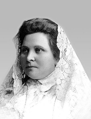
<span class="mw-page-title-main">Maria-Ivanna Hrushevska</span> Spouse of Ukrainian political leader Mykhailo Hrushevsky

Maria-Ivanna Sylvestrivna Hrushevska was a spouse of Ukrainian political leader Mykhailo Hrushevsky.

Krynychanske or Chervonohvardiiske is an urban-type settlement in Luhansk Oblast, Ukraine. Population: 1,323

Oleh Serhiiovych Khomenko was a Ukrainian serviceman, Major of the National Guard of Ukraine, defender of Mariupol, participant of the Russian-Ukrainian war. Hero of Ukraine (2022).

Denys Oleksiiovych Shleha is a Ukrainian serviceman, colonel of the National Guard of Ukraine, a participant of the Russian-Ukrainian war. Hero of Ukraine (2022).

Valerii Borysovych Padytel is a Ukrainian serviceman, colonel of the State Border Guard Service of Ukraine, a participant of the Russian-Ukrainian war. Hero of Ukraine (2022).

<span class="mw-page-title-main">Mlynky Cave</span> Gypsum cave system in Zalissia, Ukraine

Млинки is a gypsum cave located in the Ukrainian village of Zalissia, Zavodske Hromada, Chortkiv Raion, Ternopil Oblast.

<span class="mw-page-title-main">Marylivka</span> Former khutor in Chortkiv, Ukraine

Marylivka former khutir in Ukraine, now part of the village of Nahirianka, Chortkiv Raion, Ternopil Oblast, Ukraine.

<span class="mw-page-title-main">Oleksa Volianskyi</span> Ukrainian priest, ethnographer, cultural and educational activist

Oleksa Mykolaiovych Volianskyi was a Ukrainian priest, ethnographer, cultural and educational activist. Full member of the Shevchenko Scientific Society (1905).

<span class="mw-page-title-main">Sokolivka, Kosiv Raion, Ivano-Frankivsk Oblast</span> Rural locality in Ivano-Frankivsk Oblast, Ukraine

Sokolivka is a village in Kosiv urban hromada, Kosiv Raion, Ivano-Frankivsk Oblast, Ukraine.

Pidhaichyky is a village in Zboriv urban hromada, Ternopil Raion, Ternopil Oblast, Ukraine.

<span class="mw-page-title-main">Roman Darmohrai</span> Ukrainian soldier (born 1993)

Roman Anatoliiovych Darmohrai is a Ukrainian soldier, Pidpolkovnyk of the 72nd Mechanized Brigade of the Armed Forces of Ukraine, a participant in the Russian-Ukrainian war.

<span class="mw-page-title-main">Nadiia Morykvas</span> Ukrainian writer (born 1952)

Nadiia Myroslavivna Morykvas is a Ukrainian writer, essayist, literary critic, candidate of Philological Sciences (2008), and member of the National Union of Journalists (1983) and Writers of Ukraine (1995).

Lypivka is a village in Makariv settlement hromada, Bucha Raion, Kyiv Oblast, Ukraine.

Pavlo Zaporizhskyi was a Ukrainian Icon painter, soldier, lieutenant of the UPR Army (1919–1920).

References

  1. 1 2 3 Донщина / А. І. Жуковський // Енциклопедія Сучасної України [Електронний ресурс] / Редкол. : І. М. Дзюба, А. І. Жуковський, М. Г. Железняк [та ін.] ; НАН України, НТШ. – К. : Інститут енциклопедичних досліджень НАН України, 2008.
  2. Smele, Jon (2015). Historical dictionary of the Russian civil wars, 1916-1926. Lanham, Maryland: Rowman & Littlefield Publishers. p. 334. ISBN   9781442252813.
  3. 1 2 "Область Войска Донского". Soviet Historical Encyclopedia . pp. 395–396.
  4. "Annex. Statistical indicators reference". Demoscope Weekly. Retrieved 2024-03-06.

47°26′09″N40°05′55″E / 47.4358°N 40.0986°E / 47.4358; 40.0986