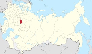
Kirov Oblast is a federal subject of Russia located in Eastern Europe. Its administrative center is the city of Kirov. As of the 2010 census, the population is 1,341,312.

Kazan Governorate was an administrative-territorial unit (guberniya) of the Tsardom of Russia, the Russian Empire, and the Russian SFSR from 1708 to 1920, with its capital in Kazan.

Smolensk Governorate was an administrative-territorial unit (guberniya) of the Tsardom of Russia, the Russian Empire, and the Russian SFSR. It existed, with interruptions, between 1708 and 1929.

The Russian Empire census, formally the First general census of the population of the Russian Empire in 1897, was the first and only nation-wide census performed in the Russian Empire. The census recorded demographic data as of 9 February 1897 [O.S. 28 January]; with a population of 125,640,021, it made Russia the world's third-most populated country at the time, after the British and Qing empires. Although the census was performed in most of the empire, no enumeration was done in the Grand Duchy of Finland.

Minsk Governorate was an administrative-territorial unit (guberniya) of the Russian Empire, with its capital in Minsk. It was created from the land acquired in the partitions of Poland and existed from 1793 until 1921. Its territory covered the majority of modern-day Belarus.

The Baku Governorate, known before 1859 as the Shemakha Governorate, was a province (guberniya) of the Caucasus Viceroyalty of the Russian Empire, with its center in the booming metropolis and Caspian Sea port of Baku. Area (1897): 34,400 sq. versts, population (1897): 789,659. The Baku Governorate bordered Persia to the south, the Elizavetpol Governorate to the west, the Dagestan Oblast to the north, and the Baku gradonachalstvo to the east on the Absheron Peninsula.

Yekaterinoslav Governorate was an administrative-territorial unit (guberniya) of the Russian Empire, with its capital in Yekaterinoslav. It bordered Poltava Governorate to the north, Don Host Oblast to the east, Sea of Azov to the southeast, Taurida Governorate to the south, and Kherson Governorate to the east, and covered the area of the Luhansk, Donetsk, Dnipropetrovsk, and Zaporizhzhia Oblasts of modern Ukraine.

Yeniseysk Governorate was an administrative-territorial unit (guberniya) of the Russian Empire, the Russian Republic, and the Russian SFSR in 1822–1925. It was named after Yeniseysk.

Vologda Governorate, also known as the Government of Vologda, was an administrative-territorial unit (guberniya) of the Russian Empire and the Russian SFSR, which existed from 1796 until 1929. Its administrative center was in the city of Vologda.

Siberia Governorate was an administrative-territorial unit (guberniya) of the Tsardom of Russia and the Russian Empire, which existed from 1708 until 1782. Its seat was in Tobolsk. The governorate was located in the east of Russian Empire and bordered China in the south, Kazan Governorate in the southwest, and Archangelgorod Governorate in the northwest. In the north and the east, the governorate was limited by the seas of the Arctic and Pacific Oceans. In terms of area, Siberia Governorate was by far the biggest of all the governorates, as it included areas in the Urals, Siberia, and the Russian Far East some of which were not yet even settled by Russians at the time.

Ufa Governorate was an administrative-territorial unit (guberniya) of the Russian Empire with its capital in the city of Ufa. It was created in 1865 by separation from Orenburg Governorate. On June 14, 1922 the governorate was transformed into the Bashkir Autonomous Soviet Socialist Republic. It occupied an area of 122,005 square kilometres (47,106 sq mi) and the territory of governorate was divided to six uyezds.

Vitebsk Governorate was an administrative-territorial unit (guberniya) of the Russian Empire, with the seat of governorship in Vitebsk. It was established in 1802 by splitting Belarusian Governorate and existed until 1924. Today most of the area belongs to Belarus, the northwestern part to Latvia and the northeastern part to Pskov and Smolensk Oblasts of Russia.Together with the Vilna, Kovno, Grodno, Minsk, and Mogilev Governorates, it formed the Northwestern Krai. The provincial city was Vitebsk, the largest city was Dvinsk.

Tver Governorate was an administrative-territorial unit (guberniya) of the Russian Empire and the Russian SFSR, which existed from 1796 until 1929. Its seat was in Tver. The governorate was located in the north of the European part of the Russian Empire and bordered Novgorod Governorate in the north, Yaroslavl Governorate in the east, Vladimir Governorate in the southeast, Moscow Governorate in the south, Smolensk Governorate in the southwest, and Pskov Governorate in the west.

Simbirsk Governorate was an administrative-territorial unit (guberniya) of the Russian Empire and the Russian SFSR, which existed from 1796 to 1928. Its administrative center was in the city of Simbirsk, renamed Ulyanovsk in 1924.
Yelabuzhsky Uyezd was one of the subdivisions of the Vyatka Governorate of the Russian Empire. It was situated in the southern part of the governorate. Its administrative centre was Yelabuga.

Malmyzhsky Uyezd was one of the subdivisions of the Vyatka Governorate of the Russian Empire. It was situated in the southern part of the governorate. Its administrative centre was Malmyzh.
Sarapulsky Uyezd was one of the subdivisions of the Vyatka Governorate of the Russian Empire. It was situated in the southeastern part of the governorate. Its administrative centre was Sarapul.
Slobodskoy Uyezd was one of the subdivisions of the Vyatka Governorate of the Russian Empire. It was situated in the northern part of the governorate. Its administrative centre was Slobodskoy.
Urzhumsky Uyezd was one of the subdivisions of the Vyatka Governorate of the Russian Empire. It was situated in the southern part of the governorate. Its administrative centre was Urzhum.

Vyatka Land is a historical region in the basin of the Vyatka River, approximately corresponding to modern-day Kirov Oblast in Russia.


