Knocknafenaig

Last updated

Knocknafenaig
Knocknafenaig.jpg
The ruins of Knocknafenaig
Argyll and Bute UK location map.svg
Red pog.svg
Knocknafenaig
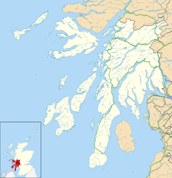
Location within Argyll and Bute
Civil parish
Council area
Country Scotland
Sovereign state United Kingdom
Police Scotland
Fire Scottish
Ambulance Scottish
List of places
UK
Scotland
Coordinates: 56°17′52″N6°15′18″W / 56.29778°N 6.25500°W / 56.29778; -6.25500

Knocknafenaig (Scottish Gaelic : Cnoc na Fennaig) is a ruined township on the Isle of Mull, Scotland.

Located in the south-western portion of the island known as the Ross of Mull, Knocknafenaig is an extremely well preserved township that shows many characteristics of the 19th-century and early 20th-century living conditions. Although it is believed to have had medieval settlements, almost no evidence remains of these due to their organic nature. Among the many ruins is a well preserved corn-drying kiln and house, known as Braigh. The Braigh is the last remaining thatched building in the Ross of Mull and was inhabited until the mid-1980s.

The name Cnoc na Fennaig translates as "Hill of the Lazybeds" (this being a reference to the type of cultivation used throughout the area).

In 1779 the township had a population of 70. After the Highland Clearances and the Potato Famine in the mid-19th century the township became increasingly deserted. After World War I Knocknafenaig was divided into six crofts for returning servicemen. Eventually the six crofts were combined to become Ardachy Farm.
Related Research Articles

Iona Island off the west coast of Scotland

Iona is a small island in the Inner Hebrides, off the Ross of Mull on the western coast of Scotland. It is mainly known for Iona Abbey, though there are other buildings on the island. Iona Abbey was a centre of Gaelic monasticism for three centuries and is today known for its relative tranquility and natural environment. It is a tourist destination and a place for spiritual retreats. Its modern Scottish Gaelic name means "Iona of (Saint) Columba".

<span class="mw-page-title-main">Scottish Highlands</span> Cultural and historical region of Scotland

The Highlands is a historical region of Scotland. Culturally, the Highlands and the Lowlands diverged from the Late Middle Ages into the modern period, when Lowland Scots replaced Scottish Gaelic throughout most of the Lowlands. The term is also used for the area north and west of the Highland Boundary Fault, although the exact boundaries are not clearly defined, particularly to the east. The Great Glen divides the Grampian Mountains to the southeast from the Northwest Highlands. The Scottish Gaelic name of A' Ghàidhealtachd literally means "the place of the Gaels" and traditionally, from a Gaelic-speaking point of view, includes both the Western Isles and the Highlands.

Isle of Lewis Region of Lewis and Harris island, Scotland

The Isle of Lewis or simply Lewis is the northern part of Lewis and Harris, the largest island of the Western Isles or Outer Hebrides archipelago in Scotland. The two parts are frequently referred to as if they were separate islands. The total area of Lewis is 683 square miles (1,770 km2).

Inner Hebrides Archipelago off the west coast of mainland Scotland

The Inner Hebrides is an archipelago off the west coast of mainland Scotland, to the south east of the Outer Hebrides. Together these two island chains form the Hebrides, which experience a mild oceanic climate. The Inner Hebrides comprise 35 inhabited islands as well as 44 uninhabited islands with an area greater than 30 hectares. Skye, Mull, and Islay are the three largest, and also have the highest populations. The main commercial activities are tourism, crofting, fishing and whisky distilling. In modern times the Inner Hebrides have formed part of two separate local government jurisdictions, one to the north and the other to the south. Together, the islands have an area of about 4,130 km2 (1,594 sq mi), and had a population of 18,948 in 2011. The population density is therefore about 4.6 inhabitants per square kilometre.

Inverness City in the Highlands of Scotland

Inverness is a city in the Scottish Highlands. It is the administrative centre for The Highland Council and is regarded as the capital of the Highlands. Historically it served as the county town of the county of Inverness-shire. Inverness lies near two important battle sites: the 11th-century battle of Blàr nam Fèinne against Norway which took place on the Aird, and the 18th century Battle of Culloden which took place on Culloden Moor. It is the northernmost city in the United Kingdom and lies within the Great Glen at its northeastern extremity where the River Ness enters the Beauly Firth. At the latest, a settlement was established by the 6th century with the first royal charter being granted by Dabíd mac Maíl Choluim in the 12th century. Inverness and Inverness-shire are closely linked to various influential clans, including Clan Mackintosh, Clan Fraser and Clan MacKenzie.

Sutherland Historic county in Scotland

Sutherland is a historic county, registration county and lieutenancy area in the Highlands of Scotland. Its county town is Dornoch. Sutherland borders Caithness and Moray Firth to the east, Ross-shire and Cromartyshire to the south and the Atlantic to the north and west. Like its southern neighbour Ross-shire, Sutherland has some of the most dramatic scenery in Europe, especially on its western fringe where the mountains meet the sea. These include high sea cliffs, and very old mountains composed of Precambrian and Cambrian rocks.

Highland Land League

The first Highland Land League emerged as a distinct political force in Scotland during the 1880s, with its power base in the country's Highlands and Islands. It was known also as the Highland Land Law Reform Association and the Crofters' Party. It was consciously modelled on the Irish Land League.

Braemar is a village in Aberdeenshire, Scotland, around 58 miles (93 km) west of Aberdeen in the Highlands. It is the closest significantly-sized settlement to the upper course of the River Dee sitting at an elevation of 339 metres (1,112 ft).

Uig, Lewis Human settlement in Scotland

Uig, also known as Sgìr' Ùig, is a civil parish and community in the west of the Isle of Lewis in the Outer Hebrides, Scotland. The Parish of Uig is one of the four civil parishes of the Isle of Lewis. It contains the districts of Carloway, East Uig, Bernera and West Uig. The name derives from the Norse word Vik meaning 'a bay'.

Bunessan Human settlement in Scotland

Bunessan is a small village on the Ross of Mull in the south-west of the Isle of Mull, off the west coast of Scotland. The settlement is within the parish of Kilfinichen and Kilvickeon, and is situated on the A849.

Knockan Human settlement in Scotland

Knockan is a township of six crofts in the community of Ardtun, in the south of the Isle of Mull off the west coast of Scotland.

Point, Lewis

Point, also known as the Eye Peninsula, is a peninsula some 11 km long in the Outer Hebrides, Scotland. The majority of Point is connected to the rest of the Isle of Lewis by a narrow isthmus, one mile in length and at one point barely 100 metres wide. The peninsula is just 6 km east of the regional capital of Stornoway, however the district of Point actually starts at the Parkend estate on Stornoway's outskirts. Point is home to around 2,600 people and is one of the few districts of the Western Isles where the population is increasing. There are about 17 villages and hamlets in Point: Melbost (Mealabost), Branahuie, Aignish (Aiginis), Knock, Swordale (Suardail), Garrabost, Lower Bayble, Eagleton, Upper Bayble, Shulishader, Sheshader (Seisiader), Flesherin (Fleisirin), Cnoc Amhlaigh, Portnaguran, Aird, Broker (Brocair), and Portvoller.

Kenmore, Perth and Kinross Human settlement in Scotland

Kenmore is a small village in Perthshire, in the Highlands of Scotland, located where Loch Tay drains into the River Tay.

Carloway Human settlement in Scotland

Carloway is a crofting township and a district on the west coast of the Isle of Lewis, in the Outer Hebrides, Scotland. The district has a population of around 500. Carloway township is within the parish of Uig, and is situated on the A858.

Torrin Human settlement in Scotland

Torrin is a settlement on the island of Skye in Scotland.

Auchindrain Human settlement in Scotland

Auchindrain lies on the A83, 6 miles (10 km) south of Inveraray in Argyll and Bute, Scotland. It is the only township to survive substantially unaltered from amongst the many hundreds that existed across the Scottish Highlands before the Highland Clearances of the late 18th and 19th centuries. The major feature of the museum is the 22 buildings and building remains of the township. Twelve of these buildings are mainly complete, with the remains of the other 10 either needing or undergoing restoration work. Much of this work is carried out by volunteers and enthusiasts like the West of Scotland Dry Stone Walling Association.

Ross of Mull

The Ross of Mull is the largest peninsula of the Isle of Mull, about 28 kilometres (17 mi) long, and makes up the south-western part of the island. It is bounded to the north by Loch Scridain and to the south by the Firth of Lorne. The main villages are Bunessan and Fionnphort, with smaller settlements including Ardtun, Camas, Carsaig, Knockan, Pennyghael and Uisken. Knocknafenaig, Suidhe, and Shiaba are three of the many cleared settlements on the Ross.

Tain & District Museum Local history museum in Tain, Scotland

The Tain & District Museum, is located in Tain, Ross-shire, Scotland. It is volunteer-run and is open April to October part of the Tain Through Time visitor centre. The museum was established in 1966 and has a collection of silver made in the local area.

Loch na Keal Body of water

Loch na Keal, meaning Loch of the Kyle, or Narrows, also Loch of the Cliffs, is the principal sea loch on the western, or Atlantic coastline of the island of Mull, in the Inner Hebrides, Argyll and Bute, Scotland. Loch na Keal extends over 20 kilometres (12 mi) inland, almost bisecting Mull, and extending to within 5 km (3 mi) of the eastern shore. The loch gives its name to the Loch na Keal National Scenic Area, one of forty national scenic areas in Scotland.

Shiaba Human settlement in Scotland

Shiaba is a ruined township located on the southwestern peninsula of the Isle of Mull, Scotland. It lies about 8 km to the east of the village of Bunessan, beyond Loch Assapol and Scoor House. It was awarded the status of Scheduled monument in 1993 due to its significance as a source of information about 18th and 19th century rural life in Scotland.

References

1. Ross of Mull Historical Centre, 2004 Discover The Ross...Uisken, Knocknafenaig & Ardalanish. Bunessan. Ross of Mull Historical Centre.