Uisken

Last updated

Uisken
Port Uisken, Mull - geograph.org.uk - 25162.jpg
The coastline at Uisken
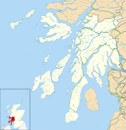
Argyll and Bute UK location map.svg
Red pog.svg
Uisken
Location within Argyll and Bute
Population6 
OS grid reference NM388189
Civil parish
Council area
Lieutenancy area
Country Scotland
Sovereign state United Kingdom
Post town ISLE OF MULL
Postcode district PA67
Dialling code 01681
Police Scotland
Fire Scottish
Ambulance Scottish
UK Parliament
Scottish Parliament
List of places
UK
Scotland
56°17′28″N6°13′16″W / 56.291°N 6.221°W / 56.291; -6.221

Uisken (Scottish Gaelic : Uisgean, meaning "water-bay") is a settlement on a sandy bay on the Ross of Mull in the south of the Isle of Mull, on the west coast of Scotland. The settlement is within the parish of Kilfinichen and Kilvickeon. [1]

Originally a series of small settlements before the clearances it was developed as a fishing and crofting settlement with a small quay, known as Port Uisken, and road over to the steamer pier at Bunessan, the development being funded by the Duke of Argyll. The quay soon fell into disrepair but crofting continued with seven crofts being mentioned in the early 1920s and three crofts still being worked today.

A cairn is prominent on the eastern skyline. This is believed to mark the funeral route that coffins used to be carried to the old chapel at Scoor. There is also a large standing stone on the same ridge as the cairn about 500m to the north but this cannot be seen from Uisken. [2]

The population is 6 (2014).
Related Research Articles

<span class="mw-page-title-main">Calgary, Mull</span> Hamlet on the Isle of Mull, Scotland

Calgary is a hamlet on the northwest coast of the Isle of Mull, in Argyll and Bute, Scotland, United Kingdom. The hamlet is within the parish of Kilninian and Kilmore. It was the origin of the name of Fort Calgary in Canada, which became the city of Calgary, Alberta.

<span class="mw-page-title-main">Port Bannatyne</span> Human settlement in Scotland

Port Bannatyne, is a coastal village on the Isle of Bute, Firth of Clyde, Scotland that is home to many steamers. Port Bannatyne developed into the 1900s as a quieter alternative to Rothesay. It is a popular harbour, with a small yacht marina and boatyard and an unusual 13-hole golf course rather than the standard 18.

<span class="mw-page-title-main">Bunessan</span> Human settlement in Scotland

Bunessan, meaning "bottom of the waterfall", is a small village on the Ross of Mull, a peninsula in the south-west of the Isle of Mull, off the west coast of Scotland. The settlement is at OS grid reference NM382218, within the parish of Kilfinichen and Kilvickeon, and is situated on the A849, at the head of a cove at the southern end of Loch na Làthaich.

<span class="mw-page-title-main">Kintra</span> Human settlement in Scotland

Kintra, literally "country" in Scots is a settlement on the North-Western coast of the Ross of Mull, Scotland. The settlement is within the parish of Kilfinichen and Kilvickeon. It has approximately 15 permanent residents, in addition to seasonal or recreational visitors. Most of the settlement is in the form of a line of houses parallel to the shore.

<span class="mw-page-title-main">Craignure</span> Ferry port on Isle of Mull, Scotland

Craignure is a village and the main ferry port on the Isle of Mull, Argyll and Bute, Scotland. The village is within the parish of Torosay.

<span class="mw-page-title-main">Aignish</span> Human settlement in Scotland

Aignish is located northwest of Knock and east of Stornoway on the east coast of the Isle of Lewis, in the Outer Hebrides, Scotland. The township is at the island side of the isthmus connecting to the Eye peninsula. Aignish is within the parish of Stornoway, and is situated on the A866 between Stornoway and Portnaguran.

<span class="mw-page-title-main">Barvas</span> Settlement, community and civil parish on the Isle of Lewis in Scotland

Barvas is a settlement, community and civil parish on the Isle of Lewis in Scotland. It developed around a road junction. The A857 and A858 meet at the southern end of Barvas. North is the road to Ness; west takes the traveller to Carloway and the West Side; south runs the road to Stornoway. According to the 2011 Census it still had the highest concentration of Scottish Gaelic speakers in Scotland with 2,037. This fell to 55% in 2022.

<span class="mw-page-title-main">Balallan</span> Human settlement in Scotland

Balallan, meaning "Allan's Town", is a crofting township on the Isle of Lewis, in the Outer Hebrides, Scotland. Balallan is within the parish of Lochs.

<span class="mw-page-title-main">Skigersta</span> Human settlement in Scotland

Skigersta is a village to the south east of Ness on the Isle of Lewis, in the Outer Hebrides, Scotland. It is the easternmost settlement in the Ness district and is 5km (3miles) southeast of the Butt of Lewis. Skigersta is situated within the parish of Barvas. There is a quay built in 1901 and a shingle beach. The area of Skigersta near the shore is called 'Lathamor'. To the south of Skigersta the moor begins and the road turns into a peat track; there are sheilings on the moor at Cuisiadar and if you follow the moor further south you reach the road at New Tolsta.

<span class="mw-page-title-main">Breasclete</span> Village in the Outer Hebrides, Scotland

Breasclete is a village and community on the west side of the Isle of Lewis, in the Outer Hebrides, Scotland. Breasclete is within the parish of Uig, and is situated adjacent to the A858.

<span class="mw-page-title-main">Callanish IV</span>

The Callanish IV stone circle is one of many megalithic structures around the better-known Calanais I on the west coast of the Isle of Lewis, in the Outer Hebrides, Scotland. It is a scheduled monument and its official name is Sron a'Chail. The site was first surveyed and recorded by RCAHMS in 1914 and again in 2009, with another survey in the 1970s by other archaeologists, but no known archaeological excavations have taken place at the stones.

<span class="mw-page-title-main">Knocknafenaig</span> Human settlement in Scotland

Knocknafenaig is a ruined township on the Isle of Mull, Scotland.

<span class="mw-page-title-main">Calve Island</span> Uninhabited island on the west coast of Scotland

Calve Island is an uninhabited low-lying island off the east coast of the Isle of Mull in Argyll and Bute on the west coast of Scotland. A whitewashed farmhouse with substantial outbuildings stands on the western shore, used as a summer residence. The island is 1+14 miles in length, and 12 mile wide at its widest point. Calve is owned by the Cotton family who make use of it in the summer months.

<span class="mw-page-title-main">Ardroil</span> Human settlement in Scotland

Ardroil is a village on the Isle of Lewis in the Outer Hebrides, Scotland. Ardroil is within the parish of Uig.

<span class="mw-page-title-main">Bogach</span> Human settlement in Scotland

Bogach is a village on the island of Barra in the Outer Hebrides, Scotland. Bogach is also within the parish of Barra, and is situated on a minor road, linked to the A888. It consists of just 8 crofts, each of which lies on a small strip of land running from north coast to south. It separates the main island at Bagherivagh from the peninsula known as Bruairnis.

<span class="mw-page-title-main">Assater</span> Human settlement in Scotland

Assater is a hamlet on Mainland, in Shetland, Scotland. Assater is situated in the parish of Northmaven. It is about 1.3 miles (2.1 km) northwest of Urafirth and 1.2 miles (1.9 km) southeast of Heylor by road.

<span class="mw-page-title-main">Salen, Mull</span> Human settlement in Scotland

Salen is a settlement on the Isle of Mull, Scotland. It is on the east coast of the island, on the Sound of Mull, approximately halfway between Craignure and Tobermory at the narrowest part of the island. The full name of the settlement is 'Sàilean Dubh Chaluim Chille'. In 1991 it had a population of 500.

<span class="mw-page-title-main">Cromore</span> Human settlement in Scotland

Cromore is a crofting township on the Isle of Lewis in the district of Pairc, in the Outer Hebrides, Scotland. The settlement is within the parish of Lochs. Cromore is about 27 miles away by road from Stornoway, the nearest town.

<span class="mw-page-title-main">Aird Uig</span> Human settlement in Scotland

Aird Uig is a village on the Isle of Lewis, in the Outer Hebrides, Scotland. Aird Uig is within the parish of Uig, and is situated on the C40 minor road which joins to the B8011 at Timsgarry. The township includes 700 hectares of common grazings to the east and west of the village.

<span class="mw-page-title-main">Rubha an Dùnain</span> Peninsula in Scotland

Rubha an Dùnain or Rubh' an Dùnain is an uninhabited peninsula to the south of the Cuillin hills on the Isle of Skye in Scotland. It contains unique archaeological sites which in 2017 were designated as a historic monument of national importance by Historic Environment Scotland.

References

  1. "Details of Uisken". Scottish Places. Retrieved 31 December 2014.
  2. "Mull, Druim Fan". Royal Commission on the Ancient and Historical Monuments of Scotland . Retrieved 31 December 2014.