Ulva Ferry

Last updated

Ulva Ferry
Hoy Lass at Ulva Ferry - geograph.org.uk - 1462914.jpg
Ulva Ferry, with the Isle of Ulva in the background
Argyll and Bute UK location map.svg
Red pog.svg
Ulva Ferry
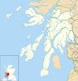
Location within Argyll and Bute
OS grid reference NM445398
Council area
Lieutenancy area
Country Scotland
Sovereign state United Kingdom
Post town ISLE OF MULL
Postcode district PA73
Dialling code 01688
Police Scotland
Fire Scottish
Ambulance Scottish
UK Parliament
Scottish Parliament
List of places
UK
Scotland
56°29′02″N6°08′28″W / 56.484°N 6.141°W / 56.484; -6.141

Ulva Ferry (Scottish Gaelic : Caolas Ulbha) is a hamlet on the Hebridean island of Mull, on its west coast.

Ulva Ferry is on the shore of Ulva Sound (Caolas Ulbha) and the ferry connects Mull and the island of Ulva (Ulbha). Ulva Primary School is located at Ulva Ferry, rather than on the island of Ulva itself.[ citation needed ]


Related Research Articles

<span class="mw-page-title-main">Argyll and Bute</span> Council area of Scotland

Argyll and Bute is one of 32 unitary council areas in Scotland and a lieutenancy area. The current lord-lieutenant for Argyll and Bute is Jane Margaret MacLeod. The administrative centre for the council area is in Lochgilphead at Kilmory Castle, a 19th-century Gothic Revival building and estate. The current council leader is Councillor Jim Lynch.

<span class="mw-page-title-main">Staffa</span> Island of the Inner Hebrides in Argyll and Bute, Scotland

Staffa is an island of the Inner Hebrides in Argyll and Bute, Scotland. The Vikings gave it this name as its columnar basalt reminded them of their houses, which were built from vertically placed tree-logs.

<span class="mw-page-title-main">Isle of Mull</span> Island off the coast of Scotland

The Isle of Mull or simply Mull is the second-largest island of the Inner Hebrides and lies off the west coast of Scotland in the council area of Argyll and Bute.

<span class="mw-page-title-main">Ulva</span> Island in the Inner Hebrides of Scotland

Ulva is a small island in the Inner Hebrides of Scotland, off the west coast of Mull. It is separated from Mull by a narrow strait, and connected to the neighbouring island of Gometra by a bridge. Much of the island is formed from Cenozoic basalt rocks, which are formed into columns in places.

<span class="mw-page-title-main">Loch Leven (Highlands)</span> Sea loch in Highland, Scotland, UK

Loch Leven is a sea loch located onto the west coast of Scotland. It is spelled Loch Lyon in Timothy Pont's map of the area and is pronounced Li' un. However, the local Gaelic pronunciation is Lee' oon

Gometra is an island in the Inner Hebrides of Scotland, lying west of Mull. It lies immediately west of Ulva, to which it is linked by a bridge, and at low tide also by a beach. It is approximately 425 hectares in size. The name is also applied to the island summit, which is a Marilyn. The island has been owned since 1991 by Roc Sandford, a wealthy environmental campaigner who lives mostly in London and part of the year on Gometra.

<span class="mw-page-title-main">Ben More (Mull)</span> 966m high mountain in Scotland

Ben More is the highest mountain and only Munro on the Isle of Mull, Scotland. It is also the highest peak in the Scottish isles – and the only Munro – apart from those on the Isle of Skye. The mountain is situated close to the centre of the island, above the shores of Loch na Keal.

<span class="mw-page-title-main">Ulva Island (New Zealand)</span> Island in New Zealand

Ulva Island is a small island about 3.5 km (2.17 mi) long lying within Paterson Inlet, which is part of Stewart Island / Rakiura in New Zealand.

<span class="mw-page-title-main">Island of Danna</span> Inhabited tidal island in Argyll and Bute

The Island of Danna or Danna, is an inhabited tidal island in Argyll and Bute.

This is a list of islands in Scotland with the name Garbh Eilean or similar, meaning "rough island" in Scottish Gaelic.

<span class="mw-page-title-main">Salen, Mull</span> Human settlement in Scotland

Salen is a settlement on the Isle of Mull, Scotland. It is on the east coast of the island, on the Sound of Mull, approximately halfway between Craignure and Tobermory at the narrowest part of the island. The full name of the settlement is 'Sàilean Dubh Chaluim Chille'. In 1991 it had a population of 500.

<span class="mw-page-title-main">Tobermory High School</span> Local authority, all-through school in Tobermory, Isle of Mull, Scotland

Tobermory High School is the only secondary school on the Isle of Mull. It is located in Tobermory, at the northern end of the island.

<span class="mw-page-title-main">Sound of Harris</span>

The Sound of Harris is a channel between the islands of Harris and North Uist in the Outer Hebrides of Scotland.

<span class="mw-page-title-main">Orosay</span> Tidal Island by Barra, Scotland

Orosay is a small uninhabited tidal island in the Sound of Barra lying at the north end of Traigh Mhòr, the "big beach" on the north east coast of Barra. It is one of ten islands in the Sound of Barra, a Site of Community Importance for conservation in the Outer Hebrides of Scotland. It is about 30 hectares in extent and the highest point is 38 metres (125 ft).

<span class="mw-page-title-main">Sound of Mull</span> Sound between the Inner Hebridean island of Mull and mainland Scotland

The Sound of Mull is a sound between the Inner Hebridean island of Mull and mainland Scotland. It forms part of the Atlantic Ocean.

Eas Fors is a waterfall on the island of Mull in Scotland. It is situated on the Ardow Burn south of Dervaig. There is another Eas Fors on the Allt an Eas Fors on the west coast of Mull north of Ulva Ferry.

<span class="mw-page-title-main">Loch na Keal</span> Sea loch in Argyll and Bute, Scotland

Loch na Keal, meaning Loch of the Kyle, or Narrows, also Loch of the Cliffs, is the principal sea loch on the western, or Atlantic coastline of the island of Mull, in the Inner Hebrides, Argyll and Bute, Scotland. Loch na Keal extends over 20 kilometres (12 mi) inland, almost bisecting Mull, and extending to within 5 km (3 mi) of the eastern shore. The loch gives its name to the Loch na Keal National Scenic Area, one of forty national scenic areas in Scotland.

Ulva in literature and the arts refers to the literary and artistic connections to the island of Ulva in the Hebrides of Scotland.

<span class="mw-page-title-main">Kilninian and Kilmore</span> Civil parish on Isle of Mull, Scotland

Kilninian and Kilmore is a civil parish on the Isle of Mull in the county of Argyll, Scotland, part of the Argyll and Bute council area. It is one of three parishes on the island and extends over the north-western part. It is bordered by the parish of Torosay in the south-east. It extends about 15 miles north-west to south-east and is 13 miles wide.