Dervaig

Last updated

Dervaig
Church at Dervaig.jpg
The unusual round tower of the church
Argyll and Bute UK location map.svg
Red pog.svg
Dervaig
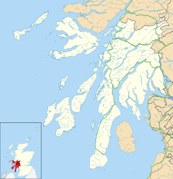
Location within Argyll and Bute
OS grid reference NM432518
Community council
Council area
Lieutenancy area
Country Scotland
Sovereign state United Kingdom
Post town ISLE OF MULL
Postcode district PA75 6
Dialling code 01688
Police Scotland
Fire Scottish
Ambulance Scottish
UK Parliament
Scottish Parliament
List of places
UK
Scotland
56°35′17″N6°10′59″W / 56.588°N 6.183°W / 56.588; -6.183

Dervaig (Scottish Gaelic : Dearbhaig) is a small village on the Isle of Mull off the west coast of Scotland. [1] The village is within the parish of Kilninian and Kilmore, [1] and is situated on the B8073 [2] roughly midway between Tobermory and Calgary. In 1961 it had a population of 82. [1]
Contents

Etymology

Both the English name Dervaig and the Gaelic name Dearbhaig are derived from the Old Norse Dervig, meaning "Good inlet", [3] referring to Loch a' Chumhainn, which the town sits on.

Church

The town is known for its unusual round church Kilmore Church. The original church was built in 1755, however, there is not a complete description of it in the records, so it is unknown what it looked liked. [4] It was built to replace the nearby Church of Kilcolmkil and is thought to be very similar to the church of Kilninian which was built at a similar time but still stands. [4]

The existing church was built in 1905, being designed by Glasgow architect Peter MacGregor Chalmers with stained glass by Stephen Adam. [5] The "pencil" shape design of the tower is an uncommon sight nowadays in Scotland, however many similar churches still survive in Ireland. [4] The church was renovated in 2004. [4]

Other sites

The Bellachroy Hotel is the Isle of Mull's oldest inn, dating back to 1608. [6] The main street of the town was planned and established by Alexander Mclean of Coll in 1799. [3]

Related Research Articles

<span class="mw-page-title-main">Isle of Mull</span> Island off the coast of Scotland

The Isle of Mull or just Mull is the second-largest island of the Inner Hebrides and lies off the west coast of Scotland in the council area of Argyll and Bute.

<span class="mw-page-title-main">Argyll</span> Historic county in Scotland

Argyll, sometimes called Argyllshire, is a historic county and registration county of western Scotland.

<span class="mw-page-title-main">Rodel</span> Human settlement in Scotland

Rodel is a village on the south-eastern coast of Harris, an island in the Scottish Outer Hebrides. Rodel is situated in the parish of Harris. It was historically the capital of Harris, and the main port, before Tarbert took the title.

<span class="mw-page-title-main">Calgary, Mull</span> Human settlement in Scotland

Calgary is a hamlet on the northwest coast of the Isle of Mull, in Argyll and Bute, Scotland, United Kingdom. The hamlet is within the parish of Kilninian and Kilmore. It was the origin of the name of Fort Calgary in Canada, which became the city of Calgary, Alberta.

<span class="mw-page-title-main">Port Bannatyne</span> Human settlement in Scotland

Port Bannatyne, is a coastal village on the Isle of Bute, Firth of Clyde, Scotland that is home to many steamers. Port Bannatyne developed into the 1900s as a quieter alternative to Rothesay. It is a popular harbour, with a small yacht marina and boatyard and an unusual 13-hole golf course rather than the standard 18.

<span class="mw-page-title-main">Bunessan</span> Human settlement in Scotland

Bunessan, meaning "bottom of the waterfall", is a small village on the Ross of Mull, a peninsula in the south-west of the Isle of Mull, off the west coast of Scotland. The settlement is at OS grid reference NM382218, within the parish of Kilfinichen and Kilvickeon, and is situated on the A849, at the head of a cove at the southern end of Loch na Làthaich.

<span class="mw-page-title-main">Castlebay</span> Village on the island of Barra

Castlebay is the main village and a community council area on the island of Barra in the Outer Hebrides, Scotland. The village is located on the south coast of the island, and overlooks a bay in the Atlantic Ocean dominated by Kisimul Castle, as well as nearby islands such as Vatersay. Castlebay is also within the parish of Barra. The village is located on the A888, which serves as a circular road around Barra. In 1971 it had a population of 307.

<span class="mw-page-title-main">Gatehouse of Fleet</span> Human settlement in Scotland

Gatehouse of Fleet is a town, half in the civil parish of Girthon, and half in the parish of Anwoth, divided by the river Fleet, Kirkcudbrightshire, within the council administrative area of Dumfries and Galloway, Scotland.

<span class="mw-page-title-main">Craignure</span> Ferry port on Isle of Mull, Scotland

Craignure is a village and the main ferry port on the Isle of Mull, Argyll and Bute, Scotland. The village is within the parish of Torosay.

<span class="mw-page-title-main">Fauldhouse</span> Human settlement in Scotland

Fauldhouse is a village in West Lothian, Scotland. It is about halfway between Glasgow and Edinburgh. The nearest towns to Fauldhouse are Whitburn and Livingston. Other neighbouring villages include Longridge, Shotts and Stoneyburn. At approximately 750 feet above sea level, Fauldhouse is one of the highest villages in West Lothian.

<span class="mw-page-title-main">Tarbert, Harris</span> Human settlement in Scotland

Tarbert is the main community on Harris in the Western Isles of Scotland. The name means "isthmus", "crossing point" or "portage", in Gaelic. The isthmus, between the sea lochs West Loch Tarbert and East Loch Tarbert, joins south Harris to north Harris and Lewis. In 1981 it had a population of 503.

<span class="mw-page-title-main">Tarskavaig</span> Human settlement in Scotland

Tarskavaig is a crofting village on the west coast of Sleat on the Isle of Skye in Scotland. It sits in a glen which meets Tarskavaig Bay and lies opposite the Isles of Eigg, Rum and Canna. It is often said that Tarskavaig has the best view of the Cuillin in Skye.

<span class="mw-page-title-main">Sannox</span> Human settlement in Scotland

Sannox is a village on the Isle of Arran, Scotland. The village is within the parish of Kilbride. The name comes from the name the Vikings gave to the area, Sandvik, meaning the Sandy Bay.

<span class="mw-page-title-main">Salen, Mull</span> Human settlement in Scotland

Salen is a settlement on the Isle of Mull, Scotland. It is on the east coast of the island, on the Sound of Mull, approximately halfway between Craignure and Tobermory at the narrowest part of the island. The full name of the settlement is 'Sàilean Dubh Chaluim Chille'. In 1991 it had a population of 500.

Suidhe is a ruined township located on the southwestern peninsula of the Isle of Mull, Scotland. It lies about three-quarters mile (1.2 km) to the west of the village of Bunessan in the civil parish of Kilfinichen and Kilvickeon. It was awarded the status of Scheduled monument in 2004 on the basis of its potential value as a source of information about post-medieval, and possibly medieval, settlement and economy in the Western Isles of Scotland.

Stephen Adam (1848–1910) was a 19th/20th-century Scottish influential stained glass designer. He was a pioneer of modern stained glass in Scotland. The majority of his work is in the Pre-Raphaelite style, often with a twist towards Celtic mythology, and is mainly sited in western Scotland. Although the bulk of his work is for churches he also received many secular commissions.

<span class="mw-page-title-main">Loch Frisa</span> Lake on the Isle of Mull, Inner Hebrides, Scotland

Loch Frisa is a loch on the Isle of Mull, Inner Hebrides, Scotland. It falls within the Argyll and Bute unitary authority area. The loch runs largely northwest to southeast. Its northwestern end is about halfway between Tobermory and Dervaig. It is the largest loch on the Isle of Mull and lies in the civil parish of Kilninian and Kilmore.

<span class="mw-page-title-main">Torosay</span> Civil parish on Isle of Mull, Scotland

Torosay is a civil parish on the Isle of Mull in the county of Argyll, Scotland, part of the Argyll and Bute council area. It is one of three parishes on the island and extends over the central and south-eastern part. It is bordered by the parish of Kilninian and Kilmore in the north and Kilfinichen and Kilvickeon in the south-west. It extends about 12 miles east-west and 10 miles north-south. On the north-east coast it is separated from the mainland by the Sound of Mull. On its south-east coast, part of it is almost severed from the rest of the parish by the sea lochs Spelve and Buie, together with the freshwater loch Uisg, in between. This peninsula, which includes the hamlet of Croggan, is joined to the main island by a small isthmus at Kinlochspelvie and another at the settlement of Lochbuie. There is a smaller sea loch Loch Don, which gives its name to the hamlet of Lochdon. Further north, there is a bay at Craignure which is the location of a ferry port.

<span class="mw-page-title-main">Kilfinichen and Kilvickeon</span> Civil parish on Isle of Mull, Scotland

Kilfinichen and Kilvickeon is a civil parish on the Isle of Mull in the county of Argyll, Scotland, part of the Argyll and Bute council area. It is one of three parishes on the island and extends over the south-western part and includes the islands of Iona, Erraid and Inch Kenneth. It is bordered by the parish of Torosay in the north and east. It extends about 23 miles north-east to south-west and is 18 miles wide.

<span class="mw-page-title-main">Kilninian and Kilmore</span> Civil parish on Isle of Mull, Scotland

Kilninian and Kilmore is a civil parish on the Isle of Mull in the county of Argyll, Scotland, part of the Argyll and Bute council area. It is one of three parishes on the island and extends over the north-western part. It is bordered by the parish of Torosay in the south-east. It extends about 15 miles north-west to south-east and is 13 miles wide.

References

  1. 1 2 3 "Details of Dervaig". Gazetteer for Scotland . Retrieved 30 March 2011.
  2. "B8073". Sabre. Retrieved 31 December 2014.
  3. 1 2 "Dervaig". Isle of Mull website. Retrieved 21 January 2024.
  4. 1 2 3 4 "Kilmore Parish Church". Mull Historical Society website. Retrieved 21 January 2024.
  5. "Always happy in his designs: The legacy of Stephen Adam".
  6. "The Bellachroy Hotel". Mull Historical Society website. Retrieved 21 January 2024.