
Guruvayur is a municipal temple town in Thrissur District, of Kerala State in India. It is a suburban town of Thrissur city, located 27 kilometres (17 mi) from Thrissur towards the north-west. It houses the Guruvayur Shri Krishna Temple. It is located at a distance of 292 km (181 mi) from the state capital Trivandrum towards the north-west, 80 km (50 mi) from Kochi towards the north, 90 km (56 mi) from Calicut towards south.

Thiruvambady is a major hill town and a suburb in southeastern Kozhikode district in Kerala, India. Thiruvambady is a Panchayat headquarters, and a legislative assembly constituency, situated 35 kilometres (22 mi) from the district headquarters of Kozhikode.
Ambaji (Ambājī) is a census town in Banaskantha district in the state of Gujarat, India. It is known for its historical connections with sites of cultural heritage.

Chavakkad, formerly Chowghat, is a municipality in Thrissur district of Kerala state in India. It is a suburban town of Thrissur city. Chavakkad is noted for its beach and fishing. It lies on National Highway 66 is located about 75 km (47 mi) north of the city of Kochi, 25 km (16 mi) northwest of Thrissur, and 24 km (15 mi) south of Ponnani.
Ashtamichira is a village in Thrissur district in the Indian state of Kerala.
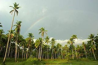
Kottapadi is a village near Guruvayur town in the district of Thrissur, Kerala, South India. Kottapadi literally translates to Gates to Fort. Kottapadi has now gained prominence Punnathurkotta for which it has been named, which used to house elephants belonging to the Guruvayoor temple. Elephants that are an integral part of certain temple rituals are boarded and trained here.

Wadakkancherry is a major town in Thrissur, Kerala. Up until 1860, this area was part of Chelakkara Taluk. Now, it is the headquarters of Talappilly Taluk.

Thenhipalam is a census town and a panchayat in Tirurangadi taluk in Malappuram district of Kerala, India, with a population of 27,273 as per 2001 census, consisting of 13,293 males and 13,980 females. Tenhipalam forms a portion of the Malappuram metropolitan area as of 2011 Census. University of Calicut, the first university in the Malabar region, is located north-west part of the Panchayat. 'Chelari' is the main commercial place in Tenhipalam panchayat while 'Panambra' is considered the headquarters of the panchayat. The small town between Chelari and the university is called Kohinoor.

Eravathur is a small village situated towards the south end of Thrissur district of Kerala state in India. This village is situated nearly 40 km (25 mi) away from Ernakulam city and nearly 45 km (28 mi) from Thrissur city.

Kanichar is a village and Grama Panchayat in Kannur district in the Indian state of Kerala.
Mullassery is a village in Thrissur district in the state of Kerala, India. It is located 20 km (12 mi) west of District Headquarters Thrissur and 278 km (173 mi) from the state capital Thiruvanathapuram. It houses Parambanthali Mahadeva temple, Good Shepherd's Church and Our Lady of Mount Carmel Church. The nearest railheads are at Guruvayoor and Thrissur. Nearby airports are Cochin International Airport and Calicut Airport. Mullassery has a wetland ecosystem which is known as Kole lands. These Kole lands are considered rice granaries. Mullassery is an agricultural village however, today majority of youth of this village are UAE expatriates.

Vatanappally (Vatanappilly/) is a panchayat and census town in Thrissur district, in the state of Kerala, India.It is a suburb of Thrissur city.

.

Chalakudi railway station is an important railway station between Irinjalakuda railway station and Divine Nagar railway station in the busy Shoranur–Cochin Harbour section in Thrissur district. Chalakudi railway station is operated by the Chennai-headquartered Southern Railways of the Indian Railways. It is an 'A' class station under Trivandrum division, and the second-largest station in Thrissur district after Thrissur railway station. It is also the first station declared as Adarsh station in Thrissur district. The nearest airport is Cochin International Airport which is 19 kilometers away from here.
Chhokran is a village in Jalandhar District of Punjab State, India. The village is administrated by Sarpanch who is elected representative of village. It is located 3.8 km (2.4 mi) away from census town Apra. Chhokran is located 45 km towards East from Jalandhar, 17.5 km (10.9 mi) from Phillaur and 120 km (75 mi) from Chandigarh. The nearest train station is situated 23 km (14 mi) away in Phillaur, nearest domestic airport is at Ludhiana and the nearest international airport is 139 km (86 mi) away in Amritsar. The village has postal head office 1 km (0.62 mi) away in Moron.
Turan is a small village in Phillaur tehsil of Jalandhar District of Punjab State, India. It is located 1 km (0.62 mi) away from the Apra-Banga road and 11 km (6.8 mi) away from the postal head office at Dosanjh Kalan. The village is 3 km (1.9 mi) away from the census town Apra, 16 km (9.9 mi) from Phillaur, 42 km (26 mi) from Jalandhar, and 120 km (75 mi) from the state capital Chandigarh. The village is administrated by Sarpanch who is elected representative of village.
Lohgarh is a medium size village in the Phillaur tehsil administrative region of Jalandhar District of Punjab State, India. It is located 3.5 km (2.2 mi) away from postal head office Apra. The village is 16.4 km (10.2 mi) away from Phillaur, 43 km (27 mi) from Jalandhar, and 120 km (75 mi) from the state capital Chandigarh. The village is administrated by a sarpanch who is an elected representative of the village as per the Panchayati raj (India) local government system.
Tehang is a large village in Phillaur tehsil of Jalandhar District of Punjab State, India. The village is administrated by Sarpanch who is the elected representative of village and it is located 3.2 km away from Nagar, 8.5 km from census town Apra, 43.5 km from Jalandhar and 120 km from state capital Chandigarh. Tehang has postal head office in tehang which is 7.4 km away from the village.
Kadiana is a medium size village in Phillaur tehsil of Jalandhar District of Punjab State, India. It is located 4.4 km (2.7 mi) from Nagar, 10 km (6.2 mi) from Phillaur, 55 km (34 mi) from Jalandhar and 117 km (73 mi) from state capital Chandigarh. The village is administrated by a sarpanch who is an elected representative of village as per Panchayati raj (India).
Ladian or Ladhian is a village in Phillaur tehsil of Jalandhar District of Punjab State, India. It is located 36 km (22 mi) from postal head office Dosanjh Kalan, 9.8 km (6.1 mi) from Ludhiana, 53.4 km (33.2 mi) from Jalandhar and 108 km (67 mi) from state capital Chandigarh. The village is administrated by a Sarpanch, an elected representative of the village.

