
The Andaman and Nicobar Islands is a union territory of India. It consists of 836 islands grouped into two island groups: the northern Andaman Islands and the southern Nicobar Islands, separated by a 150 km (93 mi) wide channel. Port Blair is the capital and largest city of the territory, located about 1,190 km (740 mi) from Chennai and 1,255 km (780 mi) from Kolkata in mainland India. The islands are sandwiched between the Bay of Bengal to the west and the Andaman Sea to the east with the northern-most point located 901 km (560 mi) from the mouth of Hooghly river. Indira Point at 6°45’10″N and 93°49’36″E at the southern tip of Great Nicobar is the southernmost point of India.

According to official estimates in India, 10,749 people were killed, 5,640 people were missing and thousands of people became homeless when a tsunami triggered by the 2004 Indian Ocean earthquake near the Indonesian island of Sumatra struck the southern coast on 26 December 2004. The earthquake registered 9.1–9.3 Mw and was the largest in five decades. It was followed by strong aftershocks on the Andaman and Nicobar Islands. The death toll of the earthquake was 1,500 people.
Car Nicobar is the northernmost of the Nicobar Islands. It is also one of three local administrative divisions of the Indian district of Nicobar, part of the Indian union territory of Andaman and Nicobar Islands. Annual rainfall is 2800 millimetres.

Port Blair is the capital city of the Andaman and Nicobar Islands, a union territory of India in the Bay of Bengal. It is also the local administrative sub-division (tehsil) of the islands, the headquarters for the district of South Andaman, and the territory's only notified town.

North Andaman Island is the northern island of Great Andaman of the Andaman Islands. It belongs to the North and Middle Andaman administrative district, part of the Indian union territory of Andaman and Nicobar Islands. the island is lying 137 km (85 mi) north from Port Blair.
Little Andaman Island is the fourth largest of the Andaman Islands of India with an area of 707 km2, lying at the southern end of the archipelago. It belongs to the South Andaman administrative district, part of the Indian union territory of Andaman and Nicobar Islands. It lies 88 km (55 mi) south of Port Blair, the capital of Andaman and Nicobar Islands.
Great Nicobar is the southernmost and largest of the Nicobar Islands of India, north of Sumatra. It is part of India, in the Nicobar district within the union territory of the Andaman and Nicobar Islands.
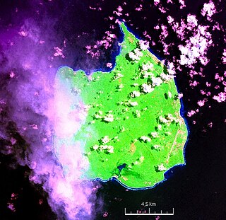
Nancowry is an island in the central part of the Nicobar Islands chain, located in the northeast Indian Ocean between the Bay of Bengal and the Andaman Sea.
Trinket Island is one of the 24 islands that make up the Nicobar Islands chain, located in the northeast Indian Ocean between the Bay of Bengal and the Andaman Sea. It is located east of Kamorta Island.

Middle Andaman Island is an island of the Andaman Islands. It belongs to the North and Middle Andaman administrative district, part of the Indian union territory of Andaman and Nicobar Islands.
Indira Point, the southernmost point of India's territory, is a village in the Nicobar district at Great Nicobar Island of Andaman and Nicobar Islands in India. It is located in the Great Nicobar tehsil.

Minicoy, locally known as Maliku, is an island in Lakshadweep, India. Along with Viringili, it is on Maliku atoll, the southernmost atoll of Lakshadweep archipelago. Administratively, it is a census town in the Indian union territory of Lakshadweep. The island is situated 425 km west of Trivandrum, the capital city of Kerala.
Mayabunder is a town and a tehsil in the northern part of Middle Andaman Island, Andaman Archipelago, India. The name is also spelled Maya Bunder or Maya Bandar. As of 2001, the county had 23,912 inhabitants, of which 3182 were in the town. It was settled in the British colonial period by immigrants from Myanmar and ex-convicts from Mainland India.
Nandyal is a city and District headquarters of Nandyal district of the Indian state of Andhra Pradesh. It is a municipality and the headquarters of Nandyal mandal in Nandyal revenue division.
Little Nicobar is one of the Nicobar Islands, India.
Interview Island is an island of the Andaman Islands. It belongs to the North and Middle Andaman administrative district, part of the Indian union territory of Andaman and Nicobar Islands. It lies 125 km (78 mi) north of Port Blair.
Located in eastern India, Bihar is the twelfth-largest Indian state, with an area of 94,163 km2 (36,357 mi2) and an average elevation of about 150 metres above mean sea level. The landlocked state shares a boundary with Nepal to the north, the state of West Bengal to the east, Jharkhand to the south, and Uttar Pradesh to the west. Bihar lies in a subtropical temperate zone and its climatic type is humid subtropical.
Landfall Island is the northernmost island of the Indian union territory of Andaman and Nicobar Islands. It belongs to the territory's North and Middle Andaman administrative district. The island lies 220 km (137 mi) north of Port Blair, and is situated 300 km (186 mi) south of Myanmar. It is home to the Kari tribe.
Pulomilo is an island in the Nicobar district of Andaman and Nicobar Islands, India, and is home to a village of the same name. It is located just north of Little Nicobar Island.
Long Island is an island of the Andaman Islands. It belongs to the North and Middle Andaman administrative district, part of the Indian union territory of Andaman and Nicobar Islands. The island is located 80 km (50 mi) north from Port Blair.


