
Udupi Shri Krishna Temple is a well-known historic Hindu temple dedicated to Lord Krishna and Dvaita Matha located in the city of Udupi in Karnataka, India. The Matha area resembles a living Aashram, a holy place for daily devotion and living. Surrounding the Shri Krishna Temple are several temples namely the Udupi Anantheshwara Temple which is over a thousand years old.

Ganagapura is a Village in Karnataka, India. It is located in the Afzalpur taluk of Kalaburagi district in Karnataka.The Village is noted for its Temple to Lord Dattatreya, who is said to have attained realization on the banks of the confluence (Sangama) of rivers Bhima-Amarja.

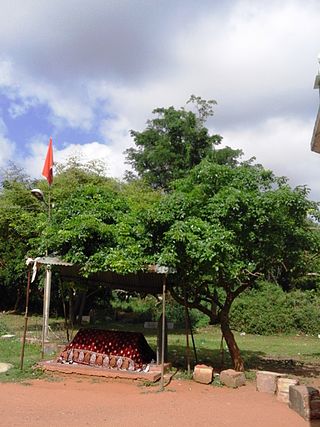
Mangasuli is a village located in Northern Karnataka, India. It is located in the Athani taluk of Belgaum district in Karnataka.
Savadi is a village in the southern state of Karnataka, India. It is located in the Athani taluk of Belgaum district. Located on the banks of the Krishna river, also called Uttaravahini - which flows northwards at Savadi, most of the population here is largely dependent on agriculture for its sustenance. Animals domesticated are buffaloes, goats, dogs, horse, bullocks, sheep and fowl. Historically being a belt of Jowar cultivation, with the recent irrigation projects near the village, from the past two decades, the chief crop has been sugarcane. Savadi is closely located to many sugar industries of the Krishna basin, and is part of the major supplier belt of sugarcane in Athani Taluk, and consequently Belgaum district.
Telsang is a village in the southern state of Karnataka, India. It is located in the Athni taluk of Belgaum district in Karnataka.There are two freedom fighters from here, one is Shri Dhanavant Rayappa Halingali and another is Shri Baburao Hujare who was the first MLA in Bombay state before Karnataka Yekikarana.
Ugar Budruk is a village in the southern state of Karnataka, India. It is located in the Athni taluk of Belgaum district in Karnataka. It is around 38 km from the city of Sangli, Maharashtra. Ugar comes under the Kagwad constituency.
Atharga is a village in the southern state of Karnataka, India. It is located in the Indi taluk of Bijapur district in Karnataka.
Chadchan is a taluq in the southern state of Karnataka, India. It is located in Vijayapura district in northern part of Karnataka.
Chandkavathe is a village in the southern state of Karnataka, India. It is located in the Sindgi taluk of Bijapur district in Karnataka.
Huvina Hipparagi also Huvin Hipparagi is a Town in the southern state of Karnataka, India. It is located in the Basavana Bagevadi taluk of Vijayapura district in Karnataka.
Kalakeri is a village in Northern part of Karnataka, India. It is located in the Sindgi taluk of Vijayapura district in Karnataka. Pincode is 586118.

Kanamadi is a village in the southern state of Karnataka, India. It is located in the Bijapur taluk of Bijapur district in Karnataka. It is a border village between Karnataka and Maharashtra. One end of village is attached to Maharashtra and other end is adjacent to Belagavi District. It is well known for agriculture of Pomegranates and Grapes. Kanamadi is one of largest exporter of Pomegranates in the Bijapur region. It is also famous for 12th Century Dharidevar Temple. And it is historical war place of dharidevara mountain between two kings of God and this temple to kanamadi town on huge underground way is here it's open only the Jatra mahotsava.
Yankanchi is a village in the southern state of Karnataka, India. It is located in the Sindgi taluk of Bijapur district in Karnataka.
Sathegala is a village in the southern state of Karnataka, India. It is located in the Kollegal taluk of Chamarajanagar district.
Sriramapura is a town in the southern state of Karnataka, India. It is located in the Hosadurga taluk of Chitradurga district in Karnataka.
Gudgeri is a village in the Kundgol taluk of Dharwad district in the Indian state of Karnataka. It is located in the Kundgol taluk of Dharwad district in Karnataka.
Balehosur is a village in the Lakshmeshwar taluk of Gadag district in the Indian state of Karnataka.
Narayanapur Rural is a panchayat village in the southern state of Karnataka, India. It is located in the Shorapur Taluka of Yadgir district in Karnataka. It is located on the bank of Krishna River and adjacent to the Dam called "Basavasagar" Narayanpur Dam.
Gurgunta also spelled as Guragunta is a village in the northern state of Karnataka, India. Gurgunta is famous for the ancient Amareshwara temple. It is located in the Lingasugur taluk of Raichur district in Karnataka. Karnataka National highway 150A passes through the village. This village is just 10 km away from Hutti Gold Mines, the unique primary gold producing company. This is also one of the hobli centre in Lingasugur taluka. This village consists of number of folds. most of the lands have been irrigated. Paddy is the major crop grown here. Remaining Non irrigated lands are grown by sun flower, cotton, toor, jawar etc. Major occupation is agriculture and small business. Huts and Mud roof houses are being replaced by RCC buildings. The famous Religious place Sri Gudagunti Amareshwara Temple is located near Gurgunta village. Before independence, Gurgunta was ruled by the Nayaka kings from 1636 to 1948. Around 16 Nayaka rulers have been ruled this state. In memory of this old fort and palace can be seen. This village consists of Grama Panchayat, Govt. P.U. College, High School, Primary School, RSK, Primary Health Centre, Veterinary dispensary, and hostel. Lord Venkateshwara Temple is located in the village. Navaratri Utsava (DASARA) is celebrated very nice. 9 days will be fully engaged in Bhajana and Purana functions. Moharam festival is also one of the famous festivals celebrated in the village. Gundlabandi Halla falls is small falls nearby 4 km. Tinthini Mouneshwara Temple is a religious and pilgrim place located near 20 km from Gurgunta. Though this village is not having bus stand and daily travelling passengers suffering a lot during summer and rainy season.
Babalad or Muttyna Babalad is a village in the southern state of Karnataka, India. It is located in Bijapur taluk of Bijapur district, Karnataka. It is nearly 25 km from the district headquarters, Bijapur. It's one of several small villages near Bijapur.


