Belgaum is a city in the Indian state of Karnataka located in its northern part along the Western Ghats. It is the administrative headquarters of the eponymous Belgaum division and Belgaum district. The Government of Karnataka has proposed making Belgaum the second capital of Karnataka, hence a second state administrative building Suvarna Vidhana Soudha was inaugurated on 11 October 2012.

Ugar Khurd is a town municipal council in the district of Belagavi, in the state of Karnataka, in India. Khurd and Kalan Persian language word which means small and Big respectively when two villages have same name then it is distinguished as Kalan means Big and Khurd means Small with Village Name.

Belagavi district, also known as Belgaum district, is a district in the state of Karnataka, India. The district is known as Sugar Bowl of Karnataka with 1.5 lakh (150,000) hectares being used for commercial production and it has displaced Mandya district in sugar cane production over the last decade. The city of Belagavi is the district headquarters in North Karnataka. It houses the second legislative building, where the Karnataka Legislature will meet once a year. A popular sweet is kunda. According to the 2011 Census of India, it has a population of 4,779,661, of which 24.03% live in urban areas, making it the second most populous district in Karnataka, after Bangalore. The district has an area of 13,415 km2 (5,180 sq mi) making it the largest district in Karnataka, and is bounded by Kolhapur District and Sangli district of Maharashtra state on the west and north, on the northeast by Bijapur district, on the east by Bagalkot district, on the southeast by Gadag district, on the south by Dharwad and Uttara Kannada districts, and on the southwest by the state of Goa.
Bailhongal is a Taluk in Belagavi District of Karnataka state in southern India. Bailhongal Taluk is located towards the north-east part of Belagavi. The taluk headquarters is about 44 km from the district headquarters. The total geographical area of the taluk is 1122.40 km2. There are 126 revenue villages and 14 hamlets with a total population of 356,400 people, according to the 2001 census.

Chikkodi is a taluka and Town Municipal Council city in the Belgaum district of Karnataka, India. It is a Subdivision of the district. Chikodi, Athani, Hukkeri, Raybag, Nipani and Kagwad are the taluks that come under Chikodi Subdivision. It is 75 kilometers from the city of Belgaum, 65 kilometers from Kolhapur, 51 kilometers from Miraj, 160 kilometers from Hubballi, and 570 kilometers from the capital of Karnataka state, Bengaluru. Chikodi has many district level offices but it is not designated as a district by the Government of Karnataka. It is one of the major cities that lies in the border between Karnataka and Maharashtra states.official language is Kannada.
Mahalingpur or Mahalingapura in Kannada is a town of Bagalkot district in the Indian state of Karnataka. Agriculture, weaving and jaggery production are the primary industries here. In the past, town was called as Naragatti. Later renamed as Mahalingpur after the gracious appearance of Lord Shri Mahalingeshwara. People speak typical Kannada, understand English and Hindi. The town is known for its picturesque surroundings and pleasant climate. The Ghataprabha River flows through nearby Nandagaon village from its source, which lies to the southwest of the town, and in Kudala sangama gets merge with Krishna. Mahalingpur is one of the major commercial towns in the Bagalkot district. Jaggery and Saari's are common export marketing stuffs here.

Athani is a city in the Belagavi district of Karnataka, India. It is 140 kilometers from the city of Belagavi, 70 kilometers from Vijayapura, 55 kilometers from Miraj, 100 kilometers from Kolhapur, and 624 kilometers from Bengaluru.

Kuknoor is a town in Kukanoor taluk in the Koppal District of the Indian state of Karnataka, which is located about 40 km northwest of Hospet and 7 km from the Mahadeva Temple in Itagi. Kuknoor is known for the temples of the Rashtrakutas and Chalukyas in the town, with the most notable being the Navalinga Temple.
Ainapur is a town in the southern state of Karnataka, India. It is located in the Athani taluk of Belgaum district in Karnataka. Ainapur village is famous for Peda, the village situated near river Krishna. Sugarcane is the chief cultivated crop and Kannada is the primary spoken language.
Athani (Rural) is a rural area in the southern state of Karnataka, India. It is located in the Athani taluk of Belagavi district in Karnataka.
Jugul is a village in the southern state of Karnataka, India. It is located in the Athani taluk of Belagavi district in Karnataka.
Madabhavi is a large village located in Athani taaluk of Belagavi district, Karnataka state of India. The village is famous for production leather chappals which have main market in Kolhapur. The village name came from Madya means central and Bhavi means open well. Open well is near panchayat of village. This village Has two Oldest Ancients Temples one Kalbhairava and another one is Madhukeshwar temple.

Mangasuli is a village located in Northern Karnataka, India. It is located in the Athani taluk of Belgaum district in Karnataka.
Murgod/Murugodu is a village in the southern state of Karnataka in India. It is located in the Savadatti taluk of Belagavi district in Karnataka, 491 km from the capital Bengaluru and 54 km from district headquarters Belagavi.
Shedbal is a town in the southern state of Karnataka, India. It is located in the Athni taluk of Belagavi district in Karnataka. Shedbal is very close to Sangli Miraj twin cities.
Atharga is a village in the southern state of Karnataka, India. It is located in the Indi taluk of Bijapur district in Karnataka.
Kalas is a village in the southern state of Karnataka, India. It is located in the Kundgol taluk of Dharwad district in Karnataka. This is the native place of Guru Govindabhatta, who is the guru of Santha Shishunal Sharif. Today we can find Samadhi of Guru Govindabhatta here. His aradhana takes place every year during summer.

Belavanaki is a village in southern state of Karnataka, India. It is located in Ron Taluka of Gadag district in Karnataka. It belongs to Belagavi Division.
Badachi is a village in Belgaum district in the southern state of Karnataka, India. It is located in Athani Taluka of Belgaum District, near Bijapur -Athani Highway. Maashahibi Darga is situated in the village managed by native Mulla(s) .Allabax S MULLA, Peeralal s mulla, Badashahlal d mulla and every year Maashahibi and Shakarbashah Uras is happen in April or may month,
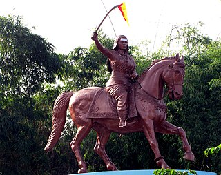
Athani Taluk is the largest taluk in Belgaum District, Karnataka, India. It has a total area of 2,070.54 square kilometres (799.44 sq mi), of which 70% is cultivated. This includes 4 towns, 115 inhabited villages and hamlets with a rural population of 4,07,485, according to the 2011 census. The total population of the taluk is 5,25,832. It is bounded by Sangli District of Maharashtra in the north, Bijapur District in the east, and Bagalkot District in the southeast. Geologically the area is covered by Deccan Trap formations. The average annual rainfall is 582 millimetres (22.9 in). Two rivers flow through the taluk: the Krishna River and the Agrani.

